|
Monday, December 26, 2011
Progress Notes
Early settlers in Miller County faced many challenges for survival including basic needs such as shelter, clothing and food. Commerce as a means of making a living or providing goods was not available since stores were few and far between; the settlers’ only means of survival was to provide as they could for themselves and families using the most basic and primitive of tools. The Civil War also was an impediment to progress; during those years of strife the major objective in Miller County was defending one’s family and farm from bushwhackers, and invading militia loyal either to the North or South. After the Civil War economic depression persisted for ten to twenty years and poverty was rampant in many areas.
However, Miller County, and even much of the state of Missouri, had one asset that offered advantage. The area had lead deposits which when recovered offered the farmer or miner a source of cash income which greatly improved economic circumstances beyond what was obtained by trading and bartering.
For most of its history, Missouri was the largest lead producer in the country. Historical records show that lead was first mined in Moniteau County in 1841 and in Miller County in the 1850s. I have written in previous Progress Notes some of the story of the lead mines of Miller County. In the Progress Notes of November 12, 2007 I wrote about the history of the town of Gageville and its lead mines.
In a more recent Progress Notes of September 5, 2011 I presented a geological exploration report of the county by geologists Sidney Ball and A.F. Smith which included some of the history of lead mining in Miller County:
Another name for lead which you may find occasionally in the following narrative is “galena.” Much less often lead is called Sulphuret of Lead. Other forms of lead are Carbonate of Lead (Cerussite) and Phosphate of lead (Pyromorphite)
This week I am going to present noted Miller County historian Clyde Lee Jenkins’ story of lead mining in Miller County. Clyde, as many readers know, wrote one of the most complete histories of our county contained in two different volumes. The present narrative is found in Volume 2 (End of Civil War Through 1900). P. 67-75.
I chose Clyde Lee’s narrative because he lived long enough ago that he was able to collect innumerable oral histories from elderly Miller County natives, some of whom actually witnessed the events described in their stories. This is true regarding Clyde Lee’s history of lead mining in Miller County since most of that occurred after the Civil War. The events and the people Clyde describes in his narrative occurred long enough ago that few photos are available to accompany the narrative. However, Clyde’s colorful style of writing and the quoting of the oral histories he obtained serve to offer “word pictures” which enhance his story. The first part of Clyde’s narrative describes the early history of iron mining; however, attention soon turns to the mining of lead which Clyde describes in great detail. I have some photos of the very early lead mines which are interspersed with the narrative but their location is not known precisely so they are to be interpreted as examples of the early mines during the time frame of the narrative.
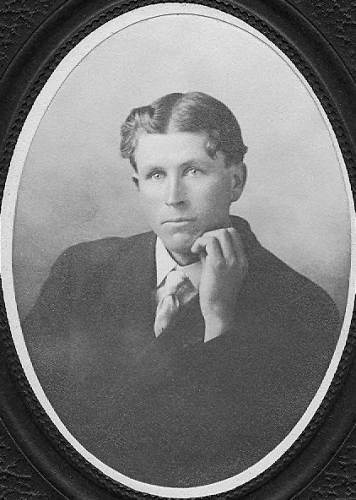
Judge Jenkins History of Miller County
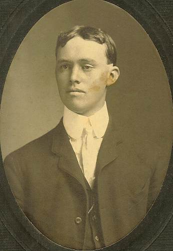
Volume 2; reprinted 1997 (photo 01)
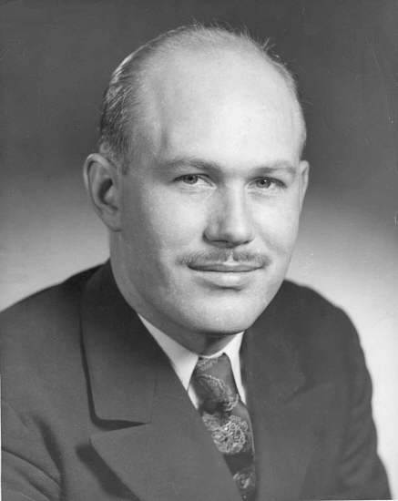
01 Clyde Lee Jenkins
Mining
p. 67-75
In the early 1850’s, Temple E. Bell, while sojourning down a hollow in the present community of Gageville, found the first vein of lead which was mined in Miller County successfully. Bell’s slaves operated the mine; and afterward, before the Civil War, Bell operated a lead mine with slaves near Capp’s Landing (photo 02).
02 Bell Tunnel Mining Company
The first mining enterprise in Miller County of major importance commenced in the early 1850’s. In 1849, Silas Capps, while in St. Louis, having taken a flatboat loaded with produce to market, informed Charles Semple, in the iron smeltering business, an abundance of iron ore might be obtained off land in his possession near Humphrey’s creek in Miller County.
Charles Semple, purchasing the land, sent John B. and William M. Semple to the site, and soon having opened a drift, they removed more than 20,000,000 pounds of iron ore, delivering it to St. Louis by flatboat.
In 1868, Charles Himrod of Erie County, Pennsylvania, leasing many acres of iron bearing land in Miller County, reopened the “John Semple” mine, working the area extensively. He believed iron ore so abundantly plentiful in Miller County, many lease holds were taken stipulating 5 cents would be paid to landowners for each 2240 pounds of iron ore removed, and 5 cents for each cord of wood used, with settlement “every three months at the office of the Iron Works.”
This created such an interest in mineral deposits, the inhabitants commenced prospecting, finding a number of sizeable iron ore deposits. In many places the ore was situated so closely to the surface, only shallow pits were dug. This ore was moved overland by wagon to the Osage River at Capp’s Landing, with some of it, later, shipped to the Frisco railroad at Dixon and Hancock. In 1880, the Curtsinger Iron Mine in south eastern Miller County produced 10,000 tons of ore.
Many leased holds were obtained from inhabitants by various companies in the iron mining business; the companies selling leaseholds among themselves. The Southwest Iron Company, and Laclede Iron Company were two of the most active.
Lead Mines
During this time the Charles A. Walker lead mines, in Saline Township, were extensively worked by Samuel Rose of Camden County. The ore was hauled first to Jefferson City by ox teams because, although slower, a good bull team could pull a load of greater weight than a horse team (photo 04).
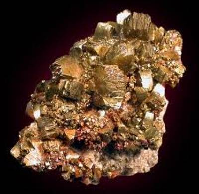
04 Lead Ore
Then the ore was hauled to Stringtown, near Sulphur Spring on the Saline Creek, where Conologue’s smelter, known as the “Pioneer” furnace, was situated. A post office was established at the site: Joe Matthew’s having a chair factory, and a grist mill nearby. A store was opened, with stables built to accommodate miners, and the traveling public, on the Jefferson City-Springfield state road.
In 1870 a number of inhabitants of Saline Township petitioned the County Court for a good road, commencing at Samuel Dresser’s blacksmith shop on the western most road leading down Mineral branch to the Saline Creek and down said creek to the Pioneer furnace near Matthew’s mill and the state road.
A remonstrance, filed with the court, stated the “road would not be practical for the creek has to be crossed four times in two miles, and could be surveyed along a ridge where no bottom land would be damaged, but then it would not pass the Johnson and Durbin furnace in whose interest this road had been projected.” This remonstrance was answered by inhabitants telling the court “if their desire is to vacate a road beginning at the southwest corner of Samuel Dresser’s farm then to Mineral branch and down it to the Saline Creek, and down it to the Pioneer furnace, then don’t do it, for it is their only practical route from the furnace to the Walker mines, the McMillan & Hill mines, and to all mines west of that. In fact, it is the only practical inlet and outlet for all the mineral and lead smelted on Saline Creek.”
Commissioners appointed by the County Court to mark out the road met at the Pioneer furnace on December 7, 1872. William Wadley, S.D. Bliss, and Madison H. Belshe surveyed a route, and the road was opened.
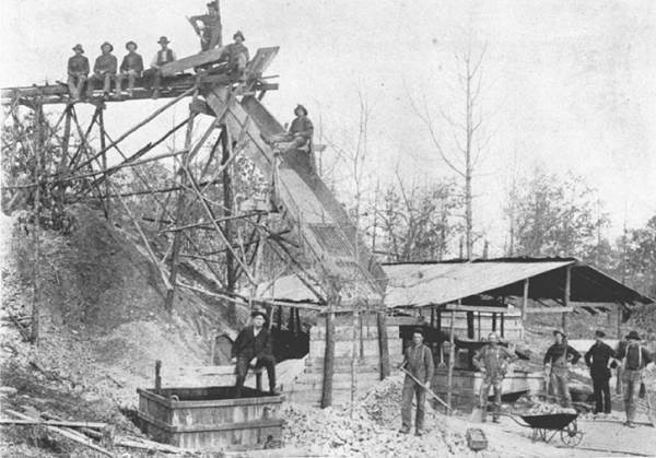
In 1869, a company of ten men commenced working the Grass Roots diggin’s on the James G. Blackburn farm. A smelter was erected, known as the Johnston & Durbin or “Buckeye” furnace. This company removed approximately 2,000,000 of lead by 1871 (photo 07).
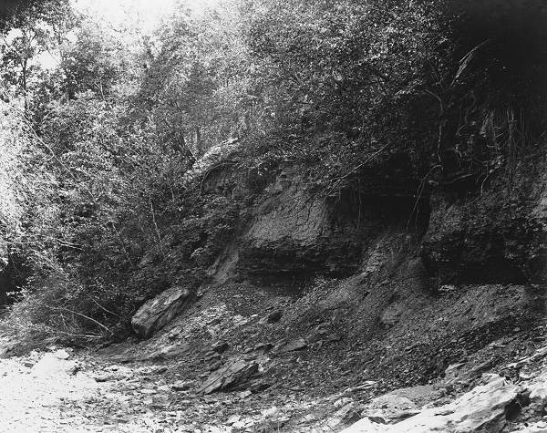
07 Lead Mine - Unspecified Location
John M. Evans said, “I worked on what is known as the grass root lead mines. I worked there as a miner. There was a part of the mines worked out known as the reserve. The first amount of mineral procured from grass root on this reserve was between 67 and 70 thousand pounds. There were two more lots of about 30 thousand pounds each taken out by the first company. This mineral was taken up before October, 1871, then we quit for a while.”
“The next company was composed of seven men. We raised about twenty thousand pounds at one time, and about 60 thousand pounds at another time. This was raised outside of the reserve. James G. Blackburn helped raise about 18 thousand pounds of this. Blackburn then helped to take out about seven thousand pounds from the rock shaft before it filled with water,” Evans continued.
“The company composed of six men and myself, took out about 65 thousand pounds on the reserve. Johnston paid me $50 at one time in 1871, and at another time Johnston paid me $210. Mr. Durbin paid me $100 in the winter of ’71 & 72. I later received more money from Mr. Durbin, I think receiving $700 while I was a member of the company.”
A.J. Buster said, “My occupation is smelter. I smelted in the Buckeye furnace owned by Durbin. We smelted about thirty six hundred pounds in 24 hours. It takes about two and one half cords of wood to smelt thirty six hundred pounds. I don’t know the value of the wood, although when I was smelting at the Pioneer furnace, their wood cost one dollar and twenty five cents per cord. Wages in 1871 was from $3 to $3.50 per day for smelters. It takes about six hours to run a complete charge after it is put into the furnace into the pig, then about two hours to recharge with mineral, draw the slag, and refill with wood”.
William M. Blackburn, of Saline Township said, “I am the owner of what is known at the Bill Blackburn mines on Jack Buster Creek. I sold these mines to Durbin, Johnston and Company during the summer of 1871 and winter of 1871 & ’72. In the summer of 1871 the company removed twenty thousand pounds of lead, and in the winter, after’72 commenced, the company raised 12 thousand pounds of mineral. This lead was hauled to the Buckeye furnace, run into the pig, then hauled and shipped from the Spring Garden Landing at Tillman’s.
In 1870, E.G. Miller, W.S. McMillen commenced mining a lead deposit northerly from the Walker mines. This enterprise was known as the McMillen & Hill mine, and in one season yielded 1,000 ton of ore, the mineral hauled and smelted at the Buckeye furnace.
Fox Mines
Thomas W. Simpson said, “I reside on Holland Creek in Fresno County, California. Sometime in the year of 1856, I entered, in my own name, at the Fayette Land Office in Howard County, Missouri, and for my own use and benefit 258 acres of land in Miller County.”
“Sometime in My, 1868,” he continued, “I gave my brother, John G. Simpson, who was then about to visit Missouri, a general power of attorney, authorizing him, for me, to sell or lease the whole, or any part of the land, on such terms he might deem just and reasonable. I arrived in California in the year of 1857, and have never been out of the state since coming here,” Thomas W. concluded.
On August 2, 1870, Judge John G. Simpson, Chairman of the Board of Supervisors, Fresno County, California, said “I reside on Big Dry Creek in Fresno County. I left California for Missouri, after my brother gave me the power of attorney, about June 1, 1868. When I arrived in Miller County, under that power of attorney, I sold two small tracts of my brother’s land, one to Lowry Greenup, the other to Malinda Lumpkin.”
“Neither of these tracts are near the larger tract north of the Saline Creek. I was on the larger tract of land twice while I was in Miller County, and remained within five or six miles of it, from about the 4th day of July to about September 27the, 1868,” he continued. “Considerable prospecting had been done I found on lands in the vicinity, so I did not sell or lease it, with a view mineral deposits might be found of considerable value.”
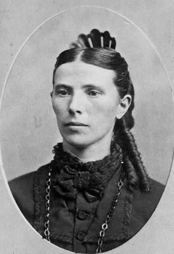
“I got my brother in law, Jasper N. Henley,” Judge Simpson said, “to look out for the land, pay the taxes on it for me, and see that the timber on it was not cut and wasted which I considered valuable. I told Jasper to let anyone who wanted to go upon the land and prospect for lead ore the privilege of doing so, and have what they could make prospecting until further orders, but to notify me or brother Tom if anything valuable was found” (photo 11).
11 Jasper and Julia Norfleet Henley
“After these verbal instructions to my brother in law,” Judge Simpson said, “I left Missouri on September 21, 1868, and returned to California where I arrived October 22, in Fresno County, at home. In January, 1869, I received the following letter:
Dec. 28 1868
Dear brother I take the present opportunity of writing you a few lines to let you know we are all well. I hope when this reaches you it may find you enjoying the same blessings of life. All of the connexions are well. I received your letter a few days ago, and was glad to hear you had got home same. I received the check for Mother also, and Obermires paid it off. I lifted your and Mother’s notes and he paid me the money for the balance. Hauenstein is wanting your land. He’s willing to give six hundred dollars for it now. There has not been any one digging for minerals in it yet (photo 12).
12 William Hauenstein II
You can write whether you are willing to take that or not. Uncle William Greenup has moved into Missouri and he wants to know what you would take for your share in the three forty’s that lay down toward Nancy Simpson’s, the three lower forty’s. Times are dull here and money scarce. Christopher did not come in this fall. He went back to Texas. He talks of coming here or going to California in the spring. I will have to close, it is nearly mail time. Tomma and Leona says to tell Uncle John they would like to se him and tell the children howdy for them. They were on a great way to go California awhile but I do now know whether they will ever go or not. Give our love to Wilber and his wife, and receive the same yourselves. Write to us often for we are glad to hear from you. So no more at present.
Your affectionate brother and sister
Jasper N. Henley
|
“Brother Tom said he would take that for the land,” Judge Simpson said, “so I wrote Jasper he could have a deed made out in the name of my brother, Thomas W. Simpson, as grantor, sent it here, and I would have it duly executed by my brother and forwarded to him for Hauenstein.”
“I received no communication acknowledging receipt of the letter,” the Judge continued, “but in January, 1869, I received a letter saying that mineral had been discovered on the land, that two men prospecting on it had found a huge deposit. I replied to the letter immediately, and informed Jasper if he had not made any deed for the land, not to make any, that if it turned out to be productive or minerals it would be valuable, and worth a good deal more. Between February and March I received another letter in which Jasper stated the two men who were prospecting upon the land for minerals produced, which he stated was the customary rate. Here I offered brother Thomas a trade for the land, and the terms of the trade were then agreed upon and settled between us.”
“I then informed Jasper by letter he could lease the land to those men if he chose to do so, for a very short time, or, if he chose to work it himself, to manage it in such a way best in his own judgment, but he should prevent miners from destroying the timber.”
On August 1, 1869, Jasper N. Henley, as agent for John G. Simpson, leased the Judge’s 258 acres east of the Hackney diggings to Alfred Franklin, James A. Simpson, and William Carter including occupancy of the land for nine months, for the purpose of opening the numerous veins and deposits of great value discovered by them.
On August 31, 1869, William Carter sold his interest in the lease to Franklin and Simpson. On January 15, 1870, James A Simpson assigned his interest in the lease to H.A. Cugwin. On March 28, 1870, Alfred Franklin assigned his interest to H.A. Cugwin. On May 17, 1870, H.A. Cugwin sold and assigned his interest in the lease to John Clark of Cole County; each in turn, having removed considerable ore.
About the first of June, 1869,”Judge John G. Simpson, at Millerton, in Fresno County California, said, “I received from my brother Christopher Simpson, who was then in Miller County, a request that I lease to him my mineral lands. His letter was dated My 9, 1869. I answered on June 9, by letter addressed to him, in which I said he could take the land and work it himself for his own benefit, or he and Jasper could work it together, for their join benefit, and I instructed Mr. Henley, if Christopher wanted to work the land alone, to turn possession of it over to him. Then on July 21, 1869, I received a letter from Madison H. Belshe offering me $1,400 for the land, and three days later, I wrote him I was accepting his offer. On August 3, 1869, I executed a deed for the land to Mr. Belshe, forwarding it to Jasper N. Henley with instructions the deed be delivered when Belshe tendered the money.”
On August 16, 1869, I received a letter from Henley saying the land had been sold to John G. Clark of Cole county and ‘please send the deed as soon as you get this letter for we have bargained the land off…”
Jasper N. Henley having agreed to sell the Judge’s land, and doing so, rightfully, as his agent, received only a promise from Clark the purchase money of $650 would be tendered when the deed was presented. Lacking any consideration, in cash or other wise, there was no valid sale.
Upon hearing of this, Madison H. Belshe put a saddle upon his fastest riding mare, and with silver in his saddle bags, journeyed to the state of California, tendering $1,400 to John G. Simpson, returning home with the Judge’s former real estate in his possession, the deed in his pocket.
In the meantime, John G. Clark of Cole County, was busily engaged upon the land, overseeing a number of skillful miners raising, opening deposits, and working the veins.
On October 1, 1869, Madison H. Belshe, Joseph P. Fox, and C.D. French appeared upon the premises, ordering the miners to leave, or suffer vexations with the law for trespass. After menacing, abusive, and threatening language between the parties, the miners did leave, Belshe, French and Fox taking possession of the mining equipment, and hauling away thirty five thousand pounds of lead ore upon the ground.
These diggings were afterward known as part of the Fox mines; having diggings elsewhere.
Hackney’s Diggings
In 1868, Captain Wesley A. Hackney struck a lead deposit on his farm. This was about six miles north of Tuscumbia. A thorough searching of the premises revealed lead could be found everywhere. Captain Hackney, after reserving the large deposits for his own use, leased his land to many parties, including Hereford & Sheckels, Alfred Franklin, Benjamin F. Lawson (photo 13), James G. Blackburn, Jacob Gantt, William H. June, Lewis Todd, and many others.
13 Benjamin Lawson Family
The ore uncovered by the miners stunned the inhabitants.
On November 9, 1874, Captain Hackney sold his farm to Eben C. Quimby and J.R. Gage of St. Louis for thirty thousand dollars, a fantastic sum of money in the decade of depression following the Civil War.
Immediately moving in, Gage and Quimby called for miners, laborers, and teamsters, and a village arose at the site. This place, known as Gageville, was soon a rip-roaring mining camp. John B. Crocker built thirty two clapboard dwelling houses at Gageville in a very short time. A first class hotel was erected for the accommodation of guests and miners. A blacksmith shop and general store were opened for business. A livery barn and stables were erected for teamsters and teams. The post office at Stringtown was moved to Gageville; so was the Pioneer furnace, with another smelting furnace erected beside it. Together these furnaces ran four million pounds of molten ore into the pig the first two years (photo 15).
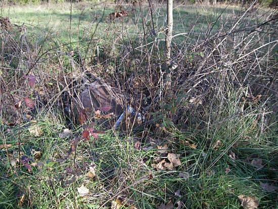
15 Gageville Lead Mine Pit - 2008
On March 31, 1875, Gage sold out to Quimby, and on October 12, 1875, Quimby sold the Gageville enterprise to the Osage Lead Company, a St. Louis firm, headed by John W. Conologue. The Osage Lead Company commenced business by selling $75,000 in the New York Securities Market.
Reuben C. Sherman, Secretary of the Osage Lead Company, said “The Osage Lead Company is doing business at Gageville. I keep the books of the company, and all the accounts of the expenses and outlays. We smelt at our furnaces three charges of twelve hundred pounds in every twenty four hours, for which the expenses are ten dollars and five cents for each furnace. This includes the wages of the smelter, his helper, and the wood. This is the entire expense from the time the ore is put into the mineral house until it is run into the pig. We pay the smelter $2.25 a charge of twelve hundred. I can ship from Tillman’s Landing to St. Louis for 25 cents per hundred.
Note: You can read more about the Gageville mine at this previous Progress Notes.
Curty Mines (photo 16)
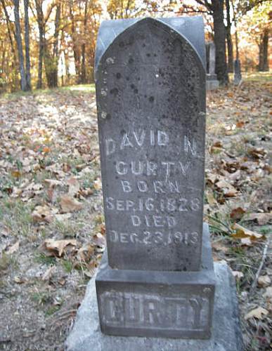
16 David Curty Headstone - Gageville Cemetery
David N. Curty said, “I am the owner of a lead mine. I do not work the mine. I leased the area on April 2, 1870 to Jacob Gantt and William H. June. The lease has never revoked or canceled. Subleases have been let by Gantt and June. I make a division of the proceeds from the sale of the ore at the furnace, and after taking my royalty, only watch.”
William H. June subleased part of the mine to William Loveall and Alexander Graham. Then, on December 31, 1870, William Loveall and Alexander Graham agreed to grant William H. June the one third part of the lease granted by him to them for the consideration that June would grant Alexander Graham and James A. Simpson at one third part of the entire lease granted William H. June and Jacob Gantt by David N. Curty.
In 1875, the mine was in full swing. David N. Curty said, “I have known there were parties at work since the first of July. The reason why I know is I saw them engaged. I was at the mine. James A. Simpson and Alex graham was raising lead. Considerable lead was taken up about the middle of July, and to the best of my knowledge, William H. June did not assist in taking up this mineral. He had quit working about the 10th of June, removing his hands before that.”
“I can describe the mine” David N. Curty said, “I have a map. The first shaft shown on it was sunk by Simpson and Graham. They took up much lead. This was after their contract. They had a contract with June and Lewis Todd, but June quit. The shaft is not on the Loveall sub lease. The shaft out of which this lead was gotten is situated from the south line about 80 or 90 yards, and is No. 6.
“There is another shaft immediately west, or No. 1. It is about 12 or 15 feet deep to the best of my knowledge. It was sunk by Simpson, Graham, and June working together. This shaft is in a sublease. They raised about 6,000 pounds of lead; about the same from No.2.”
“The third shaft,” Mr. Curty continued, “is known as the Jackson, Johnson, and Hines, and is about 40 years southwest from the first shaft. About 4,000 pounds of lead was taken out of it. I made a division of the lead between Jackson, Johnson, Hines, June and myself. I don’t believe William June done any labor on this shaft.”
“Shaft No.4 is situated about 25 or 30 feet west of the second shaft. June, Simpson, and Graham dug this shaft. It is about 22 or 23 feet deep, and considerable lead was taken from it,” Curty said.
“Situated west of shaft No.4,” Curty continued, “is shaft No. 5. It is 25 or 30 feet deep, and was sunk by Rogers under the direction o June in December, 1870. There was about 12,000 pound of lead raised at that time. Last April, Todd and June went into the Rogers’ shaft again, and took out about 8,000 pound of mineral. There was then a controversy between the parties as to whom the mineral belonged. June and Todd claimed the lead, and the others disputed their right. Graham said Todd and June had no right to work without the consent of all parties. Graham claimed his third part, and they disputed if for some time, and finally, when they agreed to let Graham have his part, Graham agreed not to take it if there would be no future violation of the contract. All commenced working harmoniously according to agreement. Together, they took out about 6,000 pounds of mineral. I made a division of the proceeds of the money for which the lead was sold, to each a third part, after the royalty was taken out. Graham, Simpson, and June seemed happy together. The last time I seen them together, June was loading mineral, whistling and singing; and Simpson down in the shaft, every time he would holler up to him, Alec would dance a little jig before grabbing the windlass and chant a little song or verse something about another hog in the sty and calico in the woman’s eye!”
“Directly after the sale of the mineral in contention from the Rogers’ shaft,” Curty said, “I was at the mine, and Simpson, Graham, June, and myself got to talking about the lease right held by June. Mr. June said he had transferred his 2/3 interest. If Jacob Gantt established his half of the right of the lease, then he would be transferring Gantt’s half, and consequently he would have to defend what he had transferred. June said to exonerate myself from that liability I will transfer my right back to you, but he never did do that. They soon had some more difficulties, but they got it adjusted, then it flared again.”
Alexander Graham, with James A. Simpson beside him, said, “by occupation we are miners engaged in raising lead ore or galena in Miller County, and had lying on the ground about 5,000 pounds of mineral, and William H. June hauled it away without our consent.”
“I have been mining for the last twelve months,” Graham continued. “I am in possession of the land for mineral purposes where the mineral was raised. James Simpson and myself raised the mineral and cleaned it and put it in two boxes and a hand barrow, with some lying on the ground. I was past there last week and saw the mineral. Afterward I saw part of it at the Pioneer furnace. Part of it was in the furnace, smelting.”
Edward H. Hill said, “I am deputy clerk at the Pioneer furnaces. The mineral received from William H. June was placed in the mineral house, where all other ore is put at the furnace. June told me to tell Major Bohn not to pay anyone for that lead, but himself, or upon his order.”
Elias Simpson said, “I have been mining for the last three months at the Curty diggings most of the time. James A. Simpson and Alec Graham were raising mineral. William H. June’s boy, Eli, and myself, helped sink a shaft about ten feet from the one the mineral was taken from. I guess he helped go down about twenty feet. It was about four feet deep when he came to work. Only one person can work in a shaft of that depth, or any other depth, as holes are dug in this country. This shaft was about 8 ½ feet in diameter, and we commenced raising lead at about twelve feet. This shaft was not in the lease, but June claimed his part.”
“I have never placed anyone in possession of the land where shaft no.6 sinks,” David Curty said, “and I have no lease other than between myself, Jacob Gantt and William H. June. Much ore has been raised from the surrounding area, including shaft No. 6, for which my royalty is the same.”
William H. June claimed an interest in the lead from shaft No. 6, because his boy, Eli worked there. Eli said, “I went to work over there in June. Mr. Graham said I would have to show my right. I told him I had as much right there as he did, because my father had sent me. I can’t remember what month it was, May or June, but the leaves on the trees were a little larger than a squirrel’s ear. Graham refused to let me work. I went and took hold of the windlass and Graham took it away from me. I was not prohibited from working on the ground so helped Elias Simpson nearby.”
“Eli June came to where we were at work, and hung about,” Alexander Graham said. “I was tending the windlass. My partner, James A. Simpson, hollered up to hoist. June was standing between men and the handle. He took hold of the handle when my partner hollered to hoist, and I took hold and commenced drawing out. June went of muttering something. My partner Simpson is the only one who worked in the shaft. Mr. Simpson can sink by himself more than two of the gooderest men in the country. He can sink 12 to 15 feet a day in fair soil, and 10 feet in hardpack. When he digs I hists as fast as I can. When we left here to tend crops, we had 5,000 pound out.”
M.V. Wemple said, “I am a teamster at the Pioneer furnaces. On last Saturday, I went and got a load of mineral from what is called the Curty mines by direction of the company. I helped to weigh two loads of mineral, and was assisted by June, Niesley, and Todd. It is the rule to weigh the mineral and keep tally and turn it over to the clerk. William H. June delivered the mineral to me as his own, or I believe I remember he said he took it to secure his portion, until they had a settlement. There was no other person present at the time claiming the mineral. The mineral weighed 4,525 pound. Mr. June ordered that there should not be anything paid on it until it was settled.”
David Neisley continued, “I am also a teamster at the Pioneer furnaces. Last Saturday I hauled mineral from the Curty mines. I was accompanied by William H. June, Lewis Todd, M.V. Wemple, and William K. Todd. We went up there and weighed up forty three hundred and twenty five pounds. Mr. June came down to the furnace with us, and told the clerk not to pay anyone any money on the mineral until the whole thing was settled.”
Deputy Clerk Edward H. Hill said, “June came down here to the furnaces after the teams. The teams were taken from the company’s stables. The mineral was hauled by the company’s wagons and teams, accompanied by William H. June. I never heard June say where the mineral come from, but from my own knowledge of ore in the country, I know where the mineral came from. The mineral is generally weighed by the teamsters and the returns made to the person in charge by M.V. Wemple. The records show there were 4,325 pounds of lead, and the price was thirty five dollars per thousand. June told me to tell Major Bohn not to pay anyone but himself for that lead, or upon his order.”
There were many, many disputes over mining leases, rights, and interests during the decade of the’70’s. The mining boom would subside and give way to the railroad cross tie industry. The ringing of the tie hacker’s broad axes were already being heard in the woods.
In 1876, Randolph Abbett was making railroad cross ties in the vicinity of Tuscumbia, banking them on the Osage River, and rafting to the Missouri Pacific bridge at Osage City.
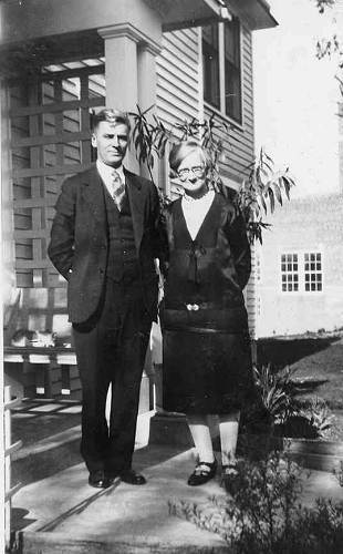
On December 10, 1878, John Andrews agreed all ties by him, or through him, made and banked at or near the mouth of Bear Creek, would be under the full control and possession of Augusta P. Folsom at Tuscumbia, to sell and receive the proceeds and after paying his indebtedness to her, give him the remainder, Augusta furnishing him and his men goods and provisions from her store in Tuscumbia to an amount not exceeding $250 a month. This procedure would be followed by tie hackers past the turn of the century (photo 17).
17 Augusta Hauenstein Fogleman
On November 6, 1879, William Vann agreed to sell William H. Hauenstein, a merchant at Tuscumbia, all the railroad cross ties made of white oak, burr oak, postoak, and chinkapin oak, banded upon the Osage River between Tuscumbia and Bear Creek, and taken from Hauenstein’s land, @ $50 per thousand.
As noted above the lead mining in Miller County began to wane in the late 1870’s as attention turned toward the coming of the railroads and the need for ties which provided some income for local farmers. The interest in lead mining remained dormant until 1926 when it resurged after the discovery of a promising lode of lead on the farm of a local Tuscumbian, Mrs. Stanley Brockman, who owned some land in Camden County. Here is the article from the Miller County Autogram about that story:
Miller County Autogram
April 15, 1926
Tuscumbia Woman Has Lead Mines
Mrs. Stanley Brockman Leases to Kansas City Company
Jeff D. Blount, who resides in the lead mining district of Camden County, came down Wednesday of last week to close a deal between his daughter, Mrs. Stanley Brockman, of this place, and the Kansas City Drilling & Mining Co.
Mrs. Brockman owns 78.33 acres of land one mile east of the Hunter store and is within the lead belt area. Mr. Blount now resides on the place and he is also working with the above mentioned company in taking land options. He reports that they took options on 320 acres of land Tuesday of last week.
Mr. Blount left with the Autogram a specimen of lead which he found on his place in a crevice in the rock. This lead is now on display at the Autogram office.
According to the terms of the lease between Mrs. Brockman and the company, work is to begin on the lease Monday of this week. The company agrees to drill 500 feet deep and is to have machinery on the lease by June 1. Mrs. Brockman is to receive a royalty of 10% on all mineral found on the tract. Twelve men are to start work prospecting. Charlie Trimmer of Kansas City is interested in the Kansas City Drilling & Mining Co.
When asked about the effect the construction of the dam would have on the mining area, Mr. Blount said that the water would flood practically none of the lead area. He also states that the Farmers Fund Corporation has taken for the Missouri Hydro Electric Power Co. options on a great deal of land in the lead belt and that this land is now worth more than the company paid for same.
Mr. Blount thinks that the construction of the dam will be a wonderful boost for Camden County. About ten acres of Mrs. Brockman’s farm will be flooded by the dam and Mr. Blount expressed himself that he would rather give the company the ten acres rather than see the proposition fail. He is setting out an orchard on the place and expects to find a ready market for fruits and other farm products at a good price if the dam is built. Mr. Blount is very enthusiastic about the mining prospects and remarked that land was being leased for prospecting on every side.
The rediscovery of lead in the area caused great excitement for a while. Lawrence Wright, editor and publisher of the Miller County Autogram was so excited that he wrote the following article about the discover of lead on Mrs. Brockman’s farm:
Miller County Autogram
Thursday, April 15, 1926
Discovery of Lead in Camden County Renews Interest In Miller County
Story of Old Lead Mines in Camden County Reads Like That of Miller; Greatest Lead Find in Miller County Was Three Miles North of Tuscumbia (photo 18)
18 Lawrence Alfred and Carmen Ercel Bassman Wright
What effect will the finding of rich deposits of lead in Camden County have on the mining industry in Miller County? Will this renew enthusiasm in this county and lead to finding of rich deposits here?
These are questions that may be answered in the affirmative some day. The story of lead in Camden County reads like the story of lead in Miller County. In Camden County, according to the Linn Creek Reveille, “Float mineral, in clay formation, was what the amateur prospectors looked for, being most easily procurable with pick and shovel. All of these recognized that the great ore bodies only as awaited capital, equipment and transportation to yield their riches.”
Miller County’s old timers remembered the excitement created shortly after the war by the finding of lead on the Saline at what was known as the Grass Root Diggings, and the Hackney Mines. It is said that Rube Vaughan discovered lead when he was snaking a log down the hill and the end of the log dug up a chunk of lead. Captain W.Z. Hackney relates that two Irishmen, who worked for them, got it into their heads that there was lead on the Hackney place and they did some prospecting which later brought into existence the once famous Hackney mines.
Lead was discovered in Miller County in several places by the old frontiersmen, who in a crude way, smelted it for use in hunting. It has been dug in many places in the county, but, so far, has only been worked commercially on the Saline Creek and its tributaries north of Tuscumbia. In 1869 and the early seventies it required two furnaces, day and night, to smelt the ores that were being produced in that locality, but transportation at the time was both difficult and expensive and this fact, coupled with a material decline in the markets, caused continued development to be abandoned and the industry in this area has not since been restored to its wonted interest.
Grass Root Diggings, on what is now the Jesse Hicks farm, on the Big Saline at Sulphur springs, was so named because the lead was found cropping out of the ground from under the grass roots. It is estimated that there has been $250,000 worth of lead taken from the ground in Miller County, and that the Hackney and Grass Root Diggings produced the bulk of this product.
The fact that there has been no prospecting in this area to speak of except with pick and shovel, and in view of the fact that this was the condition in Camden county until the Thompson Nixon Company made the big find by going deeper, should be sufficient incentive for mining experts to investigate the Grass Root and Hackney lead belt.
Lead is now being found in Camden County within five or six miles of the Camden-Miller line, and if the find is as extensive as some claim it to be, there is reason to believe that lead will be found in Miller County adjoining this section of Camden.
There seems to be a point of peculiar interest in the finding of lead in this section of Missouri and that is that lead is found in a belt extending in a northeast southwest direction. Lead is being mined at Henley, on the Rock Island, northeast of Tuscumbia. Lead has been found in the Lawson-McBride mines between Henley and the Hackney-Grass Root Mines; continuing in a southwesterly direction, lead has been found on the Arthur Edwards farm and was mined many years ago by Dr. Hickman, and at another time by Josh Stephens. Continuing southwestward, lead is being found in Morgan and Camden; then it was reported last week that lead had been found in Dallas County, still to the southwest. In a direct line with all these findings, to the southwest, we find the great Joplin mines. Take another step to the southwest and you find the famous Pitcher, Oklahoma lead mines.
A week after the above article was published by Lawrence Wright he enthusiastically wrote the following rather long narrative for the Autogram recounting the history of lead mining in the county:
Miller County Autogram
April 22, 1926
Historical Sketch of Lead Mining in Miller County
Lead Was First Found In This Vicinity Along Osage River by Hunters as Early as the Year 1811
The history of lead mining in Miller County is an interesting story and dates from the early part of the last century until the year 1905. Miller County is within the Central Missouri lead district. According to the State geological report, this district, as a whole, has been much less exploited than either the Southwestern or Southeastern Missouri district, hence the product is small in comparison.
A very complete and accurate report of the lead mining operations was compiled in the year 1903 by Messers. Sidney H. Ball and A.F. Smith, state geologists. The information contained in this article is obtained from this report, being of a technical nature, and also from people who mined lead in the Saline Creek district during the hey day of the lead industry.
According to the geologists’ report, the greater share of the lead output in Miller County has been mined along the Saline and the North Little Saline creeks. This area, known as the “Saline diggings,” extends four miles east and west, and five miles north and south. Other diggings are scattered throughout the county.
H.H. Breckenridge, Jr., was among the first, if not the first writer, to mention the occurrence of lead in the region tributary to the Osage River. He says that as early as 1811, hunters reported an abundance of lead in the country adjacent to the Osage River. Soon after this Schoolcraft, in his report under the title, “A View of the Lead Mines in Missouri,” stated that lead had been found in the Osage country. Henry Kin, M.D., in his report of 1839, states that lead is found every where along the Osage River, and that the Little Tavern, the Saline and the Little Gravois, are among the creeks on which good lead indications exist.
In the fifties, it is said, the pioneers gathered galena from the creek beds and smelted it in hollow logs to obtain lead with which to make bullets.
The lead as found in this section is known, geologically speaking, as galena, and is of a bluish color and cubical in form. To the old miners in Miller County, lead, or galena, found in chunks in its crude state was known as “mineral,” and after it was smelted it was known as lead. Up to the time of Meek’s visit to Miller County in 1855, only a few insignificant prospect holes had been sunk and little or no mineral had been produced. He noted the occurrence of galena both in the rock and in the clay at a number of places.
Capps’ diggings are said to have flourished before the Civil War, and enough galena was mined to warrant the erection of a smelter. Temple E. Bell, in 1853, employed two slave miners on the Loveall tract, two miles southwest of Eugene, but during the war times, active mining was discontinued. Wonderful bonanzas reported to have been discovered were at this time lost, never to be refound.
Shallow mining began on a large scale in 1868 and 1869. Perhaps the first mining was at the Clay diggings near Spring Garden. This is the old homestead of W.B. Clay, now Miller County surveyor and highway engineer. The discovery of the Fox diggings soon followed, and then that of the Curty and Indian Grave diggings. About this time the Loveall diggings were reopened and worked on a large scale. In 1871 or 1872 followed the discovery of the most important products in this section known as the Walker, Grass Root and Gageville diggings. All of the galena produced came from the clay and in consequence the cost of mining was increased. The most improved hoist was a portable windlass.
Geologists report that galena produced in Miller County was of a very high grade. Regis Chauvenet made an analysis of a sample from the Walker diggings and reported a very small percentage of impurities. The galena contained about 86 per cent lead. Associated minerals include barite, calcite, crystallized dolomite, Pyrite, Marcasite and chalcopyrite, Barite (known as tiff) is by far the most abundant of the associated minerals.
The lead districts in Miller County are divided designated by the formations in which lead is found. For instance, there were the prospects in the St. Elizabeth formation, Jefferson City Limestone formation, Gasconade Limestone formation and Galena and Blende in Coal. As heretofore stated, the largest findings were in the Saline Creek area, which is of Gasconade Limestone formation.
As this is by far the largest producing area of galena in the county, this phase of the lead mining industry becomes of special importance. In this section the Gageville, Grass Root and Walker mines produced the greatest amount of mineral. Other prospects which produced were the Fox diggings, McBride and Lawson diggings, Curry diggings, Loveall diggings, Indian Grave diggings, Melton diggings, Swallow diggings, the Blackburn diggings and the Compton diggings.
Of all these mines, possibly the Gageville mines, which are known as the Hackney diggings, have been operated more extensively than any other mines in this county. This mine was located and was operated by the Gageville Mining Company of which G.C. Ramsey of Jefferson City was president, and Joseph N. Deihl was manager. These mines were located on a north and south ridge, and the richest prospect was found on the south end of the ridge. This hill is now pitted with innumerable mining holes bearing testimony of mining activity there in the past.
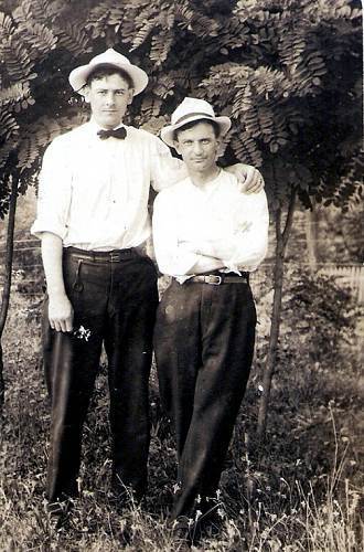
In March, 1872, W.A. Hackney and John Buster (photo 18a) opened a shaft in a sink hole 125 feet west, and 10 feet below the present main shaft.
18a John Buster
This sink hole proved to be a chimney 18 feet deep and 7 feet in diameter, which was filled with red clay carrying a high percentage of galena. At the bottom of the chimney there is a crevice striking N. 74 degrees east, which was followed 8 feet, where it ran into a pocket of coal measure shale. The upper surface of the shale was followed 75 feet and the rock immediately above is said to have been very rich. Sixty thousand pounds of galena are reported to have been taken from this galena.
From the time of this strike up to 1903, more or less mining was done on different parts of the ridge. During as late as the 1901-03 winter there were three drillers and from 12 to 15 miners on the hill.
Back in the early seventies, there was little farming done in the Saline country. The tie business was then unknown to the farmers and the big thing was prospecting for mineral. When neighbor met neighbor the questions they asked each other were, “How is the family? Where are you prospecting now?” During the winter time in particular, everybody prospected. Lead was talked at town, at home, and everywhere. That was the all consuming subject. Men and boys could be seen at any time with pick and bucket searching over the hills for mineral. When they dug a supply they would take it to the smelters on the Saline and get the cash.
The main shaft of the Gageville (Hackney) mines was 132 feet deep. From this mine from 150,000 to 200,000 pound of galena was mined from the clay openings in the rock. Later on, from September 7, 1901, to January 18, 1902, this shaft was worked intermittently by two men who, together, mined 14,820 pound of galena. The output of the Gageville mines to May, 1874, was 100,000 pounds, 55,000 pounds were produced from May, 1901 to March, 1902. The total output of this mine is approximately 700,000 to 800,000 pounds.
Recently, parties from Lawrence, Kansas, consisting of Erasamus Haworth, former state geologist of Kansas, and J.R. Holmes, a dealer in investments, have leased the Grass Root diggings from Jesse Hicks, the present owner of the mines. These men have, by their written contract, agreed to start mining operations at these diggings within 120 days from the date of the lease.
The location of these diggings is on the high steep hill west of the Jesse Hicks residence, on the Big Saline. The best way to reach these mines is over State Highway No. 17 from Tuscumbia or Eugene, leaving the highway at the Mrs. John Kallenbach farm about four miles from Tuscumbia, taking the Sulphur Sprngs road a short distance north of the Kallenbach farm. It is approximately one mile over to the Grass Root diggings from the State Highway (photo 19).
19 Antoinette Nixdorf Kallenbach (Minnie)
Galena (lead) was first discovered at Grass Root mines in the spring of 1872 by Reuben Vaughan, who found the shining mineral when a log which he was dragging down the hill with a team dug the mineral out of the ground. At that time the Grass Root property consisted of what is now the Green Blackburn and Jesse Hicks farms. About the time lead was discovered (in a small way, however) the farm was bought by Uncle Jimmie Blackburn, of near Rock Enon church, near California, he paying $1000 for 500 acres. After he bought the place, lead was discovered more extensively, but as Uncle Jimmie had put all his money into the land, he had nothing left for mining purposes. He formed a partnership with Jim Johnson of near Mt. Pleasant and Colonel Durbin of California. They soon developed the diggings by finding several rich veins and excitement over the find lead to great activity.
Mr. Blackburn and family moved to the farm. He had a number of children, and one of his daughters, Mrs. W.H. Mitchell, relates that she and her sister, Mrs. James Buster(both being girls at that time) often gathered Mountain Pinks, a flower found on the hillside, and in pulling up the flowers they would sometimes find lead fastened to the roots of the flowers. Due to the fact that the lead was found among the grass roots, Mr. Blackburn gave the mines the name of Grass Root diggings, and that name has remained to designate these mines from the many other diggings in the Saline country.
Soon after the big discovery, it was estimated that 100 men were working on the hill, and the hillsides were covered with miners’ shanties. For two years, forty or more men were at work at the mines, but since the year 1874 the diggings have been worked only intermittently.
Prospect holes were sunk on all sides of the hill, the holes apparently being dug in systematic rows in most instances. In that day there was no machinery for separating lead from the rock as it appeared in disseminated form. When a vein of lead was struck, the vein was followed until no more lead was found. In one instance on the upper part of the southeastern slope of a hill a shaft was sunk to a depth of 80 feet and passed through 25 feet of clay so rich in galena that 100,000 pounds were raised.
It should be borne in mind that at this time the whole Saline country was being prospected, and lead was being found in all that area bounded on the east by the west branch of Jim Henry creek, on the south by the Little Saline, and extending in a western and northerly direction approximately six miles.
Great piles of lead were stacked on the hill at Grass Root mines, and teams were busy hauling the mineral to the Grass Root smelter. This smelter stood in the Saline Creek bottom between Sulphur Springs and the present home of Green Blackburn. The old steel pan which was used for smelting the lead may yet be seen here.
Another smelter was located at the Gageville (Hackney) mines, also another, the Pioneer smelter, was situated near the Ferd Johnson house at the Saline Creek crossing. For many months these smelters were in operation day and night, the furnaces never becoming cool for weeks at time. Spouts from these smelters poured constant streams of molten lead into molds. Pigs at the Pioneer smelter were of 75 pound size, and 50 pound size at the Grass Root smelter. James Buster of Eugene is probably one of the best informed men on mining operations in those days for he operated the Pioneer and Grass Root smelters a great deal.
The Pioneer smelter was operated for the use of the general public, and scores of people took their mineral here to have it cast into pigs.
There are various estimates as to how much mineral was taken from the Grass Root diggings, such estimates running all the way from 500,000 pounds to 1,000,000 pounds. Lead was worth anywhere from $25 to $50 per ton in those days, but at present prices this lead would be valued at approximately one fourth million dollars. It was due to the decline in price to about $6 to$20 per ton that interest waned in lead mining. The supply of free ore apparently dwindled as the veins were worked out.
There is every reason to believe that the Saline Creek area contains deposits of disseminated ore. It apparently was not known at that time that lead running in disseminated form was a much better indication of extensive deposits, and no attention was paid to mineral found in this form. Since the finding of the rich Joplin and Picher mines, it is demonstrated that inexhaustible deposits are found in disseminated form, and machinery was invented to separate the ore from the rock.
Samplings of both disseminated and free ore from the Grass Root mines were left at the Autogram office a few days ago. These specimens were found at the diggings by Edgar Hicks. The old dumps at the Grass mines are said to contain considerable mineral. This mineral was left in the dumps as it was unprofitable at that time to separate the lead from the rock and dirt.
All the lead shipped from the Grass Root, Gageville and other diggings on the Saline was shipped by steamboat. The pigs of lead were hauled from the smelters to the Tellman landing near the mouth of the Saline. Many of our old timers can remember the Steamer Tom Stephens and other boats leaving the landing laden with cargoes of lead, ricks of pig lead being stacked on each side of the boat (photo 20).
20 Herman and Mary Ann Tellman
Quite a number of old timers who mined at the Gageville and Grass Root diggings are yet living in this county. These old prospectors are virtually unanimous in declaring their belief that there is an inexhaustible body of lead in the Saline Creek area and that the “big find” will be made some day.
About a month after the above article was published by Lawrence Wright he wrote a short follow up narrative describing the renewed interest in lead mining all around Miller County:
Miller County Autogram
Thursday, May 27, 1926
Mining Operations in Miller County
Prospecting for lead and zinc ore in Miller County is now going on in several places, especially in some of the old fields where mineral has been found in the past.
Haworth & Helmets, who have leased the Grass Root diggings and other properties on the Big Saline, are preparing to go to work this week.
Fred and William Umstead have taken out about fifty pounds of lead and zinc ore on the Gay Watson place on Cat Tail Creek (photo 21).
21 Fred Umstead
Their prospecting has been of a shallow nature, but the showings are good, and deeper prospecting might develop something worth while.
Parties from Picher, Oklahoma are now opening up the old mines at the Hannah Brothers farm, known as the Rothwell mines. Considerable mineral has been taken out of these mines in the past.
Parties who own the mining right to the Davidson zinc mines on Brushy Fork creek, near Wilson Cave, are making plans to have the mines developed. The mineral rights on this tract are owned by William H. Hauenstein, C.O. Short, W.S. Stillwell, J.L. Prock, E.P. Clark, Elmer Waite, the heirs of Dr. Moore and the heirs of Randolph Abbett (photos 22 - 25).
22 Walter and Lydia Fendorf Stillwell
23 William Bear and Ed Clark
24 Elmer Waite
25 Estella Moore, Alice Catherine Fancher and Dr. Harry John Moore
This is said to be one of the best prospects in Miller County for zinc. Eight or nine holes were sunk on this tract and zinc ore was found in every hole. This ore runs in disseminated form in rock and is similar to that in the Joplin district. Old miners claim that the ore is of high grade quality.
Paul Phillips of Eldon has taken a lease on the Conlogue mines (old Walker diggings) of the Milldale neighborhood. It is said that shallow mining here in the past has produced 1,000,000 pounds of high grade lead ore.
Franklin Brothers of Eldon are interesting parties from the mining district in mineral prospects on their farm east of Eldon.
W.H. Hauenstein has had mining parties looking over his mineral lands near Capps.
Apparently, the resurgence of interest in lead mining faded away not too long after the above article was written as little more was published about the mining of lead thereafter.
So that completes the story of lead mining in Miller County. One of the reasons lead mining probably will not return is the history of contamination it caused to our water resources. This website discusses the issue of lead contamination locally:
“For most of its history, Missouri was the largest lead producer in the country. Historical records show that lead was first mined in Moniteau County in 1841 and in Miller County in the 1850s. Lead mining, smelting and milling has contributed to lead contamination in soils and water in various locations throughout the state.”
You can refer to the website for more information about the issue of lead contamination.
That’s all for this week.
 Joe Pryor
Previous article links are in a dropdown menu at the top of all of the pages.
|