|
Monday, September 5, 2011
Progress Notes
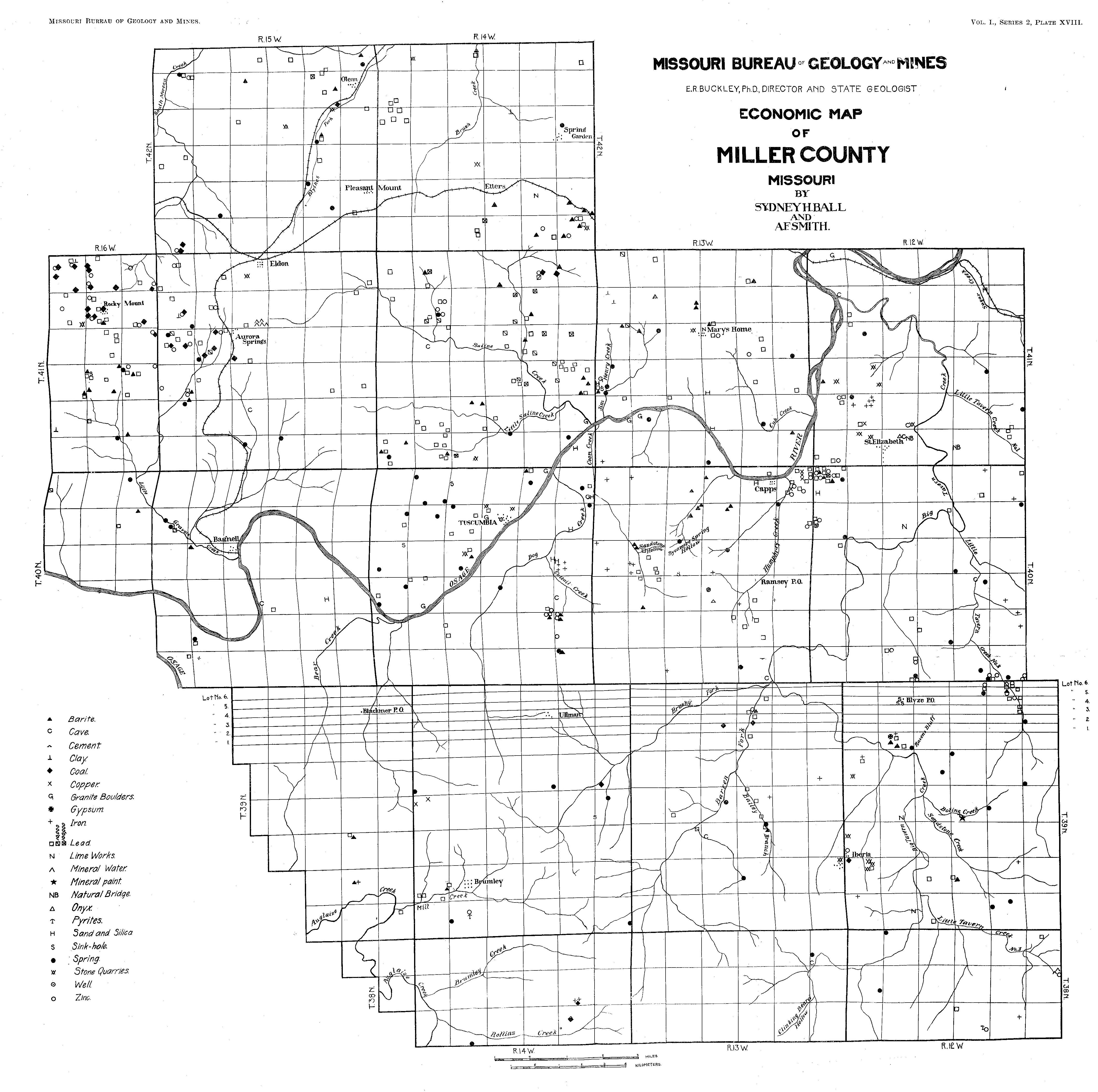
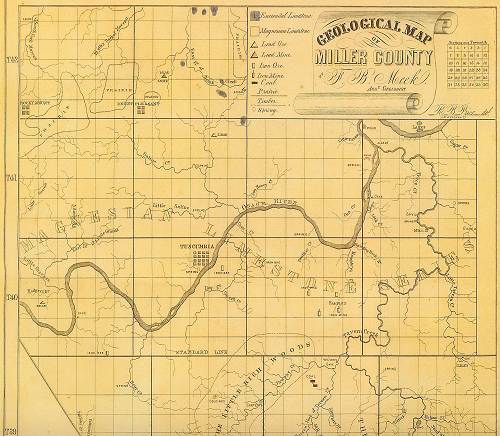
This week I am going to present the story of the history of mining in Miller County. At one time more than a hundred mining operations were present in the county, something that is hard to believe these days when as far as I know, now no mining occurs of any significance. However, as indicated on the following map of the county which lists the locations of mines present in the latter part of the 19th century, you can see that many mines were up and working (photo 01).

01 Map of Mines and Deposits in Miller County
Click image for larger view
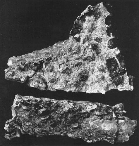
Here is a photo of the Bell Company Mining Company, one of the more successful mining ventures in the county (photo 02):
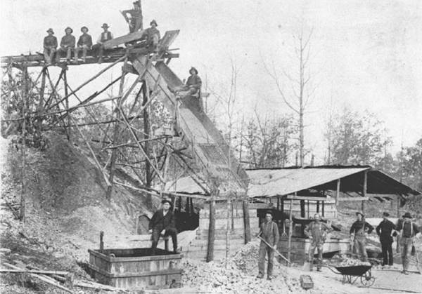
02 Bell Tunnel Mining Company
In a previous Progress Notes I wrote about the lead mine at Gageville.
It is difficult to find much written about all these mines which once were scattered all around the county. However, I did run across two sources. First, is a short narrative by Daniel Frazer Thompson (photo 03); and second is a long narrative taken from a book published by the Missouri Bureau of Geology and Mines in 1903 titled “The Geology of Miller County.”
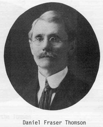
03 Daniel Fraser Thompson
Here is the narrative by Daniel Frazer Thompson:
MINERAL RESOURCES of Miller County
Daniel Frazer Thompson
Miller County Autogram
December 21, 1911
The mineral resources are varied and rich. Lead was discovered by the original frontiersmen who, in a crude way, smelted it for use in hunting. It exists in different localities of the county but has, so far, been commercially worked only on Saline Creek and its tributaries north of Tuscumbia. In 1869 and the early seventies it required two furnaces, running day and night, to smelt the ores that were being produced in that locality, but transportation at the time was both difficult and expensive and this fact, coupled with a material decline in the markets, caused continued development to be abandoned and the industry has not since been restored to its wonted interest. But some little mining of the ore, especially in the vicinity of Tuscumbia, on both sides of the river, has been continued and it is still occasionally mined. It is estimated that, first and last, a million dollars of value in lead ore has been mined in Miller County.
Large deposits of hematite (a black or blackish-red to brick-red mineral, essentially Fe2O3, the chief ore of iron) and specular iron (another name for hematite) have been known to exist in this county since 1836. In 1857 Charles Semple, an enterprising St. Louisan, selected iron lands near and south of Tuscumbia, but died before he could develop them; they had been developed sufficiently, however, to determine their immense richness. In 1872 iron was discovered near the southeast corner of the county, but was not worked and lies dormant to this day. Near this discovery, though, some very rich banks were developed in 1873 to a point of determining their value to some extent, one seam showing 18 feet in thickness. Coal has also been found and, to some little extent, mined in the county, north and south, but the great abundance of timber will probably prevent its development until the introduction of factories demand it for use therein.
Kaolin, which we commonly call chalk, has been found in different localities and is mined to profit. Only recently shipments were made by river from Tuscumbia by that old pioneer mine owner and developer, Captain W.A. Hackney, and this industry is worked more or less every year. Barium, or “tiff,” is also mined. A large deposit of this latter mineral on the waters of Little Gravois in the vicinity of Bagnell is being worked by a St. Louis company and regular shipments go to the metropolis for reduction and market. Professor H. L. Moles of Tuscumbia is in charge of the work.
Miller County has lime “to burn” and the quality is everywhere unexcelled, but at only one point in the county has the lime industry become of commercial importance. But for more than half a century private kilns for private use have been burned in all parts of the county when lime was needed. On the C.R.I. and P. railroad (Chicago, Rock Island, and Pacific railroad) near Spring Garden, a little more than two years ago, the “Colorado Lime Company” was organized and equipped on a fairly extensive scale, but by reason of developments the company recently held a meeting at its offices in St. Louis and voted to change the name to the “Spring Garden Marble and White Lime Company,” and announced its intention to expend $100,000 for the development of machinery for the production of marble. The marble, which is declared to be a high graded gray marble, underlies the limestone. “Experts have reported that the marble deposit extends under nearly all of the property, which is 52 acres in extent, in strata from 4 to 8 feet thick, and borings showed the deposit to be 60 feet in thickness.” The lime kilns will be continued in operation.
Other valuable minerals abound, while building stone of most excellent quality is amply provided.
It very well could be that the above narrative is all you want to know about mining in Miller County, and I understand. However, we do not have anything substantial about the history of mining on our website, and because mining was a significant part of the economy of our county at one time, this week I am going to present a detailed accounting of the mining industry here during the 19th century as presented by geologists Sydney H. Ball and A. F. Smith in their landmark book, “Geology of Miller County” published in 1903. Our county was one of only a few which had such a significant and detailed mapping of mines and geological variations present so the work of these authors is of some historical importance. What I have copied from the book is an abridged version where I have eliminated sections that were very technical regarding geological information not directly associated with the mining industry:
The Geology of Miller County
By Sidney Ball and A.F. Smith
Missouri Bureau of Geology and Mines
Jefferson City, Mo
1903
VII and VIII
The field work for this report was done during the winter of 1901-1902 and during the spring and early summer of 1902. Mr. Ball did the field work on the north side of the Osage River and Mr. Smith did the field work on the south side. The work was based mainly upon elevations obtained from the survey of the Missouri Pacific and Chicago, Rock Island & Pacific Railways. All elevations were made with aneroid barometers.
The mapping was done by traversing on foot or horseback, distances being obtained by pacing and directions by using a Gurley’s “Geologist’s Compass” (photo 04).
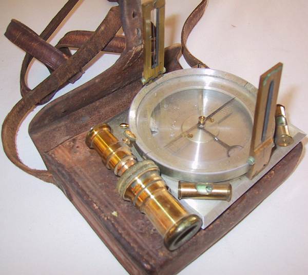
04 Gurley's Geological Compass
Starting at a known section corner, the direction which it was wished to pursue was obtained by the compass and indicated on the field sheet by the use of a protractor. The distance to the second station was then determined by pacing and its position, with respect to the first station, was indicated by a dot on the field sheet. Changes in the direction traversed were shown by the bearing of the compass and these were plotted by aid of the protractor on the field sheets. By a careful adherence to this plan of working the men always knew their location with sufficient accuracy for geological mapping.
In this manner every section of land in the county was traversed, and outcrops of rock, mines, prospects, soils, clays and every indication minerals or ores was noted and recorded in the field note books. Special attention was given to the mines and the body of the report contains accurate descriptions of all the important mines and prospects in the county.
XII
Miller is one of three counties which have been surveyed since November, 1901. It is one of the most centrally located of the counties of the State and constitutes a very desirable point from which to begin the systematic stratigraphical work, which it is intended to continue into all parts of the State.
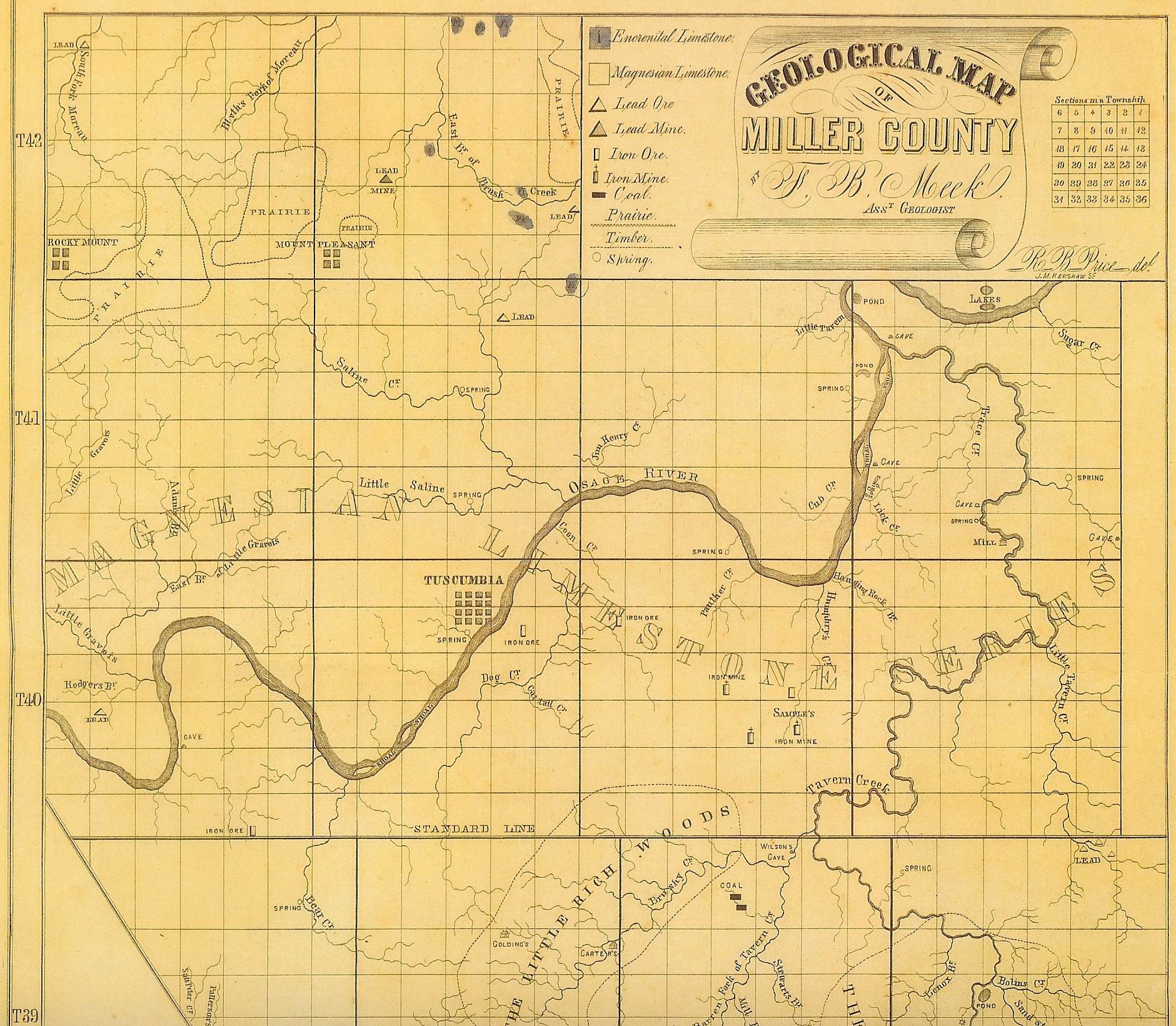
This is the second county of the Ozark region for which a very detailed survey has been made. In 1871 the Bureau published a reconnaissance report on Miller County by F.B. Meek.
p. 1
Chapter I
Physiography
The Ozark plateau includes that portion of Missouri south of the Missouri River, the northern part of Arkansas and small portions of Kansas, Illinois and Indian Territory. This plateau has an area of approximately 75,000 square miles, and has the shape of a low, flat dome extending approximately 500 miles east and west and 200 miles north and south. On all sides the Ozark plateau is hemmed in by lowlands: to the east and southeast lie the gulf plains, to the south the Arkansas valley, and to the west and north the prairie plains. The elevation of the region, which is in some places 2100 feet, together with its dome like structure, are in sharp contrast with the surrounding level plains, making the plateau a distinct topographic unit.
p. 2
The surface of Miller County can, both physiographically and economically be divided into (1) alluvial plains, (2) hilly areas, and (3) table lands.
The alluvial plains include what are known as bottom lands, or those portions of the county which are covered by the water of the Osage River during periods of flood. The total area of these valley tracts is about thirty five square miles, of which twenty six are a part of the flood plain of the Osage River (photos 05 and 06).
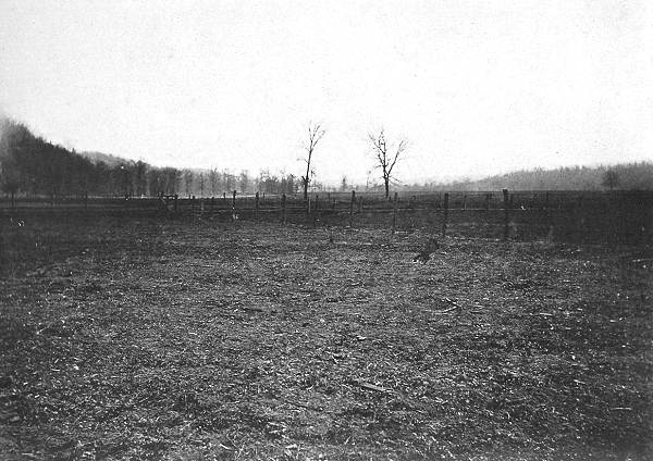
05 Flood Plain of Osage River
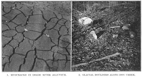
06 Mudcracks in Osage River Alluvium and Glacial Boulders along Dog Creek
p. 5
The Hilly or Broken Country
The hilly or broken country covers about 480 square miles, nearly four fifths of Miller County. It comprises all of the county with the exception of the prairie land in the northern part and the many pronged bottom land of the interior. In the northern part of the county the elevation varies from that of the alluvial plain of the Osage River to that of the prairie with which it merges at an average elevation of 920 feet above sea level. In the southern part of the county, the hill country attains an elevation of 1050 feet.
p. 9
The Upland Area
The upland area is all in the northern part of the county and is coextensive with the catchment area of the south Moreau creek and its tributaries. It embraces most of the land underlain by the Jefferson City formation north of the Osage River, with the exception of a small area in the vicinity of Mary’s Home, and another along the southern edge of the upland area.
These areas are drained by the tributaries of the Osage River, which have cut the land into hills and valleys typical of the hill country.
The sudden change from the topography of the rough hill country with its numerous rock exposures to that of the prairie, with rounded contours and few rock exposures, must be largely ascribed to the gradient of the streams which are much steeper in the hill country. The creeks flowing into the Osage River from the south side of the divide are only from 10 to 18 miles long while the Moreau on the north side travels 45 miles from where it leaves the county to where it empties into the Missouri River.
p. 10
Sinks, Caves and Natural Bridges
The physiographic features resulting from the work of underground waters may be considered under the heads of sinks, caves and natural bridges. Although these are the most conspicuous results of solution by underground waters, undoubtedly a much larger amount of rock has been removed in solution without resulting in the formation of any of the above physical features.
Sinks are most abundant on ridge land. In the bed of a tributary of Jim Henry Creek, the water disappears underground during flood time, reappearing as a muddy torrent in a spring on the other side of a fifty foot ridge.
Four caves are of distinct notice.
Stark Cave is at the head of a steep gulch leading from one of the headwater streams of the Little Gravois. The mouth of the cave is 100 feet wide and from 12 to 15 feet high, and extends about a fourth of a mile into the hill. Measuring all of its ramifications it had approximately a mile of chambers, many of which are of considerable size. There are a number of tortuous passages 25 feet high and so narrow that one can scarcely traverse them. Red clay similar in every respect to the residual clay of the shallow mines, covers the floor, ankle deep. The chambers are decorated with stalactites, stalagmites and columns, some of the latter being a foot in diameter and twenty feet high (photo 07).
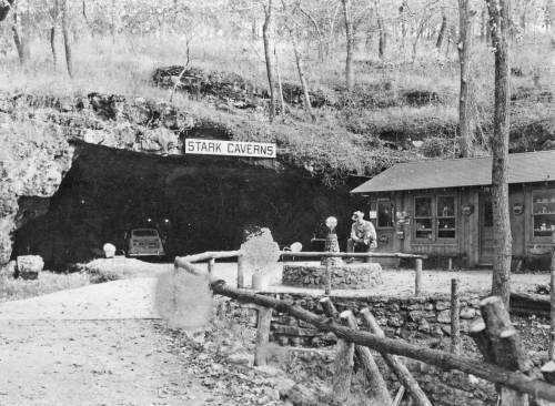
07 Stark Cave
Wilson’s Cave is located along the Big Tavern creek. It is chiefly interesting from the fact that one of the oldest settlers and most unique characters in Miller County was buried in a small chamber directly above the mouth of the main opening. The mouth of Wilson’s cave is irregularly oval in outline, having a breadth of 75 feet and a height of 30 feet. The cave has about 150 yards of narrow, winding passages. Some stalactites and stalagmites are present (photo 08).
08 Wilson's Cave
Beckman’s Cave
The cave extends a quarter of a mile into the hill. A partial falling in of the roof at the entrance has formed a miniature natural bridge. The stalactites, though small and few in number, have a beautiful white color. Mr. Beckman says that within his memory many chambers which were formerly passable, are no almost completely closed with travertine.
Klinger’s Cave
This cave is situated at the head of a ravine tributary to Saline Creek. The entrance is 30 feet wide and 15 feet high. Seventy five feet from the entrance the cave widens into a chamber 40 feet broad in which water stands to a depth of from three to five feet (photo 09).
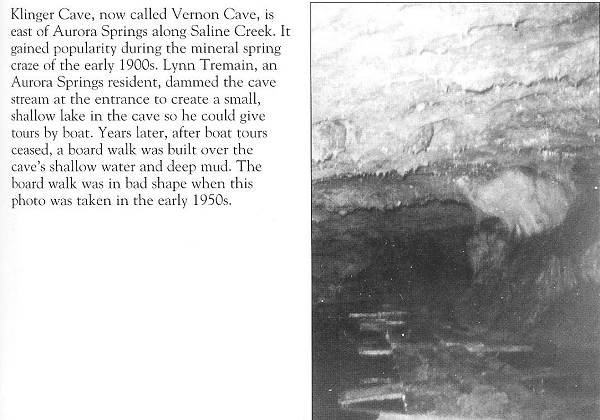
09 Klinger or Vernon Cave (Weaver)
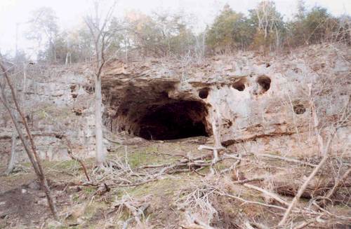
A number of other caves of less importance exist in the county including the cave at the mouth of the Big Tavern Creek (Bat Cave) and the Doerhoff cave north of St. Elizabeth (photo 10).
10 Bat Cave
Natural Bridges
Only one natural bridge of any importance occurs in this county. It is located east of St. Elizabeth. The opening underneath the bridge is 200 feet long, 20 feet high and 50 feet wide. A few stalactites on the under side give evidence that this opening may at one time have been a cave. A small stream flows under the bridge and joins Tavern Creek a short distance away.
p. 13
River Systems
Miller County is drained by two river systems, the Osage and the Moreau. These systems differ from each other widely; first, in catchment area, the Osage drains one sixth of the state, while the Moreau drains less than one hundredth; second, in character of water, the former, except in time of flood, being remarkably clear, while the latter is extremely muddy; and third, in the shape of the valleys, the Osage being hemmed in by precipitous cliffs and rugged hills while the Moreau is, as a rule, bounded by low, roundish slopes.
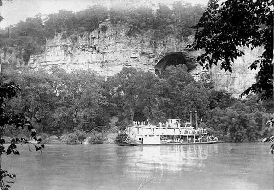
The Osage River (photo 11)
11 Osage River in Miller County
Click image for larger view
The Osage River rises in east central Kansas and flows south and east through Missouri to the center of Miller County, where it turns rather abruptly and flows north and northeast between Cole and Osage Counties into the Missouri River. The Osage River is the largest tributary received by the Missouri River in Missouri. All of Miller County, with the exception of the prairie land in the northern part, is drained by the Osage River and its tributaries.
From the western border of Miller County to Tuscumbia, the Osage River flows in a general easterly direction; from Tuscumbia to where it leaves the county, it flows in a general northeasterly direction. A straight line drawn through the county from the point where it enters to where it leaves is less that 24 miles long, while the actual distance covered by the river, in all its windings through the county is over 40 miles. In its course through Miller County the Osage River falls about 30 feet, making an average grade of three fourths of a foot per mile. The volume of water in the stream varies greatly at different seasons. In the drought of 1901 the stream could be forded on foot at a number of places without more that wetting one’s shoe tops, while in the following spring and winter the water was in places 40 feet deep. In the flood of 1895 the river rose 36 feet, completely inundating the bottom land farms, washing away fences, hay stacks, and corn and flooding houses and stores in Tuscumbia and Bagnell which were built on the alluvial plain. On subsiding, the river left a deposit of alluvium averaging three fourths of an inch in thickness on lever ground.
The Osage River is navigable during eight or nine months of the years in which there is an average rainfall. Much of the produce of Miller County is shipped by boat down this river. Great numbers of railroad ties are rafted down the Osage to Bagnell from Miller, Morgan, Camden and Benton counties.
Tributaries of the Osage River
From the north flow the Little Tavern, Cub, Jim Henry, Saline, Gum, Lick and Little Gravois Creeks and Shut in Branch.
From the south it receives the Sugar, Tavern, Humphrey, Panther, Coon, Dog and Bear creeks, while the Auglaise, commonly called the “Glaze,” flows through the southwestern corner of Miller County, joining the Osage in Camden County
The Moreau River
The Moreau River is north of the Osage Moreau divide and consists of the Moreau River and its tributaries. It is formed by the junction of the North Moreau and South Moreau. The North Moreau and its tributaries flow through Cole, Moniteau and Morgan counties, while the South drains a part of Cole, Morgan, Moniteau and Miller Counties.
p. 19
THE RELATIONS OF PHYSIOGRAPHIC TYPES TO INDUSTRIAL AND SOCIAL CONDITIONS
Tales of Spanish silver mines of bonanza richness in Miller County are without foundation. Some Spanish adventurer may have penetrated this portion of the Ozarks, but of this there is no authentic record. Of the presence of the French we have abundant proof in the names Auglaize, Gravois and perhaps Saline. The oldest inhabitants also tell of early French traders and trappers who found in the forests and along the streams ample opportunity for hunting and adventure.
The first permanent settlers were hardy mountaineers from Kentucky, Tennessee and Virginia, who found in the craggy hills and fertile valleys a prototype of their former homes. A man intent on war or the chase may disregard hills and valleys, rock strewn plains and brushy forests, but burdened with a family and household goods he will invariably enter a new land by the easiest line of travel. Thus it happened that these pioneers, half hunters and half farmers, traveling by boat, came up the Osage River and built their homes on the banks of this river and its tributaries. The mountaineer built his house by some spring, usually well up on the hillside not only to be above the malarial bottoms but also to escape the devastating floods. With an abundance of corn, fish and game, these sturdy pioneers lived in comparative ease. By the inaccessibility of their hill fastnesses, these people were largely isolated from the outside world, on account of which each settlement became self sustaining. Every farmer raised his own sheep and his wife carded, spun and dyed the wool, and wove the cloth for their garments. Cotton was also raised on nearly all of the farms. During the fall, hogs were killed and the meat cured and dried for winter’s use. Deer and wild turkeys were always plentiful. After severe storms, when the gullies were washed clean, the men and women would gather galena out of the coarse gravel and smelt it by improvising furnaces out of hollow logs. In this way they obtained lead for their bullets.
The nearest trading post was Jefferson City where pelts, furs and venison hams were exchanged for powder and other necessities, which were often packed home on the pioneer’s back. As game became scarcer, necessity compelled the hill man to increase his “clearing” in order to make a living for himself and family. Neither his training nor his temperament made him a good farmer and in many instances more skillful and energetic farmers from other portions of the state supplanted him.
Other mountaineers turned their attention to stock raising, the waist high grass of the ridge lands proving as nutritious to the cattle as it had been to the vast herds of deer before the advent of civilized man. Much of the land which is now covered with timber was at that time covered with a rich growth of prairie grass, only broken by occasional small timbered areas. In the early days the Indians and trappers yearly burned the prairie to kill the tree sprouts and increase the feeding ground for the deer. With the increase in the acreage of fenced land, the buildings became so numerous as to necessitate the discontinuance of this practice. Thus it happened that gradually the area burnt over became smaller and smaller until the discontinuance of the spring fires has allowed the underbrush and trees to cover thousands of acres of formerly valuable grazing land.
In the meantime settlers entered the upland area, quickly occupying the then easily cultivated prairie land. Soon all the desirable prairie land was under cultivation while hundreds of acres of forested bottom lands remained untouched.
Many of the inhabitants of the upland had been slave holders in their native states, and when they emigrated to Miller County they brought their negroes with them. The hill and bottom land people with their small farms could not use slave labor to advantage, while the larger acreage of the prairie farms favored their use. Thus in Miller County at the beginning of the war we note the influence of physiography on the distribution of the Negro and indirectly molding the sympathies of the people. During the war both factions were continually harassed by bushwhackers, who found a safe retreat in the wild, rugged hills and valleys of the hill country. After the war, there was a considerable influx of northerners, some seeking their fortune in the “New South” and others health in the Ozarks.
The railroad tie industry in Miller County began in the early eighties, increasing each year until in 1901 the output amounted to 200,000 ties. The tie cutting industry created a class of people who made it their only means of a livelihood. These people moved from gulch to gulch as the timber in each became depleted. Their log cabins are seen everywhere, but the owners have nearly all moved to less settled parts of Missouri or Arkansas.
Through physiographic conditions the inhabitants of Miller County are divided into two quite distinct classes. The people of the prairie and bottom lands, on account of the acreage of tillable land in their farms and the fertility of the soil, constitute a class distinct from the people of the hill country where agricultural conditions are much less favorable.
The prairie and bottom land people are better provided for in the way of transportation. The main line of the Chicago, Rock Island and Pacific Railroad skirts the southern edge of the upland, while the Bagnell branch of the Missouri Pacific traverses it from north to south.
These not only serve as outlets for produce but as a means of communication with the rest of the state. The steamboats served the inhabitants of the river bottoms in a similar capacity.
The comparative value of the prairie, river bottom and hill lands is shown by the price at which each can be purchased. The prairie and bottom land bring from $15.00 to $35.00 per acre, while the hill land is worth on an average of $2 to $5 per acre. Large tracts of hill country are yearly sold for taxes, for about twenty five cents per acre. The difference in the quality of the houses, barns and live stock of the two regions is surprising.
The broad, flat topped ridges in the vicinity of St. Elizabeth and Iberia are remarkably productive. The people are thrifty and much of the land is valued at from $10 to $25 per acre. The prosperity of the inland towns of Iberia and St. Elizabeth results very largely from the productiveness of the land of these tableland area.
Among the hill people, many of the customs of the early settlers are still retained, and the speech is also filled with quaint expressions and provincialisms that it forms a veritable patois. The hills and valleys still seem to constitute, to their minds, impassible barriers, and not infrequently persons are encountered who have never been outside of the county.
The low price of farm labor and the absence of factories have to a large extent kept the foreign emigrant out of Miller County. For this reason a high percentage of the citizens are American born. In the northeastern portion of the county there are two thrifty German settlements, the one centering around St. Elizabeth and the other around Mary’s Home. Although nearly all the people of these communities are American born, they still, to a large extent, speak German.
Chapter II
PROCTOR LIMESTONE
The magnesium limestone or dolomite of which this formation is composed is the oldest sedimentary rock exposed in Miller County. This formation has a very limited areal distribution in this county, but outcrops over considerable areas in the adjacent counties of Camden and Morgan Counties are found. In Miller County it is exposed for some distance along the Osage River near Brockman’s Ford, midway between Tuscumbia and Bagnell; and at King’s bluff, four miles below Tuscumbia. Away from the river this limestone outcrops along Humphrey’s Creek in the vicinity of Ramsey post office and in Sycamore Spring hollow.
Chapter III
GUNTER SANDSTONE
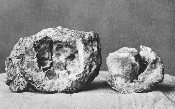
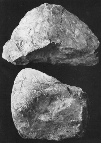
In most places along the Osage River this sandstone outcrops in bluffs as a single bed. At Brockman’s ford and King’s bluff the upper two or three inches are finely laminated. Near Ramsey post office and in Sycamore Spring hollow the sandstone occupies the creek beds and is split into relatively thin strata (photo 12).
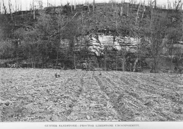
12 Gunter Sandstone - Proctor Limestone Unconformity
Chapter IV
GASCONADE LIMESTONE
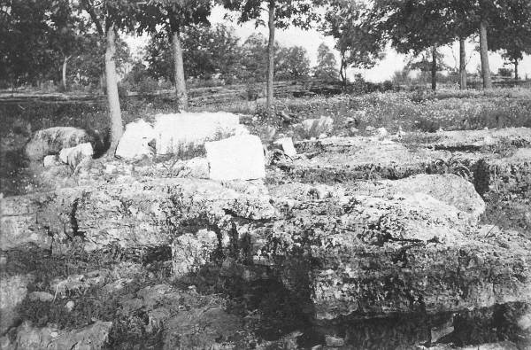
The Gasconade limestone is the surface rock over about on fifth of Miller County. The most typical exposures occur along the bluffs and ridges of the Osage River, which in several places has cut its channel through the entire thickness of the formation exposing the Proctor limestone and Gunter sandstone underneath. The Gasconade limestone in this county is very uniform and constant in thickness, averaging between 240 and 250 feet. Rising in precipitous cliffs along the Osage River and the large tributaries, it gives a ruggedness to the scenery that has justly made the Osage valley one of the most picturesque in the state. High bluffs on either side skirt the river throughout its entire course in the county. At Capps and just above and below Bagnell the bluffs are precipitous and especially high, having in the two latter places an elevation of about 350 feet above the river. Up to the present time the greater part of the lead and zinc ores mined in Miller County have come from areas where is present Gasconade limestone (photos 13 and 14).

13 Recession in bluff of Gasconade Limestone on Osage River
14 Differential Weathering of Cherty Dolomite
Chapter V
St. Elizabeth Formation
This complex has been named the St. Elizabeth because it is typically developed in the town of St. Elizabeth. This formation varies much, as well in thickness as in lithological characters, being usually a fine grained regularly stratified quartz sandstone of a light grayish brown color, but sometimes passing into a heavy bedded light gray or whit sandstone. The formations include lead, zinc, silica, copper, barite and iron ore. The McMillan and Crump diggings on the north side of the river are the only mines from which any considerable amount of ore has been taken. A large part of the iron of this county is in the St. Elizabeth formation south of the Osage River. The Bolin and Sandstone creeks south of the Osage River contain the most sandstone (photos 15 - 18).
15 Flat Topped Ridge Underlain by the St. Elizabeth Formation
16 Curling Structure in Dolomite of the St. Elizabeth Formation
17 Differential Weathering of Ordovician Chert
18 Cross Bedding in Bolin Creek Sandstone
Chapter VI
Jefferson City Formation
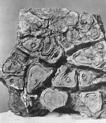
The Jefferson City formation, so named by Winslow because it is typically exposed at Jefferson City, Missouri, underlies the higher portions of the county on both sides of the Osage River. This formation consists principally of beds of dolomite (limestone or marble rich in magnesium carbonate), containing chert nodules and in places interstratified with thin layers of chert, sandstone and shale. The Jefferson City formation underlies the gently rolling prairie land north of the Osage River, the ridge land near the village of Ulman, and the broken hill country in the southern part of the county. The formation has a tendency not to form steep cliffs due to the ease with which the comparatively thin beds flake off, forming step like slopes rather than precipitous bluffs. The disintegration of the dolomite, sandstone and shale of the Jefferson City formation furnishes the best soil of any of the formations in Miller County. Consequently, the best farming land, outside of the river bottoms, is in the prairie country north of the Osage River. South of the river away from the river bottoms the best soil is in the region around Ulman. Besides having a more desirable composition, this soil retains moisture longer than that of the other formations (photos 19 and 20).
19 Weathered Surface of Pitted Beds of Jefferson City Limestone
20 Peculiar Form of Chert Nodule
Chapter VII
Pacific Sandstone
South of the Osage River, particularly in townships 38 and 39 north, ranges 13 and 14 west, on the tops of the highest ridges, where the dolomite of the Jefferson City formation has a development of from 100 to 150 feet, there are numerous fragments of sandstone, chert and quartzite. Although the fragments are abundant, the beds from which they were derived are exposed in very few localities. However, such as remain indicate clearly that at one time at least portions of the southern half of the county were overlain by a sandstone formation which has since been almost entirely removed.
Chapter VIII
Lower Carboniferous Limestone
The Upper Burlington Carboniferous limestone has a very limited areal distribution in Miller County. It occurs in small, isolated areal distribution in Miller County in small, isolated areas called outliers; as chert boulders and pebbles; and as chert and limestone fragments in the Saline Creek area.
Note: Chert is a fine-grained silica-rich microcrystalline, cryptocrystalline or microfibrous sedimentary rock that may contain small fossils.
The Upper Burlington limestone appears to have been laid down in a sea of moderate depth, teeming with animal life. The absence of vegetable remains and clay matter indicates that the strata were deposited at some distance from the shore. No ore has been found in this formation. The lime has too many joints to be of value as a building stone. It has been used to a small extent for foundations and the Missouri Pacific railroad has used it in several places for bridge piers and road ballast (photo 21).
21 Burlington Limestone showing Local Dip
Chapter IX
Graydon Sandstone
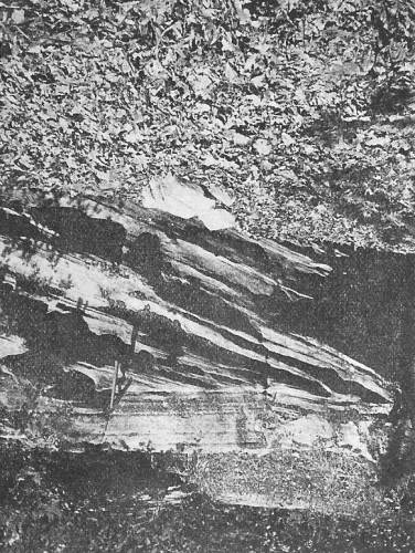
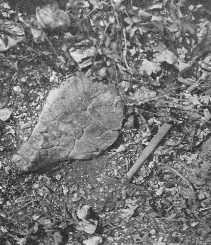
Observations in the fields suggest that the Graydon sandstone, in part at least, and the Coal Measure shale are probably phases of the same formation. About 150 separate and distinct areas of Graydon sandstone in Miller County are found, three fourths of which are north of the river. All but thirty of these are found in a belt six miles wide adjacent to the Osage River. The Grayson sandstone is composed of fine to medium grained, well rounded quartz sand. The sandstone is regarded as a rock in which lead and zinc ores are unlikely to occur and in Miller County there is no exception to this rule. The crushed sandstone has been used locally in plaster and was utilized to a small extent in the concrete used for the bridge abutments along the Chicago, Rock Island & Pacific Railroad (photos 22 - 26).
22 Jointing in Graydon Sandstone
23 Polygonal Markings on weathered surface of Graydon Sandstone
24 Graydon Sandstone - Adcock Exposure
25 Shale showing Slicken Sides and
Boulder of Faulted Limestone showing Planing and Scratching
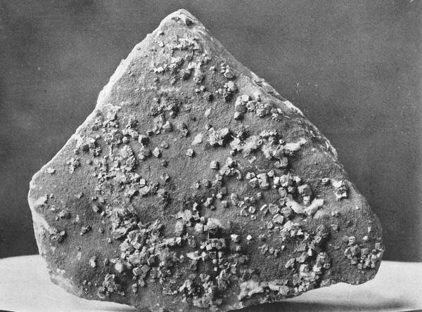
26 Sandstone incrusted with crystals of Galena from Little Nugget Mine
Coal Measure Shale
The Coal Measure shale occurs on the north side of the river as does the Graydon sandstone. Sixty isolated areas were located north of the river. All of these are small, the largest not having a diameter of more than 700 feet. Fossils are common in the Coal Measure shale in some areas. Both cannel and bituminous coal are associated with the Coal Measure shale. Some of the numerous minings include the Loveall diggings, The Little Nugget Mine, The Sight Me Prospect, the Son Prospect, the Republic Coal Mine, the McClure Prospect, the Knowall Prospect, the Scott Shaft, the Spaulding Prospect, the Garner Well Section and the Gageville Mines (photo 27).
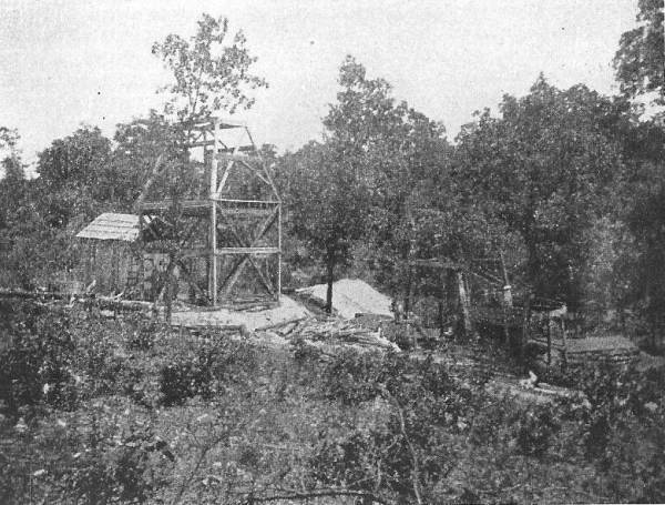
27 McClure Mines
Chapter X
Glacial Age
Glacial granite boulders were found at eight localities in the bottom land of the Osage River. The boulders are subangular and are in some instances polished on one side. The occurrence of several boulders at almost every locality noted, indicates that they were probably transported on icebergs.
Chapter XI
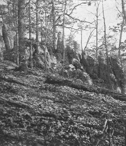
Structure
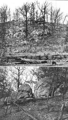
The faults south of the Osage River in Miller County are all tension of gravity faults. Raven’s bluff located along the Big Tavern Creek is one of the most famous land marks in the area. It is a big unturned block of faulted Gasconade limestone 130 feet high. It is located at the west end of a narrow ridge separating Tavern Creek from two of its small tributaries (photo 28).

28 Raven's Bluff
Chapter XII
Dolomite and Chert and Their Origin
Dolomite
No pure or even approximately pure limestone formations occur in Miller County. All are sufficiently high in magnesium carbonate to be classed as dolomite.
Chert (a rock resembling flint and consisting essentially of a large amount of fibrous chalcedony with smaller amounts of cryptocrystalline quartz and amorphous silica) most consistently is found in the St. Elizabeth formation. There is considerable difference of opinion regarding the origin of Chert. Some believe it is of organic and others that it is of chemical origin.
Chapter XIII
Economic Considerations
Barite
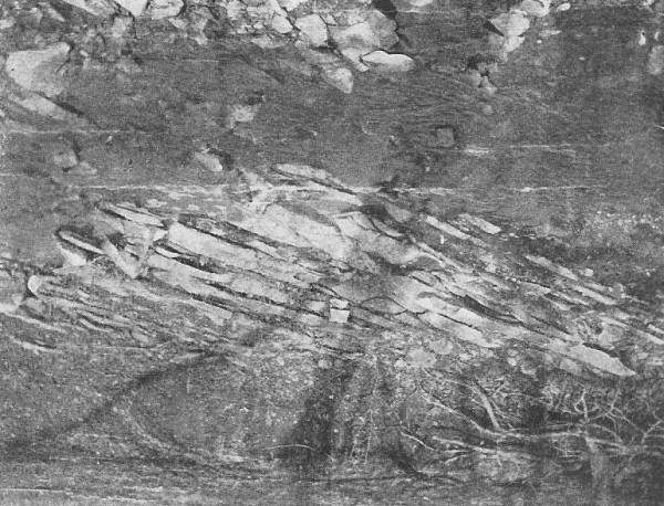
Barite, or barium sulphate (BaSO4) is commonly called “tiff” by the miners, and the “diggings” are known as “tiff banks.” This mineral occurs in all parts of the county either in crevices and cavities in the rock or as fragments in the residual clays. The latter deposits have been the source of nearly all the barite shipped from Miller County. In the “tiff banks,” it is mainly concentrated next to the underlying country rock, although small pieces are scattered through the clay. The Seigel Martin “tiff bank” located on a high bluff overlooking the Little Gravois creek, is a type of the “tiff banks” of Miller County. In this bank the barite occurs in reddish clay overlying the Gasconade limestone and is about 40 feet from the top of the formation. Nearly all the barite is segregated in the two feet of clay immediately above the rock. It occurs in more or less rounded masses of the crystalline variety. The surfaces of the fragments are usually stained red with iron oxide, but the interior is white. Some bluish colored crystals with inclusions of small hematite and malachite crystals were observed. The barite in this county is usually mined at odd times by the farmers. The strip it method is employed in mining and the cleaning is done by hand. The product is mainly sold to local merchants who ship it to St. Louis. Although one of the most abundant minerals in Miller County, it is being mined very little.
Building Stone
Excellent building stone for rough masonry abounds in Miller County. The wide distribution of good rock, coupled with the thinness of the soil, accounts for the numerous small quarries and the absence of any large ones. With a greater demand for substantial buildings and the introduction of better railroad and highway facilities, Miller County might become a considerable producer of dimension stone.
“Cotton rock” has been used extensively as a building stone throughout central Missouri. It is a compact, fine grained, argillaceous dolomite, having a white or cream color. It is soft and can be cut and dressed very easily. This rock occurs abundantly in the extreme northern and southern portions of Miller County where it is quarried on a small scale. When newly laid it has a pleasing appearance but weathering has a tendency to open up the stratification planes with the result that layers scale off.
Pitted dolomite beds occur in many parts of the county and constitute an excellent source of supply for rough dimension stone. The numerous cavities and occasional siliceous patches render it unfit for hammer dressed work. The rock is medium to coarse grained, and is strong and durable. It can be obtained in large blocks, and is well adapted for heavy foundation or footing purposes.
Clay
Both residual and transported clays occur in Miller County. The residual and stream clays will probably never be used for making anything but common brick. The brick in the Iberia Academy building were made out of clay obtained in the western part of the village near the head of Lenox branch.
Gold and Silver
The visitor to Miller County everywhere hears rumors of gold and silver discoveries. The belief in the existence of these metals in Miller County can be traced to four sources: (1) to the finding of iron pyrite which bears a slight resemblance to some gold ores; (2) to the tradition of rich silver mines once worked by the Indians and Spaniards; (3) to the reports issued by unreliable assayers; and (4) to the so called Colorado “miner” and the “diving rod expert.” There is very little, if any, probability that these ores occur in Miller County.
Iron
All the iron ore in this county with the exception of a few scattering boulders of limonite, occurs south of the Osage River. Iron deposits were known to exist in this and neighboring counties at a very early date. About ten years after the close of the Civil War there was a boom in iron mining in Miller County, as a result of which a number of new banks were developed. The mining was carried on by large outside corporations, who prospected the southern part of the county very thoroughly. Innumerable shallow pits were dug, but in not more than a dozen localities were the deposits considered important enough to work. It is known that some of the ore was carried by wagon to the railroad at Hancock and Dixon, and some was hauled to Capps and shipped by boat down the Osage River. At several of the “banks:” the ore was never moved from the dump piles. Considerable of the ore hauled to Capps was never shipped and may be seen today in piles near the steamboat landing.
Mining was carried on more or less spasmodically for a period of five years, when it was entirely abandoned. Since that time scarcely any attempt has been made to develop these properties, although several new ore bodies have been located. Poor transportation facilities, combined with the discovery of enormous deposits of iron ore in the Lake Superior region, are the most potent reasons for the cessation of iron mining in the county.
Lime
Up to the present time lime burning in this county has been carried on in a very primitive manner. In the rural districts each farmer makes his own lime by heaping and burning together wood and limestone boulders which have been covered with earth and sod. Sometimes a hole is dug in the hillside and in this the lime is burned.
Mr. J.E. Sullen has operated a kiln east of Etterville for eight years. He states that during this time he has sold $525 worth of lime, of which nearly one half was produced in 1900. The entire output was sold to farmers and towns people in the immediate vicinity. Abandoned or temporary kilns are found in many areas.
Lead and Zinc
Miller County is within the so called Central Missouri lead district. This district, as a whole, has been much less exploited than other areas and the product is consequently small. The greater share of lead output of Miller County has been mined along the Saline and the North Little Saline creeks. This area, known as the “Saline diggings,” extends four miles east and west, and five miles north and south. Other diggings are scattered throughout the county.
Mr. H.M. Breckenridge, Jr. was among the first, if not the first writer to mention the occurrence of lead in the region of tributaries to the Osage River. He says that as early as 1811 hunters reported an abundance of lead in the country adjacent to the Osage River. Soon after this, Schoolcraft stated that lead had been found in the Osage country. Henry King, M.D. in his report of 1839 states that lead is found everywhere along the Osage River, and that the Little tavern, the Saline and the Little Gravois, are among the creeks on which good lead indications exist.
In the fifties, it is said, that the pioneers gathered galena (a bluish-gray cubic mineral with metallic luster consisting of lead sulfide and constituting the principal ore of lead) from the creek beds and smelted it in hollow logs to obtain lead with which to make bullets.
Up to the time of Meek’s visit to Miller County in 1855, only a few insignificant prospect holes had been sunk and little or no “mineral” had been produced. He notes the occurrence of galena both in the rock and in the clay at a number of places.
Capps diggings are said to have flourished before the war, and enough galena was mined to warrant the erection of a smelter.
Shallow mining began on a large scale in 1868 or 1869. Perhaps the first mining was at the Clay Diggings north of Etterville. The discovery of the Fox Diggings soon followed and then that of the Curty and Indian Grove Diggins. About this time the Loveall Diggings were reopened and worked on a large scale. All of the galena produced came from the clay and in consequence the cost of mining the ore was very little. The deepest shafts, sunk to bed rock, represented but a half week’s work, and the most improved hoist was a portable windlass.
In 1878 the price of lead fell from $5.15 to $3.40 per hundred weight, and lead mining in Miller County became unprofitable. Also about this time Miller County became a center for the production of railroad ties, and the farmer who had formerly employed his winter months profitably in mining, found more lucrative employment in cutting ties. The low price of lead and the abundance of tie timber partially account for the lapse in lead mining in Miller County.
The first lead smelter, of which we have any record, was operated at Capp’s before the Civil War. In 1870, a lead furnace was erected on Saline Creek. In the fall of 1874, a furnace was built at the Gageville mines on the ridge northwest of the main shaft. The ruins of the furnace are still standing. From 1894 until 1902 the output of lead was approximately 160 tons in the county.
That completes this old geological survey and mine survey of Miller County made in 1903.
For those who may be interested, the following document contains scans from the narrative above which describes the exact location on the Miller County Plat Map of all the mines in Miller County in 1903 (photos 29 - 41):
29-41 The Geology of Miller County
Click image to read entire document in PDF format
I was invited to participate in one of the events at the Missouri State Fair on “Bluegrass Day” last August 17. The event was a memorial to Lee Mace and the Ozark Opry which was one of the Lake of the Ozarks’ major entertainment venues for fifty three years. The memorial was part of the fair’s Show Me Bluegrass Festival in which several blue grass bands participated. My invitation came from Lee’s nephew, David Webb, who is the son of Lee’s sister, Lois Mace Webb. As I had grown up in Lee’s home town, Tuscumbia, and knew the family well, I told some anecdotes about Lee and his family which were commonly known around Tuscumbia. I was really excited to see so many people come out to be part of the tribute to Lee and the Ozark Opry. It was held under a large tent near the fair’s coliseum where about a full capacity of a hundred visitors attended each of the two presentations. David had prepared a collage of photos and videos from previously recorded Ozark Opry shows going back to the early 1950’s when the show started. Of course, early on, only a few photos were available; but in later years Lee had his show video taped for TV. These tapes have been archived and saved at the Opry’s office in Osage Beach, MO. I gathered most of my anecdotes from previous Progress Notes about Lee and the Ozark Opry as well as a history of his family. You can read these previous Progress Notes at these links:
- July 21, 2008
- August 25, 2008
Here are a couple of photos taken by David Webb at the event. The first one is of a number of posters giving the history of the Opry (photo 42).

42 Poster Display
The second photo is of David Webb, nephew of Lee Mace, standing at the side of the stage presenting some video tapes of old Opry TV shows (photo 43).
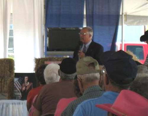
43 David Webb
Here is a brochure which David passed out at the event (photo 44):

44 Opry Flier
One of my volunteer activities is as a member of the Tuscumbia Alumni Association committee which is chaired by Larry Flaugher. Our association is holding a fund raiser which Larry has named the “Pig and Pickle Fest” to be celebrated at the Tuscumbia Riverside Park Saturday, September 17, 11 am to 7 pm. Beneficiaries are Miller County Special Olympics, Tuscumbia Alumni Association, and the Village of Tuscumbia. Featured will be BBQ and fried dill pickles accompanied by great music and a car show. Here is the flier Larry designed for the occasion which gives more detail (flier).

2011 Pig and Pickle Fest Flier
Click image for larger view in PDF format
If you want to have a really good time plan to attend the event which I anticipate will be very enjoyable and fun.
That’s all for this week.
 Joe Pryor
Previous article links are in a dropdown menu at the top of all of the pages.
|