|
Monday, February 7, 2011
Progress Notes
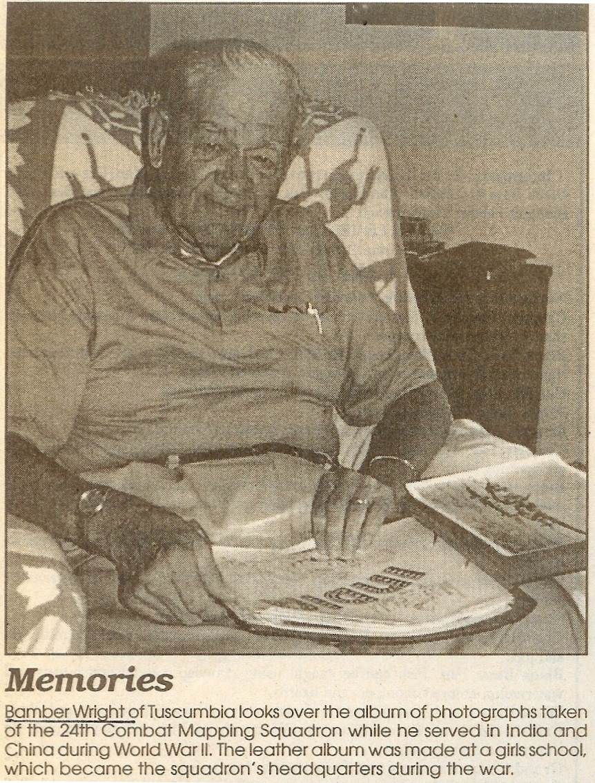
A few weeks ago I presented the WWII experience of my Uncle David Bear who had recently passed away. In that narrative he mentioned that his friend, Bamber Wright of Tuscumbia, had been drafted the same time as he (photo 01).
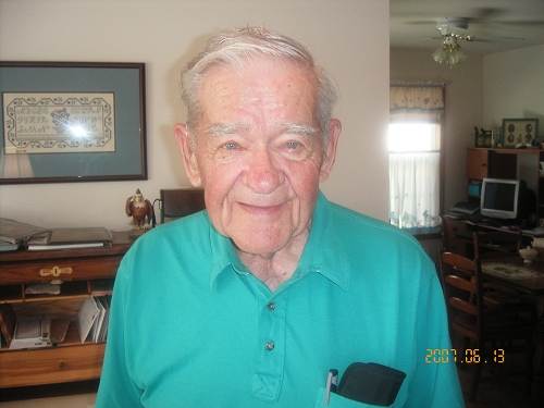
01 Bamber Wright Bamber’s WWII experience in India was in a different part of the world than David’s which was in Italy. But both were a long way from home and both had to deal with some degree of culture shock as well as the danger of being in proximity to a combatant enemy. A few years ago (I don’t have the exact date), Ginny Duffield interviewed Bamber for the Vernon Publishing Company regarding his WWII experience. So for this week I will present Bamber’s memories of his time in service during WWII.
Tuscumbia Man Served In India, China In WWII
Miller County Autogram Sentinel (Date unknown)
By Ginny Duffield
“We were fighting the forgotten war.”
That’s what one of the men who served with Bamber Wright of Tuscumbia in the 24th Combat Mapping Squadron, U.D. Army Air Corps, said at one of the reunions they have held since World War II.
Wright said while the squadron didn’t officially see combat, some were killed, perhaps as the result of enemy action in the Burma China Theater, where the squadron served.
The squadron photographed and mapped airfields on the Asian subcontinent, including India, Burma and parts of China. Had the war lingered on, and spread, the information on the airfields would have been invaluable to Allied Forces.
“We were bombed a couple of times up there,” Wright said. “We didn’t do much, but somebody had to do it.”
Wright is a member of the China Burma India Veterans Association, and helped organize and attended a reunion in Branson this spring. Next year the group will meet in Indianapolis.
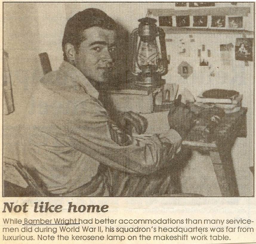
He also is a member of a local chapter of the group, which meets about every other month in Jefferson City (photo 02).

02 Bamber Wright
Click image for larger viewThirty one members of the squadron were killed as they flew over the landscape, using cameras mounted in what originally was the bomb bay of the planes. “We lost one plane that had five on it, that just disappeared,” Wright said.
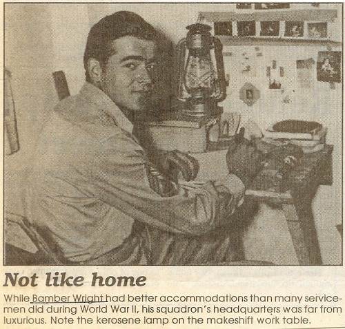
“We all went through photo school at Lowry Field in Colorado,” he said.
Wright worked primarily on the ground, in the dark room. In order to operate a camera on board a plane, he would have had to attend gunner school in Florida. He said he did not want to spend the summer in Florida, so did not attend that school.
Three copies were made of each photo, two negatives and a positive. Some of the smaller air fields would fit on one 24 by 24 negative, but others had to be pieced together from several negatives.
The copies of the photos were flown out on separate planes, in case one should go down. However, Wright said at least once the photos were mistakenly all put on the same plane.
“I don’t know how many air bases there were in India. We mapped them all,” Wright said.
One of the squadron members had been a professional photographer in New York, and has taken some of the pictures in the Baseball Hall of Fame,” Wright said. Wright said once when he was in Boston he stopped to visit the man, Maurice LaBelle.
He also visited his old lab chief in Florida twice.
The squadron left California on November 18, 1943, and arrived in Bombay, India on Christmas Day. The group left the ship the next day. “We traveled across India on a train,” he said. They ended up about 100 miles from Calcutta, at what was a girl’s school.
Wright said the troop ship, which had been a commercial vessel before the war, took the southern route through the Pacific, attempting to avoid the worst of the fighting between the U.S. and Japan. The ship called at Tasmania, the largest of Australia’s islands and then spent several hours in the harbor at Perth, Australia. A destroyer and cruiser joined the USS Uruguay for the remainder of the trip to India, Wright said.
Wright was in the service until late 1945. “I got back in New York on the first day of November, 1945,” he said (photo 03).
03 Bamber Wright
Click image for larger viewThe squadron was not large, and the men rotated assignments. “We all got acquainted,” Wright said. Now, when they get together “it’s kind of like a big family group.”
Wright said he kept in touch with several of the squadron members ever since the war, and has enjoyed the reunions. He did not go to one in Wichita and is sorry he missed that one. But he has made all the others (photo 04).
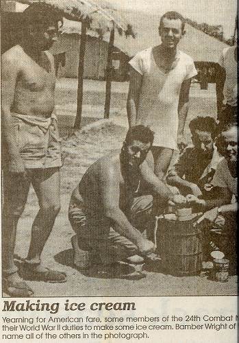
04 Some Members of the 24th making Ice Cream
Bamber, Far Right, can name all of Them
Click image for larger viewA buddy from the reunions even got a copy of “God Is My Co-Pilot,” autographed by Robert Scott, the author of the poem by the same name. Scott is 91 and the buddy lived in the same town and took the book to him, Wright said.
Wright and wife Marcella married after the war. They have three children: Ann Lee, Phillip and Jack. They also have eight grandchildren ranging in age from five to 12, four girls and four boys. Wright said they enjoy having the whole family home often, even if it is a little noisy.
Wright said World War II veterans serving in Europe, Africa or the Pacific had a much tougher war than he did.
“This was entirely a different war,” Wright said about serving in the Atlantic Theater. “It was not ever compared to Europe.”
Certainly, it seems that in a World War where soldiers can find themselves assigned to a wide variety of destinations, the experiences of any one individual can be quite variable. I previously presented the tragic experience of Army Air Force pilot Ace Tyler, who was shot down over Germany during WWII during a heroic mission. You can read that story at this previous Progress Notes.
Another very sad story is that of James Edward Law, who was tortured and killed in the Japanese forced Bataan Death March of 1942. You can read that story at this previous Progress Notes.
In a future Progress Notes I will present the WWII story of Fred Livingston, which is quite impressive due to the number of times he faced combat in a career that began with WWII and continued through the Vietnam conflict.
A number of Miller County residents who are from the eastern part of the county near Eugene are recruiting assistance to bring some improvements to the old Gageville Cemetery. The effort is being lead by John Curty who last year wrote and circulated the following letter:
Gageville Cemetery
Miller County, Missouri
John Curty
Board Member
Gageville Cemetery
May 30, 2010
Dear friends,
I thought I might mention some of the history of Gageville. The town began near the middle of the nineteenth century by a man named Gage. He was familiar with this area and knew there was a great demand for lead ore, and the abundance of lead in this part of Miller County. Mr. Gage also knew that many people were in need of employment, so he established a lead mining operation, which provided many opportunities for other enterprises such as café’s, barber shops, hotels, stables etc. An early landowner donated approximately three acres of ground for a combined church and school and the town’s name became “Gageville,” named after Mr. Gage. Eventually, there was the need for a place to bury loved ones, and they began the Gageville Cemetery. The town eventually disappeared after the mining prospects and production dried up, but the cemetery is still in existence.
The late Jim Albertson and his surviving spouse, Wanda Albertson, were the moving forces toward establishing an endowment fund for the Cemetery’s care, which is still ongoing. Because of their tireless dedication, several maintenance jobs and continued mowing in the last several years has ensured its peaceful and serene setting. A few improvement goals of the continuing maintenance items are:
1. Headstone resetting (some has been done)
2. Improved fencing around the area
3. Clearing some of the brush from the south portion of the cemetery
4. Survey and Plat of Grounds
5. Level and reseed the grave sites that have sunk down over the years
6. Construct a small shelter structure for burial services, and other activities
We can use your gift of $50 or $100 or whatever you might be able to give to build the fund and continue the legacy of our loved ones. Please make your gift payable to “Gageville Cemetery,” and mail to John Curry, 1901 N. Howard Drive, Independence, M0) 64050. Additionally, please remember the cemetery in your estate plans. We have obtained Tax Exempt Status for the Gageville Cemetery, and our identification Number is 26-028741, that provides all contributions deductible.
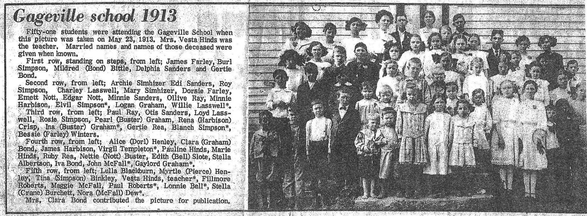
We are including a list of names of the grave sites inventory made some time ago. If you are a relative, or if you know of someone that is related to any of these names, please let us know so we can obtain what history they may have or know. Enclosed is a newspaper clipping of the Gageville School students of 1913. We appreciate your continued interest and support for the Gageville Cemetery.
Sincerely,
John Curty
Board Member Gageville Cemetery
May 30, 2010
|
Here is the newspaper clipping of the Gageville School students sent by Mr. Curry (photo 05):
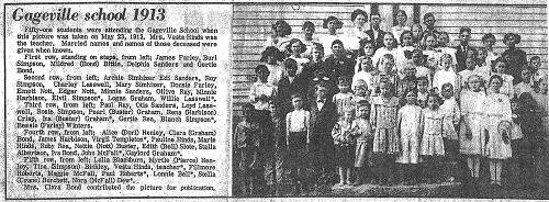
05 Gageville School - 1913
Click image for larger viewI had written about the old town of Gageville previously which you can review at this previous Progress Notes.
I am going to review some aspects of that story this week to encourage interest in this historic area and the old Gageville Cemetery. First, I will copy here a history of the old Gageville lead mine written by Helen Gibson which was the reason that the small town was begun many years ago (photo 06):
06 Helen Gibson History of Gageville Lead Mines
Helen Gibson
One of Miller County's early pioneers, Robert Enoch Simpson, was born December 23, 1807 in Kentucky. On September 11, 1828, he married Keziah Greenup. In 1834, Robert and Keziah moved to Missouri, where they settled just across the Cole County line in Saline township. This is now the site of Spring Garden, Missouri. They were the parents of nine children.
In 1850, their oldest son, John, at the age of 20, left Missouri with a party of fellow Missourians. They rode horseback to Fresno, California, where John became an early California pioneer. John's brother, Thomas W., joined him in California in 1857. Thomas owned 258 acres of land in Miller County. One of these tracts of land, north of the Saline Creek, had a lot of lead mines. Later Thomas sold the land with the mines to his brother John. Jasper N. Henley, John's brother-in-law, had the power of attorney to act as his agent regarding the land. Huge deposits of lead were found on this land in 1869 (photo 07).
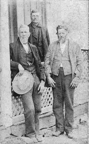
07 James, Jasper and John Henley, Helen's Great Grandfather Jasper Henley leased the land to Alfred Franklin, James Simpson (brother to Thomas), and William Carter for nine months. Carter soon sold his interest in the lease to Franklin and Simpson and they assigned their interest in the lease to H.A. Cugwin. Cugwin sold his interest to John Clark. Each had removed a lot of ore from the mines. A short time later, Madison Belshe offered John Simpson $1,400 for the land and he accepted. There was a mix-up as some one else was wanting the land, so Mr. Belshe saddled his fastest horse, and with silver in his saddle bags, rode to the State of California to pay Mr. Simpson for the land. He returned home with the deed in his pocket. In the meantime, John H. Clark was busy operating the mine. On October 1, 1869, Mr. Belshe, Joseph Fox and C.D. French appeared on the premises, ordering the miners to leave or face the law for trespassing. The miners left and Belshe, French and Fox took possession of the mine.
The Gageville mines were operated more extensively than any other mine in the county. The Miller County Vidette of July 13, 1876 gives the following location of Gageville as six miles northeast of Tuscumbia. Later, a Mr. Gage and Mr. Quimby of St. Louis purchased the mines, built a number of houses for the miners, including a hotel and general store, and erected a smelting furnace. This settlement was named Gageville after the name of Mr. Gage, the St. Louis investor. Large quantities of lead ore were smelted at the smelting furnace built by Mr. Gage and Quimby. In 1903, these two investors formed the Gageville Mining Company of which Mr. Ramsey of Jefferson City was president and Joseph Deibl was manager. The total production of lead ore from 1870 to 1879 has been estimated at 2000 tons. From 1880 to 1893, only about 100 tons of ore was produced. The decline was thought to be due to a fall in the price of lead and the railroad tie industry. Now no trace of the town of Gageville exists and the mine pits are filled up with debris and brush, for the most part lost and forgotten.
Sources: Gerald Schultz: History of Miller County; 1933. John Worth Simpson: A Family Of the American Frontier."
Here is a photo of one of the lead mines at Gageville, now almost hidden by the undergrowth of brush and dirt fill (photo 08).
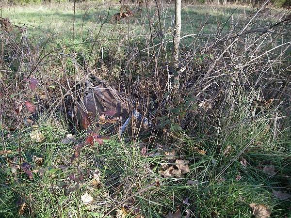
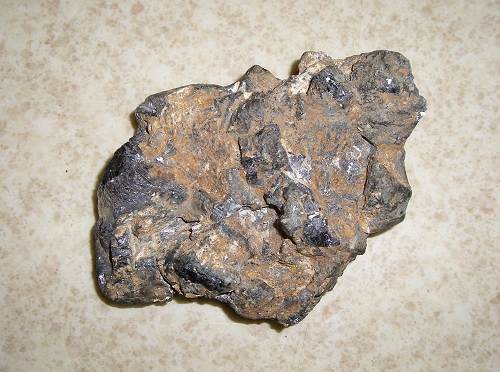
08 Old partially filled Lead Pit And here is a chunk of lead ore taken from this particular mine years ago shown me by Cindy Hart who now with her husband Norman own the property where is located the mine (photo 09).
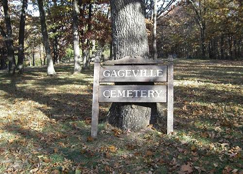
09 Lead Ore The Gageville Cemetery was first shown me by Helen Gibson about four years ago near where are located the lead mines (photo 10).
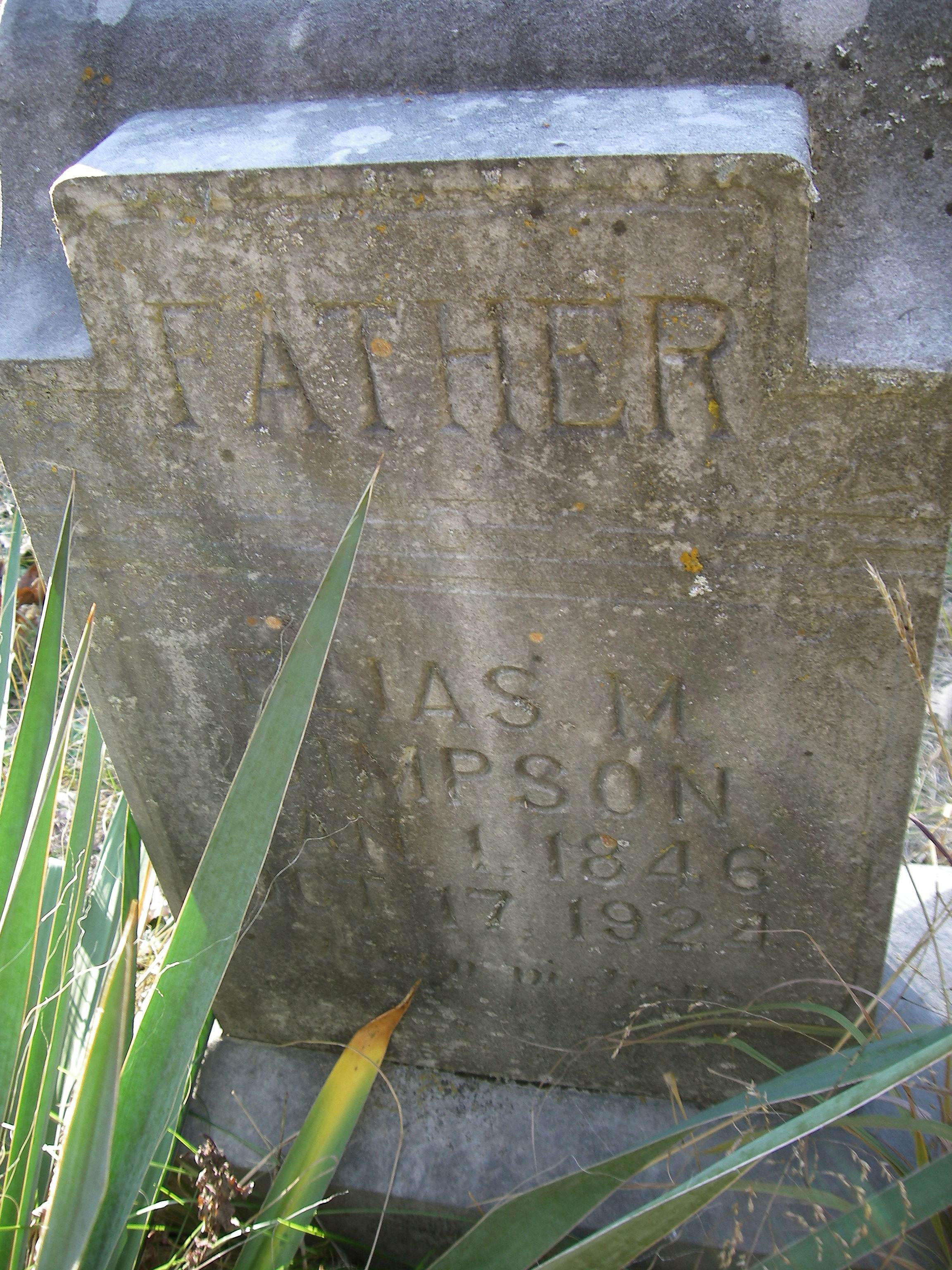
10 Gageville Cemetery Here are buried some of the earliest settlers of Miller county including the Simpson family (photo 11):

11 Simpson Headstone
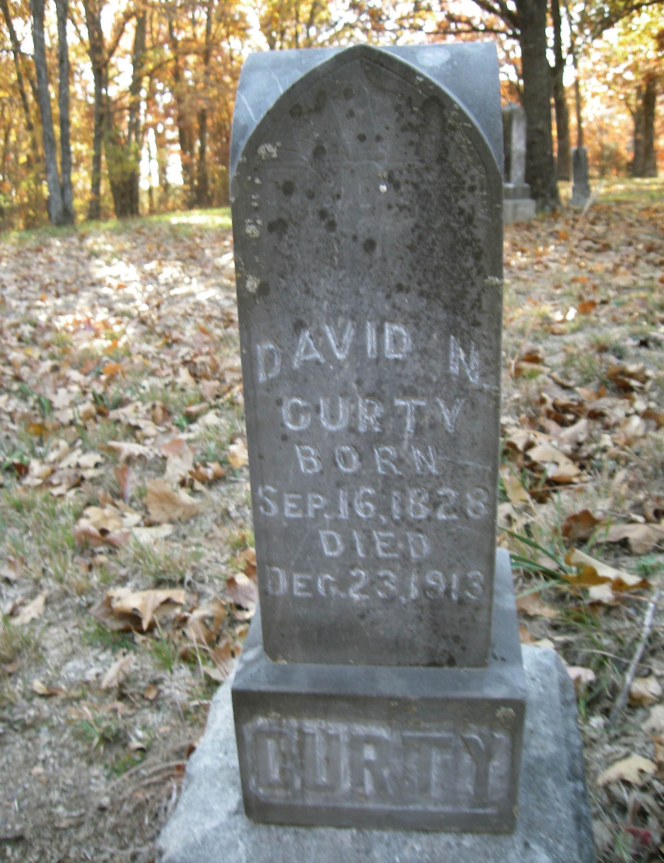
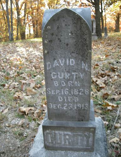
Click image for larger viewThe oldest gravestone, however, that I found on a quick search was that of David Curty (photo 12).
12 Curty Headstone
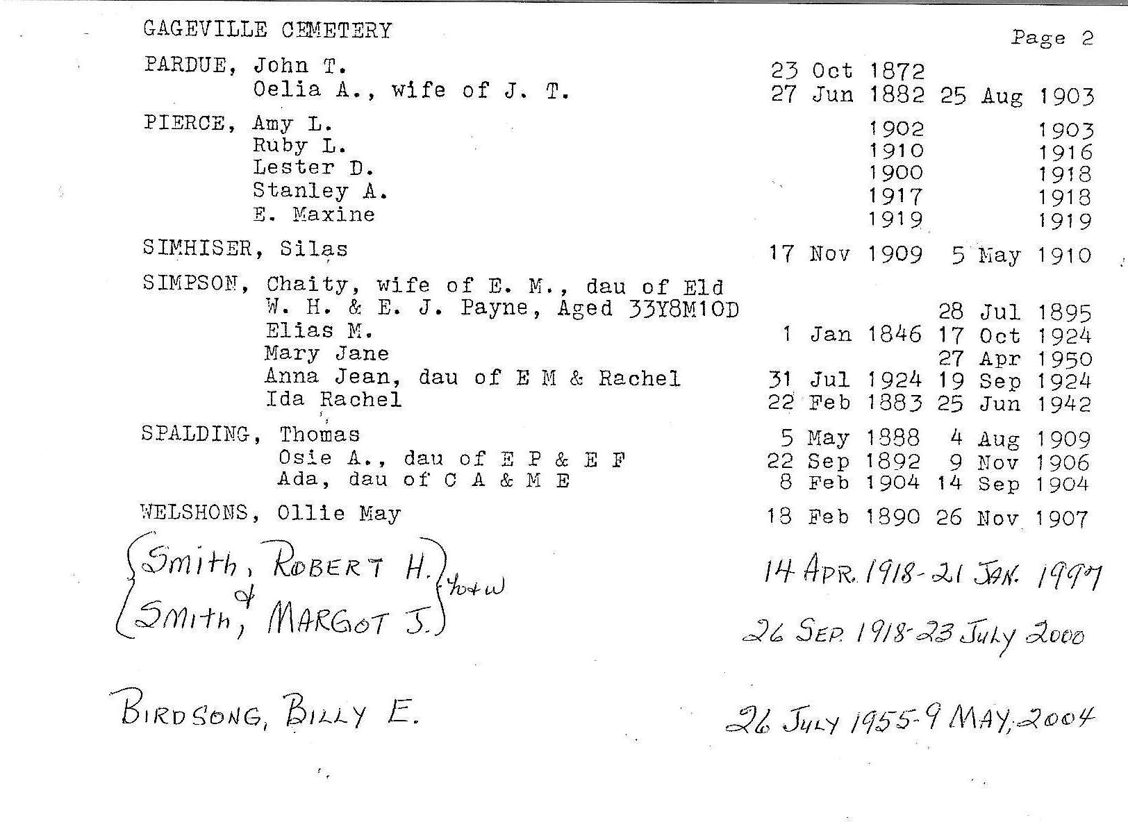
Click image for larger viewHere is a current inventory of those buried in the Gageville Cemetery sent by John Curty (photos 13 and 14).
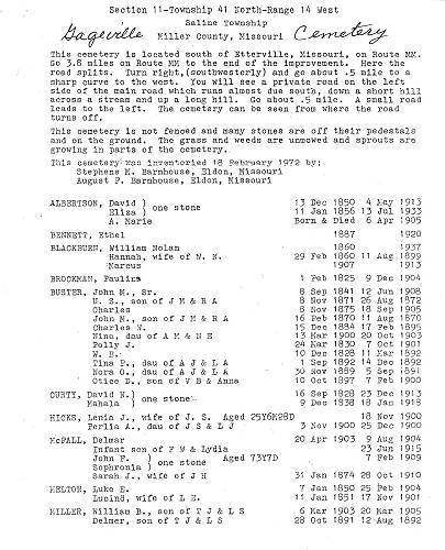
13 Gageville Cemetery Inventory Page 1
Click image for larger view

14 Gageville Cemetery Inventory Page 2
Click image for larger viewSo I hope this narrative will initiate some interest among readers about the old Gageville Cemetery and perhaps some will want to send a donation to Mr. Curty to help with the restoration of the old cemetery.
Some of the earliest names of settlements and places in Miller County have various etymological origins. Gerard Schultz, the former Professor of History at the Iberia Academy in the 1930’s, wrote a short essay about this subject which I will copy here:
GEOGRAPHICAL NAMES OF MILLER COUNTY
Miller County Autogram,
Gerard Schultz
August 28, 1930
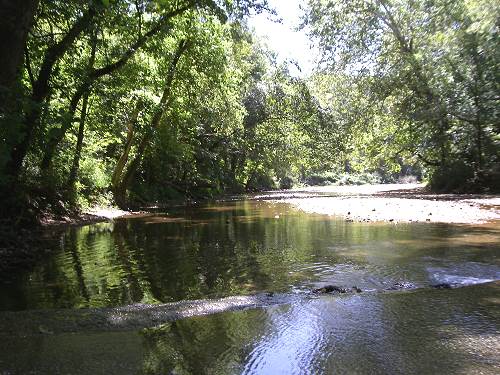
The streams, towns, and civil divisions of Miller County bear names of Indian, French, Spanish and American origin. The Osage River, the most important stream in the county derived its name from the Great and Little Osage Indians (photos 15 and 16).
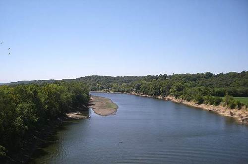
15 Osage River at Tuscumbia facing West from New Bridge
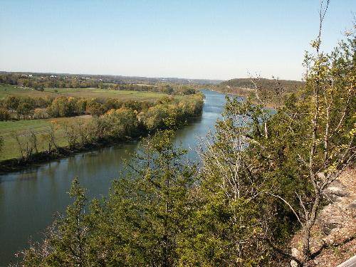
16 Osage River just below Tuscumbia Bridge The meaning of the word "Osage" is obscure, but it has been translated as "campers on the mountains" or "the strong." The latter meaning is especially significant as the Osage Indians were noted for their physical strength. The Osages were said to have been the tallest race of men in North America, few being under six feet and many being seven feet tall. These Indians were the first historic inhabitants of the Osage River region in Missouri.
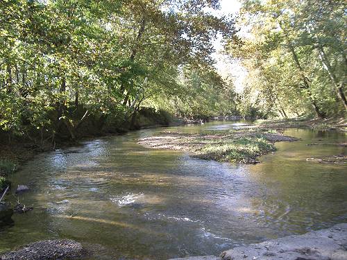
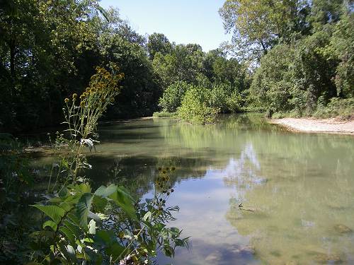
The names of all the larger creeks are of French origin. French explorers, traders, and trappers were the first white men to come to what is now Miller county. Passing up and down the Osage, they gave names to Tavern, Saline, Little Gravois, and Grand Auglaize creeks (photos 17 - 20).
17 Big Tavern looking Downstream
18 Big Saline Creek
19 Little Gravois Creek
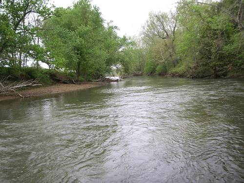
20 Windes Eddy on Glaize Creek The Tavern, the largest tributary of the Osage in the county, was originally known as "Caverne" creek, so called by some early Frenchmen for the large cave at the mouth of the creek.
Saline and Gravois are French terms pertaining to salt and gravel, respectively. Auglaize is a French phrase meaning "at the clay" or "at the loam."
As permanent settlements did not begin in this county until two decades after Louisiana Territory had been purchased from France by the United States, most of the place-names are of American origin, two exceptions being Tuscumbia and Iberia. Tuscumbia is derived from "Tash-kambi," a Cherokee Indian word meaning "The warrior who kills."Iberia is the ancient name for Spain.
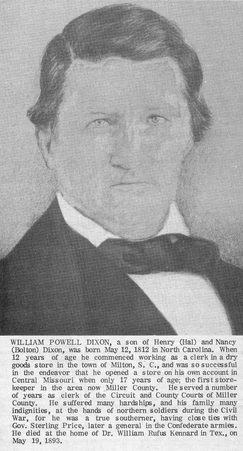
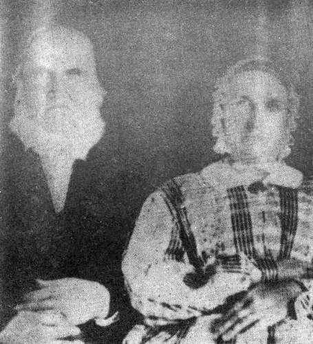
Spring Garden, the site of the first store in what is now Miller county, was named by William Miller and William P. Dixon for a place of that name in the southern part of Virginia (photos 21 and 22).
21 William and Sarah Miller

22 William Powell Dixon
Click image for larger viewOlean was laid off by H. S. Burlingame and James Proctor in the winter of 1881-82, when the Missouri Pacific railroad was built through there.
It was first called Proctor Station in honor of J. G. Proctor, but the post office was named Cove on account of another Proctor, Missouri. As this proved unsatisfactory, it was named Olean for a town of the same name in New York. Although the town site of Eldon was not laid out until the spring of 1883, it now ranks as a city. Eldon probably took its name from a place of that name in Iowa. It was started by G. R. Weeks (photo 23), T. J. Hart, Samuel Newton, and Minor Allen, who purchased forty acres of land and had it surveyed into town lots.
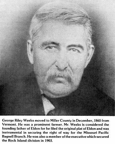
23 George Weeks Lakeside owes its existence to Osage Dam, a huge hydro-electric dam now in the process of construction. This dam will create the largest body of water between the Great Lakes and the Gulf of Mexico. The Lake has been named "The Lake of the Ozarks."
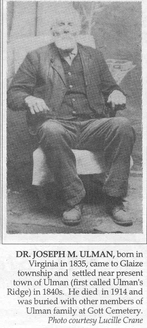
A number of individuals were honored with geographical names, such as Bagnell, Etterville, Ulman (photo 24), and Brumley. The last mentioned place was named in honor of William Carroll Brumley, a prominent figure in Miller county politics after the Civil war.
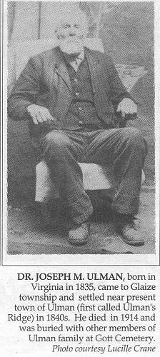
24 Dr. Joseph Ulman
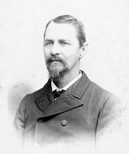
Click image for larger viewThe town of Brumley was laid out by J. M. Hawkins in 1877 (photo 25).
25 James M. Hawkins Bagnell was named for William Bagnell, who was in the railroad tie industry along the Osage river (photo 26).
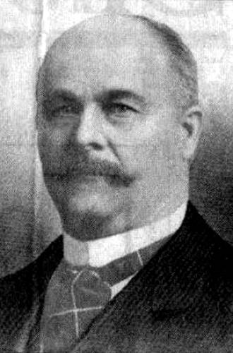
26 William Bagnell At one time more ties were shipped at Bagnell than at any other point in Missouri. St. Elizabeth is almost better known as Charleytown. It was given the latter name in honor of Charley Holtschneider of Westphalia, Osage county, who donated the land for the large and beautiful Catholic church erected there.
Miller county was created by an act of the General Assembly of the State of Missouri, February 6, 1837. It was named in honor of John Miller, the fourth governor of Missouri.
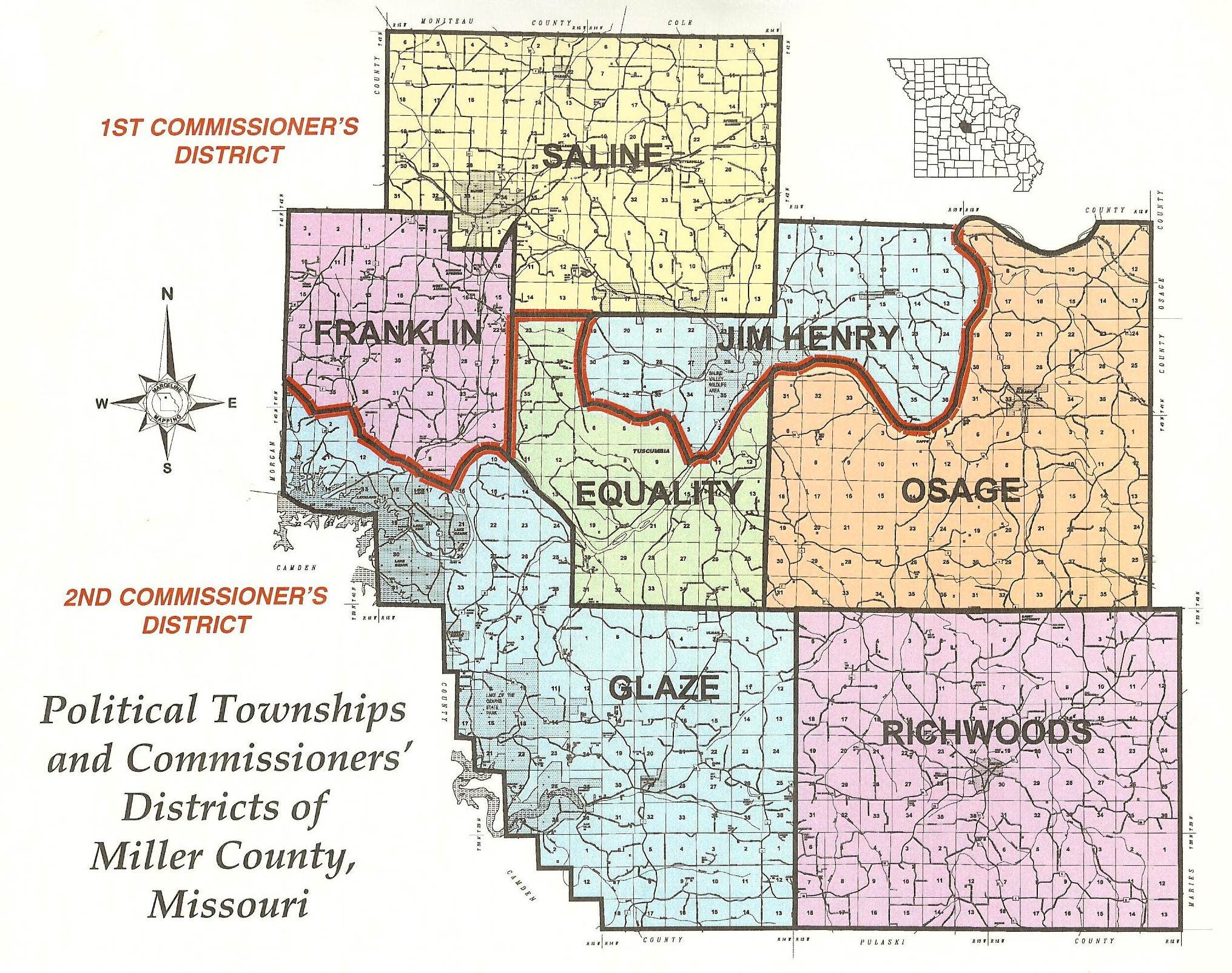
May 1, 1837, the county court opened its first session in the log house of William Miller, located near the mouth of Saline creek. On the following day, the court divided the county into four civil townships. These were Saline, Osage, Rich woods, and Equality. The present-day townships of Jim Henry, Glaze, and Franklin were formed later (photo 28).
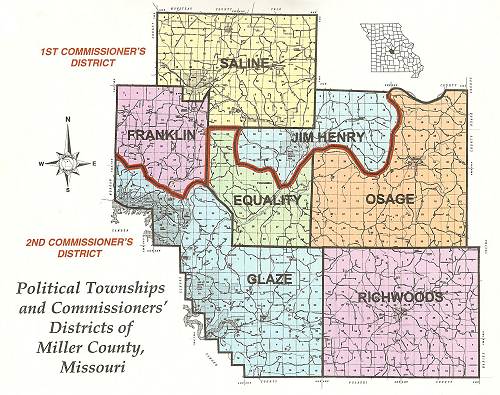
28 Miller County Political Townships
Click image for larger viewSaline Township was named for the creek which heads in it. Glaze is an abbreviation of Auglaize. Jim Henry township bears the name of an Indian who lived in a cave in the western part of the township (photo 29).
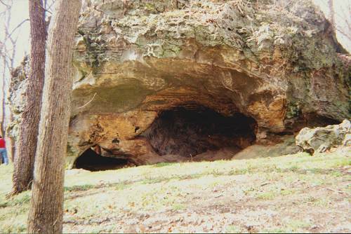
29 Jim Henry Rock Cave Osage township was named for the river which forms part of its northern boundary. Richwoods township was so named because the growth of timber was much larger in it than in much of the surrounding country.
That’s all for this week.
 Joe Pryor
Previous article links are in a dropdown menu at the top of all of the pages.
|