I received the following email recently from John Schultz, who is the son of Gerard Schultz, one of Miller County’s most well known historians:
Dear Dr. Pryor
Peggy Hake gave me your email address. I'm John Schultz. I'm the son of Jennie Lee Brumley Schultz and Gerard William Schultz. I spent my first 12 yrs. in Iberia. My father wrote The History of Miller County and also The Early History of the Northern Ozarks. I've been gathering the Wilson-Brumley family history for some time now.
I've been trying to put together a Wilson-Brumley family history reunion, maybe the first weekend of October. I've talked to interested people in Houston, Texas and in a town in Mississippi. I would appreciate whatever help you can give. Do you have names of any descendants?
I answered John and told him I would certainly be interested in attending a Wilson-Brumley reunion. In fact, John’s mother Jenny, who was the wife of Gerard Schultz, is a distant relative of mine. My great grandmother Susie Forrester Abbett's sister, Sarah Forrester, married George Ramsey and they had a daughter named Aulta. Aulta Ramsey married Johnnie Brumley and their daughter, Jenny Brumley, married Gerard Schultz. Therefore, Gerald Schultz married my great great Aunt Sarah’s granddaughter who would have been my fourth cousin. I didn’t know Gerard as he had left Miller County about the time I was born. I am very happy his son John is going to return once again to Miller County to host a reunion of members of his mother’s family.
At any rate, once again this week I am going to copy one of Gerard’s historical articles from the Autogram newspaper. These articles are an invaluable resource of Miller County history since Gerard wasn’t able to integrate all of them into his book, “History of Miller County” due to space restrictions. The following article by Gerard I copied from an old copy of the Miller County Autogram:
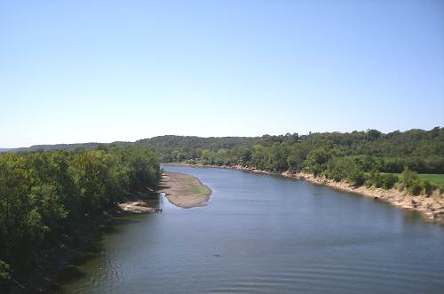
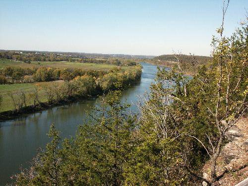
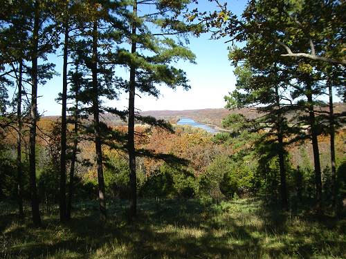
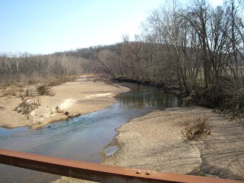
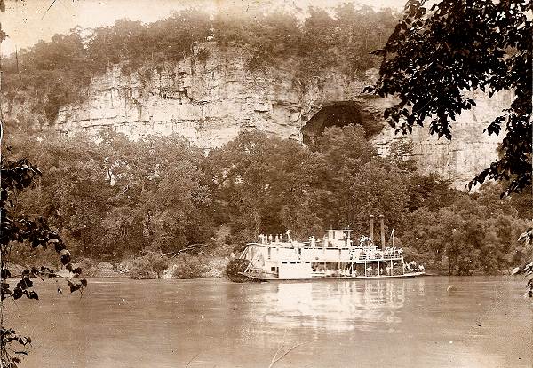
The streams, towns and civil divisions of Miller County bear names of Indian, French, Spanish, and American origin. The Osage River, the most important stream in the county, derived its name from the Great and Little Osage Indians (photos 02, 03 and 04).
02 Osage River at Tuscumbia facing West from new Bridge
03 Osage River East of Tuscumbia
04 Osage River between Panther and Humphrey's Creeks
The meaning of the word “Osage” is obscure, but it has been translated as “campers on the mountains” or “the strong.” The latter meaning is especially significant as the Osage Indians were noted for their physical strength. The Osages were said to have been the tallest race of men in North America, few being under six feet and many being seven feet tall. These Indians were the first historic inhabitants of the Osage River region in Missouri.
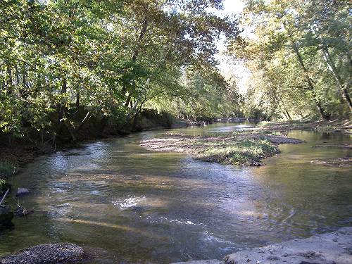
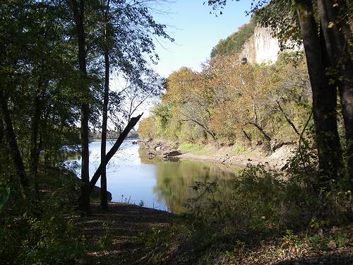
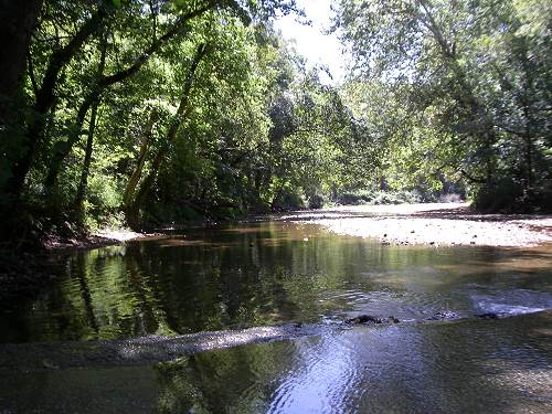
The names of all the larger creeks are of French origin. French explorers, traders, and trappers were the first white men to come to what is now Miller County. Passing up and down the Osage, they gave names to Tavern, Saline, Little Gravois, and Grand Auglaize creeks. The Tavern, the largest tributary of the Osage in the county, was originally known as “Caverne” creek, so called by some early Frenchmen for the large cave at the mouth of the creek (photos 06 - 09).
06 Big Tavern looking upstream at Highway A Bridge
07 Big Tavern looking downstream near mouth at Osage River
08 Big Tavern Osage Confluence - Bat Cave Upper Right
09 J.R. Wells and Bat Cave in Bluff
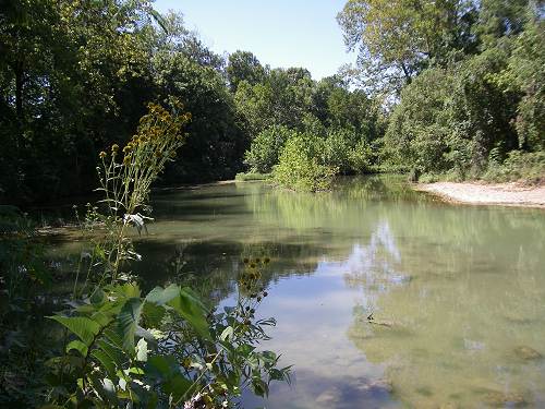
Saline and Gravois are French terms pertaining to salt and gravel, respectively (photos 10 and 11).
10 Big Saline Creek
11 Little Gravois Creek
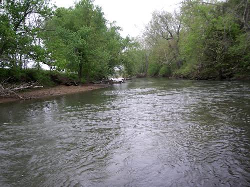
Auglaize is a French phrase meaning “at the clay” or “at the loam”(photo 12).
12 Windes Eddy on Glaize Creek
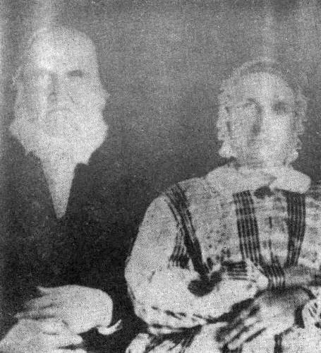
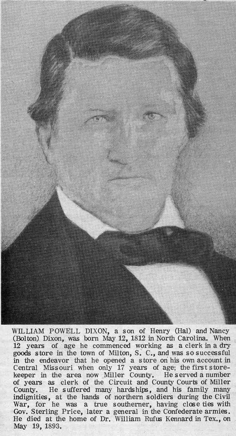
As permanent settlement did not begin in this county until two decades after Louisiana Territory had been purchased from France by the United States, most of the place names are of American origin, two exceptions being Tuscumbia and Iberia. Tuscumbia is derived from “Tash-kambi,” a Cherokee Indian word meaning “The warrior who kills.” Iberia is the ancient name for Spain. Spring Garden, the site of the first store in what is now Miller County, was named by William Miller (photo 13) and William P. Dixon (photo 14) for a place of that name in the southern part of Virginia.
13 William and Sarah Miller
14 William Powell Dixon Click image for larger view
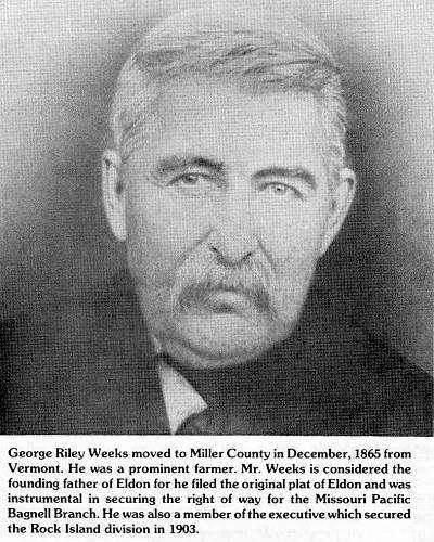
Olean was laid off by H.S. Burlingame and James Proctor in the winter of 1881-1882, when the Missouri Pacific railroad was built through there. It was first called Proctor Station in honor of J.G. Proctor, but the post-office was named Cove on account of another Proctor, Missouri. As this proved unsatisfactory, eventually, it was named Olean for a town of the same name in New York. Although the townsite of Eldon was not laid out until the spring of 1883, it now ranks as a city. Eldon probably took its name from a place of that name in Iowa. It was started by G.R. Weeks (photo 15), T.J. Hart, Samuel Newton and Miner Allen, who purchased forty acres of land and had it surveyed in to town lots.
15 George Riley Weeks
Lakeside owes its existence to Osage Dam, a huge hydro-electric dam now is in the process of construction.
Note: When Gerard wrote this article the name of Bagnell had not yet been selected for the dam.
This dam will create the largest body of water between the Great Lakes and the Gulf of Mexico. The lake has been named, “The Lake of the Ozarks.”
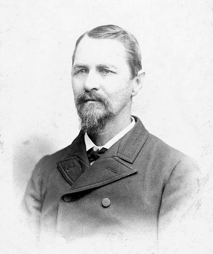
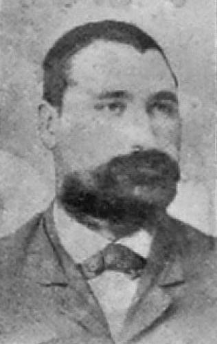
A number of individuals were honored with geographical names, such as Bagnell, Etterville, Ulman, and Brumley. The last mentioned place was named in honor of William Carroll Brumley, a prominent figure in Miller County politics after the Civil War. The town of Brumley was laid out by J.M. Hawkins in 1877 (photo 16).
16 James M. Hawkins
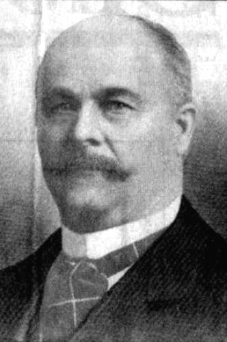
Bagnell was named for Wiliam Bagnell (photo 17), who was in the railroad tie industry along the Osage River.
17 William Bagnell
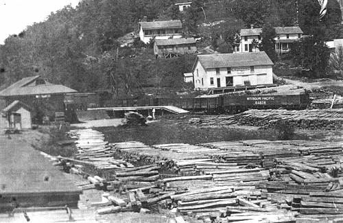
At one time more ties were shipped at Bagnell than at any other point in Missouri (photo 18).
18 Bagnell Tie Yard
Ulman was named after Dr. Joseph Ulman (photo 18a).
18a Dr. Joseph M. Ulmon
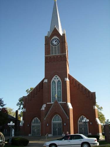
St. Elizabeth is almost better known as Charleytown. It was given the latter name in honor of Charley Holtschneider of Westphalia, Osage County, who donated the land for the large and beautiful Catholic Church erected there (photo 19).
19 St. Lawrence Church
The first church was built close to the river and was the first Catholic Church in the county (photo 20).
20 First Catholic Church in Miller County
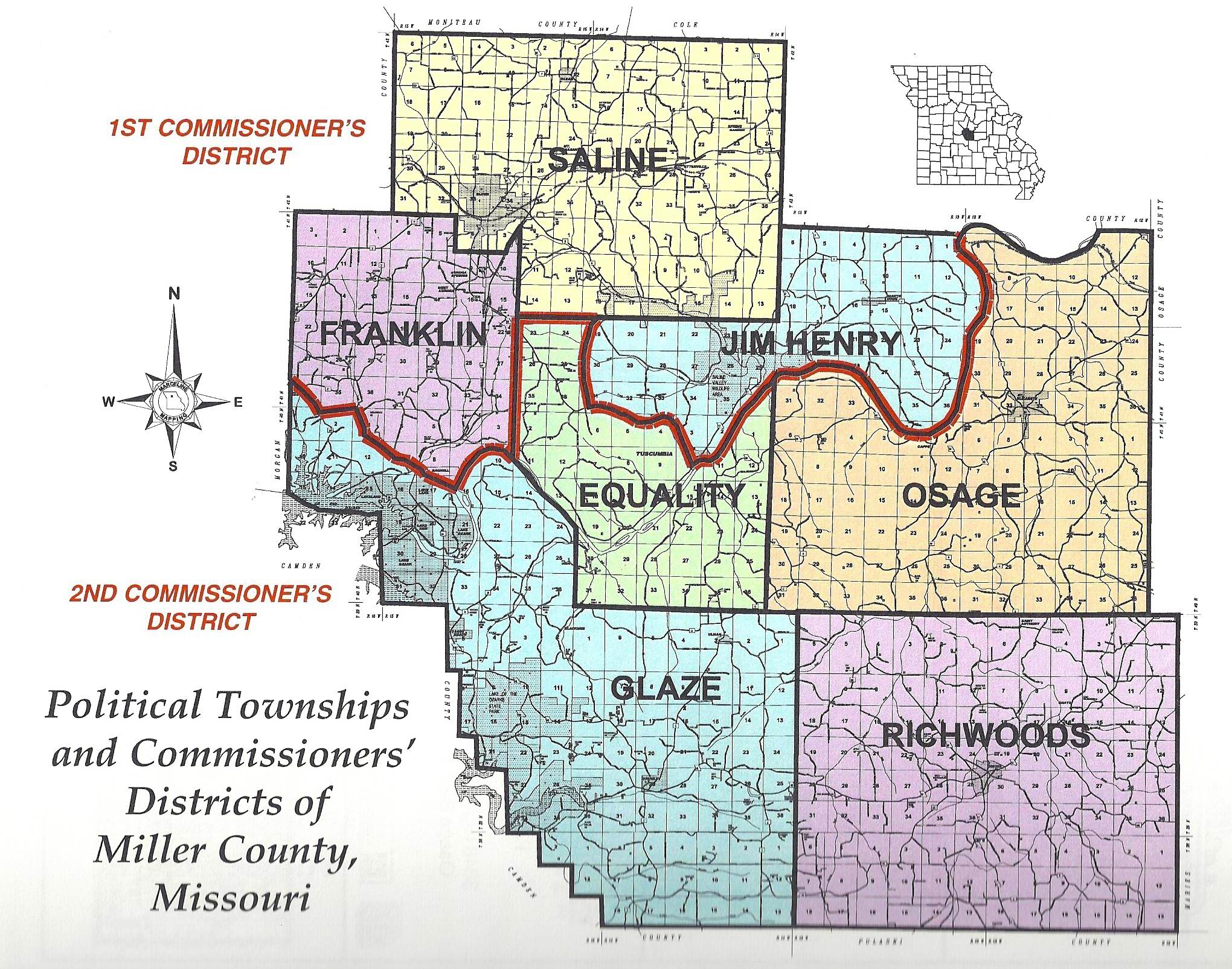
Miller County was created by an act of the General Assembly of the State of Missouri, February 6, 1837. It was named in honor of John Miller, the fourth governor of Missouri.
May 1, 1837, the county court opened its first session in the log house of William Miller, located near the mouth of Saline Creek. On the following day, the court divided the county into four civil townships. These were Saline, Osage, Richwoods, and Equality. The present day townships of Jim Henry, Glaze, and Franklin were formed later. Saline township was named for the creek which heads in it. Glaze is an abbreviation of Auglaize. Jim Henry township bears the name of an Indian who lived in a cave in the western part of the township (photo 22).
Osage township was named for the river which forms part of its northern boundary. Richwoods township was so named because the growth of timber was much larger in it than in much of the surrounding country (photo 23).
23 Miller County Townships Click image for larger view
Thanks Gerard.
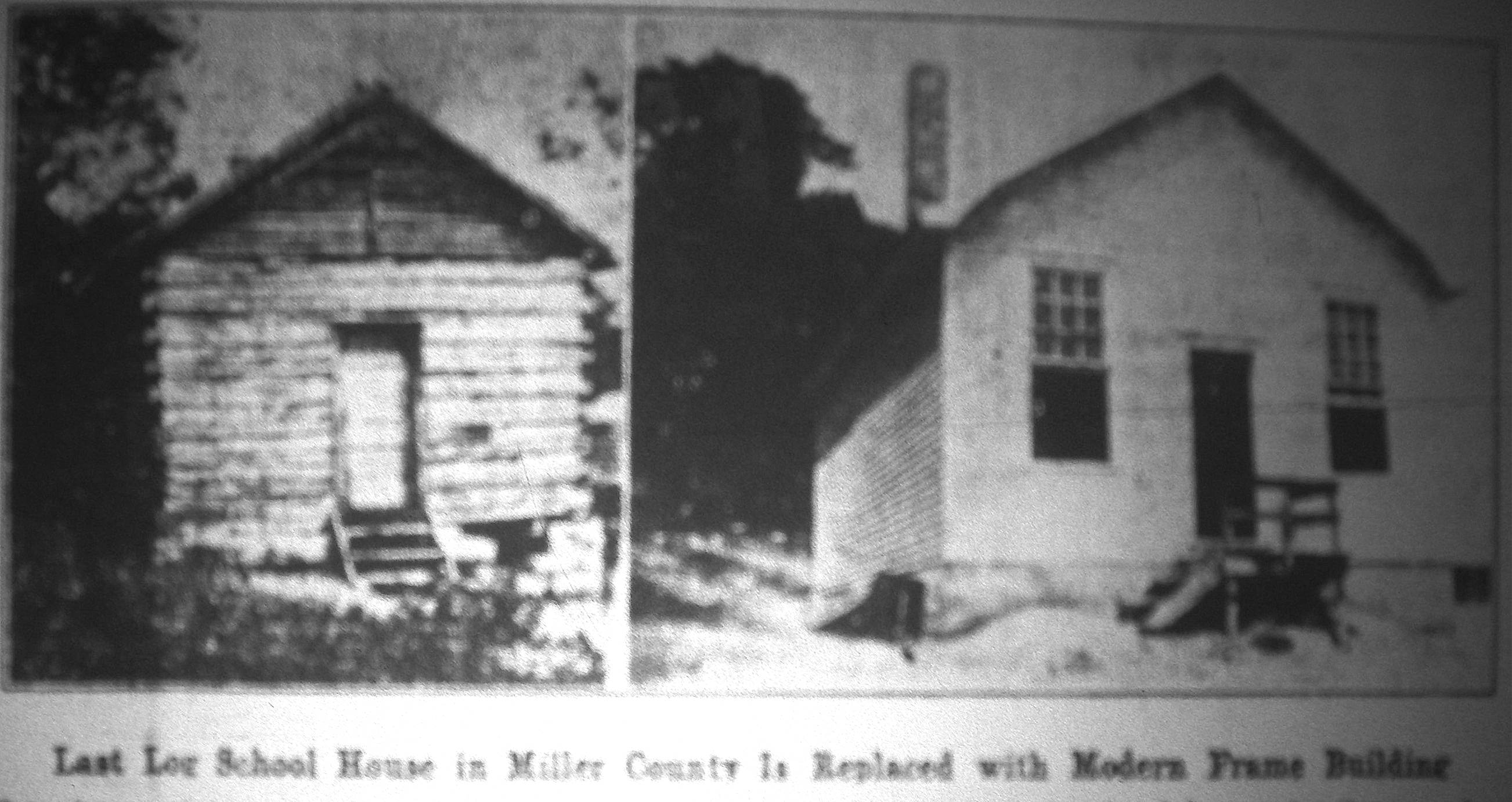
The last log one room school house in our county was replaced in 1931. I found an article in the Autogram which recorded this event:
Last School House in Miller County is Replaced With Modern Frame Building
Miller County Autogram Sentinel
January 22, 1931 (photo 24)
24 Capps School - Old and New Click image for larger view
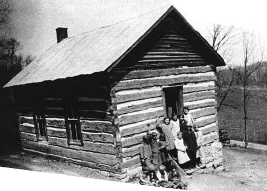
The above picture represents the recent evolution of the old log school house in Capps school district, Number 39, to a modern frame building. The old building was built 42 years ago and is the last log school house to give way to a frame building (photo 25).
25 Original Log Capps School
The new structure is 32x20 feet in dimensions, with a five foot cloak room across the front of the building. The ceiling is 10 ½ feet high. Light is admitted into the building on the east and north sides, with 20 % plus window pane, and windows have shades adjustable. Equipment includes slate blackboards, new single seats, oiled floors, sanitary water cooler, book case, teacher’s desk and chair; and, in fact, everything is modern except the heating plant, which will be added this fall if finances will permit. Two windows on the south side admit light for the cloak room, and eight windows in the east and two in the northeast corner, with windows close to ceiling, admit light advantageously for the entire school room. The building was designed by County superintendent C.D. Snodgrass (photo 26), and was constructed by board members A.L. Barnhart, I.M. Curry (photo 27) and Ed Wickham.
26 C.D. Snodgrass
27 Irvin Curry - Husband of Barcy (Abbett) Curry
Note: Our website has a short history of the Capps school.
School Information:
The original Capps School was a log building that was constructed in the latter portion of the 19th century.
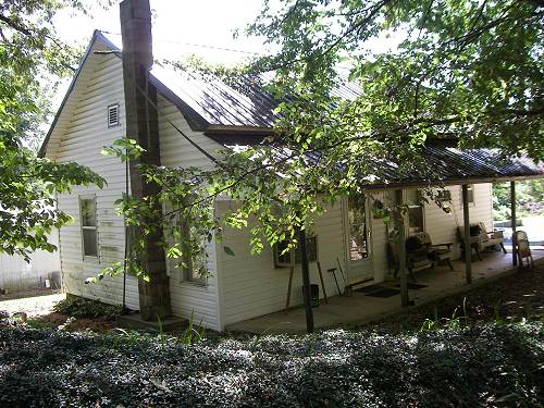
Once it was known as the Springdale School deriving its name from a spring that was located nearby and used daily by the children for their water supply. The school that now exists was built approximately in the year 1929. Mrs. Susan Pendleton lives in the remodeled school today (1982) which sits just a short distance south of Highway 52 across the highway from the old settlement of Capps Landing (photo 28).
28 Second Capps School is now a Home
Some of the teachers who have taught in this second school have included Anna Heldstab; Fleeta Jarrett; Ace Tyler; Faye Bond Lamb; Lita Lynn Livingston Keeth; Billie Thompson Setser; and Lillian Coburn. The school was consolidated into the St. Elizabeth School District in the time era of 1948-49. The last teacher to teach at the school was Ms. Lillian Coburn who lives today in Sacramento, California.
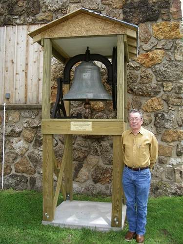
Jim Clark, one of our board members went to grade school at Capps. By that time the old log school had been replaced by the frame building described above. Jim said that he and his family lived a couple miles west of the Capps school. Some of the walk to get to the school was through woods and steep hills. His sister, who was two years older, was frightened to walk through the woods alone. For that reason Jim’s parents decided he should start school a year earlier than normal so he could accompany her on the walk to the school. For that reason Jim eventually finished school before a lot of his friends. Jim is the current caretaker of the Capps cemetery not far from the school where many of his relatives are buried.
Here is a photo of Jim at the museum in front of the old Tuscumbia Presbyterian Church bell for which Jim crafted the stand and roof for its outside display (photo 29).
29 Jim Clark in front of Bell
The town of Capps once was a thriving community but only a few buildings are left there now. One of the reasons early pioneers settled there was because the river had a natural landing area for a ferry as well as steamboats which delivered goods and products to local merchants and farmers. Kelly Warman-Stallings wrote an article some years ago detailing the history of Capps. It is on our website but for convenience I will copy it here:
CAPPS/CAPPS LANDING
By Kelly Warman-Stallings
The Ghost Towns of Central Missouri
I am not sure when the settlement of Capps came into existence, but probably in the mid 1800s. The Capps family, for whom the vicinity was named, was in Miller County as early as the 1840s. The small river town, which was located near the Osage River in northeast Miller County, had several business places at the turn of the 20th century. Situated on the south side of the river, and located in Osage township, it contained several general stores, a post office, a hotel, a blacksmith shop, a doctor's office, and a ferry boat crossing. It also had a school nearby, about 1/2 mile south.
The ferry boat crossing was called Capps Landing (some called the town Capps Landing as well) and it was a very important and major way of crossing the river for our pioneer forefathers. It was the nearest ferry and many folks relied on it both north and south of the river in Osage and Jim Henry townships.
Tuscumbia, the county seat in Equality Township, had a ferry also but it was quite a few miles upriver from Capps. The post office was established in 1892 and was in operation until 1911. After the turn of the century, Perry Nixdorf (son of Dr. Anton P. Nixdorf) set up a doctor's office in the small town. He also had a practice in the nearby town (across the river) called Mary's Home at the same time and traveled the river between the two settlements. This busy doctor resided in the Pleasant Farm area (photo 30).
30 Perry Nixdorf, M.D.
In 1878, the county had a total of 65 schoolhouses, yet only 56 teachers were employed and received wages of $22.50 per month. In 1878 there were 55 schools for the white children and one school for the black children. In 1930/31 there was a Capps school district No.39 and school was held in a small one-room schoolhouse just south of the small village. The teacher in 1930 was Lucy Kubachek who lived in Tuscumbia. The Capps school district was also known as Spring Dale.
Today, very little remains of the town. Once more, Mother Nature has reclaimed the land with her wooded areas and the mighty Osage rolls past what was once a busy ferry crossing. The Capps cemetery is still maintained and still bears the name of this once busy river town.
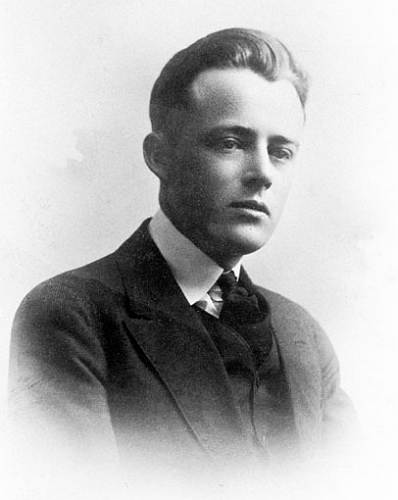
Recently, I found an old book published in 1949 which recorded the history of common “superstitious” beliefs among natives of the Ozarks of south Missouri and northern Arkansas. I thought it interesting enough to place it on our website in serial form over the next few weeks. It was written over a number of years by Vance Randolph (photo 31), originally a native of Kansas, who became enchanted with the Ozarks, moved here, and married a local native of the area.
31 Vance Randolph
Here is his biography from Wikipedia:
Vance Randolph (February 23, 1892 - November 1, 1980) was a famous folklorist who studied the folklore of the Ozarks in particular. He wrote a number of books on topics including the Ozarks, Little Blue Books, and juvenile fiction.
Randolph was born in Pittsburg, Kansas, the son of a lawyer and a teacher. Despite being born in a privileged home, Randolph dropped out of high school to work on leftist leaning publications. This did not stop him from attending college and he graduated from what is now Pittsburg State University in 1914. He pursued graduate work at Clark University and received a Master of Arts degree in psychology.
He moved to Pineville, McDonald County, Missouri in 1919. He never moved away from the Ozarks and remained in the Ozark Mountains from 1920 until his death. He met his first wife in McDonald County, Marie Wardlaw Wilbur, and made a living by writing for sporting and outdoor publications. While writing, Randolph used pseudonyms, but never for his work on the Ozark culture.
In 1927, Randolph had his first article published in the Journal of American Folklore, based on work on Ozark dialect and folk beliefs. The dialect work led to multiple publications throughout the 1920's and 1930's in American Speech and Dialect Notes. In 1947, Randolph had his first major book release, published through Columbia University, Ozark Superstitions.
Randolph wrote about non-folklore aspects of Ozark society, such as music. His Ozark Mountain Folks describes the creation of a distinctive church choir singing style created by a corps of uncredentialed, itinerant choral instructors.
Pissing in the Snow and Other Ozark Folktales was a national bestseller. He published over a dozen works on Ozark folklore. A longtime member of The Missouri Folklore Society, he was elected a Fellow of the American Folklore Society in 1978. He married Mary Celestia Parler in 1962. He died in 1980 in Fayetteville, Arkansas.
This week’s segment is a general introduction of the book. Because the narrative is long, I will place it as an attachment in the PDF format (photo 32).
32 Ozark Superstitons - Introduction Click image to read the entire introduction in the PDF format
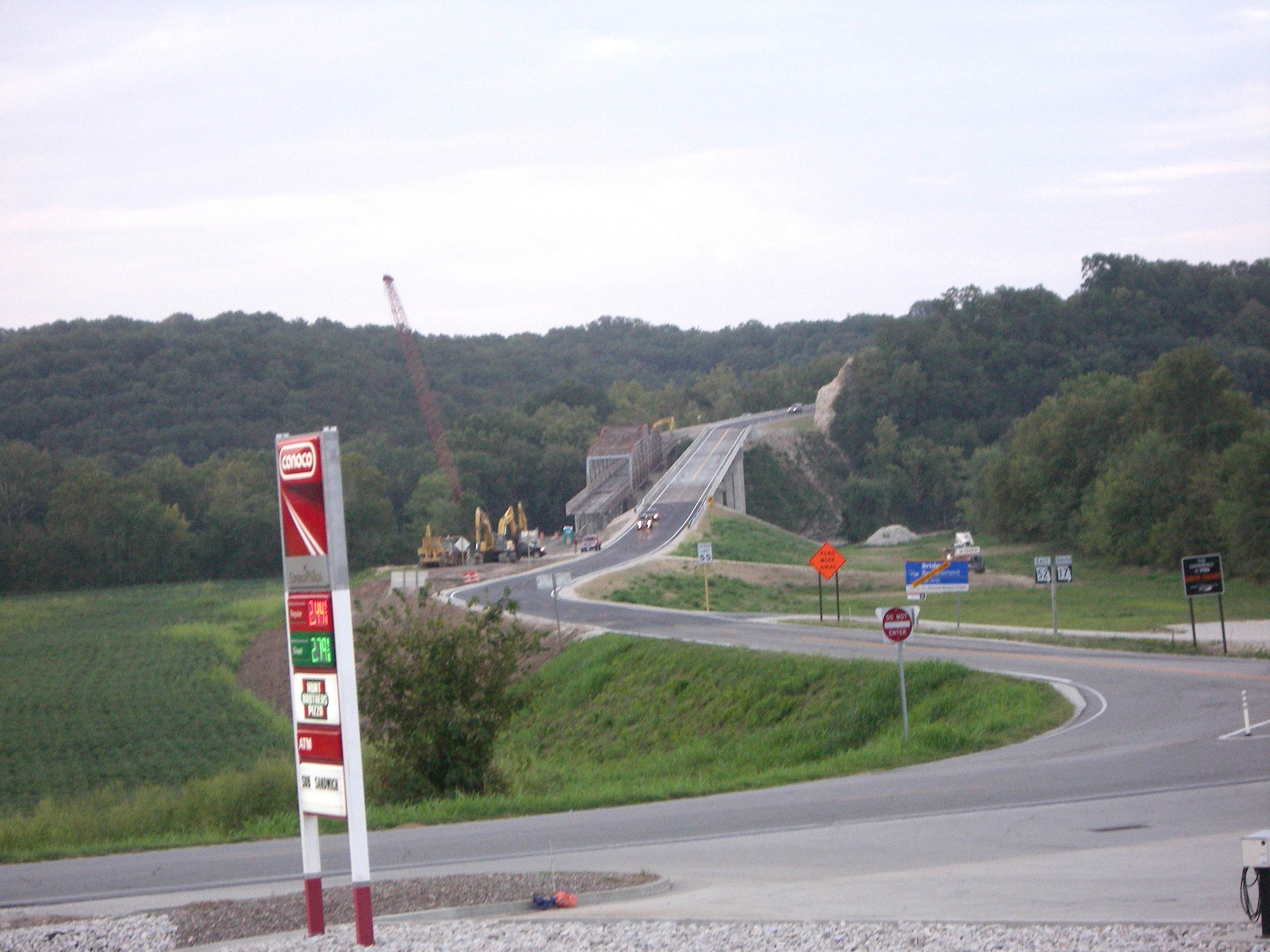
Last week’s Progress Notes was devoted to the new bridge opening ceremony and celebration. I found a website which gave a good history of the history of the bridge as well as construction details. According to the author the bridge has historical value and is eligible to be placed on the National Register of Historic Structures. The author has some strong opinions about the decision not to preserve the bridge because of its unique and historical design. However, whether you agree with him about that I think you will find the historical and construction detail recorded in his website very interesting.
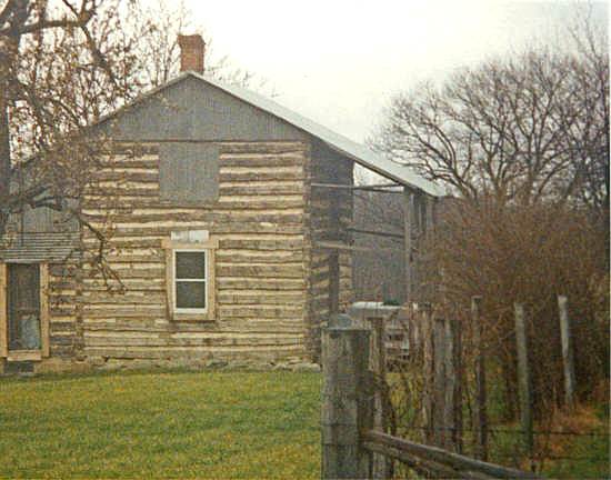
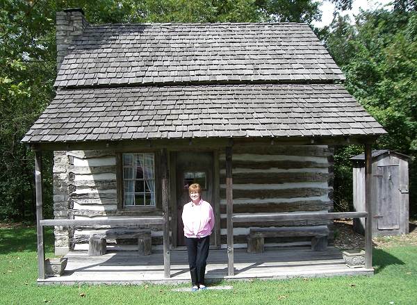
We occasionally have visitors to the museum who have a family connection to the old Lupardus Cabin now located on our museum campus. Perhaps they or relatives lived in the cabin at one time or another over its history at the original Lupardus farm near Ulman. For example, my wife’s grandparents, Willard and Maggie Boyd were the last occupants of the cabin. But it isn’t very often that we have a visitor who actually was born in the cabin. However, one of our visitors last week, Judy Thompson Comer of Jefferson City, is one of those few people who were born in the cabin. The cabin was where her father and mother, Mr. and Mrs. Jack Thompson lived at the time. I took her photo in front of the cabin which is located just north of the museum (photo 33).
33 Judy Thompson Comer
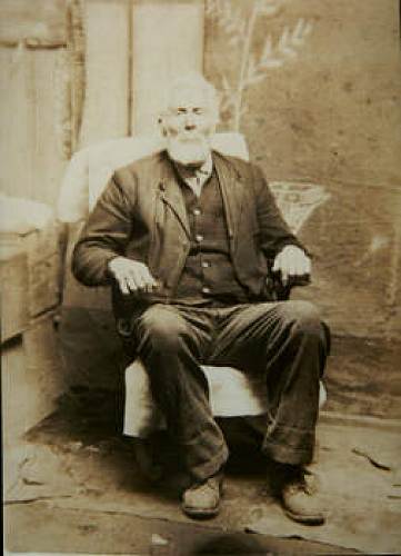
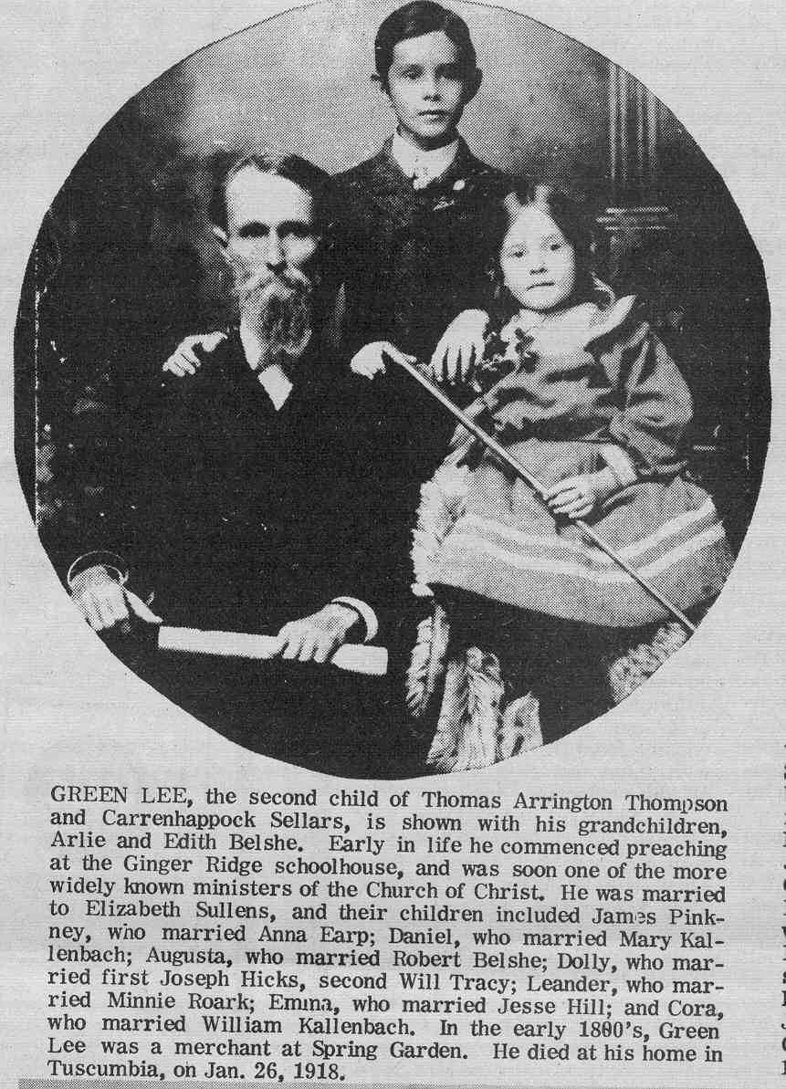
Judy’s great grandfather was Green Lee Thompson, one of our county’s early preachers and evangelists (photo 34).
34 Green Lee Thompson Click image for larger view
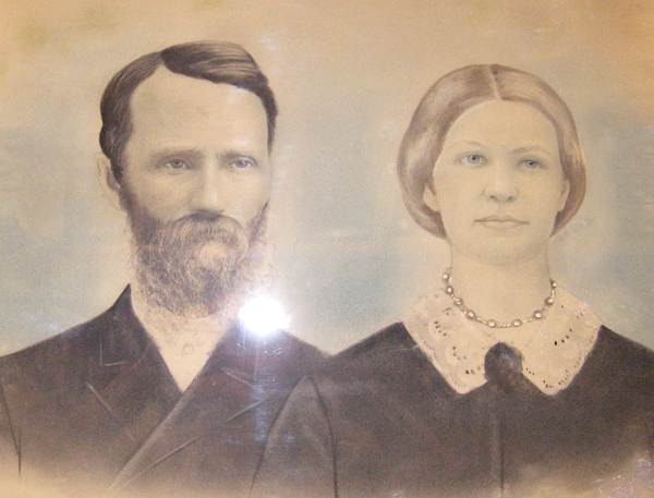
A large framed photograph of Green Lee and his wife Elizabeth is hanging on the “Wall of Patriarchs” in our museum (photo 35).
35 Green Lee and Elizabeth Thompson
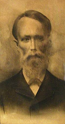
I have another photo of a framed portrait of Green Lee provided me by former Tuscumbia resident, Clifford Hill (photo 36).
36 Green Lee Thompson - Great Grandfather of Clifford Hill
Green Lee was his great grandfather also. Clifford was born and raised on a farm in the valley just west of the museum. Green Lee in later years lived on a farm very close to where Clifford lived. That farm was where Green Lee passed away in 1918.
Here are two great websites about Green Lee Thompson sent me by our website manager, David Statler. The first website features photographs taken at his burial site in the Tuscumbia Cemetery and the second records his father’s genealogical history and burial site at the Tuscumbia Cemetery.
The Thompson/Tomson name has more than one spelling even among members of the same family. You'll notice that in the newspaper clipping (see photo 34 above) which has his photo and a caption it is spelled Green Lee and the surname is spelled Thompson. Almost all the descendents now use the Thompson spelling. But on the tombstone you will notice the surname is spelled Tomson. This spelling variation does cause confusion at times.
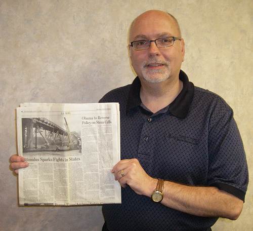
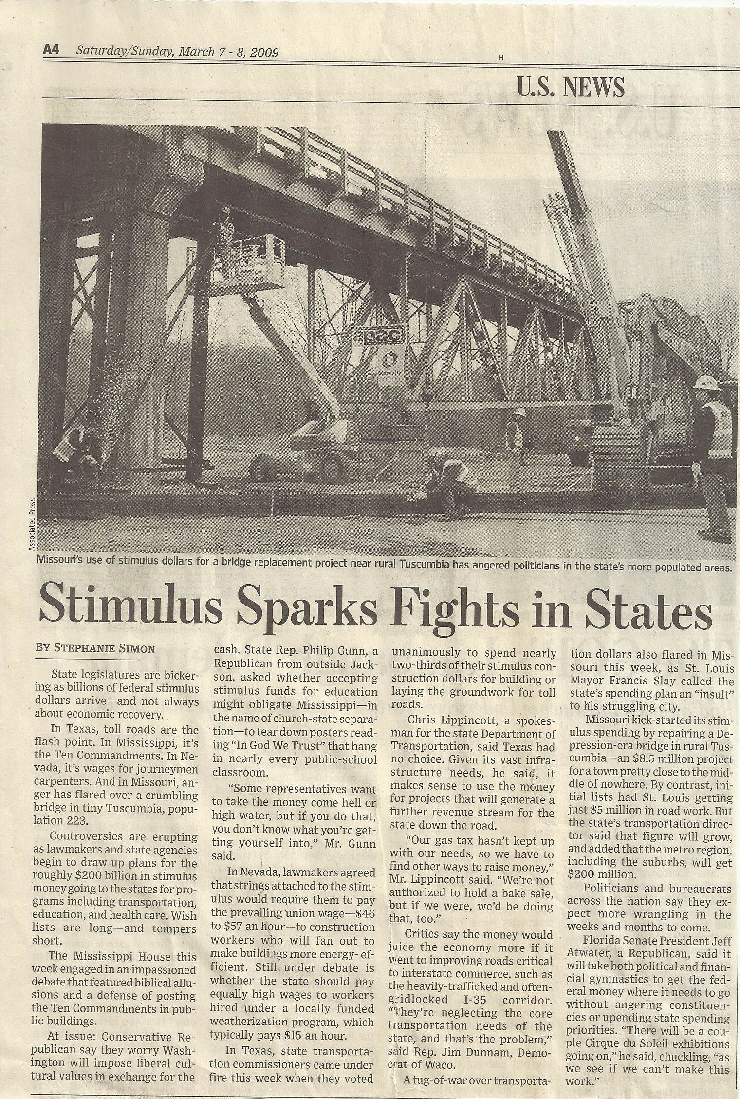
The Bank of Iberia and its Executive Vice President, Richard R. Wright, have been very generous to our Miller County Historical Society. Recently, Richard and the Bank donated five hundred dollars to help underwrite the expense of the recent Bridge Opening Ceremony and Celebration. This week, Richard called me and told me had an article he had saved about our bridge which he had taken from the March 7-8 2009 edition of the Wall Street Journal. He was offering it to us for our soon to be completed museum display devoted to the Bridge Opening events. Even though the article was not particularly understanding of the dire necessity of replacing the bridge, I was very happy to have it to add to our historical collection we are gathering together about this once in a lifetime event. We are very thankful to Richard and the Bank of Iberia for their support of our county museum and historical society. Here is a photo of Richard holding the article (photo 37) and another photo of the article itself (photo 38):
37 Richard R. Wright - Executive VP Bank of Iberia
38 WSJ Article - 8 March 2009 Click image for larger view
Late Addendum!
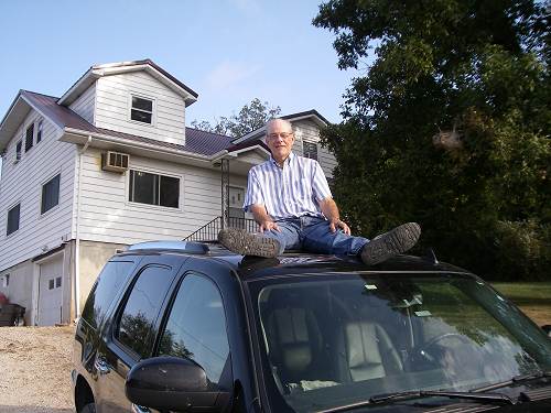
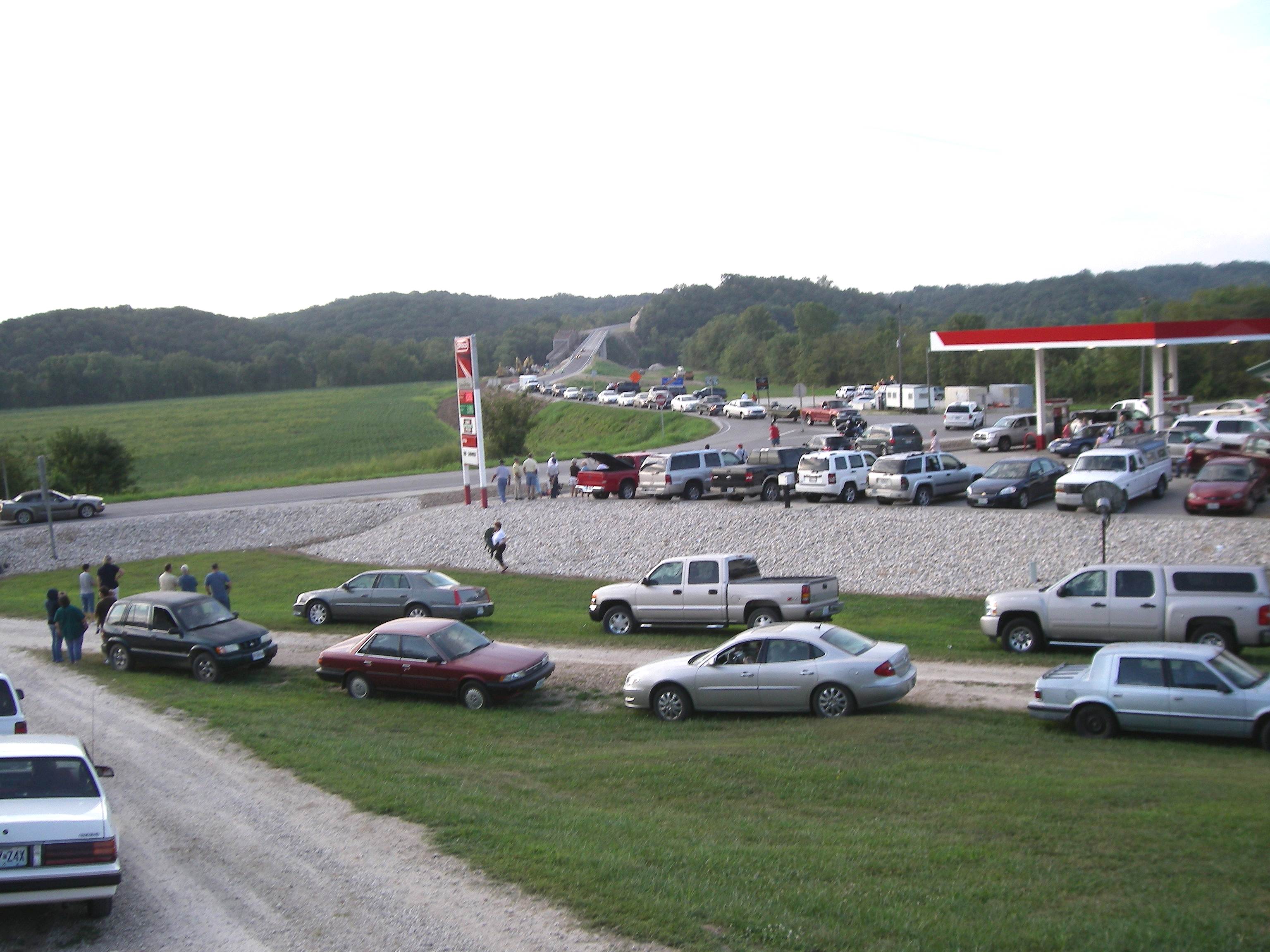
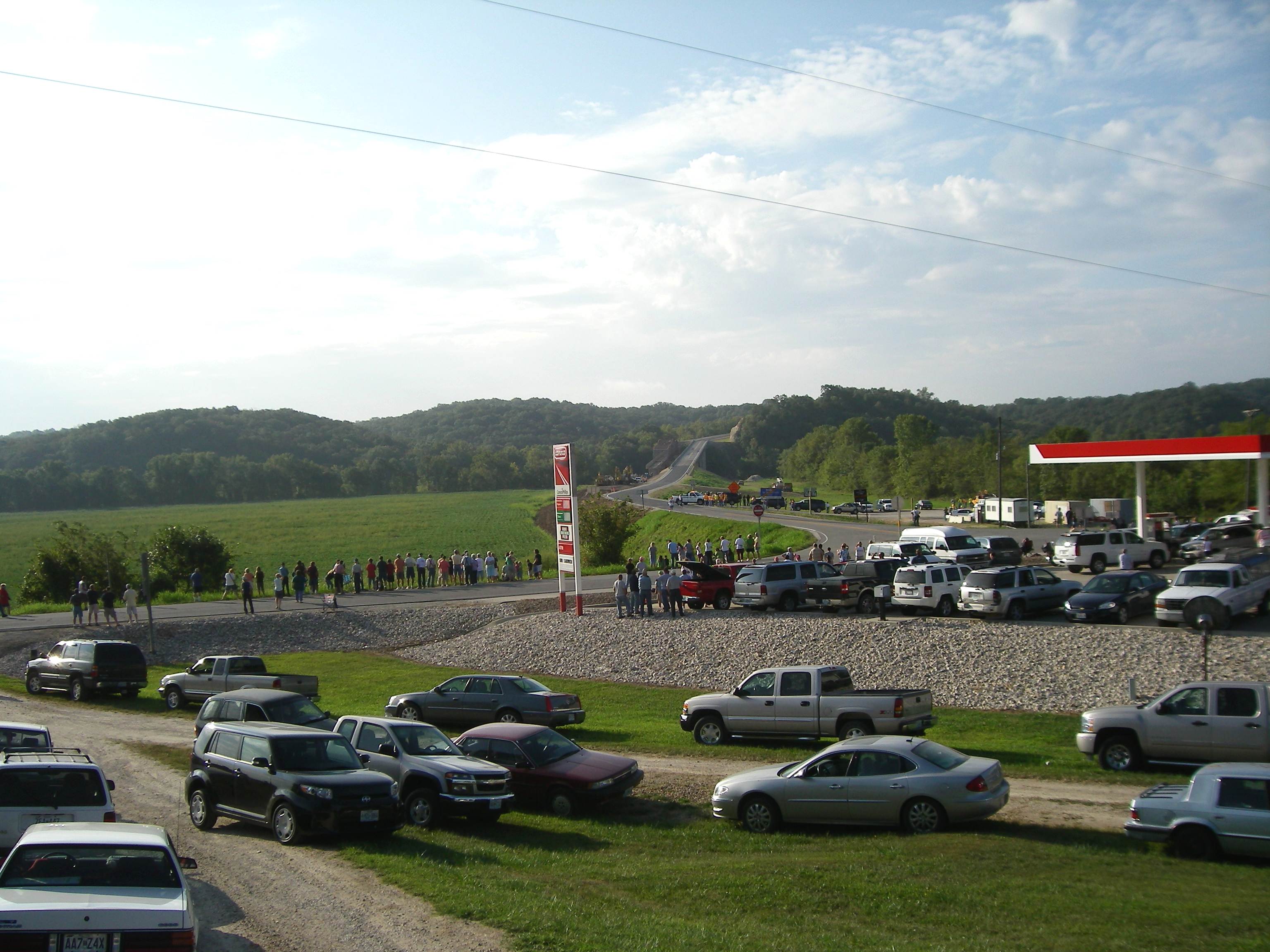
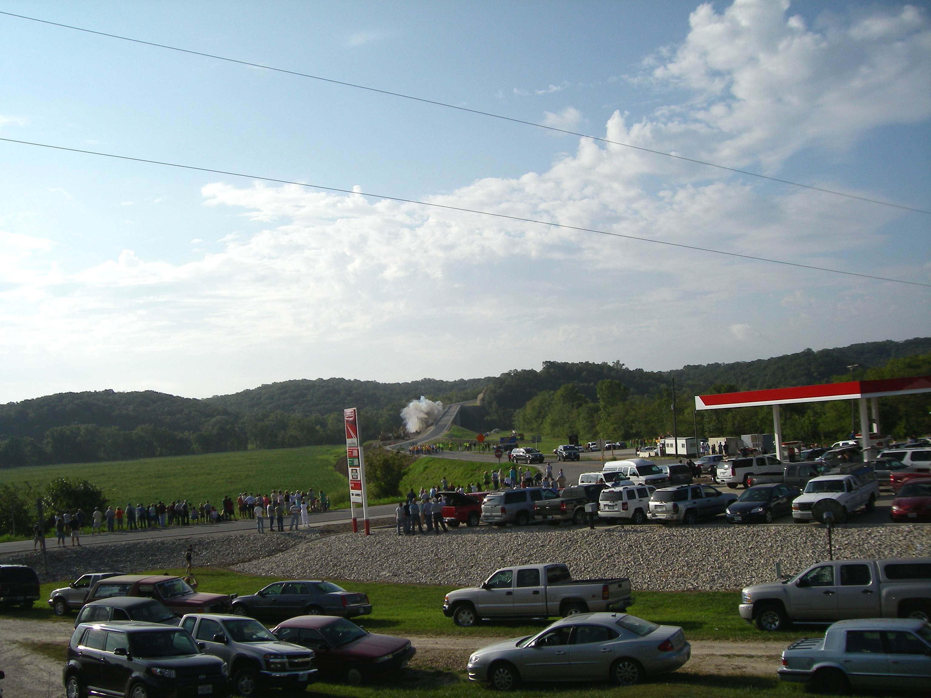
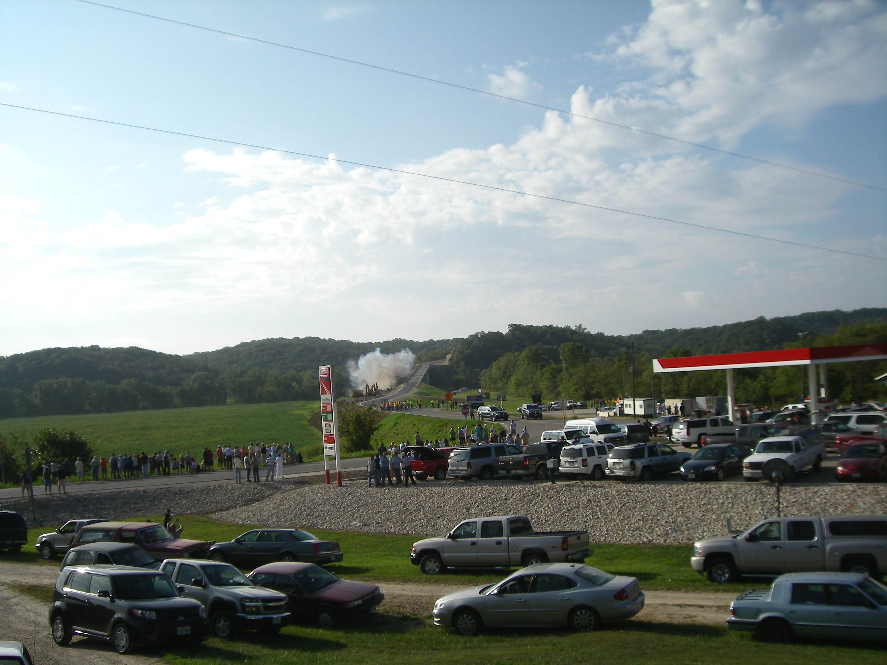
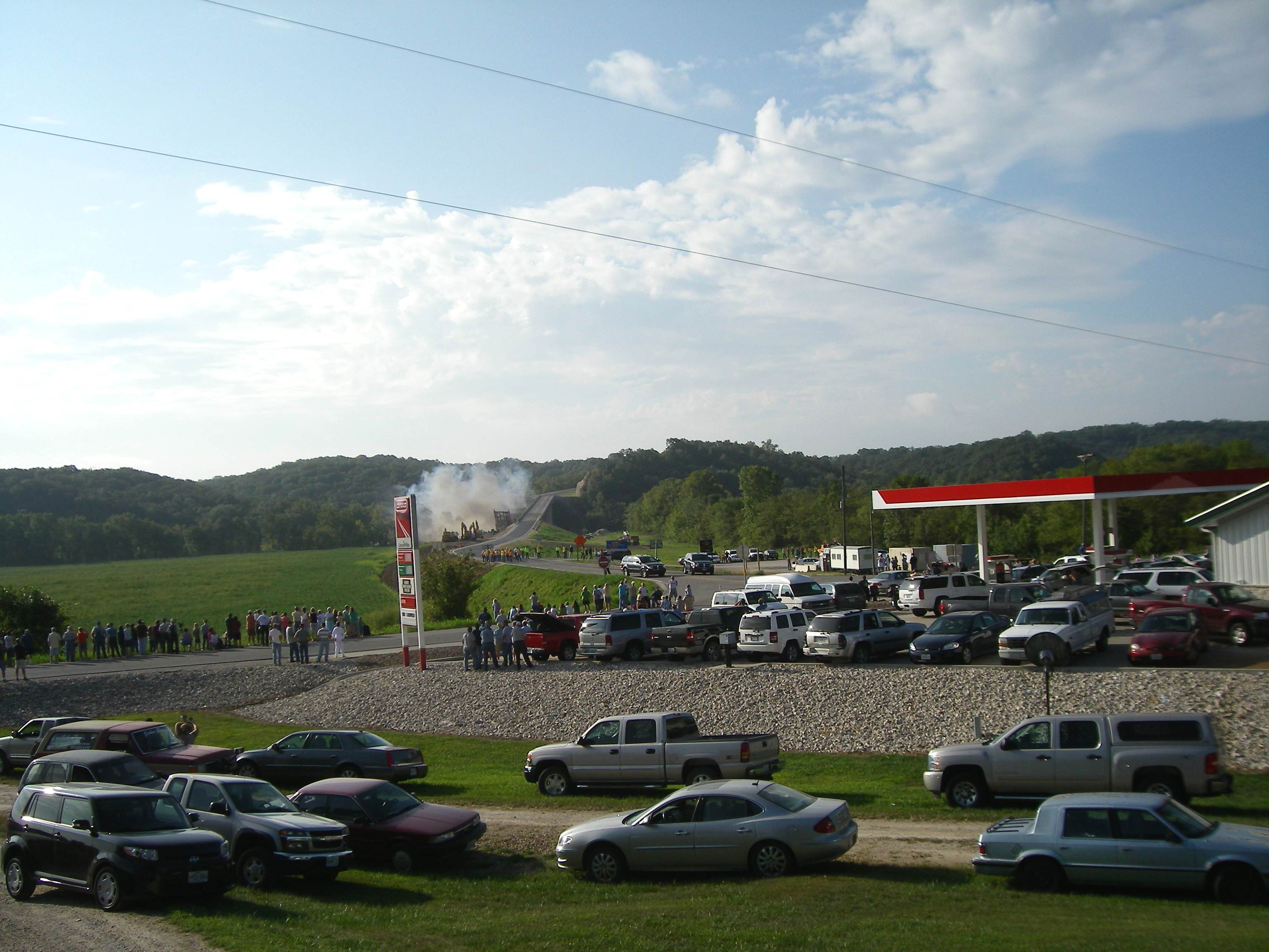
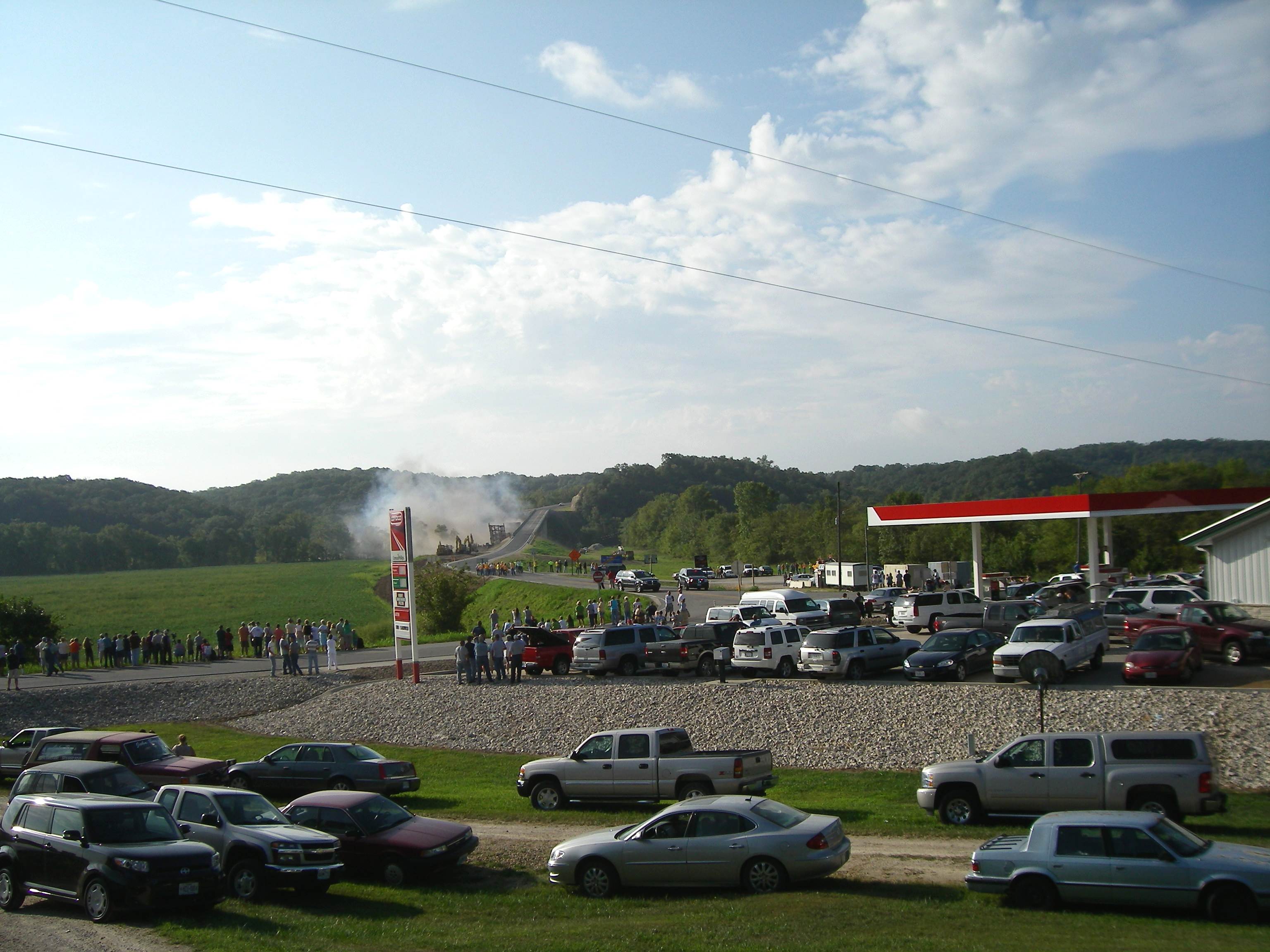
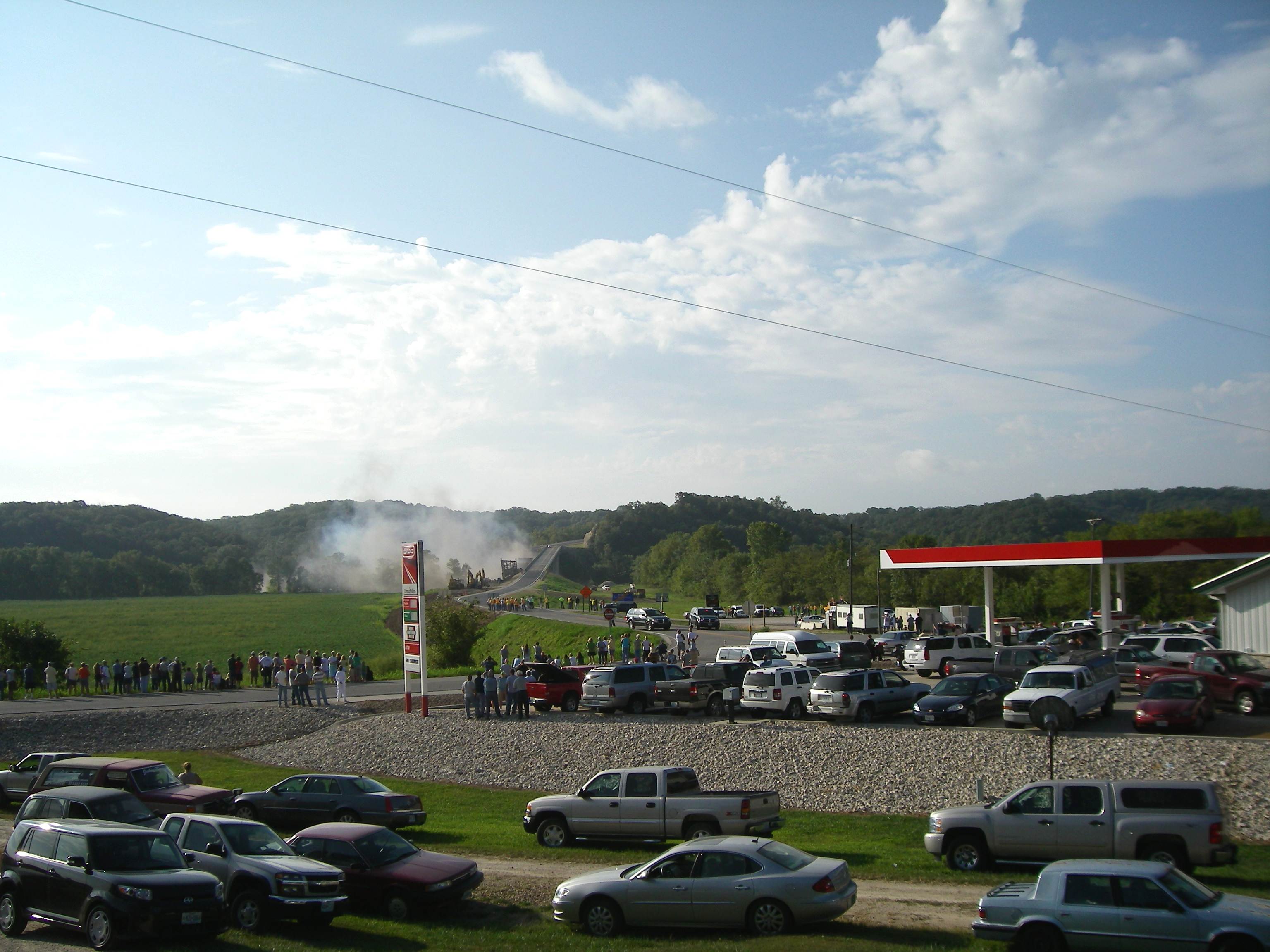
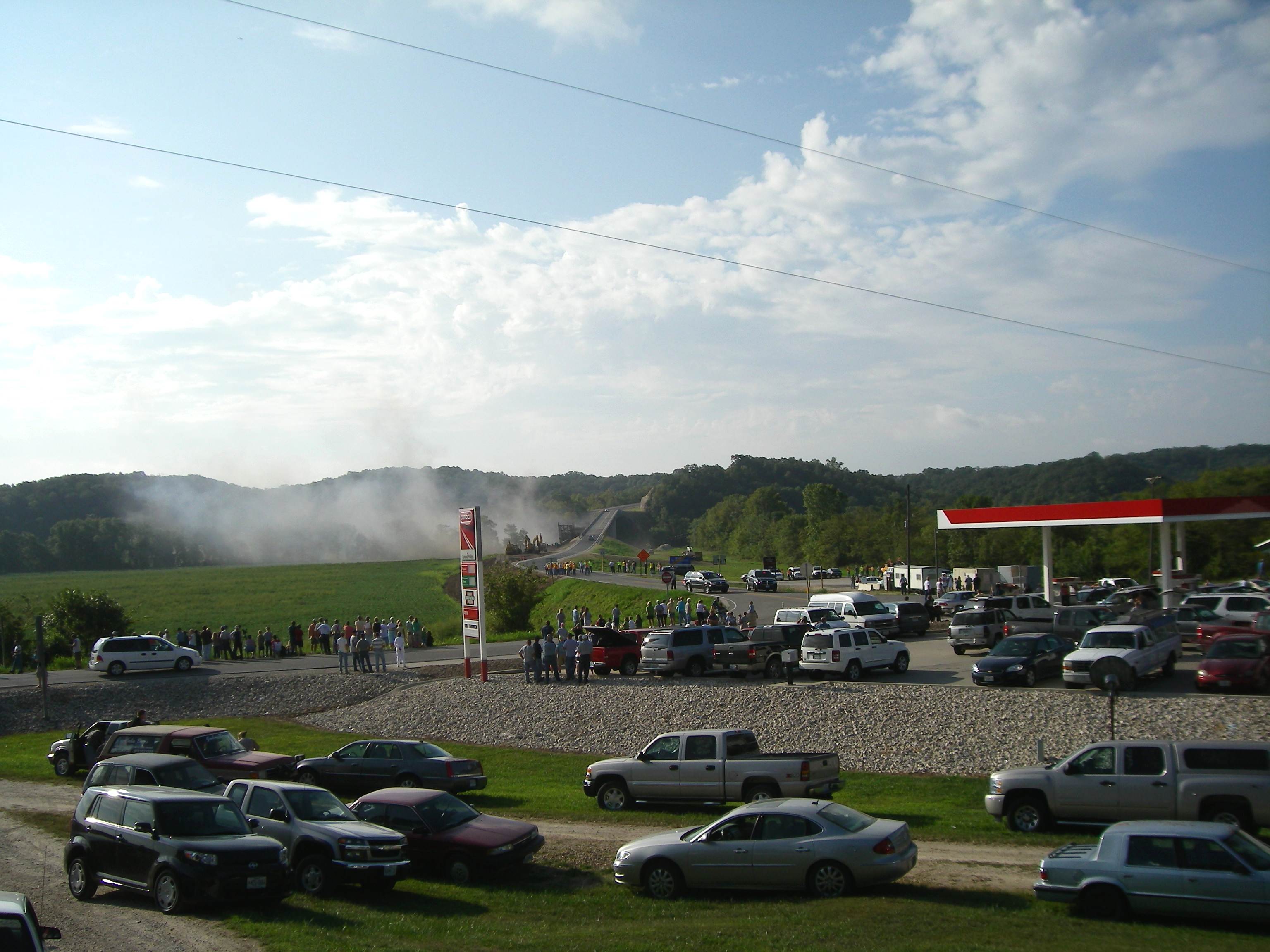
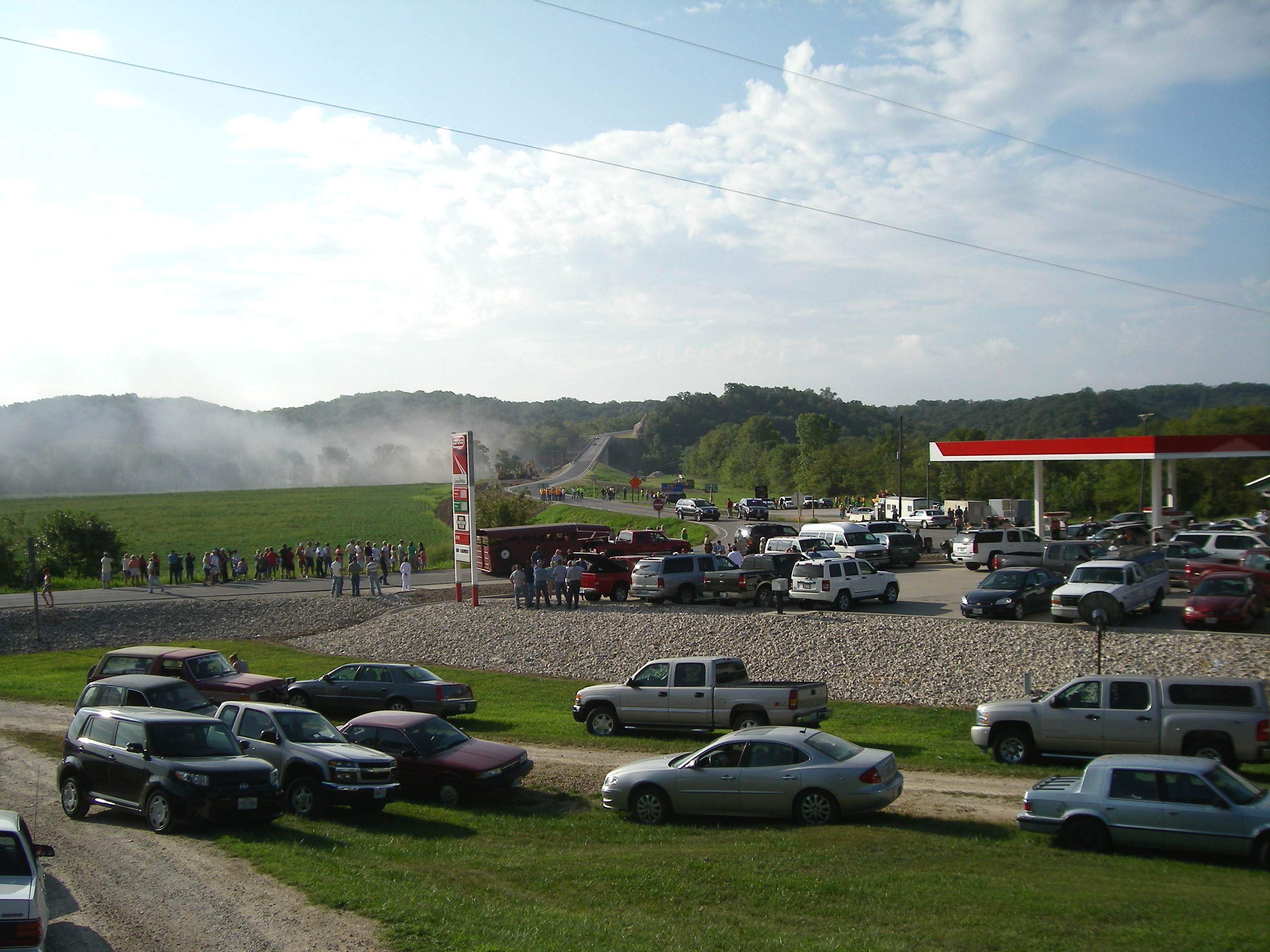
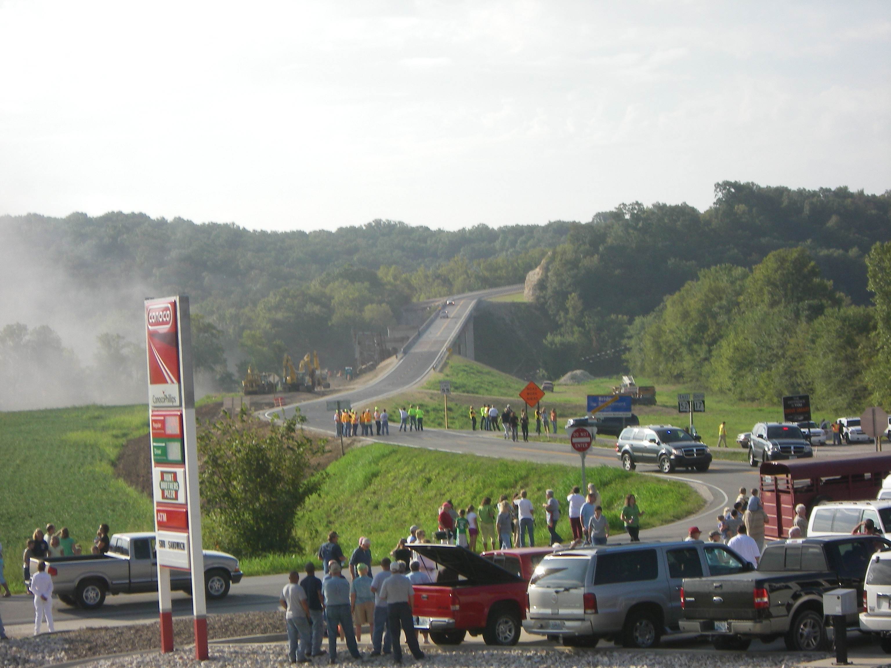
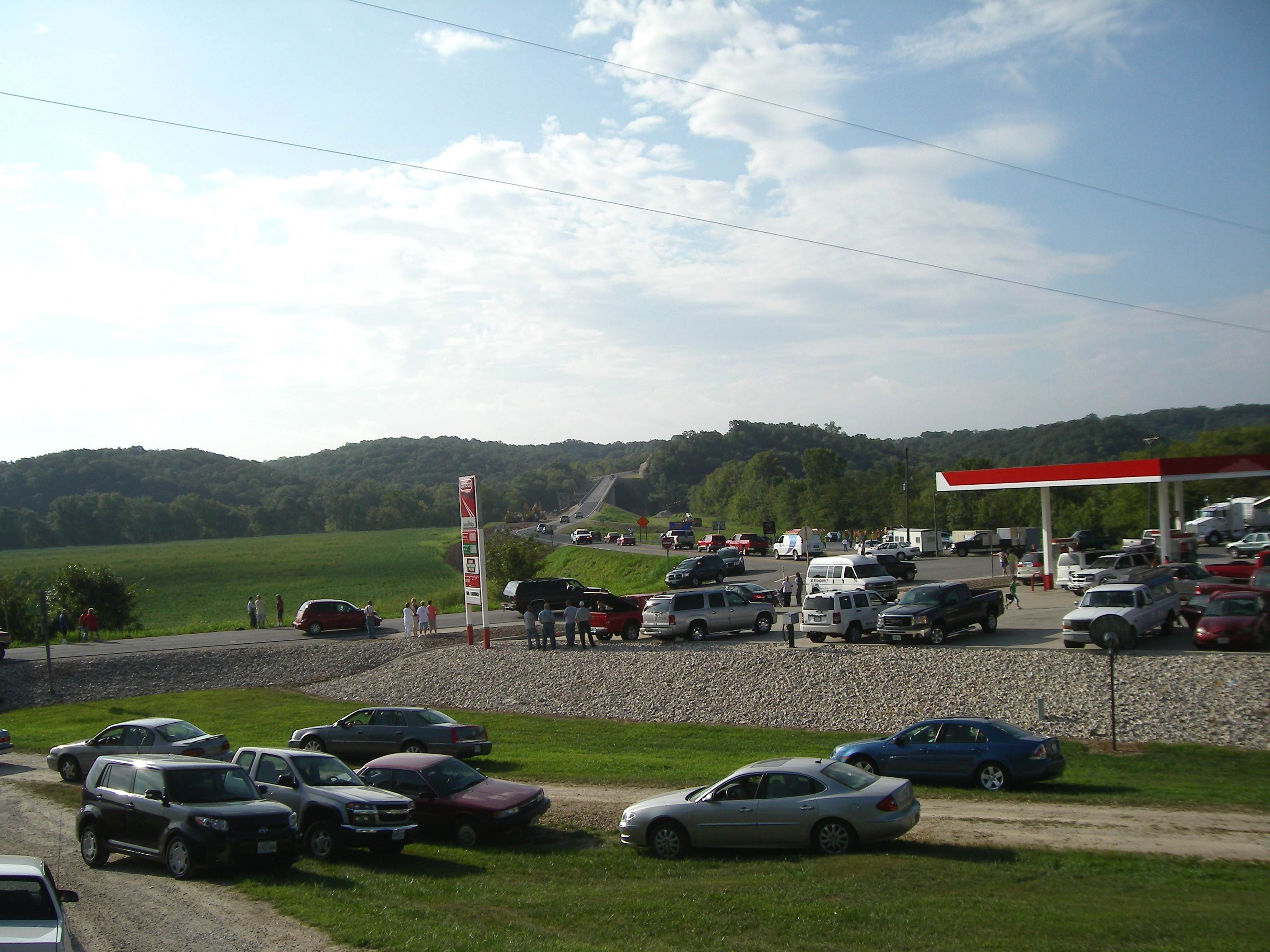
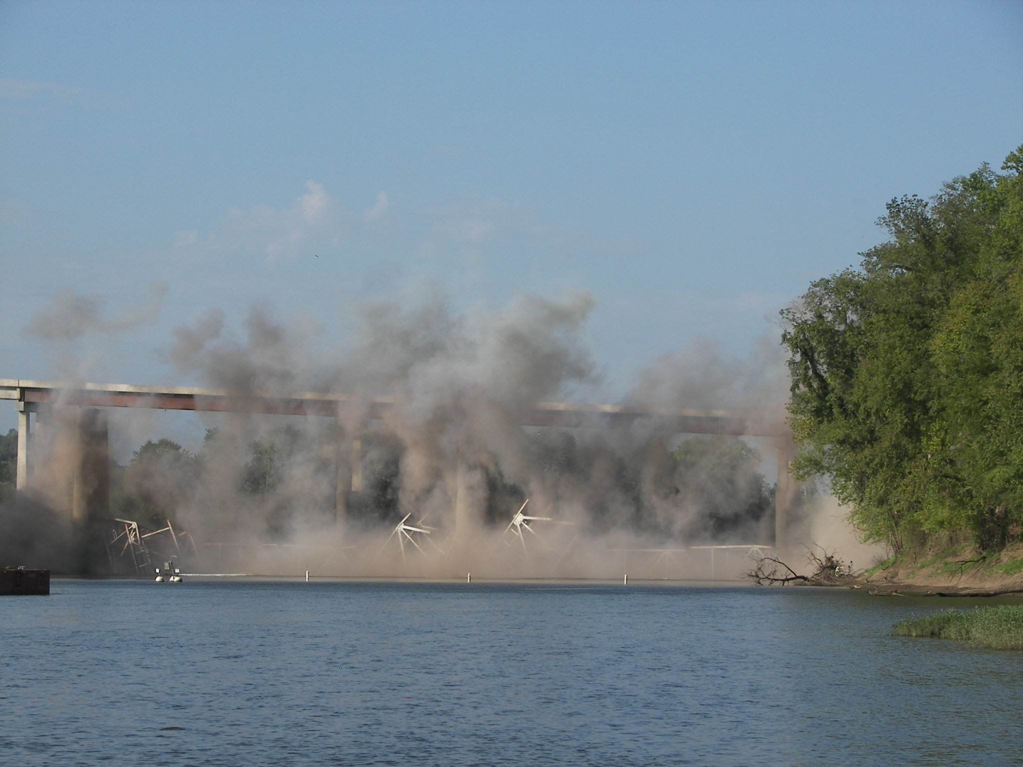
Last Tuesday, August 31, I got up early and went down to the Highway 52/17 junction in Tuscumbia to watch and photograph the replaced Osage River Bridge implosion scheduled by MoDoT (Missouri Department of Transportation) to take place at around 8:30 a.m. I parked my car in the driveway of my cousin, Jim Pryor, whose home is next to the highway and has a good view of the bridge. A good number of people joined me and as the time came near for the implosion around two or three hundred people had gathered. One of the crowd took my picture with my camera as I awaited the bridge takedown (photo 39).
39 Getting Ready
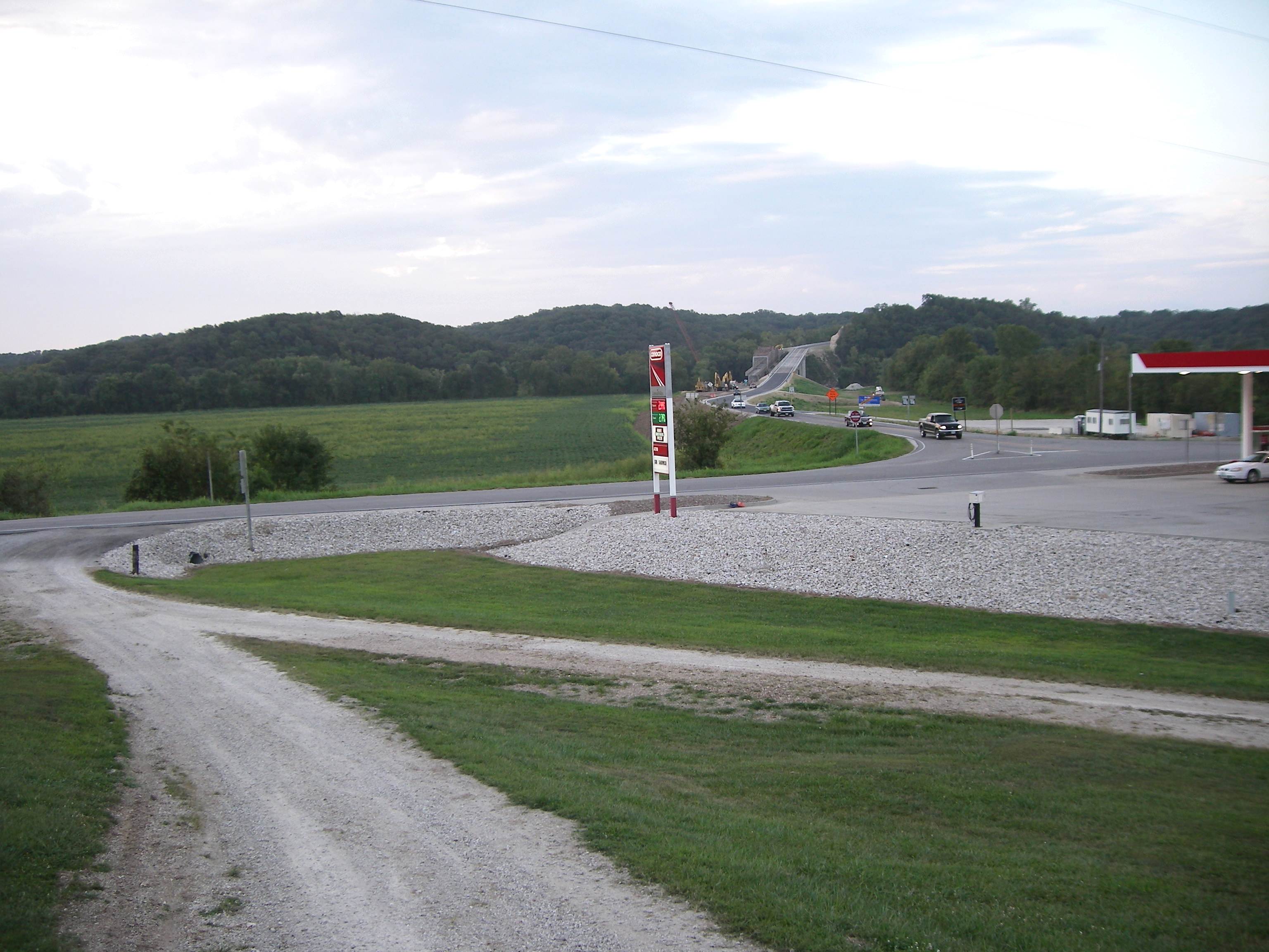
I took a number of photos before the crowd got too large. The following are a collage of photos with explanatory captions (photos 40 - 52).
Just click on any of the photo thumbnails to view a larger image.
Note: Once you click on an image below, a new window will open. It would be best to maximize this new window by clicking on the middle box in the upper right-hand corner of the window. When you move your cursor over the image in this new window, it will change to a magnifying glass. Once this occurs, click on the image and it will show in a larger format for easier viewing.
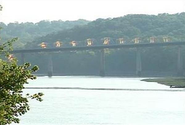
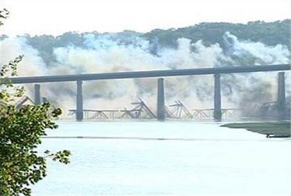
A reporter from KRCG TV took some dramatic photos upstream from the explosion (photos 53, 54 and 55).
53 Tuscumbia Bridge Implosion
54 Tuscumbia Bridge Implosion
55 Tuscumbia Bridge Implosion
Below is footage from MoDOT which was reported by KMBC out of Kansas City:
Here's a video from observer, Sean Ryno:
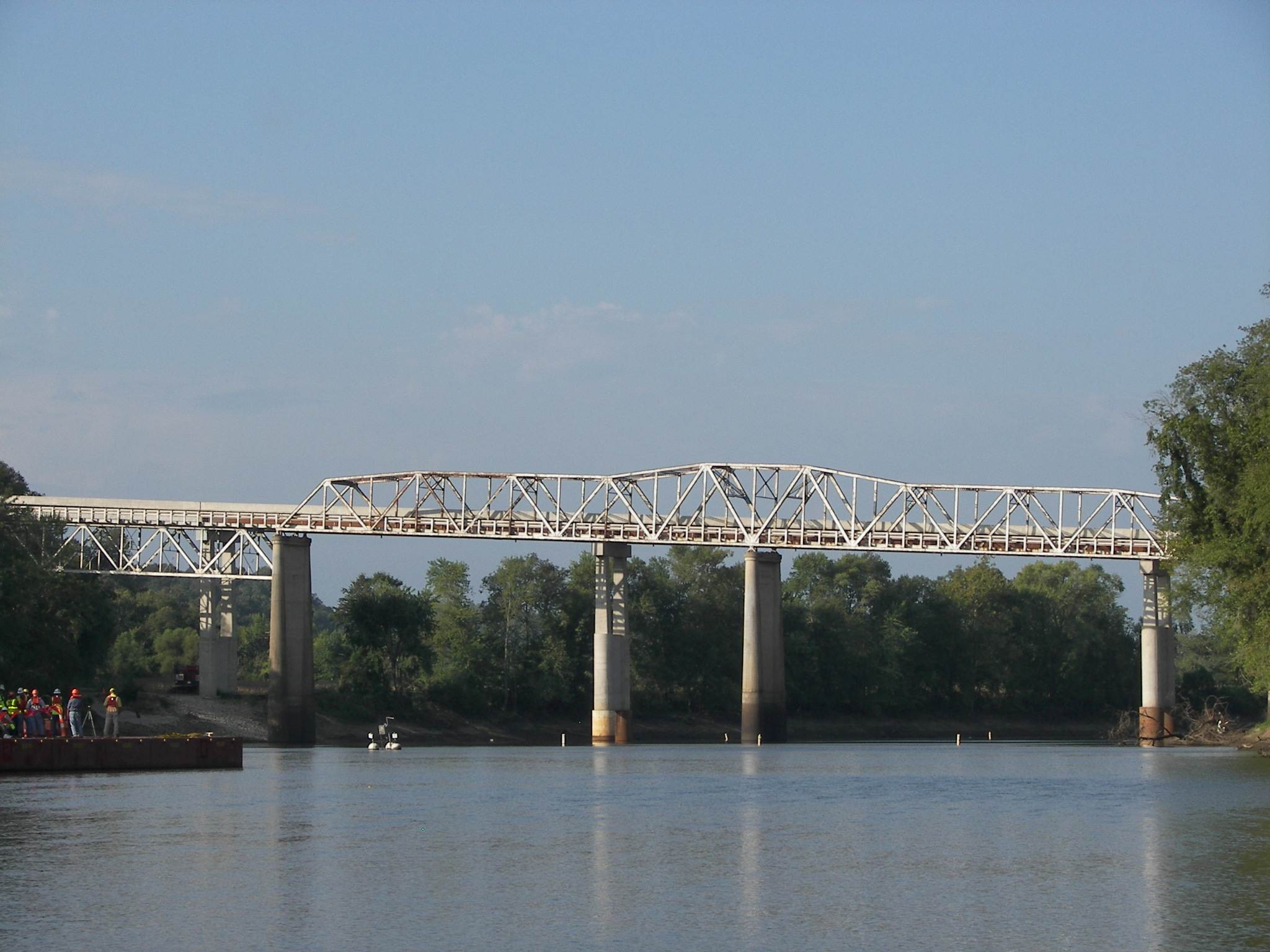
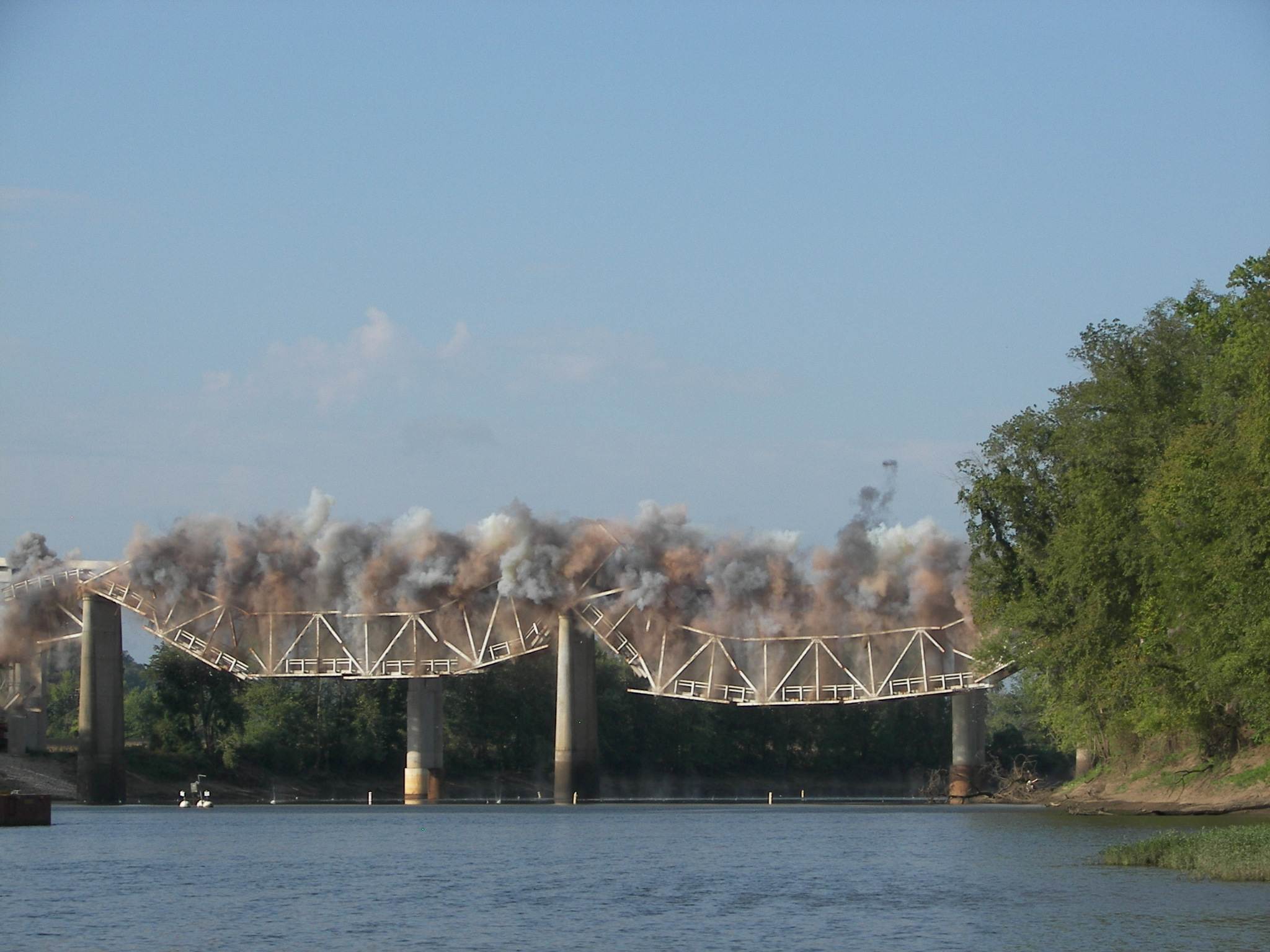
But the best photos were taken by Karen Smith of our Miller County Historical Society Board from a mid river position downstream (photos 56, 57 and 58).
56 Bridge Pictures Click image for larger view
57 Bridge Pictures Click image for larger view
58 Bridge Pictures Click image for larger view
That’s all for this week.
Joe Pryor
Previous article links are in a dropdown menu at the top of all of the pages.

 Joe Pryor