|
Monday, December 7, 2009
Progress Notes
A few weeks ago I was forwarded an email with a link to a website which was quite interesting as it featured photos of the first commercial passenger boats to appear on the Lake of the Ozarks at Lake Ozark right next to the Bagnell Dam.
For convenience, I will also copy it directly to this page to facilitate access to it. This webpage was part of the blog, “LakeOzarkTalk.com” (note: this website is no longer active or available) and was an entry from a gentleman named Brad from St. Louis, MO:
“Like I had said before, my interest in lake history centers around boats and boating of days gone by. I don't know how much interest there is here about the boats that Union Electric owned and operated after the lake was created, but I thought I'd throw it out for those that might have an interest. Our family started vacationing at Lake of the Ozarks in 1953. That was when I was introduced to the biggest and baddest wake throwing boat on the lake, the Tuscumbia (photo 01a).
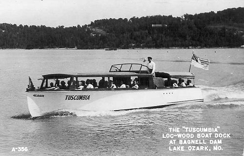
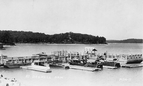
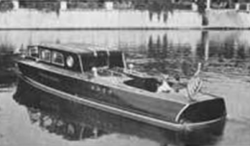
01a The Tuscumbia The Tuscumbia was one of a fleet of boats that Union Electric bought and put into service in 1931 when the lake was opened to boat traffic. They were used at a Union Electric owned and operated ride dock to carry paying passengers and dignitaries on sight seeing trips up the newly formed lake (photo 01b).
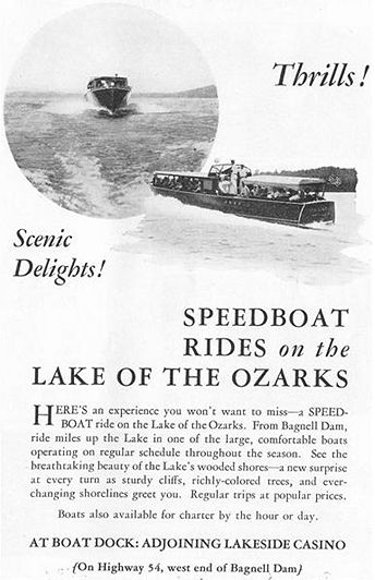
01b Speedboat Rides Ad Just as Union Electric named the five guest rooms at Egan (known now as Willmore Lodge) after towns that were relocated or flooded by the lake (Linn Creek, Zebra, Passover, Arnolds Mills, and Nonsuch), the boats were named after what I assume were ports along the Osage river before it was impounded (photos 01c - 01f).
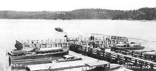
Photo 01c:
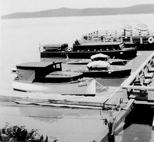
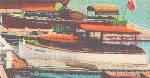
Starting on the left, bottom to top: Gravois (25' Richardson Little Giant), Niangua (24' Hackercraft),
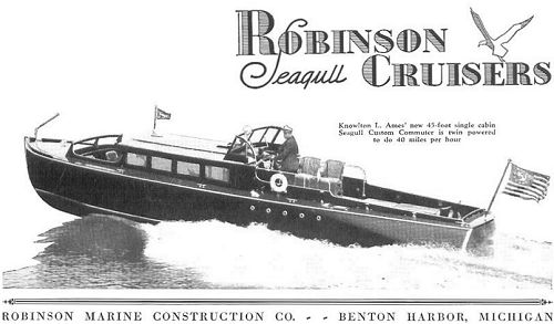
Tuscumbia (45' Robinson Seagull Custom Commuter)
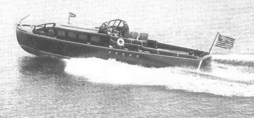
Top Leaving Dock: Grand Glaize or unknown (38' Robinson Seagull Custom Commuter),
Top Right at Dock: Grand Glaize or unknown (38' Robinson Seagull Custom Commuter)
01d Boats at Dock
01e Boats at Dock
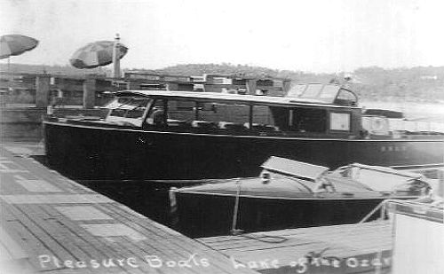
01f The Tuscumbia and Niangua Tuscumbia, Grand Glaize, and a third boat were all Robinson Seagulls powered by Kermath Sea Wolf engines. Tuscumbia was 45' 36 passenger, Grand Glaize 38' 28 passenger, and judging by pictures, the third boat was the same as Grand Glaize. All three boats were custom built based on standard Robinson Sea Gull hulls. The most obvious customization was the cabin roof height (photos 01g - 01j).
01g The Tuscumbia - Note the lettering on the stern:
U.E.L.&P.CO. (Union Electric Light & Power Company)
01h
Ad for Robinson Seagull Commuter. Note cabin height and top speed for this 45 footer,
the same as the Tuscumbia. 40 M.P.H. was an incredible top speed for a 45 footer in 1931!
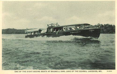
01i Tuscumbia Postcard
01j 45' Robinson Seagull Ad Gravois, is a 25' Richardson Little Giant (photo 01k and 01l).
01k The Gravois
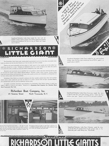
01l The Gravois - Richardson Little Giant Ad Gravois still runs on Lake of the Ozarks today making it the oldest running boat on the lake (photo 01m).
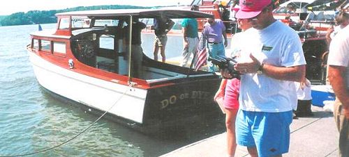
01m The Gravois at the Tan-Tar-A Boat Show a few years ago Niangua (photo 01n) was a Hackercraft. Hackers, as they are affectionately known among collectors are referred to as the Steinway of the runabouts. The most famous Hacker known today is Thunderbird that runs around Lake Tahoe today.
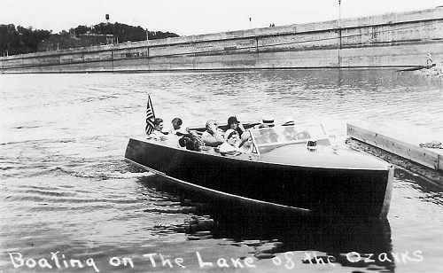
01n The Niangua, what I think I can safely say was the first
commercially
operated "speedboat" on Lake of the Ozarks Fannie J (photos 01o - 01q) is the one boat that didn't follow the boat naming theme. She was a 38' Hacker Commuter also powered by twin Kermath Sea Wolf engines and the most exotic boat of the fleet. The King of Siam had one just like her only with Gold fittings. She was reserved for Louis Egan and guests of the lodge.
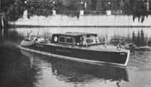
01o The Fannie J
01p The Fannie J
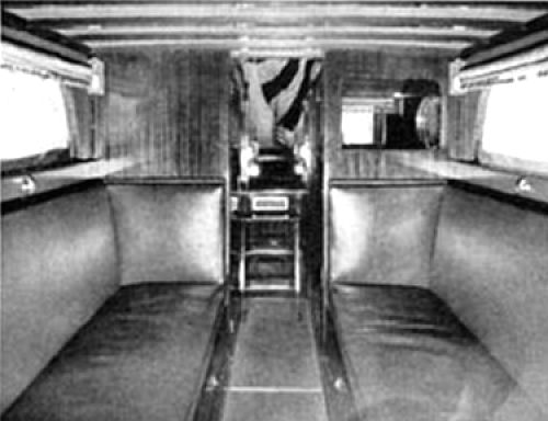
01q The Fannie J Fannie J had what I think is to date the most exotic boathouse to ever grace the lake located in the cove by the lodge (photos 01r and 01s).
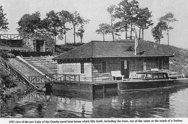
01r The Fannie J Boathouse
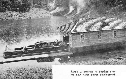
01s The Fannie J Boathouse It is my opinion that Fannie J was to date the finest boat to ever run on Lake of the Ozarks (photo 01t).”
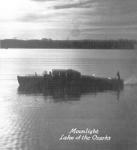
01t The Fannie J in the Moonlight
On reading the above copied narrative and seeing the photos from the "LakeOzarkTalk.com" website I was quite interested in seeing once again some of the boats I remembered as a youngster when I and my parents visited the “strip” area next to the dam. We would visit the “strip” at least once a week, for one reason, because my mother’s Aunt and Uncle, Alma (Abbett) and Bob Craven, had a restaurant there named the “Chicken Kitchen.” Many readers may remember that restaurant today although since that time it has been torn down (photo 02).
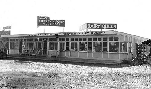
02 Bob's Chicken Kitchen I had featured in a previous Progress Notes some of these boats which had been driven by David Shelton of Eldon (photo 03), who had worked there at the time.
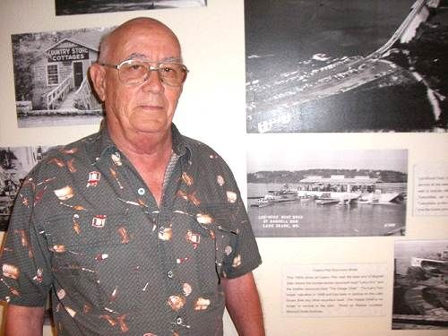
03 David Shelton David had worked several summers there in the 1950’s as captain of several of the boats which were used to give tourists boat ride tours of the lake. David told me that he often captained the first two boats docked on the left in this next photo (photo 04).
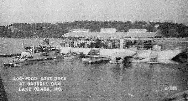
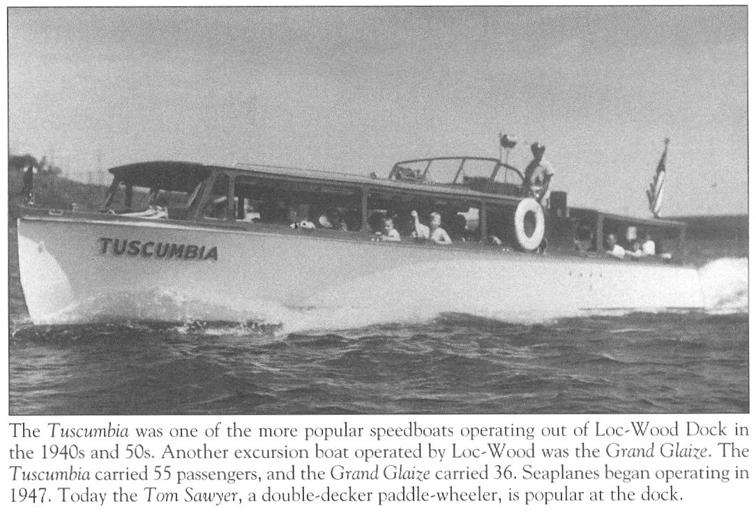
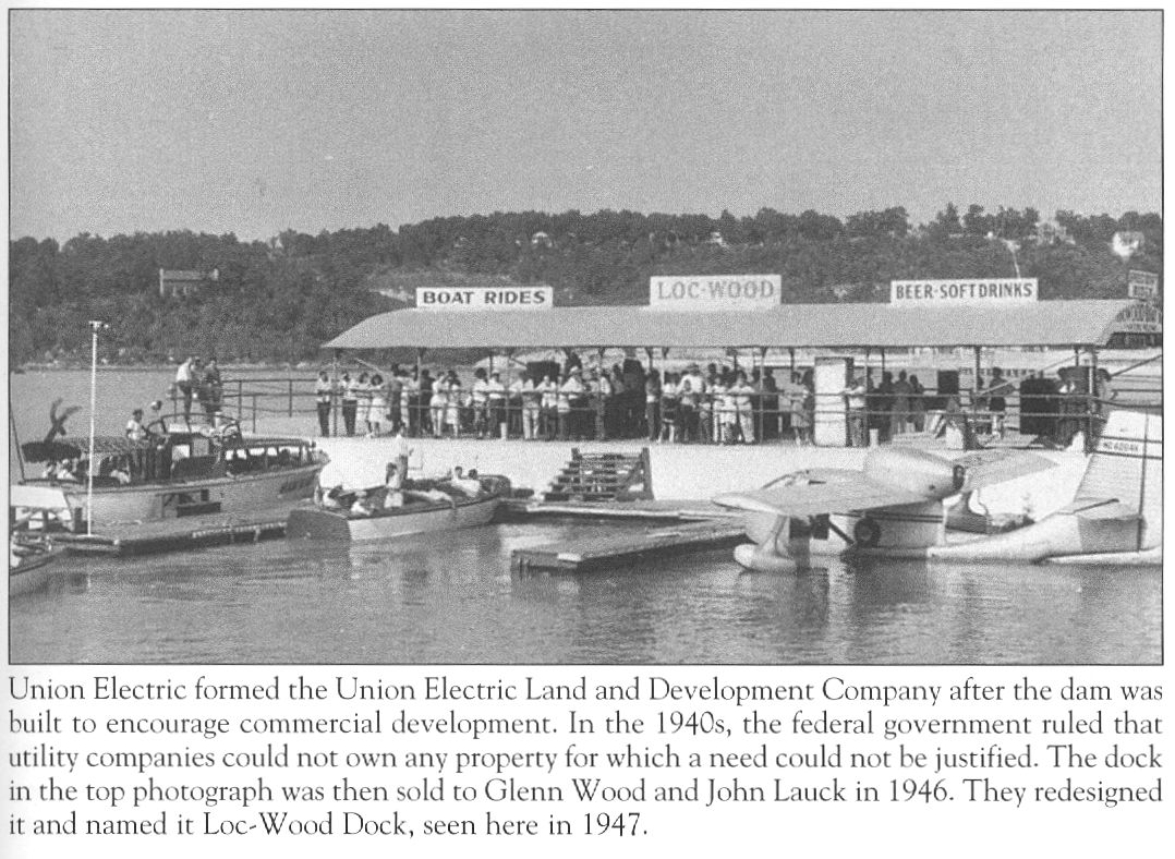
04 Boats at Loc-Wood Dock The first one, which was a fifty passenger boat, was named the Tuscumbia (photo 05).

05 The Tuscumbia
Click image for larger viewThe second boat was a speed boat named the Higgins. A third boat he also captained is not in this photo but it was a Chris Craft cruiser. David said the boat dock was named after the surnames of the owners, John Lock and Glen Wood. I remember best the speed boat which David captained, the Higgins, and the way David would end the tour by coming in to the dock at a very high rate of speed simultaneously blowing the boat horn and then making a sudden left turn but still be able to maneuver the boat precisely into the dock slip without bumping either side.
In those days speed boats were something new for most people and were fun and exciting, especially if David was the captain.
David said that the boat dock next to the Loc-Wood dock was owned by Harvey Fry and was known as the Casino Dock. This is where the famous Larry Don excursion boat was located (photo 06).
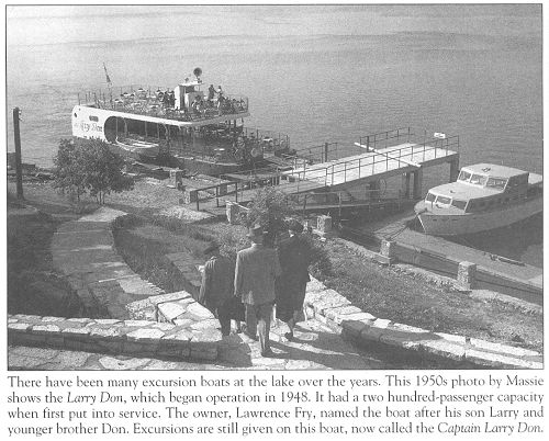
06 The Larry Don
Click image for larger viewThis area called “The Strip” at Bagnell Dam has had a tumultuous history well documented by Dwight Weaver (photo 07) in his latest book, “History and Geography of Lake of the Ozarks Volume II” (photo 08).
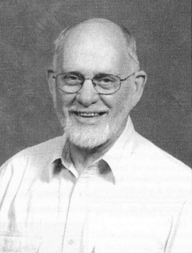
07 Dwight Weaver

08 Book Cover Over the last several years Dwight has recorded in a series of four books the most exhaustive history of the Lake area ever published of which I am aware. He also has been a great friend of our museum having designed and set up a large display about the Miller County portion of the Lake of the Ozarks in the museum which is one of our most popular exhibits containing many photographs. You can purchase his books at one of the several book stores in the Lake area as well as online at this email address: zet@socket.net or by phone at 573.365.1171.
I received permission from Dwight to share with the readers of this website his history of “The Strip” at Lake Ozark:
Bagnell Dam Strip
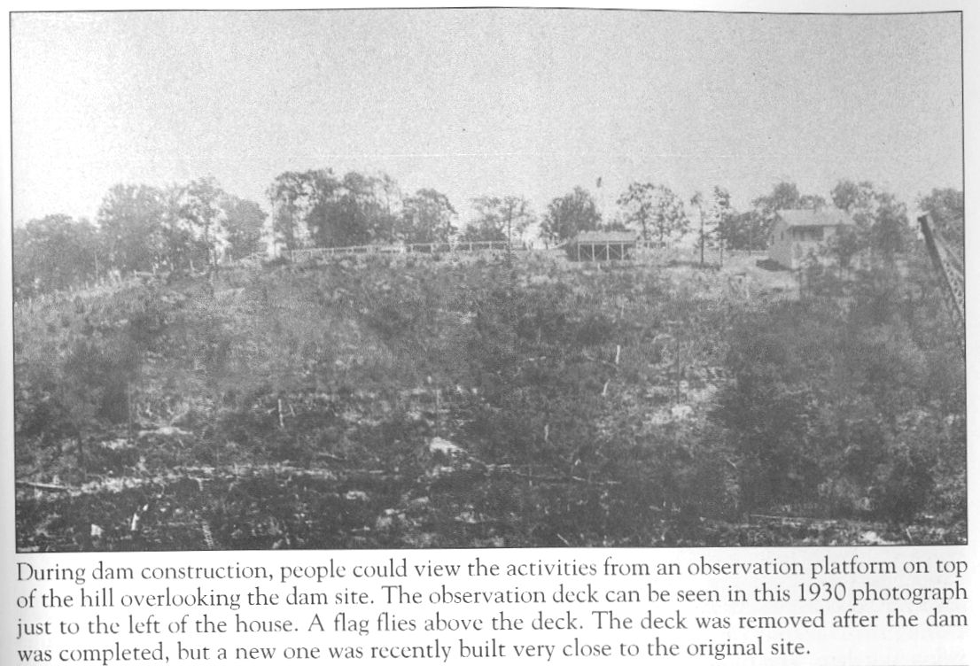
During the 22 months that Bagnell Dam was under construction between August 1929 and June 1931, the project was the most popular tourist attraction in the Midwest. No engineering feat of such magnitude had been seen before in the Missouri Ozarks. Big city newspapers encouraged their readers to make the trip to the town of Bagnell to see this marvel in the making. Sight seers flocked to the site by the hundreds, despite financial constraints caused by the Great Depression. To accommodate the visitors, Union Electric Light and Power Company constructed an observation area on the bluff above the dam construction site (photos 09 and 10).
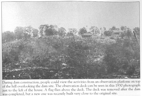
09 Observation Deck
Click image for larger view
10 Dam from Observation Area
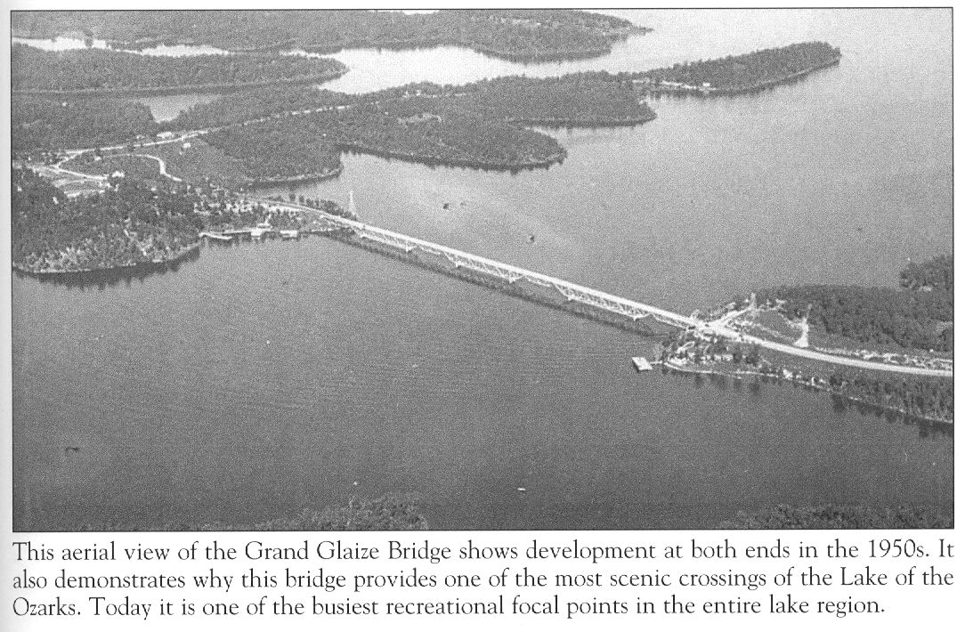
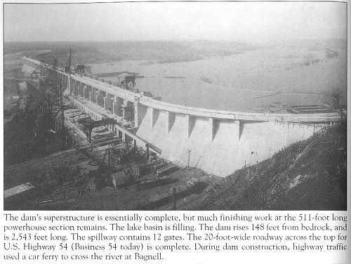
Click image for larger viewBy the time dam construction entered its final phase in January 1931, the new Grand Glaize Bridge eight miles to the southwest was complete and opened to traffic. Stretching across the Grand Glaize valley some 90 feet in the air, the bridge itself became a tourist attraction. As yet there was no water beneath it, but by February the Lake basin began to fill, making the new bridge an even larger attraction than the dam construction partially because of the bridge’s unusual design. Because the truss structure was on the under side rather than above it, and the bridge railings were low, the crossing was open airy and very scenic, the bridge quickly earned a nickname…the “Upside Down Bridge” (photo 11).

11 Grand Glaize Bridge
Click image for larger viewThousands of people arrived on weekends to watch the water slowly rise in the newly forming Lake of the Ozarks. The visitors needed gas, food and lodging, which instigated a building boom at the west end of the Dam. Overnight, it seemed, hotels, cares, drugstores, novelty shops, gas stations, grocery stores, saloons and dancehalls materialized along the new highway just west of the Dam. Nearly all of the structures were on the north side of the road. The south side, because of its precipitous embankment, was considered unsuitable for building purposes because it would require an expensive foundation.
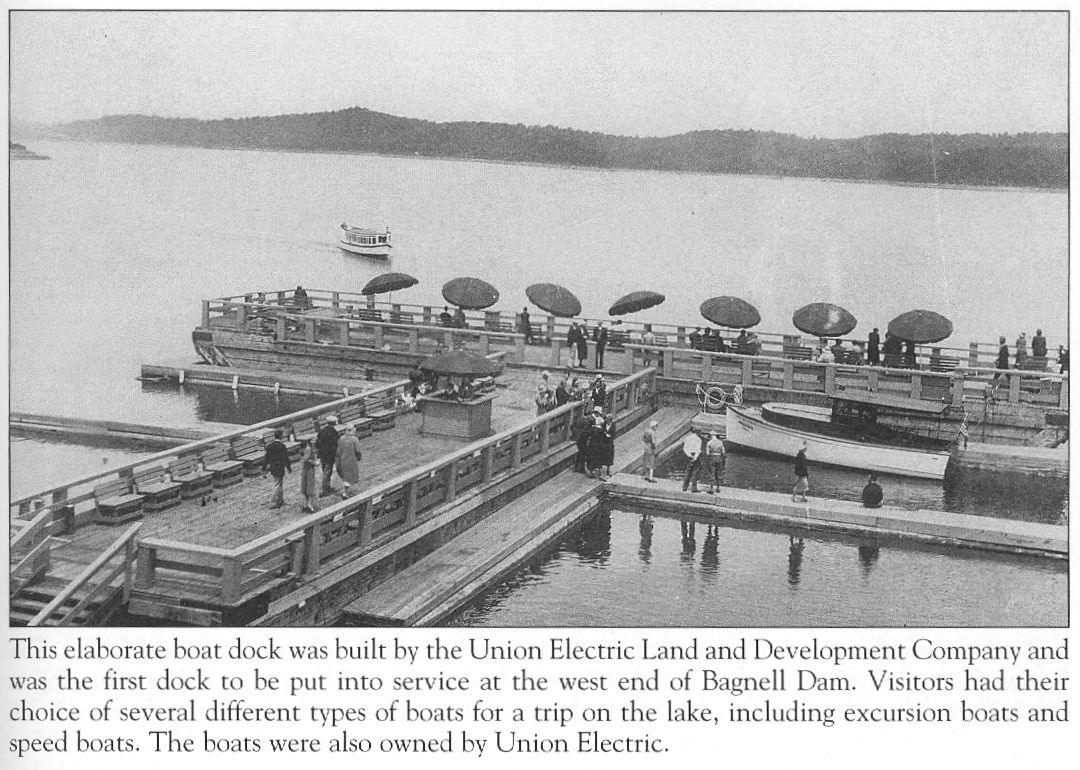
During the construction of the Dam, Union Electric formed a subsidiary called the Union Electric Land and Development Company. This company incorporated an area around the Dam and named it Lakeside. On Lakeside property at the Dam’s east end, the company built a hotel on the bluff above the Dam (Holiday House) (photo 13).
13 Holiday House At the west end of the Dam they built a large commercial boat dock (Union Electric Bathing Pavilion and Excursion Boat Dock later sold to Glen Wood and John Lauck) (photos 14 and 15) and a restaurant (Lakeside Casino Cafe) (photo 16).
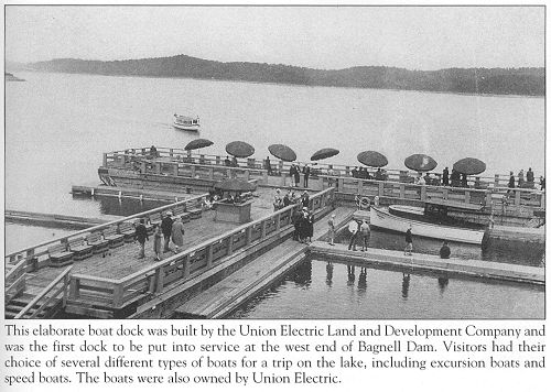
14 Union Electric Bathing Pavillion and Excursion Boat Dock
Click image for larger view

15 Loc-Wood Dock
Click image for larger view
16 Lakeside Casino By January 1932 the concentrations of sightseers were greatest at the west end and a village was taking shape. Yet the village lacked several important things…an official name, a post office and a school.
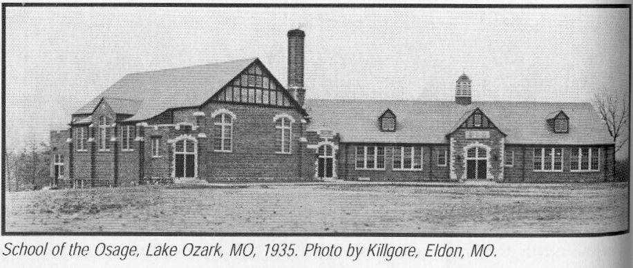
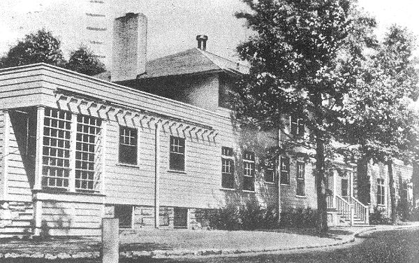
The local children were attending school in Lakeside Village in a building near Holiday House. The school district was a consolidation of the Bagnell and Pleasant Grove school districts north of the Dam. But most people wanted the school on the west side, so, using short term bonds and a Public Works Administration (WPA) grant, a school building was erected about one mile southwest of the Dam. This school became School of the Osage. “The building was planned by Bonsock and Pearce, architects of St. Louis, and constructed by the Epple Construction Company of Columbia, Missouri,” said the 1946-47 Pow Wow, the School of the Osage Year Book. The school was in operation by the beginning of 1934 and graduated 12 students at the end of its first year (photo 17).

17 School of the Osage
Click image for larger viewBut naming the new village was a different matter. It became a divisive issue. One faction called the town South Bagnell and even formed its own South Bagnell Chamber of Commerce. Another faction opted for New Bagnell, and the names Lako and Lake Ozark were also proposed. As this matter festered, there was movement towards getting a post office. Up to this point, the people of the village got their mail through Eldon, to the northeast, or Zebra (renamed Osage Beach in 1935) to the southwest.
The people petitioned for a post office and, by vote, elected Frank Andrews postmaster. Andrews favored the name Lake Ozark. So did the U.S. Postal Service and so, by August 1, 1932, Lake Ozark had been born and officially named (photo 18).
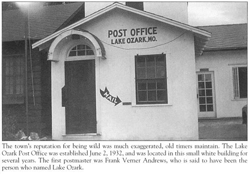
18 Lake Ozark Post Office
Click image for larger viewThe community, knowing the popularity of the Dam, began promoting itself through its newly formed Bagnell Dam Chamber of Commerce. For additional information on this turbulent period in the early history of Lake Ozark, see Lake Ozark in Volume One of this history series.
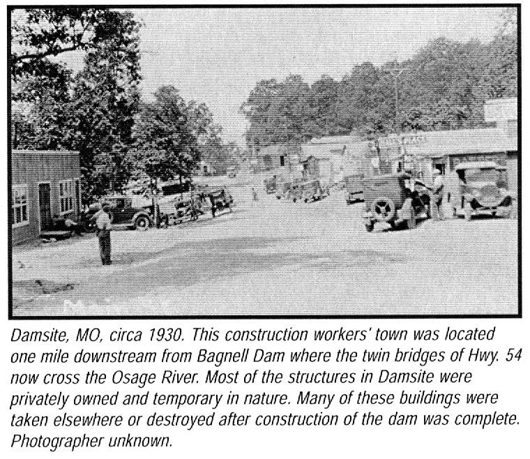
In 1933, national Prohibition ended, and alcoholic beverages became legal, bringing sighs of relief because prior to this only bootleg liquor could be had in Lake Ozark if you knew the right person. Bootleg liquor had been a problem at Damsite, the predecessor to Lake Ozark. Damsite was a laborers’ camp that existed only during the construction period. It stood about where the Highway 54 twin bridges across the Osage River below the Dam today. Bootleg liquor, gambling and vice troubled Damsite and other nearby labor camps because of the criminal elements that filtered into the area from Kansas City. The sheriff of Miller County, paid by Union Electric, had to have a crew of 35 deputies on duty much of the time to patrol the labor camps and keep trouble at bay (photo 19).
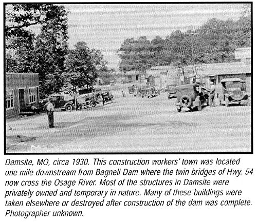
19 Damsite
Click image for larger viewOnce the Dam was complete, the criminal element continued to bring bootleg liquor into the area despite raids by local law enforcement. One raid nabbed bootleggers who were operating on the Lake itself. Saloons and dancehalls proliferated, causing urban newspapers to call Lake Ozark a honky-tonk town. Local businessmen were incensed and fiercely defended the new town’s reputation. The repeal of the 18th amendment went a long ways toward ending the bootleg liquor problem but the image of Lake Ozark as a honky-tonk town carried through most of the 1930’s largely because there were so many dancehalls and taverns along The Strip. As late as 1942, the WPA Guide to Missouri could not resist pointing this out in their landmark guide of the state written for tourists. “Lake Ozark,” said the guide, is “composed of a single row of one and two story buildings, hotels, restaurants, dancehalls, taverns and shops and is a roadside hamlet catering to vacationists.”
There were times in the 1930’s when business lagged but overall, business in Lake Ozark prospered on a small scale, despite several disastrous fires and the Great Depression.
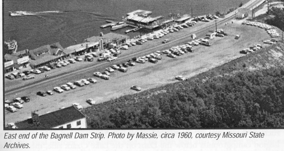
By the 1940’s, buildings lined the north side of the highway in Lake Ozark, clustering along a three quarter mile stretch from the Dam to School Road. This developed corridor, today officially called Bagnell Dam Boulevard, became known as the Bagnell Dam Strip (The Strip) (photo 20).
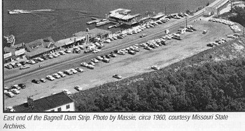
20 East End of Strip
Click image for larger viewResorts, hotels, gift shops and other businesses continued to spread west along the highway. The Miller Camden county line takes a zigzag course along Highway 54, which did not become “Business 54” through Lake Ozark until the mid 1970’s, all the way from the Dam to the city’s southwest limits. Lake Ozark, therefore, lies in two counties, which has at times created problems for the city and for businesses that straddle the border between the two counties.
The Strip, a three quarter mile long corridor from the Dam to School Road, quickly became THE destination point for most tourists to the Lake area. Free tours of the facilities at Bagnell Dam, sponsored by Union Electric, and the lack of substantial development along the highway in Osage Beach, were additional factors that focused attention of Lake Ozark. So too did the fact that Highway 54 passed over the dam, funneling all westbound traffic directly to The Strip.
As the Great Depression waned, World War II reared it ugly head, bringing rationing of cars, tires and fuel, which had its own dampening impact on tourism. But the businessmen of The Strip hung on. The most dramatic event of this period was the flood in the spring of 1943 that threatened to drown the power plant below the Dam and shut the operation down. More than 500 men…a mixture of army and civilian…fought the battle for a week with sandbag dikes and won. For the full story of the Flood of 1943, see Volume One of this history series.
Prosperity came with the 1950’s and 60’s when tourism nationwide hit the big time and it wasn’t long before both sides of The Strip were lined with businesses. As you drove off the Dam, you were likely to encounter young people at the west end waving flyers and hawking tickets to competing attractions that offered excursion rides on the Lake. The competition among excursion boat operators at the west end of the Dam was so intense that quarrels sometimes erupted and lawsuits were threatened. During the spring and summer months, especially on weekends, it was traffic gridlock from one end of The Strip to the other. Because the road to School of the Osage exited onto the west end of The Strip, locals attending evening events at the school in the spring and fall months found it necessary to plan extra time to get to the school and get home afterwards because bumper to bumper traffic crawled along so slowly. Mixed in with this horrendous traffic were hundreds of rowdy teenagers from major urban centers who came to drink and indulge in unruly behavior. In the evening hours they created bedlam on The Strip.
Lake Ozark thought it had put its sullied reputation of the 1930’s and 40’s behind it with the influx of family oriented businesses that came with the 1950’s and 60’s. But once again, big city newspapers were calling Lake Ozark a rowdy place. By 1966, the drinking, yelling, fighting and harassment of vacationers had gotten out of hand on weekends. Lake Ozark discovered that their town had no ordinances to enforce lawful behavior. Neither was the city incorporated and it had no police force. They also discovered that a town straddling the boundaries of two counties could have other problems, but city administrators got busy and solved the problems in a few months. The town was incorporated, laws enforcement officers were hired, and by Labor Day weekend the task had been accomplished and things became more orderly.
The 1970’s dawned with consternation over the need for municipal water and sewer facilities. Weekend traffic gridlock on The Strip encouraged the Missouri Department of Transportation (MODOT) to view The Strip as a bottleneck for traffic. Major new improvements to Highway 54 were underway from Jefferson City to the Lake, transforming the highway from a two lane road to a four lane divided highway. MODOT solved the bottleneck problem at the Dam by bypassing Lake Ozark altogether, routing the highway around the Dam one mile downstream from the Dam. The Osage River was bridged and the new route funneled nearly all traffic directly into Osage Beach at the southwestern limits to the city of Lake Ozark. Osage Beach began to experience a new prosperity.
The route through Lake Ozark became “Business Highway 54.” Through the remainder of the 1970’s and most of the 1980’s, businesses along The Strip saw a substantial decrease in visitors and traffic and entered period of economic decline. The slump carried well into the 1990’s. As businesses failed and closed, vacant buildings began to haunt The Strip.
There were a few economic bright spots during this period, however, such as the arrival of the annual Mountain Man Festival in the American Legion campgrounds below the Dam on the Lake Ozark side, the arrival of the annual Magic Dragon Car Show to crowd The Strip with color, lively entertainment, and throngs of visitors, and then the Governor’s Cup Power Boat Races. But as the city approached the year 2000, new problems emerged …the appearance of drugs and the return of young people who found it fairly easy to buy controlled substances in the area. Their late evening loitering on The Strip began driving away what few family groups still came to The Strip. Even the students at School of the Osage avoided The Strip because of the drug problem. The problems were compounded by a long struggle among city administrators over how to cope with the city’s problems. Rapid turnover in the city staff and quarreling by the Board of Aldermen brought public ridicule from the local media. Another detriment to business on The Strip was the “rundown” and “decrepit” look of many of its buildings.
During the 1980’s and early ‘90’s, while Osage Beach exploded with new development and transformed its highway corridor through popular shopping malls and big box stores, and turned its transportation corridor from a two lane into a five lane highway, Lake Ozark and The Strip seemed frozen in time. Sixty year old visitors commented that The Strip had hardly changed in appearance from the days of their youth. The only enhancement the city had succeeded in making during this period was improvements to the sidewalk and parking areas along The Strip’s north side and even that project had been underfunded and controversial.
But while the city’s two decades of woe had been initiated by the construction of a bridge and a highway that took traffic away from The Strip, the 1990’s brought another bridge that offered better promises…the Community Bridge, which linked Lake Ozark with Shawnee Bend, a large chunk of almost undeveloped land that had been inaccessible to Lake Ozark developers for 65 years
The changes that would ensue following dedication of the bridge in 1998 would seem agonizingly slow but as Shawnee Bend exploded with the development of luxury homes and the infrastructure that accompanies such development, and Horseshoe Bend entered a period of renewed development and infrastructure improvements, Lake Ozark entered the 21st Century with the promise of better days on the horizon than had been glimpsed in decades. Now as this history is written, nearly a decade into the 21st century, so much new development is underway and planned for Lake Ozark that it represents tens of millions of dollars worth of investment.
As for The Strip itself, significant new developers with substantial funding have undertaken the effort to revitalize The Strip. This development, if it comes to pass, will include a near total overhaul of the face and functionality of this vital historic downtown area. The plan will also preserve the uniqueness and historic qualities of the district. Major new developments adjacent to The Strip will include the American Legion bottomlands (that area below Bagnell Dam fronting the Osage River on the Lake Ozark side), and virtually all of the land…hundreds of acres…between Business Highway 54, The Strip, and Highway 54 at the west end of the twin bridges that cross the Osage River below Bagnell Dam.
Thanks Dwight for the narrative and the photos about “The Strip” at Lake Ozark!
As a follow-up of sorts to the early history of Lake Ozark and the Bagnell Dam the next narrative is going to reach very far back in Osage River history to discuss the early efforts to bring commerce to the interior of Missouri through river boat traffic. Gerard Schultz (photo 21), who was a well known professor at the Iberia Academy in the early part of the last century, is best known perhaps for his “History of Miller County” written in 1933.
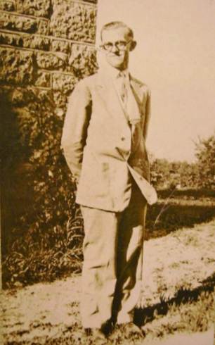
21 Gerard Schultz Gerard wrote many historical articles for local papers when he was living here and one of them was about the beginnings of river boat traffic on the Osage. I have referred several times in the past to Gerard’s book about Miller County History and we have many biographies on our website written by him. So I thought before presenting his article about the early navigation by river boats on the Osage I would spend some time informing readers about Gerard’s personal history. Although I never met Gerard, he did marry a fourth cousin of mine, Jenny Brumley (and this was long ago in 1928). Jenny’s grandmother, Sarah Forrester Ramsey, was a sister to my great grandmother, Susie Forrester Abbett. But since Gerard and Jenny left Miller County a year after I was born I didn’t know them, although my mother did.
First I will present a short biography of Gerard which is on our own website sent us by his family:
GERARD SCHULTZ FAMILY
Gerard Shultz was a professor of history at the Iberia Academy between 1926 and 1944 where he also taught German. He authored several books during his years as an educator and while at Iberia he wrote "A History of Miller County Missouri" and "A History of the Missouri Northern Ozarks." After he left Iberia Academy he moved into Iowa and later to Michigan where he authored books on history pertaining to those states.
Gerard Shultz was born near Owensville, in Gasconade County on 2/11/1902, a son of Rev. George C. and Helene Schultz, both natives of Germany. His parents came to America when they were young and married in Troy, New York. His paternal grandfather was a small manufacturer in Westphalia, Germany and his maternal grandfather owned a bakery in Elberfeld, Germany. Gerald came from a family of nine children (four sons & five daughters).
Gerard graduated from Knoxville College, Galesburg, IL where he earned his bachelor's degree and his master's from the University of Minnesota. During his career as a teacher he taught in Missouri, Iowa and Michigan. He came to Miller County in 1926 to teach at Iberia Academy and two years later, on August 22. 1928, he married Jennie Brumley who had also attended Iberia Academy. Jennie was born 4/14/1908, a daughter of John D. & Aulta (Ramsey) Brumley of Miller County. Her grandparents were early Miller County pioneers (John M. & Lucy Ann (Martin) Brumley and George M. & Sarah (Forrester) Ramsey).
Gerard and Jennie became parents of three sons, John, Gerard Jr., and Daniel. At the time of their father's death in 1974 all three sons were living in Illinois. After leaving Iberia, Gerard and his family moved to Iowa for a while. From there they went to Huron County, Michigan. He retired from teaching in 1967 but continued his historical writings.
Gerard Schultz died in Elkton, Mich. on 4/14/1974 from an apparent heart attack. He was survived by his wife Jennie, three sons, eight grandchildren, four sisters and three brothers. His funeral services were held in Elkton at the United Methodist Church with burial in Grand Lawn Cemetery in Elkton. The last trip Gerard made back to Miller County was in October 1973 when he and Jennie returned to Eldon to visit her aged mother, Aulta Ramsey Brumley.
The article Gerard wrote entitled “Osage River Navigation” is well researched but because it covered a period of time before photographs were common, I have no pictures of any of the early steamboats or even any of the people involved in bringing the steamboats to the interior of Missouri. As a supplement to this narrative the following websites will be of interest to some readers:
Discussion of later steamboat navigation on the Osage River
History of Steamboating on the Osage River (video)
Osage Indian History
Interviews with some old time steamboaters by Ginny Duffield with photos
Osage River Navigation
Professor Gerard Schultz
Tuscumbia Autogram
October 25, 1934
The study of steamboat navigation on the Osage River before the civil war must begin with some knowledge of the river basin. The Osage River rises in eastern Kansas, flows east to the Kansas Missouri line and thence through or along the border of Bates, Vernon, St. Clair, Henry, Benton, Morgan, Miller, Cole, and Osage counties, Missouri. It empties into the Missouri river twelve miles below Jefferson City. It has a very crooked channel with many ox bows and an extremely uneven flow of water. In dry seasons the flow becomes very small for the size of its drainage basin of about 250 miles. During some dry seasons more than half its flow comes from the Niangua which before the construction of the Osage Dam entered the Osage just above the former site of Linn Creek.
Note: Gerard uses the name Osage Dam because at this time in 1934 the official name, Bagnell Dam, had not been decided.
The land in the upper part of the river basin is rolling, but in its lower stretches the river flows through a hilly and wooded region.
As a part of Louisiana Territory the Osage river country belonged at first to France, passed to Spain in 1763, and was returned to France in 1800. It became part of the United States by the Louisiana Purchase of 1803. During the period of French and Spanish ownership and for about two decades after the region had become a part of the United States, it was the hunting ground of the Osage Indians. As early as 1693 the French visited these Indians for purposes of trade. It was estimated that at the time of the transfer of Louisiana to the United States the traffic with the Osages amounted to $28,000 annually. The boats used in the trade were canoes, rafts and keel boats.
As far as the facts are known, the year 1837 inaugurated the first use of steamboats on the Osage river. According to the Jeffersonian Republican, published at Jefferson City, the steamboat North of St. Louis, which had ascended the Osage the week of July, was stranded as a result of a rapidly falling river. It was reported that she was lying high and dry on an island, six or seven feet out of the water, about thirty miles from the mouth of the river. In the spring of 1838 the steamboat Adventure ascended the river for a distance of 160 miles and returned to St. Louis, having experienced little difficulty in navigating the Osage. We are informed that the “country on the principle branches of the Osage above the Niangua is as fine as any other part of Missouri and settling rapidly by a highly respectable population” and that there was “very little surplus produce to bring away from that region of the country at present, the provisions being consumed by emigrants who arrive in great numbers in the spring and fall of the year.” The first steamboat to be expressly employed in the Osage river trade seems to have been the Osage Packet in 1840, which was operated by Benjamin B. Bryan. In 1841 the steamer Leander carried 200 tons of freight to Warsaw and Osceola and returned to the port of St. Louis with freight and passengers on May 15. The following year the Maid of Osage, a vessel of 63 tons burden, was built at Osage City expressly for the Osage river trade. This steamer was owned and operated by Captain Nansen Bennett of Cote Sans Dessein in connection with the James H. Lucas, a Missouri river steamer. During 1844, the year of the greatest known flood on the Osage the Maid of Osage ascended the river as far as Harmony Mission in Bates County. This year the steamers Warsaw, Agatha, and Huntsville also entered the Osage river trade.
Note: Currently, the record flood level to date was recorded in 1943, the most severe flood in Osage River history.
By 1846 the traffic began to assume some degree of regularity. The following is a list of steamboats on the Osage for each year from 1846 to 1860, inclusive: (1846) Otter, Cora; (1847) St. Louis Oak, Cora, Otter, Wave; (1848) Lightfoot, Lake of Woods, St. Louis Oak, Haydee, Wave; (1849) Eliza Stewart, Wave, Martha, Pearl No. 2; (1850) Allegheny Mail, Lake of the Woods, Wave, Enterprise, Haydee; (1851) Mary Blane, Daniel Hillman, Financier, Sacramento, Allegheny Mail, Fayaway, Wave, Pocahontas; 1852 Fayaway, Daniel Hillman, St. Ange; (1853) Lightfoot, Wenona, Wave, St. Ange, El Paso; (1854) Lightfoot, Kentucky No. 2, J.B. Gordon, St. Francis, Wave, El Paso, Milburn, Wenona; (1855) Emma Harmon, Alliance, Excel; (1856) Mary C., Thomas E. Tutt, Excel, E.A. Ogden, Colonel Morgan, G.W. Jones, Navigator, Gossamer, Regulator, William Phillips, Alliance, Alice; (1857) Castle Gardy, Low Water, Laclede, Fire Canoe, Alliance; (1858) Chippewa, Mary C. Mansfield, T.L. Crawford, Laclede, Saracen, Sam Kirkman, York State, Brazil, Medora, Lake City, Alliance; (1859) Brazil, Belfast, Chippewa, Laclede, Chippewa Falls, Conewago, Alliance, Courier, Dew Drop, Chippewa, Cedar Rapids, Colonna, Umpire No. 3, Forest Queen, Belfast, Alliance.
The upstream traffic consisted principally of salt, groceries, nails and iron. The commodities that constituted the bulk of the down stream traffic were pork especially that from hogs fattened on acorns, furs, peltries and grain, chiefly wheat. Other commodities transported downstream were apples, bee cords, dried beef, blooms of metal, barley, butter, canvassed hams, castor beans, cattle, chickens, cigars, deer skins, deer hair, eggs, feathers, flour, flaxseed, dried fruit, ginseng, grease, hair, hemp, hides hoop poles, iron ore, lard, leather, linsey, lumber, mustard seed, pig lead, pickled hams, peaches peas, potatoes, otter skins, rags, skins, soap, staves, sugar, tallow, tobacco, venison hams, wagon spokes, wax and whiskey. Deer must have been plentiful in the Osage river country even during the fifties. In March, 1850, the steamboat Wave arrived at St. Louis with a cargo which included 301 venison hams. In 1854 Warsaw alone shipped 144 bales of deer skins.
From March to June and from October to December were the best seasons for the navigation of the Osage. Traffic was suspended during the winter and generally during the summer. The distance a steamboat would cover per day depended on her power, the current of the river, weather, winds and so on. Under favorable conditions a boat could make about five miles an hour going upstream. This rate of speed was almost double going downstream. In June, 1851, the Financier made a trip from Warsaw to St. Louis in 22 hours. The Osage was bankfull and on a stand. In May, 1856, the Thomas I. Tutt left Linn Creek at four o’clock in the morning and arrived at the mouth of the Osage at two o’clock that afternoon, achieving an average speed of ten miles an hour.
In navigating the Osage a number of steamers sank or were damaged. The Ware sank a short distance above Warsaw during the fall of 1849 and on September 18, 1855, the steamer Alliance sank in the Osage river with a cargo valued at $40,000. Both steamers were raised and repaired. On May 25, 1859, the T.L. Crawford “ran into woods” near Linn Creek and knocked down both chimneys. There is also a record of a riot which occurred among deckhands on board the steamboat Castle Garden when she was lying at the foot of Linn Creek shoal in June 1857. Three persons were killed and several were wounded.
In ascending the Osage, steamboats carried goods to Lisletown, Tuscumbia, Linn Creek, Warsaw, Osceola, Taborville, and Papinsville. Of these places, Osceola, Warsaw, and Linn Creek were important shipping and distributing points for southwest Missouri and even northwest Arkansas. We are told that frequently 100 wagons were in Osceola at one time to obtain supplies for stores at various distant points. By 1860 large quantities of lead from the mines of Jasper and Newton counties were hauled by teams to Osceola and thence shipped to St. Louis. We are also informed that as many as seven St. Louis steamboats could be seen at the wharf at Warsaw at one time. In 1854 the port of Warsaw shipped 11,994 pieces of bacon, 144 bales of deer skins, 2,230 furs, 33 barrels of beeswax as well as large quantities of wheat, corn, and whiskey. That year the same port received about 5000 tons of freight by steamboat from St. Louis. It is interesting to note that the larger boats were sometimes unable to turn around in the stream at the Warsaw landing and were obliged to go on to the tow head above for the purpose. During the late fifties Linn Creek became the most important point for the trans-shipment of goods which were freighted from there by wagon to Springfield and other places. Although the town had a population of only 250, the value of the goods landed there by 1858 was estimated to be between seven and eight hundred thousand dollars annually. The Jefferson Inquirer of December 4, 1858, states that “steamboats made regular trips during the past season as far as Linn Creek and occasionally visited Warsaw and Osceola.” During the same season the Osceola Independent reports the arrival of thirteen steamboats at that place. The commodities transported downstream went principally to St. Louis. In 1858 steamboats from the Osage river bought 2,909 tons of freight to St. Louis. This figure does not include freight which was shipped at Osage City. In 1860 two lines of steamboats operated from Osage City, one of these served Linn Creek and the other Papinsville. After the building of the Pacific Railroad, some of the Osage river steamers operated from Osage City in connection with the railroad.
The problem of transportation was of primary importance to the development of the Osage river country. The settlers in this part of the state were strongly in favor of the improvement of the navigation of the Osage river because they felt that their prosperity depended upon having the river open to trade. Travel by land was slow, difficult, and costly. In an article discussing the improvement of the Osage river, attention was directed to the fact that “a large portion of the surplus products are rendered valueless by the enormous cost of land carriage.” If the river could be made navigable it would furnish an economical outlet for the surplus produce of the farmers and furnish them more cheaply with the supplies they needed. The presence of shoals, overhanging trees, and sunken logs constituted the greatest impediments to navigation. The need of improvement of the navigation of the Osage was expressed in conventions, the press, the State legislature, and in Congress. Merchants were particularly active in this movement.
On February 11, 1839, an act of the General Assembly of the state of Missouri established a Board of Internal Improvements. The first duty assigned to the board after its organization was “to cause the principal rivers of this state…to be examined and surveyed with a view to the improvement of the navigation of said rivers, either by deepening of the channel thereof, clearing the bed and shores of obstructions or by a proper system of slack water navigation by means of locks and dams.” Two days later an act of the General Assembly directed the Board of Internal Improvements to make an examination of certain rivers of which the Osage was the most important. The board made its first and only report on December 10, 1840. According to this report, the survey of the Osage river was started at Osceola on March 30, and completed at its mouth on August 2, 1840. Twenty five shoals and rapids were enumerated between Osceola and Warsaw, a distance of 58 miles; thirty between Warsaw and the mouth of the Niangua, a distance of 63 miles; and forty three between the latter point and the mouth of the Osage, a distance of 108 miles. To improve navigation at the shoals and rapids it was recommended to construct wing dams and jetties of such height and extent as to insure a minimum depth of four feet. It was estimated that an expenditure of $204,600.00 would make the river navigable for some seven months of each year, for a distance of 220 miles from the mouth, for specially built boats drawing not over three and one half feet of water. At the time the survey was made the cost of transportation from Boonville to Warsaw was one dollar per hundred pounds. It was thought that improved navigation between the mouth of the Osage and Warsaw would reduce this cost by sixty percent. However, as the resources of the State were at this time inadequate for the adoption of a program of internal improvements, the State did nothing towards the betterment of the navigation of the Osage, and on February 15, 1841, the Board of Internal Improvements was abolished. Nevertheless, the report of William H. Morell, the chief engineer of the Board of Internal Improvements, became the basis for continued agitation for the improvements of the Osage river.
In 1841, 500,000 acres of land were given to Missouri for purposes of internal improvements by an act of Congress. There were numerous proposals as to how the proceeds of the grant ought to be used, but it seemed to be generally conceded that the fund should be applied to the betterment of the waterways of the State, particularly of the Osage and the North Grand. An act of the General Assembly, approved March 27, 1845, provided that the proceeds from the sale of the land be distributed equally among the counties of the State. However, in his message of November 16, 1846, Governor John C. Edwards was inclined to doubt the wisdom of the distribution act and suggested that it be repealed, and the money used in the improvement of the Osage, Grand, White and Current rivers, and the drainage of the southern swamps. During the session of the legislature, on February 15, 1847, a company to be known as the Osage River Association was incorporated. The object of this association was to improve the navigation of this river from its mouth to the western line of the State for steamboats and other craft. Any county was authorized to invest its Internal Improvement Fund, or the Road and Canal Fund, or other funds in this Association.
In improving the Osage for navigation the Board of Directors of the Osage River Association followed the recommendations made by William H. Morell, who made the survey of the river in 1840. The river, from its mouth as far up as Papinsville, was laid out into five districts. The first district extended from Tuscumbia to Erie, the third from Erie to Warsaw, the fourth from Warsaw to Osceola, and the fifth from Osceola to Papinsville. Up to September 1, 1848, the association had spent $893.47 in the first district, $1746.33 in the second, $4504.94 in the third, $1431.73 in the fourth, and $406.18 in the fifth. Improvements consisted of building dams, and digging or scraping the channel. The dams were built of brush, laide with the butt end downstream. On the tops of the brush a stone wall was built, about four feet thick and averaging two feet in height above the lower water mark. The dams extended diagonally across the river and were built a short distance below the shoals in order to back the water over the shoals and to confine it to a narrow channel near one of its banks.
As late as May, 1848, only eight counties had invested funds in the stock of the Osage River Association. All of these counties with the exception of St. Louis county, were located in the Osage river region. The funds of the Osage River Association were inadequate for its task and the directors of the Association blundered in not starting the work of improvement at the mouth of the river.
During the fifties, when the demand for adequate transportation was strong, the General Assembly passed an act, approved February 14, 1855, providing for the improvement of the navigation of the Osage river. Fifty thousand dollars were appropriated for dredging or digging out bars, removal of snags and other obstructions, and the repair and erection of wing dams, between the mouth of the Osage and Osceola. Work was to start at the mouth of the river. The Board of Commissioners named to carry this act into effect was organized on August 9, 1855, and divided the work into three districts. The first district extended from the mouth of the Osage to the mouth of the Niangua; the second, from the latter point to the steamboat landing at Warsaw; and the third from thence to Osceola. The work in the first district was directed and controlled by Sydney R. Roberts of Linn Creek; that of the second by James Atkisson of Warsaw; and that of the third by William L. Vaughn of Osceola. By November, 1855, a majority of the counties forming the Osage River Association had assigned their rights required by the act of February 14, 1855, and at intervals during the following thirteen months the entire appropriation was paid to the three commissioners of the third district, and also the chairman of the Board of Directors, who received one dollar less. The river was scraped and wing dams were built in order to deepen the water at the shoals. Over hanging trees were removed, especially along shoals and sharp bends, and such obstructions as sunken logs and rocks were removed from the bed of the river. As a result of the improvements commerce on the Osage increased. In his report on the improvements of the river of February 28, 1861, William L. Vaughn states that steamboats had made frequent trips up the river “which would have been utterly impossible before the work was done.” This activity declined during the Civil war and never revived, except for a period of years in the lower river before the railroads penetrated this region.
Thanks Gerard. Below are some of the steamboats owned by some of the partners of the Anchor Mill Company of Tuscumbia which were built in the last part of the 19th and early 20th centuries (photos 22 - 26).
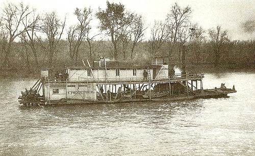
22 Frederick on the Osage
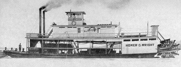
23 Homer C. Wright Steamboat
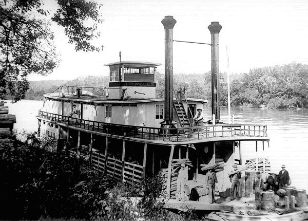
24 J.R. Wells with Men in Front
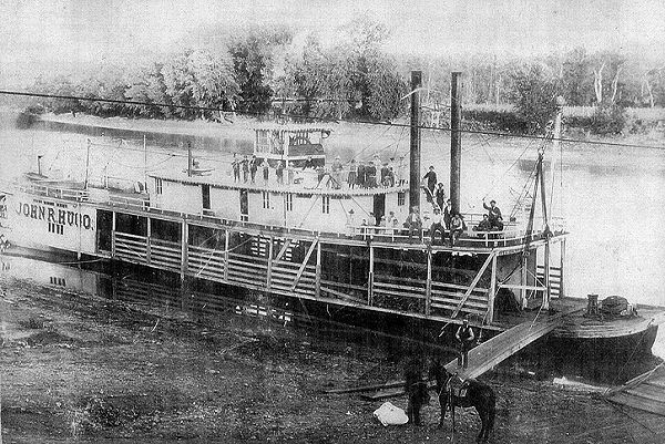
25 John R. Hugo owned by Bob Marshall
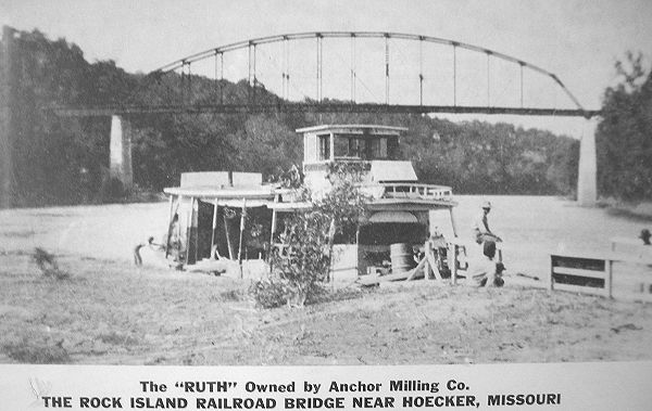
26 The Ruth owned by Anchor Milling Co. And here is a photo of a dredging boat which was necessary to keep the channel clear (photo 27).
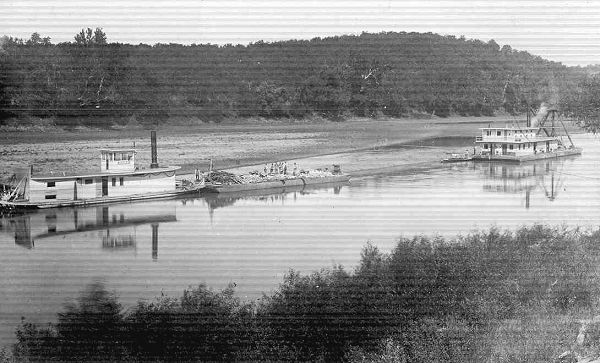
27 Dredging Boats
About two years ago we were visited by Bruce Pollock of Kansas City, who is of Osage Indian descent. He was on a mission to retrace the home of his Osage Indian ancestors along the Osage River. The day Bruce visited us Helen Schulte and Corrine Gilliam were our museum hosts. Both were well informed about the Osage Indian history of our area and were able to offer Bruce information which he recorded on video tape as part of a documentary he was filming. Two of Corrine’s grandchildren were present that day and they also offered some Osage Indian history which they had learned from Corrine. Bruce also included in the video quite a lot of video of the Osage River and the part it played in the lives of the native Osage Indians of this area. David Statler, the manager of the Progress Notes website has uploaded the video so that you can view it yourselves:
Note: Depending on which web browser you use, you may need to install Microsoft's Windows Media Player Extension to play this video. If you are using Microsoft's Internet Explorer web browser, you will see a yellow text bar across the top of the browser window stating "This website wants to run the following add-on: 'Windows Media Player Extension' from 'Microsoft Corporation'. If you trust the website and the add-on and want to allow it to run, click here..." You will need to click on this bar to allow the video to play. If you do not wish to do this, then click on the "Launch in external player" link located under the video box below.
If you want to purchase a video from Bruce you can contact him at this phone number: 816.215.4241.
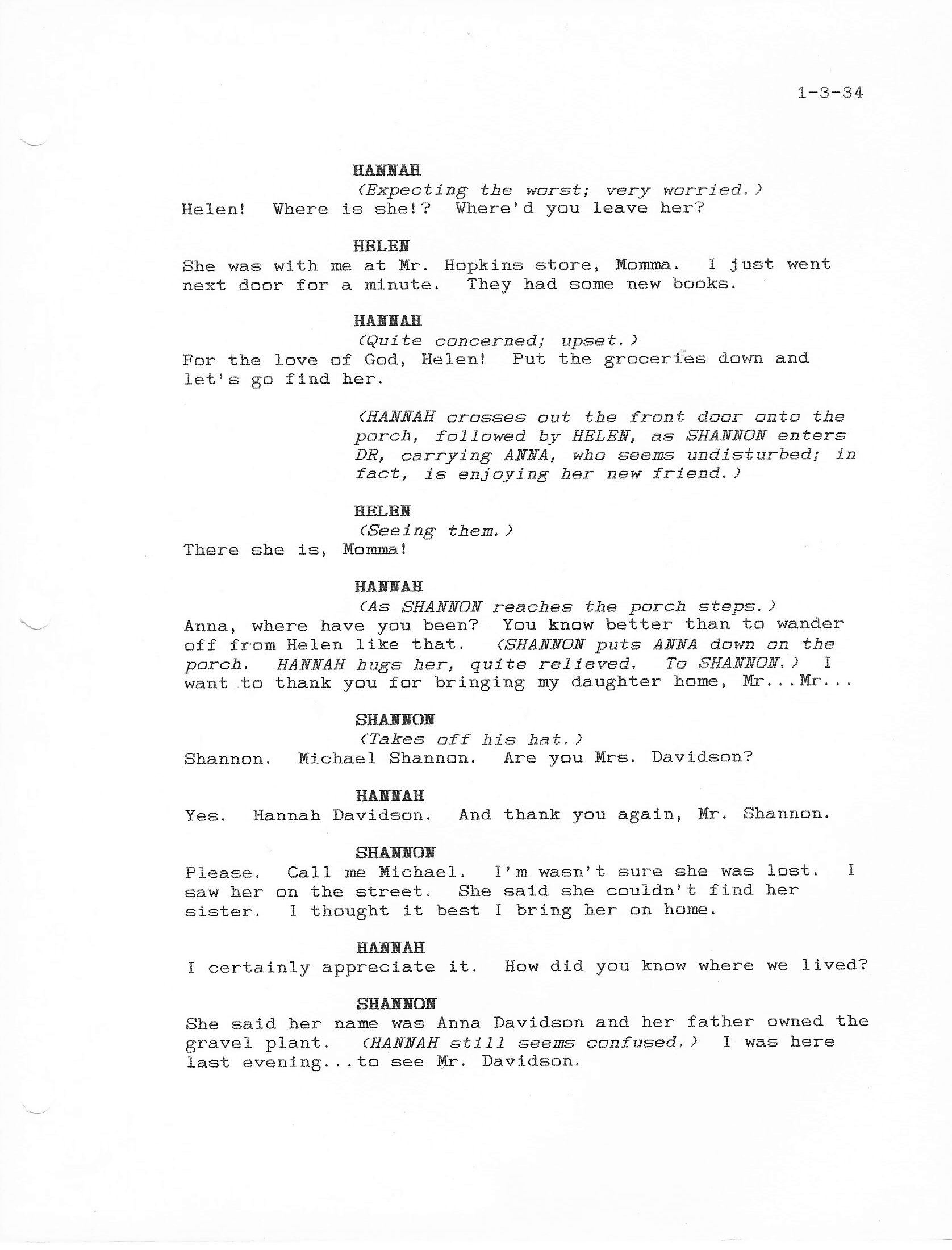
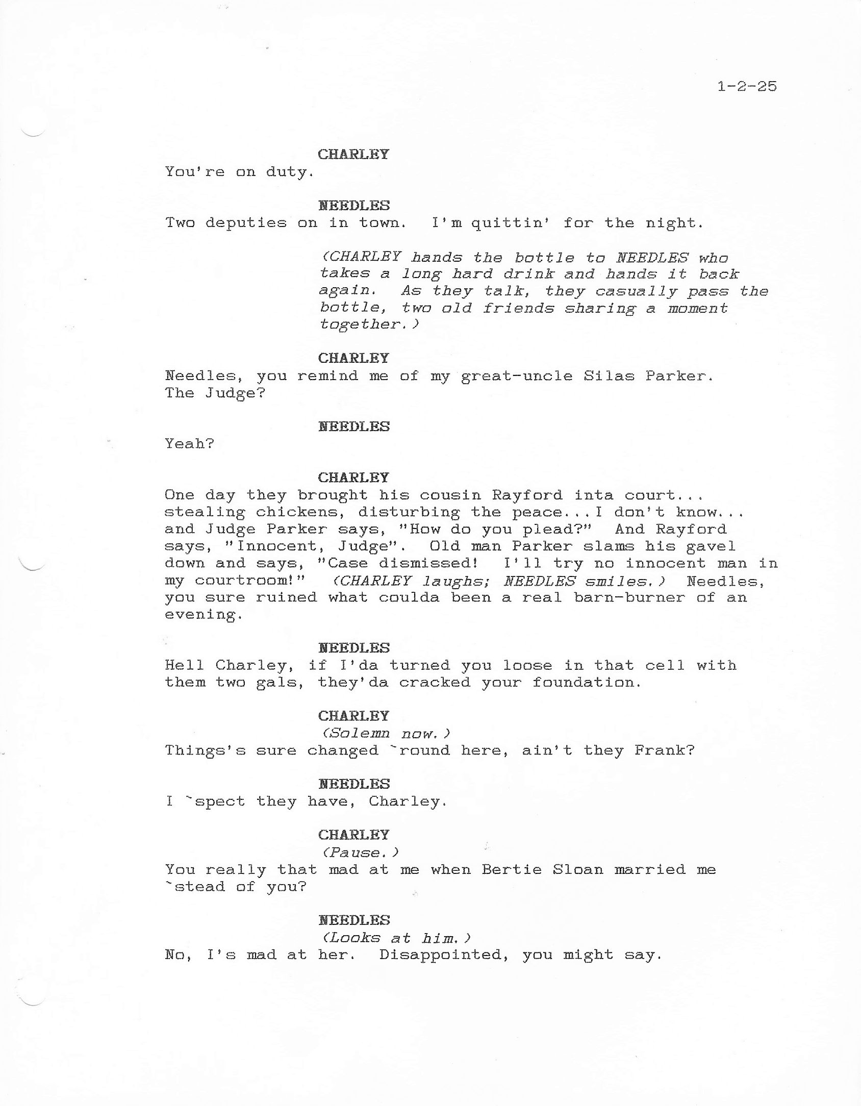
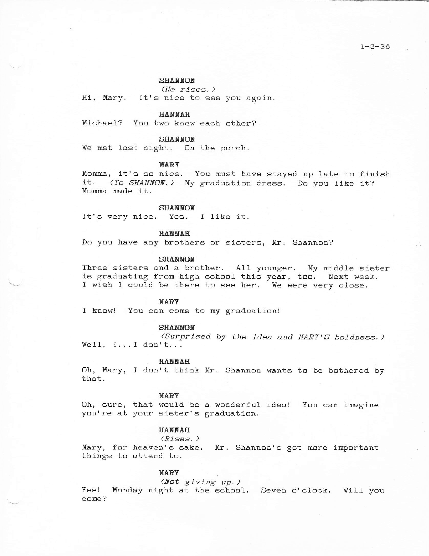
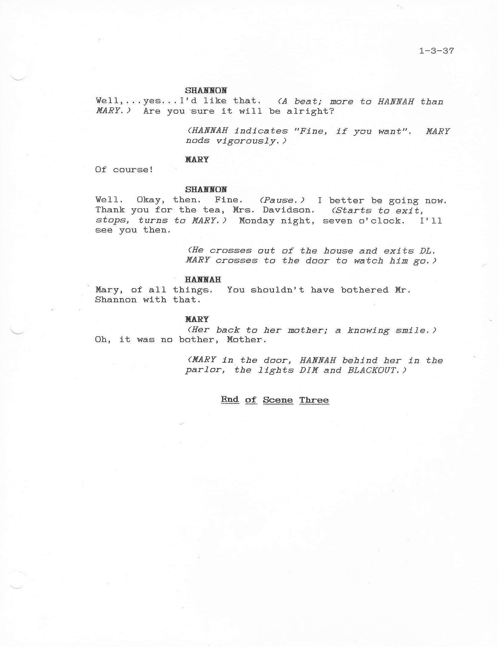
I’ll end up this week with Act One, Scene Three of the play by Tim Pilkington, The Cricket’s Song. This is a short scene in which Phillip Davidson’s daughter, Mary, and the young engineer, Michael Shannon, enter the beginning of their romantic relationship (photos 28 - 35).
The Cricket’s Song
By Tim Pilkington
Act One - Scene One
Act One - Scene Two
Act One - Scene Three (photos 28-35)
Just click on any of the photo thumbnails to view a larger image.
Note: Once you click on an image below, a new window will open. It would be best to maximize this new window by clicking on the middle box in the upper right-hand corner of the window. When you move your cursor over the image in this new window, it will change to a magnifying glass. Once this occurs, click on the image and it will show in a larger format for easier reading.
That’s all for this week.
 Joe Pryor
|