|
Monday, June 16, 2008
Progress Notes
The works of a turn of the century artist from Miller County, John Wright (photo 01), are one way to appreciate the
history of our county through the recollections of this talented artist as depicted in
some of his paintings. John Wright was the father of Francesca Wright, who is the artist
whose paintings are prominently displayed in our new entry way at the Miller County Museum
(photo 02).
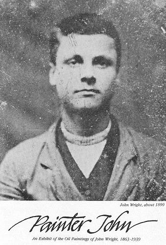
01 John Wright
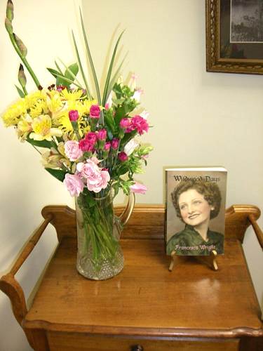
02 Wildwood Days
I had written recently about Francesca so I thought it would be a good follow-up to give some history about her very interesting father. The following article, by Alan Terry Wright, grandson of John Wright, the painter and father of Francesca, was taken from the Miller County Autogram Sentinel of June 30, 1983. The article was written on the occasion of a showing of some of John's paintings locally. The exhibit, which was set up as an art show, with free standing museum like exhibit boards, also was produced by Alan.
Early Day Area Artist's Work On Display
John was born in 1863. He grew up on the family
homestead two and a half miles north of Tuscumbia where his father owned and operated a
grist and carding mill powered by the pooled waters of one of the area's largest springs
(photo 03). Wright was filled with tales of Osage Indian lore, the
Civil war and the growth of the steamboat commerce on the Osage River. His paintings
reflect what he saw and heard.
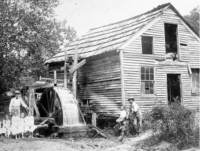
03 James Lawrence Wright Carding Machine on Saline Creek
His earliest known work is an oil on canvas
depicting a watermill with an overshot wheel similar to his father's mill. Wright's mother
died in 1874 and his father remarried five years later. After developing a strong dislike
for his step mother, he left home to live with a brother, Joseph Thompson Wright, and
family.
After leaving home, young John, along with friends
and cousins, formed a travelling musical review and variety show. John played the banjo,
performed acrobatics and did a ventriloquism act using a little wooden black boy as his
companion (photo 04). The troupe, which travelled Southern Missouri and part of
Arkansas in the 1880's also had a "Punch and Judy" puppet show in its
repertoire.
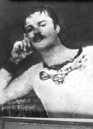
04 John Wright - Trapeze Artist
After his marriage in 1891, John turned to
his skills of mixing paint pigment and oils for a living and began house painting in the
Tuscumbia area. During an era of the replacement of old log homes with large, two storied
weather boarded farmhouses, his expert services were in demand. It should be remembered
that commercially prepared paints and varnishes were uncommon and the skill to produce and
apply paints that would withstand the hard climate was rare.
As his customers grew, so did his family. John and
Lillian (Ingram) Wright were to become the parents of nine children, one of whom is the
famous painter, Francesca Wright of Albuquerque, New Mexico. Frances is an artist in her
own right who paints using the name "Francesca" and is well known in this area.
(Note: Francesca passed away two years ago, but was living and well at the time
this article was published)
In spite of his need to support a growing family
with a trade, Wright never lost interest in his oil paintings. Innumerable old homes in
the Miller, Cole and Camden county areas bear his trademark of lovely little landscapes or
florals painted on door panels or windows as a favor to his customers. To this day, many
homeowners have preserved these artworks, refusing to remove, paint or varnish over them.
During his working years, "Painter John"
painted the steamboats J.R. Wells and Homer C. Wright after their construction at
Tuscumbia, as well as applying the name and numerals required by the U.S. Government.
These boats plied the waters of the Osage, Missouri and Mississippi rivers well into the
20th century.
His sign writing skills were well known and his
graceful letters still adorn a few churches and businesses in the Miller County area.
Wright also painted the original clock face on the
Miller County Courthouse (photo 05). Along with carpenter Dan Thompson, he also helped work out
the complicated details of constructing the dome of the courthouse. The contractor had not
previously built that type of structure and wanted Wright and Thompson's advice on
interior bracing and surface detail.
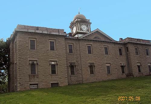
05 Clock Face Courthouse
Not only was Wright artistically talented,
but he was mechanically gifted as well. The Miller County Autogram of January 20, 1898
records:
"John Wright, who is something of a genius
himself, is building a power press for his brother, J.P. Wright, which is to publish the
first issue of the Western Preacher this month (a religious monthly printed at
Tuscumbia)."
After the death of his wife in 1923 and his
retirement to Eugene in the late 1920's, "Painter John" worked on his paintings.
Slowly and deliberately, with steady hand, he turned out an estimated 100 to 125 works of
art. Some were on canvas but most on a smooth sided fiberboard. Sadly, during the height
of the Great Depression, unable to afford other materials, he painted on common corrugated
boxboard. For many who knew "Painter John," these paintings are the most prized
of all.
Seldom did Wright's paintings sell for more than
$2.50…most were simply given to friends and relatives who have retained them until
the present day. Many have not survived. All were scattered through Missouri and the
nation. "Painter John" died February 9, 1939.
Wright's style is a mixture of quaint "folk
art" figures of animals and people, combined with skilled representations of the
form, colors and textures of nature in the wild (photo 06). He had a
penchant for intricate and sometimes extraneous detail, through which he expressed his
sense of humor and humanity. Few of his paintings do not depict a situation or "tell
a story."

06 Flower Painting by John Wright
Many of Painter John's works represent actual
places or historic events, drawn from memory or imagination. Examples include:
"Colonel Zebulon Pike's Landing at Site of Tuscumbia-1806" (Tuscumbia was an
Osage Indian camp at the time of the Pike landing) (photo 07); "Eagle
Branch at the Saline Creek in 1878"; "The Osage" (at night, near
Tuscumbia); and "Winde's Eddy" (on Wet Glaize Creek).
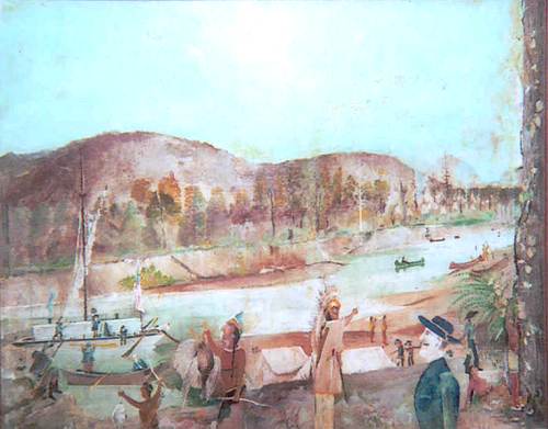
07 Pike's Landing at Tuscumbia
One of his finest works is a commissioned
painting of the lovely Victorian home of steamboat owner J.R. Wells (photo 08). The names of all the seven Wells children were hidden by
Wright in this painting. The home is still in use and stands three miles east of Tuscumbia
on Highway 17. Wright was a religious man and a few paintings depicting biblical events
have also survived.
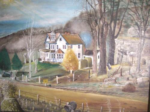
08 Wells House by John Wright
The J.R. Wells home was featured as part of the narrative about J.R. Wells placed on
this website a few weeks ago (Progress Notes - April
28, 2008).
John Wright's home in southern Miller County even had some interesting touches which he
built into the house which originally was a log home (photo 09 and photo
10).
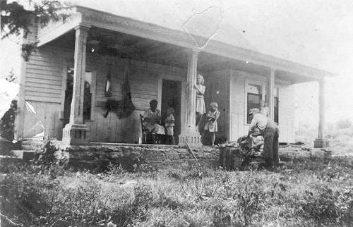
09 John Wright Home - 100 Years Ago
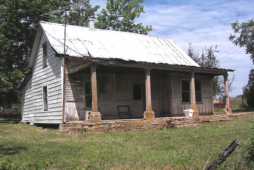
10 John Wright Home - Today
For example, the concrete columns which he made to support the porch roof are an
original after touch of his. (photo 11).
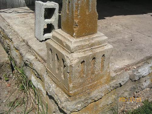
11 Concrete Columns - John Wright House
He helped build the Glover Church and at each corner of the roof put some small
wooden ornamental additions (photo 12).
Though small and barely noticeable, John always left something on his carpentry work to
identify that he had been involved.

12 Glover Church John Wright Decoration
John made furniture including this original hickory rocking chair which he gave
to his nephew, C.B. Wright (photo 13).
Also, he was a glass engraver especially for window inserts in doors as pictured here (photo 14).
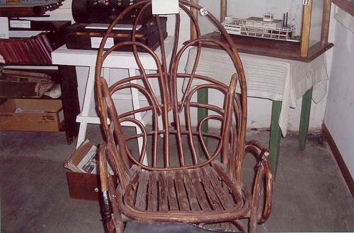
13 Rocking Chair made by John Wright
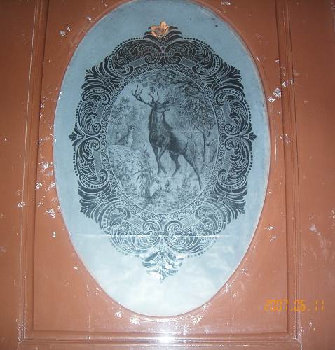
14 Wright Engraving
In his last years John lived in Eugene in a house (photo 15) which he designed and constructed but either forgot
or intentionally left out the stairs to the second story. So he made a mechanical elevator
which worked by a system of weights and pulleys to go up and down between floors.
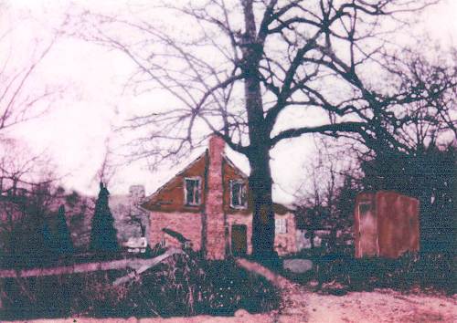
15 John Wright House - Eugene
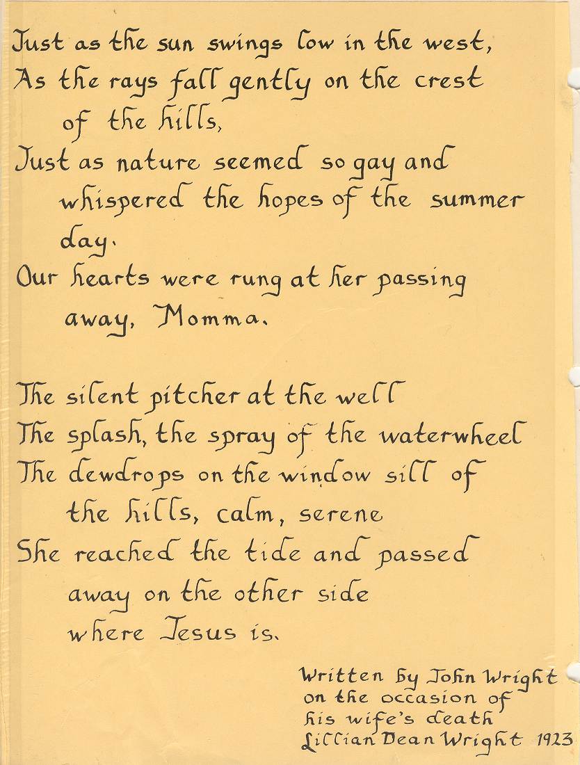
John was even known to write poetry as displayed in this short original poem (photo 16) he wrote on the passing of his
wife, Lillian in 1923.
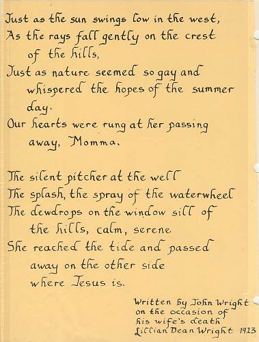
16 John Wright Poem
Click image for larger view
One of the paintings by John noted above depicted his vision of Zebulon Pike's
landing at Tuscumbia. Pike was known to have brought with him a group of Osage Indians
which he was returning to their native ground a little further up the Osage from
Tuscumbia. John apparently knew about the Indians since a number of them are depicted in
the painting. Some of them must have been native and not prisoners since the painting
seems to depict some trading occurring between the Indians and Pike's group. Peggy Hake
wrote a very interesting article about Pike's trip up the Osage and to points further west
at this location on our own website:
http://www.millercountymuseum.org/hake_peggy.html
Also on our webpage we have other links to Zebulon Pike which are of interest:
http://zebulonpike.org/pike-in-missouri
http://zebulonpike.org/
http://www.nps.gov/
http://www.americanjourneys.org/aj-143/index.asp
The history of Native Americans in Miller County and the surrounding area is of great
interest to quite a number of people in our area (photo
17).
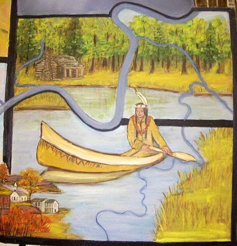
17 Osage Indian in Canoe
The Osage Indians (Wazhazhe) were semi-nomadic and lived along the Osage and
Missouri Rivers in western Missouri. They hunted on the Great Plains and fiercely guarded
their land. Women foraged and grew vegetables in the summer village gardens. The US
Government took the tribe's land in 1808 and 1818, and in 1825 established an Osage
reservation in southeastern Kansas. The Osage are closely related to the Kaw or Kanza
tribe (The People of the South Wind), from whom the name Kansas is derived. However, the Osage were not the first humans to inhabit our area.
I had known that one of my Pryor ancestors from a very long time ago was distantly
related to Nathaniel Pryor who was a member of the Lewis and Clark expedition. Stephen
Ambrose in his book, Undaunted Courage, records Pryor's activities several times in
his capacity as a scout and river guide.
Several years after Nathaniel left the expedition he eventually migrated south west
from St. Louis to Oklahoma and there married an Osage Indian woman. The town of Pryor,
Oklahoma is named after him. So I imagine that quite a few mixed race people in Oklahoma
would carry the Pryor name. I have found that years ago it wasn't unusual for the early
European settlers to marry Native Americans and quite a few people today can point to a
Native American ancestor. For example, my great grandfather on my father's side (who lived
in Wright County, Missouri) was said to have married a woman who was half Cherokee.
For a more particular history of the earliest inhabitants of the Miller County area,
the Goodspeed History of Miller County (compiled in 1889) offers some information,
interesting in that the Goodspeed authors had the opportunity to interview Miller County
inhabitants who actually had had contact with the Osage Indians before they left the
county:
Pioneer Settlement
General View
The sources of information concerning Miller
Territory previous to 1830 are very meager, as the settlers previous to that date are all
dead. The period before 1830 belonged chiefly to the Indians and white hunters. The two
main floods of immigration were late in the 30's, 50's and during the present decade,
succeeding the completion of the railway. This chapter has chiefly to do with the first
period and the first immigration of the 30's.
Prehistoric
The Mound Builders left remains along the Osage
bluffs and bottoms and on the Grand Auglaize. These are in the shape of roughly piled
stone mounds on the bluffs, where decade after decade men and boys have amused themselves
in tossing off the stones from the top "hunting for bones," and often not only
finding bones but charcoal, ashes, stone axes, well-glazed and shapely pottery, and the
like, all fairly preserved. These mounds are so comparatively uncommon that they must be
considered, in all probability, as the burial mounds of the honored ones among those
people, whose existence is so shadowed in obscurity. On the bottoms are groups of
regularly arranged earth mounds, in which is also found charcoal. These groups are not so
common, but they may have been the "national cemeteries," marking battle
grounds, though this is mere conjecture. It is quite certain, however that neither of
these are "Indian graves," as is popularly supposed. A group may be seen on the
M.M. Coburn farm. Another kind of remains not well accounted for is the so-called
"early mining holes" on the side hills two miles south of Tuscumbia. Among the
best archaeological collections in the county is one owned by John D. Brown, of Iberia.
Captain T. B. Robinson has a cup shaped vessel, found in a mound on Mill Creek that is
certain evidence of those ancient people's skill.
The Indians
Miller territory is the old hunting ground of the
Osages, but by 1830 they were here only on hunting expeditions. One noted chief has left
his name on a creek, a cave and a township, "Jim Henry." It is said the cave was
a sort of headquarters. "Joe Muncie" was more noted still, because of his having
served under Jackson at the battle of New Orleans. Early in the 30's occurred what is
humorously known as the "Blanton Indian War." Two men named Blanton were making
all possible speed from Cooper County through Cole (now Miller) to Pulaski, and gave the
alarm of a general Indian massacre, which their excited fancy painted in bloody colors.
Preston Taylor and his neighbors fortified their families at the widow Nolen's while
others took to the brush. No warriors came, however, and it soon leaked out that the
Blantons had become frightened at some harmless gunshots from white men.
About 1822 there was an Indian village on Tavern
Creek, near the mouth of Barren Fork, on the bottoms near Wilson's Cave.
Early White Settlement
While the Indians were still here white hunters and
trappers came and went, and some settled. Among the first of whom information can be
obtained was Seneca R. Y. Day, in 1815. He was followed some four years later by A. J.
Lindley, near the mouth of Big Tavern. About 1821 William and Boyd Miller settled near
Spring Garden Prairie, in the northeast, the first permanent settlers in this territory.
Both are now dead.
Between 1828 and 1833 Samuel Richardson, Maston
Burriss, John Brockman, Isaac Bass and Hugh Challas settled on the Osage River; also
Daniel Brumley on the Tavern, and Isaac Bilyeu. These were about all in the whole county
before 1830.
The Osage River was then the boundary line between
the two counties until the creation of Miller in 1837…Cole on the north and Pulaski
on the south. This fact, together with the natural barrier which a river will make to
social intercourse, long caused the people on each side to be more or less ignorant of the
other. This exists somewhat even yet, and at one time Wilson Lenox, of Iberia, was elected
representative on the issue of making two counties out of Miler with the Osage as a
boundary. The plan failed, however.
A more recent history of the Osage Indians and their predecessors was written by local
author, Victoria Pope Hubbell, in her book, A Town On Two Rivers. This book was
donated some years ago to our library and I have copied here the chapter Victoria so very
well researched and wrote about the Osage:
Children of the Middle Waters
Victoria Pope Hubbell
From the book, A Town On Two Rivers
For thousands of years before recorded history, the
Woodland people lived and hunted throughout the Ozarks. Abundant springs, cave shelters
and game populations made the area appealing to prehistoric groups adept at hunting. The
history of these ancient people is elusive to the more casual observer, due to the absence
of permanent structures or written languages.
Archeological evidence verifies the existence of
human remains from the Late Woodland period in this area. On 17 January 1960, the remains
of two people were found in a cave close to the Osage River in Miller County (later known
as Indian Burial Cave). Archeologist Carl H. Chapman, an expert in Midwestern archeology
from the University of Missouri, confirmed the skeletons as Late Woodland people. The two
females had died between the age of twenty five and thirty five (photo 19).
Analysis of projectile points and pottery shards dated the site as being from 1000 to 1200
years old.
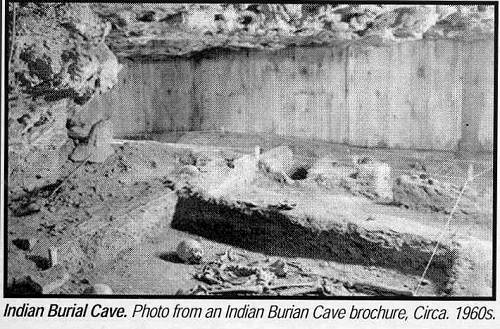
19 Indian Burial Cave Burial Site
The Indians of the Historic Period (1400-1800
A.D.) were those present when Europeans arrived in North America. In Missouri the Indians
of the Historic Period formed two primary tribes according to land ownership. The tribe of
the Missouri claimed the land north of the Missouri River, and the Osage tribe claimed the
territory lying to the south. The territory of the Osage was more extensive than this,
however, with hunting rights reaching as far south as the Snake River in Texas.
The Osage was a large tribe whose numbers in the
1800's were estimated at around 5000. In describing their territory as west of the
Mississippi River and south of the Missouri, they also named themselves: Wha-zha-zhe,
Children of the Middle Waters. The use of the name "Osage" appears to have begun
when the Frenchmen wrote "Wha-zha-zhe" phonetically in French. Later, when the
English acquired the territory and read what the French had written, the current
pronunciation may have seen its beginnings.
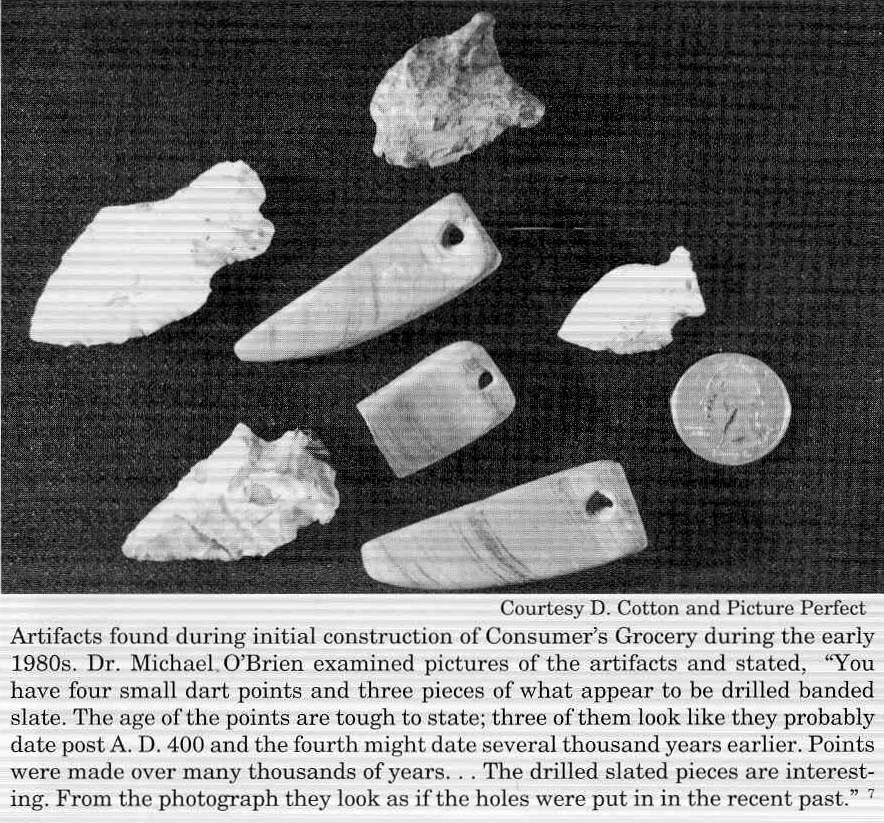
Since the beginning of settlement in this area,
residents have found arrowheads and other artifacts, usually along the river bottom,
suggesting occupation by Native American (photo 20). The assumption
that the findings are Osage in origin is difficult to prove without pottery sherds
(variant of a shard) or other archeological evidence, and Missouri archeologists estimate
artifacts found in this area were most likely of the Woodland people.
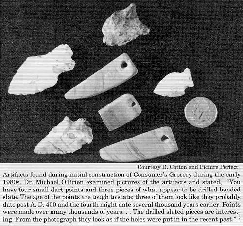
20 Arrowheads
Click image for larger view
In addition, Indian settlements other than
those of the Osage existed throughout the Ozark Highlands from 1600 to the late 1800's
Many tribes whose territories were originally east of the Mississippi had been steadily
moving west to avoid conflicts with the whites. The Indian Removal Bill (1830) legislated
the displacement of all tribes still living east of the Mississippi and resulted in an
estimated 60,000 Indians settling on traditional Osage lands. Thus, white settlers, as
well as warring within tribes, caused frequent tribe relocation.
Technically, the Osage were considered Plains Indians
whose permanent villages of long houses were slightly east of present day Kansas City.
They also had villages in the south western potion of Missouri and near Versailles,
Missouri. The Osage were considered agriculturally advanced and cultivated corn, beans,
squash, pumpkins and other crops.
At designated times throughout the year, the Osage
left their homes to hunt. The hunting season began with the black bear hunt in February or
March. After trade with the French was imitated, a beaver hunt followed the bear. They
hunted deer and buffalo in May and again in August.
The wigwam, a temporary home used on the hunting
trip, was made of green poles covered with animal skins or rush mats, resembling a modern
dome tent. These hunts took place over hundreds of years, during which the Osage Indians
occupied the Osage River area.
At death, personal possessions were traditionally
buried with the dead along with enough food and water to last for the journey to the
spirit world. Prominent men were often buried in small rock mounds or cairns with the
scalp of an enemy hung above the structure by a friend or relative. This act, a great
honor for the male responsible for the procuring of the scalp, was one of the reasons
Osage warriors were feared. They raided neighboring tribes for the burial scalps.
Artist George Catlin's realistic portrayal of
American Indians is significant in light of the cultural changes caused by American
Expansionism. Rather than paint from imagination or the descriptions of others, Catlin
(1796-1872) sketched in Indian villages and made copious narrative notes as well. His
methods, novel at the time, allowed him to artistically chronicle a doomed way of life.
Both men and women pierced and decorated the outer
ear and lobe with bones or shells. Later, they also used trade items such as silver.
Bracelets were common; men wore them on their wrists as well as their forearms.
Tattoos often designated a warrior's honor, similar
to a present day medal. The warrior could choose to confer the honor to his wife and
daughters by giving them similar tattoos. Later, head pieces with an appearance suggesting
European influence were photographed after the Indians moved to the Oklahoma reservation.
Hairstyles distinguished married women from
unmarried. While unmarried women braided their hair or brought it together in two rolls on
each side of the head, married women wore their hair down or gathered loosely with a
leather or cloth tie.
Osage children usually went naked, even in winter,
until they were six or seven. This custom was strange to the white men, one of whom noted,
"Many, and indeed most of their little children, are seen going abroad naked, even at
this cold season of the year, notwithstanding the thermometer had sometimes stood below
zero."
Young children also wore their hair in special in
group haircuts, with each clan having its own distinctive method of cutting the child's
hair. At puberty they abandoned these styles.
The relationship between the French and the
Osage was a fascinating one. Mutually beneficial to both groups, it affected the cultural
development of the Osage tribe more than it did French civilization. This relationship
also left some reminders in present day Miller County in names of rivers and landmarks.
The Osage were noted by the French as early as 1673.
French traders and trappers, whose enthusiasm for making the long journey up the Osage
River was fueled by lucrative markets overseas, initiated interaction with the Osage. By
all accounts, the two groups generally got along well. French traders were vivacious and
friendly, and accounts of them socializing with the Osage are not uncommon. The French
were not usually interested in taking large tracts of land from the Indians, nor were they
preoccupied with changing Osage customs and religious beliefs. The relationship also
benefited from sparse populations on both sides. French occupation during the 1700s
occurred at a time when the entire Native American population for the state of Missouri
was only 15,000, and few French settlers left towns for the wilds of the Ozarks. In short,
there was plenty of room for both groups to exist in harmony.
The Indian was at an advantage over all, because his
knowledge of and expertise in local trapping and hunting techniques was superior. In
return, the Osage appreciated goods which were useful alternatives in their daily lives.
The French lived among the Whaz-zha-zhe, sounding the name out in accordance with French
grammar and writing it "Ou-sa-ge" on their maps, documents and letters home.
Occasionally the Osage sold land to Frenchmen.
Although the French crown had already claimed the land, they did not send the military
power to back up this claim to such remote areas as the Ozarks. One Indian chief noted
that land often sold at six acres a penny.
Traditionally, the Indians thought in non economic
terms. "Young warriors dreamed of captives and scalps that would bring him fame and
glory." The Osage also valued their highly structured and closely knit communities,
their elaborate religious beliefs and their hunting rituals.
This old way changed in interactions with Europeans.
"The Osage, one of the "doomed" prairie horticulturists, rose to meet the
new challenges. At a time when most of the prairie farmers retreated and declined, the
Osage advanced and expanded…the Osage enthusiastically became a part of the European
exchange system…" Along with furs, the French also wanted horses and slaves, and
the Osage became the middlemen. Iron tools and guns provided a special incentive to the
Indians, along with cloth and jewelry.
The culture of the Osage changed in response to the
competition with other tribes as well as the effects of Europeans now in North America:
"This desire to acquire manufactured products
was more than Osage materialism or nascent capitalism. The Osage enjoyed the improved
quality of life that iron hoes, brass pots, and woolen stroud provided, but more
importantly, they needed French weapons in order to survive. Large, well armed tribes
living north and east of the Osage began raiding their villages in the seventeenth
century. Without guns and ammunition they would have been defenseless against the
hammering raids of the Potawatomi, Mesquakie, Sauk, and Illinois, and they would have been
driven from their homes. In order to acquire the critical weapons, the Osage became large
scale commercial hunters and aggressive livestock and slave traders".
The 1800's would not prove as profitable for the
Osage as the earlier years. The Louisiana Purchase in 1803 began the process of Americans
replacing the French as the "legal" land owners of Osage Territory . In 1806
Thomas Jefferson wrote a letter to the Osage informing them their land had been sold by
the French to the United States government for three cents an acre. Legend states the
Osage leaders responded by throwing the letter in the fire. But the Jackson administration
had an aggressive expansionist agenda "which only followed years of less sweeping
tribal dislocations, resulting in the displacement of thousands of Indians."
A period of treaty making followed, with the Indians
gradually relinquishing more and more of their traditional land. "Various treaties
shifted the Osage from one area to the next, establishing reservations first in what is
now Kansas, and finally in Oklahoma." What transpired first on paper took longer to
accomplish in reality. Although according to governmental documents local land was ceded
to the United States of America in 1825, accounts locally suggest Native Americans
lingered later into the decade.
During the 1800's, the Osage received compensation
from the government for their land in two ways: payment at one cent an acre, and hunting
rights on the land they once owned. Osage Indians took advantage of the hunting rights
until the mid 1800's returning to the area to hunt. The buffalo's extinction was
especially difficult for the tribe. There are stories within the Osage tribe of braves
returning to the plains on "symbolic" buffalo hunts going through the motions
even though they knew no animals would be found.
The culture of the Children of the Middle Waters
began with a prehistory almost as ancient as the Egyptians. For over two hundred years,
they interacted with the Europeans until the Indian removal to reservations out of state.
They were only one of many tribes from the historic period who could have left evidence of
their presence. Locally, all known burial cairns have been destroyed. Artifacts have been
gathered by individuals and have not been saved for public display. At the time of this
writing, little remains to remind residents of this Native American heritage.
Thanks Victoria.
The most romantic writing about the earliest Miller County inhabitants, I believe, is
that by Clyde Lee Jenkins in the first 23 pages of his book, "History of Miller
County: Volume 1." That section is too long to copy here but I did find a shorter
narrative written by Clyde in which he delivered as a talk at a celebration of the
bicentennial in 1976 held in Tuscumbia. This oration was printed in the Autogram and I
found it as a clipping in our files at the museum. Although Clyde's speech continued on a
timeline going into some of the history of the earliest European settlers as well as the
establishment of Tuscumbia after the Native Americans had left the area, I am copying here
only the part of the talk concerning the Indians:
Earliest Inhabitants of Miller County
Clyde Lee Jenkins
On July 4, 1776, John Hancock of Massachusetts was
president of the Continental congress of the United States of America with the national
seat of government situated at Philadelphia in the Colony of Pennsylvania. And as the
inhabitants rejoiced over the issuance of the Declaration of Independence, what was
happening in what is now Miller County, Missouri?
Well, let me tell you, it was a wilderness of
mystery, having been ventured into by only a few Frenchmen by way of the Osage River which
lay in the sun like a crooked snake kicked in the head. The Osage Valley was then, and
still is, truly the Garden of Eden of the North American Continent. It was a land known as
Louisiana, and owned by a foreign government. It was a land where wild creatures roamed in
the tall woods and upon the prairies. It was a place where the French hunters and
adventurers would see phosphorescent eyes shining around their campfires at night, where
the panthers screamed, and if pursued would like a gray ghost, sneak away with their
bellies to the ground. The buffalo roamed on the Big Richwoods and Saline Township
prairies, and in the first full moons of autumn, the bull elks would come prodding onto
the prairies, challenging.
And in the hour before dawn each morning the
flesh of the Frenchmen would creep as the voices of the many wild creatures around them
were silenced by a loud wailing, which to them sounded like the crying of the great timber
wolf in distress, but not quite so for it was human. This crying was always suddenly
broken in a lamenting of anguish, which made it appear the pleading was never finished.
This crying in the wilderness were the voices from
the mouths of nature's unspoiled children praying to their grandfather, the sun, for in
their genesis, they had descended from the sky in which there was perfect order, to the
sacred Osage River Valley, where their grandfather, the sun, afterward smiled upon them
from sunrise to sunset. These were the Osage Indians! And they were the men preeminent in
Miller County at that time.
The Osage Indians were unique. They were the tallest
tribe of Indians on the North American continent. Most of the braves stood 7 or more feet
in height, usually weighing from 160 to more than 300 pounds. They could easily stride
through the wilderness, when necessary, at more than 100 miles per day. Although they
practiced selective breeding to perpetuate the height and largeness of their warriors, the
Osage River valley was the only place in North America where the buffalo, the elk,
antelope, deer, bear, and wild vegetables could be found enough in abundance that the
splendid physical characteristics and traits of 10,000 or more human beings could be
sustained for more than 500 years.
The Osage ruled supreme from the Missouri River south
to the Arkansas River, and from the Mississippi River to the Verdigris and Red rivers on
the western plains. The only Indians they ever tolerated in their domain were a band of
Shawnee whose chief was, incidentally, a white man, having been kidnapped when a baby and
raised in captivity, becoming chief of the tribe when grown. The Osage had often, while
the Shawnee were yet living in the Territory of Indiana, traded buffalo robes to them for
maple syrup and sugar.
The history of this area, in regard to life as we
know it now, actually began in February, 1764, when French traders under Maxent, Laclede
and Company established a traders' post at what is now St. Louis. August Chouteau, then
just a youth of 14 summers, and better known as Cadet, immediately was fascinated by the
arrogant giants in the wilderness of the Osage Valley, and he commenced a rather romantic
association with them. Without him, the Osages would have destroyed St. Louis in its
infancy, but they had faith in Cadet Chouteau, and affectionately called St. Louis
"Chouteau's Town."
In 1794, Cadet, Pierre, and Edward Chouteau were
granted by the commandment at New Orleans exclusive trading rights with the Osage. In 1795
the Chouteau brothers ascended the Osage River, passing Riverside Park in Tuscumbia early
in the year, and with 100 of the king's best men, erected Fort Carondelet upon the south
bank of the Osage River, upon what is known now as Haley's Bluff in Vernon County.
Following this the Osage River was soon a commercial
way of great importance for the trappers and traders, and here at Tuscumbia, Tuttasuggy,
or Chief Soughing-in-the-Wind, of the Little Osages traded furs and peltries to the
Frenchmen for metal and trinkets and later, gunpowder and firearms.
It was about this time that the first American
settlers, who included among others, the Musick, Sullens, Clark, Martin, Richardson,
Hildebrand, and Boone families, crossed the Mississippi and settled in what is now
Missouri.
The reverend Thomas R. Musick, whose father, Ephraim,
settled beyond the fort at St. Louis in 1797, established the Fee Fee Baptist Church in
1807, which is considered by many as the first church of the Protestant faith in Missouri.
Descendants of this Musick clan, and some of the other families mentioned, are outstanding
citizens in this community today.
On the 3rd day of August in 1806, Lt. Zebulon M. Pike
and his famous exploring party to the Far West passed the present site of Tuscumbia.
Pike's party was accompanied by 51 Osage and Pawnee Indians, who included Osage Chiefs Big
Soldier, Traveling Rain, Beautiful Bird, No Ears, and White Hair who being the smallest in
stature stood 6 feet, 8 inches tall. While passing through what is now Miller County,
Pike's party killed more than 30 deer, 2 turkeys, 1 goose, and 1 wildcat.
The next year, the first white settler appeared in
Miller County, and during the next 15 years, among others, the West, Wilson, Brumley,
Bilyeu, Harrison, Snodgrass, Duncan, Crismon, Helton, and Brockman families would appear
in central Missouri, living generally among the Indians.
This was the beginning of the era of "Mountain
Men," and Jacob and 'Sam Hawken of St. Louis, were the gunsmiths who supplied the
famous Rocky Mountain rifles carried by old Bill Williams, William Ashley, Jim Bridger,
Kit Carson, and others. These were the descendants of Christian Hawken, gunsmith of
Hagerstown, Maryland, and descendants of Christian Hawken are in Miller County today.
Carl Hawken of this county has an exact replica of
the famous Rocky Mountain rifle made by his ancestors, and the reputation of the rifle for
being the best weapon on the frontier is so great that a genuine Hawken rifle in good
condition today is worth anywhere from 25 to 75 thousand dollars (photo 27).
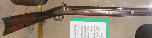
27 Hawken Rifle
(Note: The rifle possessed by Carl after his death was passed on to his son
who later passed it on to his own son who has it now.)
In 1834, James Pryor and John B. Harrison established
a trading post and ferry at the crossing of the Osage River where Tuttasuggy, or Chief
Soughing -in the-Wind, of the Osage Indians had often traded with the first hunters and
trappers. The arrival of a white man's trading post on the Osage at Tuscumbia could be
said to have been a time marker for the beginning of the significant presence of the White
Man in the land of the Osage after which the Indian gradually was crowded out and soon was
to disappear from Miller County.
Now, in closing, just let me say, since a small
child, I have been fascinated by the name Tuscumbia. For some reason, it is a place in
which I have always wanted to live. About 12 years ago, my wife and my children and myself
moved here from our farm between Tuscumbia and Eugene. The more I've studied the history
of this place, the more it has excited my feelings. There is no place in the world better
than Miller County and its seat of justice. Tuscumbia has been alive since the days when
old Chief Soughing-in-the-Wind stood here in Riverside Park, beside the river which lay in
the sun like a stunned snake kicked in the head, in North America's Garden of Eden, and in
the hour before dawn each morning, wailed his song prayer which was never finished, to his
grandfather, the sun.
This place in the Osage River Valley was alive then;
and you, the people, are keeping it alive today. So will it be 200 years from now!
Clyde Lee finishes his section of the History of the Indians in Miller County in his
book, The History of Miller County by recording a number of anecdotes which had
been passed along through several generations and had become a part of Miller County
folklore. Some of these legends are well known to long time Miller County residents;
others may not be so familiar. However, I thought they were so interesting that I would
copy them from his book at this point. What is interesting to me is that these stories are
from our very own Miller County ancestors and many Miller Countians reading them today
will recognize one or more very familiar names from their own families:
Indian Anecdotes of Miller County
Clyde Lee Jenkins
History of Miller County p. 15-23
The Osage Indians continued hunting in Miller County
for many years, even coming to this area in considerable numbers by automobile after World
War 1. A group of Indians visited the late C.P. Tellman and informed him they would
appreciate looking his farm over for a spring of clear water running from the bottom of a
perfectly shaped bowl of rock. Before the White man's arrival on the scene, religious
ceremonies had been performed by their people at this site. Receiving Tellman's permission
to search the farm, the spring and rock bowl eventually were found by them.
Other Indians in this particular group were
peculiarly interested in territory along the Dog Creek, thoroughly roaming in the Dog
Creek valley a number of days. A few local citizens believed them hunting for buried
treasure, but if gold or silver were found, they failed to inform anyone, for the Indians
departed without fanfare, suddenly, to the Southwest.
-----------------------------------------------------------------------------------------------
Early merchants profited from trading with the
Indians. J.P. Harrison, upon donating a tract of land to Miller County for the Seat of
Justice, set a portion of the tract aside as a place for the Indians to camp upon when
visiting Tuscumbia. Harrison's reservation was situated on the North bank of the Shut In
branch by the river.
Having improved a small acreage in the Big Richwoods,
Indian Tall Bear was leading a rather settled way of life when the White man arrived on
the scene. Colonel Josiah and Nancy Huddleston Birdsong purchased Tall Bear's improvement
for a gourd of powder and a hunting knife. Tall Bear informed the Colonel of having in his
youth many times stalked herds of more than 60 buffalo grazing on the prairies in the Big
and Little Richwoods, with wild game of almost all kinds in abundance everywhere.
The dress of an adult Indian, man or woman, was a
waist cloth and a belted blanket made from animal skins. No clothing was worn by Indian
children until almost grown. Their first garment was a long, home made shirt,…the
first sack dress in Miller County. The Osages lived in crude shelters made of skin and
bark.
Isaac Bilyeu and his wife, both under twenty years of
age, having followed Bill Hews into the Gasconade country on a hunting expedition in late
1818, settled on the Big Tavern Creek east of present day Iberia in the early 1800's. For
a number of year their closest neighbors were John Wilson on the barren Fork, and Daniel
Brumley on the Big tavern.
Isaac hunted for deer and bear, of which there was
abundance. From these animals he got meat for food and skins for leather breeches. For a
number of years he got corn from James Harrison, then living at the mouth of the Little
Piney in present day Phelps County. Isaac kept this corn inside his cabin concealed in a
hollow log barrel. When needed for food a small portion of the grain was placed in a bowl
shaped rock and crushed with a round stone by hand.
Until about 1829, Isaac hunted with a Indian Chief
named Rodgers. Chief Rodgers, a White man, was removed from the cradle of his parents by
Indians raiding White settlements near modern Pittsburgh, Pennsylvania, before the
Revolutionary War.
After the War, Rodgers' Shawnee band drifted down the
river from the falls of the Ohio to the Mississippi, crossing the Father of Waters and
hunting leisurely, northwestwardly, into the Ozark Mountains. Upon reaching the Gasconade
country, finding game to be in such abundance, they ceased moving, erecting their villages
on the Gasconade and Big Maries rivers. The area of the Big Tavern creek was a portion of
their hunting grounds.
The band by whom he was kidnapped eventually made
Rodgers their Chief.
---------------------------------------------------------------------------------------------------
In the late Autumn of 1815, Daniel Brumley, having
settled on the Big tavern Creek, obtained a supply of maize from the Indians at one of
their villages on the Big Maries. At Cedar creek he visited Jim and Archie Snodgrass, two
young men from Tennessee, fifteen and seventeen years of age.
In 1823 Brumley accompanied Campbell Crisman to the
Missouri river for salt coming down in canoes from the Boone's Lick. Campbell Crismon's
wife, a half-blood Cherokee, was called Wannah. Campbell told Daniel that his wife, when a
young girl, witnessed the torture of a Creek Indian captured by her father , a White man
living with the tribe, and other warriors, while on the warpath in the Great Smoky
Mountains of South Carolina.
Watching her people burn the young Creek to death at
the stake, she observed, although the fire seared his flesh, he stood like a statue, for
no Indian ever displayed any emotions in times like this. Only his hands moved slowly,
twisting and assuming grotesque shapes, as he suffered through the agonies of flaming
death.
The vision of the ordeal remained in Wannah's mind,
becoming more intensified in the later years of her lifetime. Until her death, in moments
of solitude, Wannah might be seen twisting, turning, and rubbing her hands.
Isaac Bilyeu and his wife attended one tribal dance
held by Chief Rodgers, on the Big Tavern Creek. This was a lively affair. To the rhythm of
log drums the squaws and children chanted, while the young braves stomped, jumped,
circled, and yelled in cadence.
---------------------------------------------------------------------------------------------------
In earlier days a corn dance was held by the Osage
tribe on the Big Tavern creek each spring, near their village north of the Wilson Cave,
celebrating the appearance of the first green sprigs of maize.
---------------------------------------------------------------------------------------------------
Hearing of very fertile land along the Osage River,
in the late 1820's John M. Brockman settled six miles above later day Tuscumbia, by a big
spring. He moved there with a yoke of oxen, an ox cart, a gun, a double bit axe, and a few
hand tools from in the vicinity of a very small settlement called Pleasant Mount on the
prairie.
He cleared with great toil and area out of the
wilderness near the big spring. In a short time he was joined by a stranger from the other
side of the river. The stranger carried information that if logs were to be raised for a
cabin, Mr. Brockman could find a pattern already cut on the other side of the Osage. He
had the logs for a cabin ready to be raised, but there were too many Indians. They had not
molested him in anyway, but friendly or not their standing and sitting around watching
while he worked made him nervous. He was returning to civilization and giving his tenancy
back to the Indians. He was returning to the vicinity of Pleasant Mount on the prairie.
John M. Brockman crossed the river and found the
pattern. In a few days the logs were raised and the cabin completed. The Indians remained
in the vicinity several weeks. Later, the land was patented by Mr. Brockman during the
administration of President Andrew Jackson. This farm remained in the Brockman family
until 1948, more that 120 years. The Brockman farm, the Brockman Ford across the Osage
River, the Brockman Ferry, the Brockman steamboat landing, and the Big Spring, were early
landmarks in Miller County.
--------------------------------------------------------------------------------------------------
The early settlers along the Dog creek in Miller
County were informed by the Indians that once upon a time the back waters of the Osage
River filled the creek to the upper spring on the Zelly branch. In elm bark canoes they
had traveled form the river to the spring. The settler believed this impossible since the
spring was located too high in the valley and far from the river. In 1943, the waters of
the Osage River flooded the Dog Creek and the Zelly branch filled to the upper spring. The
high waters referred to by the Indians probably occurred in 1785, noted as the Year of the
Great Waters on the Mississippi.
-----------------------------------------------------------------------------------------------
In 1828, Samuel Gilliland and his wife, Mary, settled
on a tract of land near present day Olean. The deer and the wolves played on the prairie
where Eldon is located A lone Indian, or a group of Indians in single file, traveling
across the prairie were viewed as a part of the primitive scene.
An Indian trading post was at present day Tuscumbia.
A village of Indians occupied the bank of the Osage River at the foot of the bluff and by
the spring. A White man was told by an Indian that if ever a cabin was placed at this
point it should be raised above a certain mark on the bluff side to be safe from floods.
---------------------------------------------------------------------------------------------------
In a treaty with the Osage Nation on November 10,
1808, at Fort Osage, located on the south bank of the Missouri river east of present day
Kansas City, the Indians ceded their lands in Missouri to the Government of the United
States. For these lands and others, the Great Osages received $1800 in cash and
merchandise, the Little Osages half that amount; a bargain of fantastic proportions.
However, upon ceding this part of their land to the
Government they retained a right to hunt over the ground for a number of years. These
hunting parties made the people nervous and Indian scares were common, especially on the
North side of the Osage River. Often families slept concealed near their cabins. At other
times a number of families gathered in one place for protection against imminent attack
but always the Indians were peaceable.
After the Indians ceased hunting in Miler County,
small groups occasionally passed through the territory following the old Harmony Mission
Trace and Indian trails going to and from St. Louis or to visit the great White Father in
Washington. The Old Harmony Mission trace was the White man's first overland trail through
Miller County. It was used by the first settlers from the East coming to Central and
Western Missouri, and earlier, by the fur traders and trappers of the tribe of Daniel
Boone.
------------------------------------------------------------------------------------------------
In many parts of Miller County artificial mounds and
other remains give evidence of Indian habitation. The Osages buried their dead by covering
the corpse, wrapped in skins with stones. Buried side by side and covered with stones,
mounds of considerable size were erected.
---------------------------------------------------------------------------------------------------
The sole inhabitants of the forests and the prairies
when the White man arrived on the scene, the Osage Indians, after 1835, were generally
gone as long as the sun shall shine or the waters run in the rivers, forever.
Thanks Clyde. The most famous Indian story of our county is that of Jim Henry. Because
we already have that story on our website I will link you to it here:
http://www.millercountymuseum.org/homesteads/rockhouse.html
Much more could be placed here about Miller County's first inhabitants but space and
time is limiting. However, for those who want more information one simple method for
inquiry is to use our "site index" which is the last choice of the drop down box
when you click on the "About Us" heading on the top left of our home page. In
the box just type "Indian" and you will get fifty or more places on our website
to peruse about Miller County Indians.
Our museum has several exhibits pertaining to our county's earliest inhabitants. A
major display was given us by Alton Davis, Miller County resident, who has collected
Indian paraphernalia most of his life. Alton can remember many anecdotes and stories from
Indian folklore and when he is at the museum visitors have a real treat listening to him.
He is a sculptor also and we have a couple of his works in the display (photo 28).
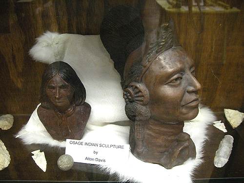
28 Indian Sculptures
He has donated hundreds of arrow heads and other Osage Indian weaponry and
artifacts (photo 29, photo 30, photo 31 and photo
32).
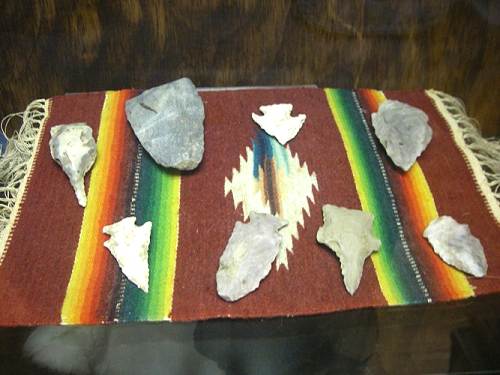
29 Arrowheads
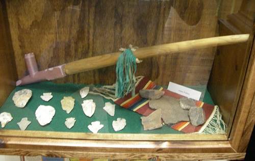
30 Arrowheads and Peace Pipe
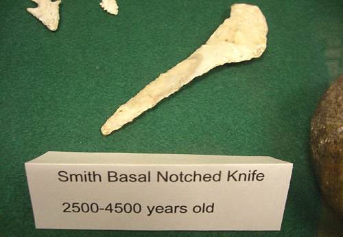
31 Stone Knife
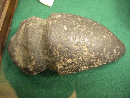
32 Tomahawk
Now for some odds and ends. Here is a ball like object, perfectly round and smooth,
given us by Patsy (Adcock) Wyrick (photo 33).
You might have thought it was a cannonball found in a field somewhere in Miller County,
something that does happen once in a great while, but this ball is too light. Patsy told
me it was a "hair ball" that was found in a cow's stomach at the time of it
being butchered.
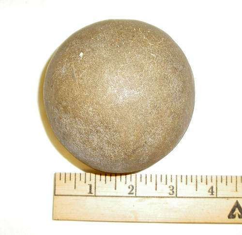
33 Hair Ball
Next is this slab of wood with hundreds of tracings and markings (photo 34). You might have thought it to be
Indian hieroglyphs. But I am told it was a larvae of some type eating its way through the
inside bark of a tree.
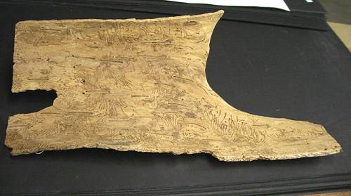
34 Etched Wood
Next we have another article given us by Patsy. This is a delicately embroidered
and beaded small pillow with the year 1903 sewn in at the top (photo 35). If anyone knows of anything that happened in 1903
that would have occasioned the creation of this beautiful piece of embroidery, please let
us know.
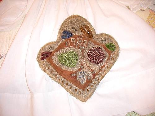
35 Embroidered Pillow
And finally, we just received this new display of the Bear family which provided
six brothers who fought for the North during the Civil War. The collection includes photos
of the brothers' parents, George and Elizabeth Bear, as well as the sons' wives and some
of their children (photo 36).
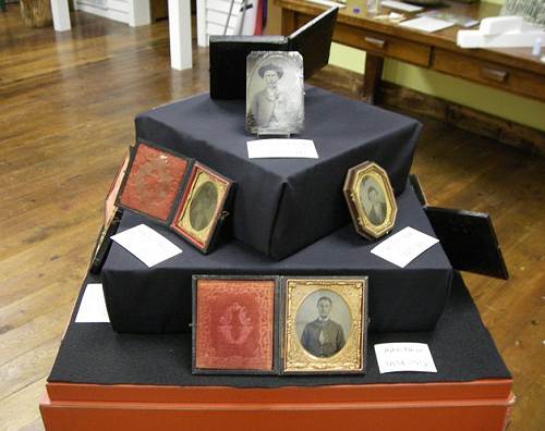
36 Bear Family Soldier Display
The unusual feature of this display is first, that so many members of one family
fought in the war; and secondly, that photos of them have survived to the present time.
You can find this display prominently located to your right just as soon as you leave the
entrance foyer to enter the museum. Also you can read in detail about the Bear family and
the six brothers who fought in the Civil War at this location on our web site:
http://www.millercountymuseum.org/people/bio_b.html
Scroll about a fourth the way down through the Bear family site to find the story about
the soldiers.
Don't forget to attend our Ice Cream Social this coming Saturday, June 21 from 11:30
a.m. to 3:30 p.m. Joe Jeffries and his group will be performing in the lower level meeting
area of the new addition located at the rear of the old museum building.
That's all for this week.
|