
MT. PLEASANT
By Peggy Smith Hake
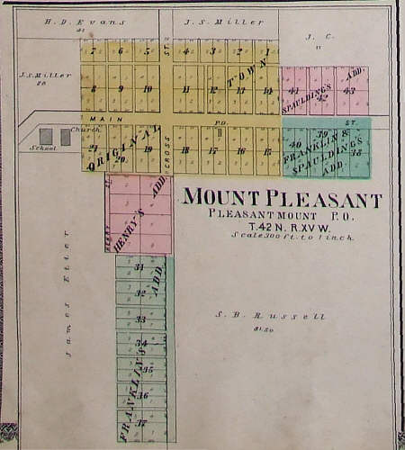 |
In 1837 when Miller County was established, there were 10 or 12 log houses in Mt. Pleasant, situated around the Burris trading post which had been built near a large spring. Four months after Miller County was formed, June, 1837, Andrew Burris and his wife filed a plat of their town and called it Pleasant Mount. This was the county's first recorded town and the first to get on a map.
A post office was established there circa 1847 and was first given the name Multnomah, which means running water, but later called Pleasant Mount.
In 1881, some of the businesses and owners were: R.H. Franklin, postmaster; D.M. Bandy, druggist, Dr. H.H. Brockman, J. Etter, general storekeeper; A.J. Love, shoemaker and lawyer; J. Morris, blacksmith; R.P. Morris, hotel owner; John J. Pitchford, Justice of the Peace; Isaac Reed, shoemaker; J.P. Spalding, hotel owner; F.M. Swanson, saddler.