|
Monday, July 18, 2011
Progress Notes
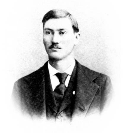
About once a year I present a history of Miller County on this page since doing so seems to be fitting because our mission is dedicated to the preservation and presentation of the story of our county. Quite a number of histories of Miller County have been presented earlier on previous Progress Notes. This week I will feature Daniel Fraser Thompson (Tomson, Thomson) who wrote a history of the county for the Miller County Autogram December 21, 1911 (photo 01).
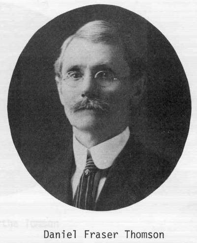
01 Daniel Fraser Thomson
Daniel was one of Miller County’s most energetic and productive citizens. He was a journalist, newspaper publisher, public official and Civil War veteran. Some of the biographies of him fill many pages. For the sake of brevity, I have a shorter biography which I will present here:
Note: The Thompson surname is spelled several ways; I am using the most common spelling, “Thompson.”
Dan Fraser, the fifth child of Thomas Arrington Thompson and Carrenhappock Sellars, was born in Hardeman County Tennessee. He came with his parents to Miller County in 1860. He enlisted in the Union Army when only 15 years of age, and served as a drummer boy. After internecine conflict he took particular interest in the GAR.
He was engaged for some time in the newspaper business, his first job being editor of the Osage Valley Sentinel in 1872, the first newspaper published in Miller County. Later, he helped Jim Pinkney Wright in the office of the Vindicator, and after his marriage, published a newspaper at Linn Creek (photo 02).
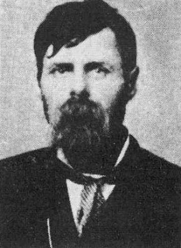
02 James Pinkney Wright
Moving to Richland, he founded the Richland Sentinel; then engaged in the publishing business at Hot Springs, Arkansas, where he founded and organized the Royal Knights of Labor in that state. Upon returning to Central Missouri later in life, he published newspapers at Iberia, Eldon, and Versailles. He served as ward master at the U.S. Marine Hospital in St. Louis in 1871; served on the staff of the State Senate; and was clerk in the adjutant general's office during the administrations of Governors Folk, Hadley, and Garner. He spent three years in Washington, D.C., copying the Civil War records of Missouri soldiers, and was often commended for his accuracy in record keeping and attention to minute details in veterans' affairs. He was married early in life to Eliza Catherine Melton, and they were the parents of Ida May (photo 03), born January 12, 1873, who was married to John W. Adcock (photo 04):
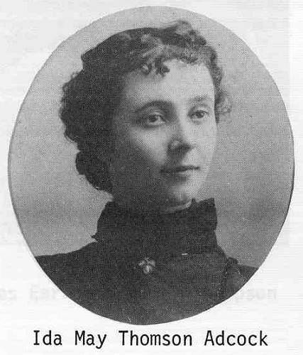
03 Ida May Thomson Adcock
04 John Adcock
You can read the complete history of the Thompson family at this previous Progress Notes.
As noted above, Ida May Thompson, daughter of Daniel and Eliza Melton Thompson, married John Adcock. Their daughter, Hilary Adcock Dunnaway, wrote an autobiography (Peace Beside the Spring) in which she identifies the home and farm where she spent her early childhood as being named "White Haven." This farm is located between Tuscumbia and Eldon on Hall's Store Road. Hilary, who was the daughter of the famous river boat captain, John Adcock, writes in her book that the idea to name their farm "White Haven" originated from her grandfather Daniel Fraser Thompson who named it after the original White Haven in Dorchester County, Maryland owned by the first Anthony Thomson. This farm and the original home now is owned by my mother in law, Elva Boyd Steen and is where my wife, Judy, was raised (photo 05).
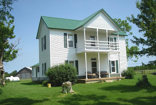
05 Adcock Steen Home
And now here is Daniel Fraser Thompson’s history of Miller County. You will note that he writes in a “flowery” style reminiscent and common among authors a century ago:
Miller County
Organization, Location and Extent
Written for the Miller County Autogram
December 21, 1911
By Daniel Frazer Thompson
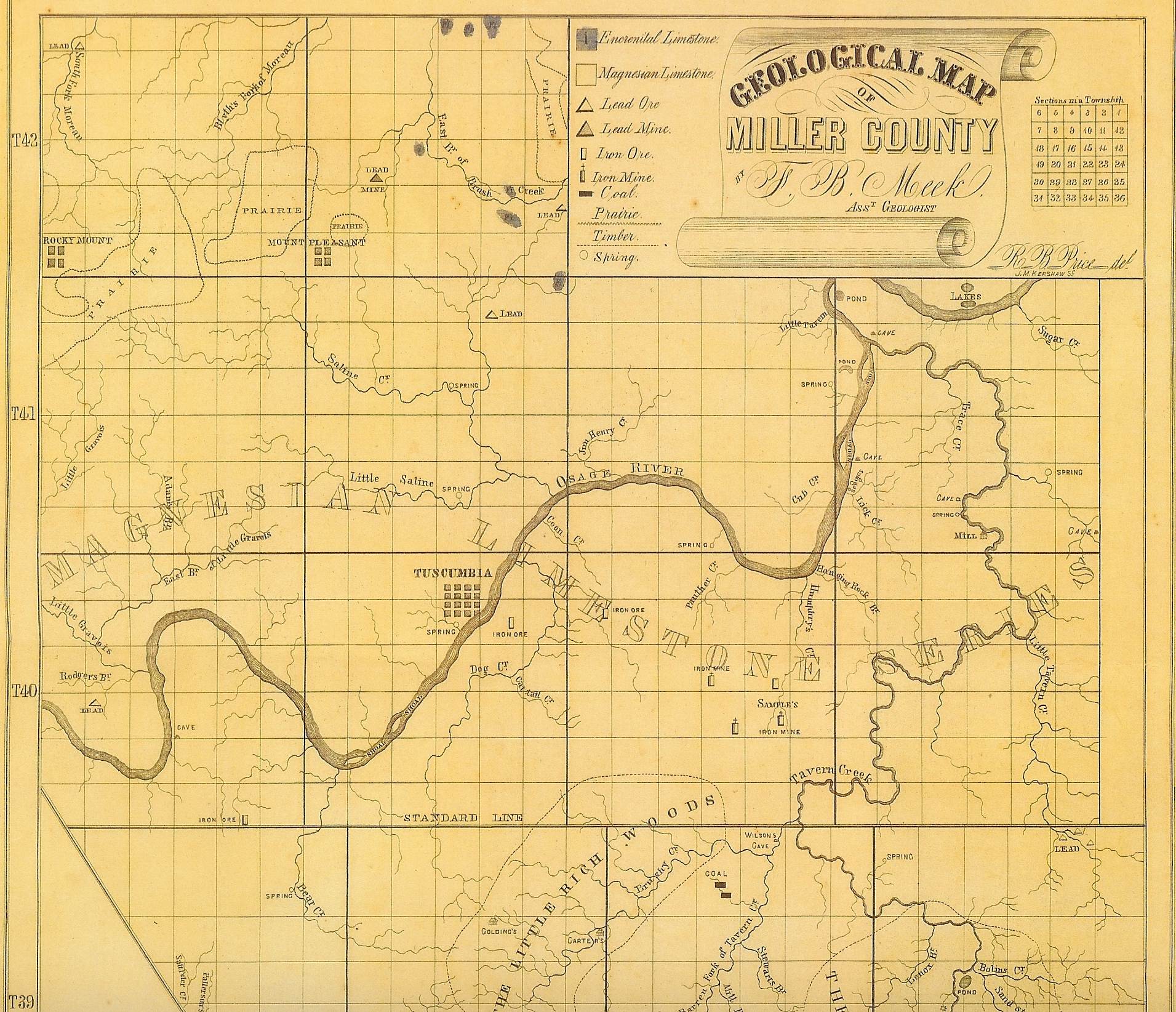
Miller County, in the central part of the State, lies south of the Missouri River, on both sides of the Osage River, which latter divides it into nearly equal sections, is bounded as follows: On the east by Maries County and portions of Osage and Cole; on the north by Cole and Moniteau; on the west by Morgan; and on the southwest and south by Camden and Pulaski counties: was erected into a county February 6, 1837, has an area of 590 square miles and contains 374,628 acres, and doesn’t owe a dollar (photo 06).
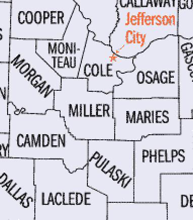
06 Miller and Adjacent Counties
HISTORY
Pioneer Days:
Settlement:
At the time of the admission into the Union of the State of Missouri in 1820, that part of Miller County lying north of the Osage River was included in Cole County and that portion south of the river was embraced in a large territory having no county organization or designation, but a portion of which was, in 1832, erected into the county of Pulaski, and five years later, from these two counties, Cole and Pulaski, Miller County was carved and named, some writers say, in honor of ex Governor John Miller, but it appears more likely from a pioneer family of that name, the first permanent settlers of the county, the most important of which was William Miller (photo 08).
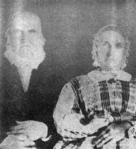
08 Willliam and Sarah Miller
Campbell’s Gazetter of Missouri (1874) to which the writer was a contributor, records that from the camp of a hunting post grew the first settlements made in this county, though it is not probable that these frontiersmen continued to live any great length of time in such manner, but finding the Indian hunting grounds good, and returning from season to season, some of them decided to make it their permanent abode. Their restless disposition, however, did not permit them to remain. Senaca R. Y. Day and others settled in 1815. About 1819 A.J. Lindlay became a “squatter” near the mouth of Big Tavern Creek, but where he came from or whither he went tradition fails to inform us. About 1825 William and Boyd Miller, brothers, the first permanent settlers of the county, arrived with their families from Virginia and took up land on and near Spring Garden prairie in the northeastern portion of the county, then under the jurisdiction of Howard County (see photo 08 of William above). Pinkney S. Miller, himself a venerable and respected pioneer,” son of one of the original settlers, William Miller, bears the distinction of being the first white male child born in the territory now embraced by Miller County, and is still living, in the enjoyment of a ripe old age, at Olean, only a few miles distant from the place of his birth. He has been a prominent farmer and man of affairs for more than a half century (photo 09).
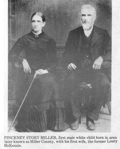
09 Pinkney Story Miller and wife Loucy
Samuel Richardson, Mastin Burris, John Brockman, Isaac Bass and Hugh Challes made settlements on the Osage River from 1828 to 1833. John Wilson and his family settled on Tavern Creek about 1832. The first winter he, with his wife and children, lived in what is still known as Wilson’s Cave, situated 30 feet above the bottoms of Tavern Creek, near the mouth of Barren Fork (photo 10).
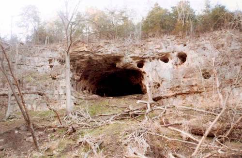
10 Wilson Cave
He was known in the neighborhood as “Uncle Jack” and his wife as “Aunt Nellie.” Testimonials of this unpretending pioneer’s real worth are recorded by one of his contemporaries in language too sincere to be omitted. This old neighbor said of Mr. Wilson: “He fed the hungry, visited the sick and clothed the naked.” He died in 1857 at the residence of John Brumley, and in accordance with his expressed wish, his body was placed in a coffin which he had himself prepared fifteen years before, and entombed in a little cave to the right of the one in which he had once lived. The mouth of this natural sepulcher was then walled up and cemented. He left directions that at his burial a good dinner, “with something to wash it down,” should be furnished to those who attended, all of which was done. Scions of these first families are still among the most highly respected citizens of the county south of the Osage River.
But few Indians remained here at the time of the actual settlement of the county and no trouble was experienced from the hostility of savages. Among those who did remain, the patriot, Jo Munsey, who served under General Jackson at the battle of New Orleans, was the leading spirit. One of the last Indians to leave was Jim Henry, who lived with his family in a rock shelter (photo 11).
11 Jim Henry Rock Home
The early settlers were without mills or markets nearer than 30 and 40 miles away and the methods of exchange were primitive, but not unlike those which obtain generally in unsettled regions. The natural water power furnished by springs and streams was soon harnessed and together with the tread wheel of the old horse mill made to provided a means for the reduction to breadstuffs, etc., of corn, wheat and other grain produced in such abundance on the farms which were rapidly carved from the forest, grassy wilderness, or rolling prairie, while the Osage River was early utilized as a means of transportation. Ye stage coach of ye days of “Auld Lang Syne” was also brought into requisition, and eventually a tri weekly mail established between Tuscumbia, the county capital, and Jefferson City, the capital of the State, 35 miles overland.
WAR
The number of “able bodied male citizens” subject to military duty within the territory later embraced within the borders of Miller County at the time of the so called “Black Hawk War,” 1832-1833, is not known, but that the self appointed Illinois Indian leader by his conduct produced the first “rumors of war” to disturb the peaceful pioneer settler here is a matter of history, and it is not improbable that the settlements furnished their quota for the expedition to Fort Pike.
The momentous Seminole Indian uprising in Florida, 1836-1837, required heroic treatment by the general government, and Missouri was called upon to furnish troops for the war which was still in progress on the date of the county’s designation by the legislature, and while history does not credit us as a county with furnishing detachments or companies for service in that war, ten years later, in the war with Mexico, some of our patriotic citizens volunteered and bore their part in these early conflicts. But the most troublesome times ever experienced by our people was the internecine strife which plunged the country into civil war, 1861-1865. Missouri being a border slave state, but at the same time, for the most part a northwestern state, there was a division of opinion not only in Miller but in every county of the commonwealth and the most intense feeling prevailed. The state was saved to the Union by the extraordinary vigilance and excellent foresight of Captain, afterward Major-General, Nathaniel Lyon, in command of the government’s forces at Jefferson Barracks.
But Missouri was converted into a veritable battle ground almost, in a twinkling; neighbor rose against neighbor, brother against brother, father and son were at variance, and even the women and children were intoxicated with the unrelenting war spirit which had seized upon all. But with the disappearance of the Confederate forces under General Sterling Price which were early driven into Arkansas by the intrepid, immortal General Lyon, who lost his life at Wilson’s Creek, and the opening of the blockade of the Mississippi river by General Grant at Belmont, the seat of war moved southward, no general engagements again occurring until toward the close of the war when in the fall of 1864 General Price made a dash into Missouri, and after the battle of Pilot Knob, a detour of the State, for the purpose, it was later declared, of recruiting his depleted forces, as did General Hook into Tennessee and Kentucky a little later.
There were, however, during the entire period of the war marauding bands, guerillas, so called bushwhackers, etc., roving about at will except so far as Missouri was able, through her militia, to hold them in check, and General Sherman’s definition of war, however rugged, was at no time inappropriate to conditions in Miller County as well as practically the entire state.
Four years of said experience left no doubt that, indeed “War Is Hell!” Miller County was not the scene of a battle as the term is ordinarily defined, but she furnished the best of her stern manhood and the flower of her youth in defense of the flag, as well as not a few of the Confederate cause, all of whom maintained the dignity of their birthright and distinguished themselves on the field of battle, many valiantly giving up their lives in the awful struggle. Toward the end of the war boys not more than 10 years of age in the beginning and old men of declining abilities fought here as elsewhere, but there is no record anywhere of a Miller County soldier having faltered in battle or failed to uphold the dignity of his proud citizenship.
PROGRESS
By reference to the official census figures of the county in another part of this paper it will be observed that a number of inhabitants mentioned as first permanent settlers, approximately 20 years prior, had been augmented as shown by the first census, 1840, a little in excess of 2000. It will also be noted that the growth in population was healthy and natural up to the decade which included the Civil War and that thereafter to the present time the progress of the county in population as well as otherwise is indicative of no mean natural magnetic attraction, to speak figuratively. In other words, the varied and abundant resources at the surface, coupled with the discoveries and development of the vast treasures of hidden mineral wealth beneath, have been the means of causing a steady inflow of, and increase in, population and wealth from the earliest settlements to this day…and still they come; and still our inexhaustible resources, and our energetic, chivalric, public spirited and hospitable people invited all to come and share with us in the further development of the fortune nature has so lavishly here bestowed and set within easy grasp of the husbandman in all his various callings as such, the miner, mechanic, manufacturer and working capitalist. We want no drones! But this is diverging, somewhat, though not unnaturally.
The best arable lands though now largely under plow, in meadow, or pasture, may still be bought, some with fine homes, more cheaply perhaps than any lands of the same character anywhere with like development and favorable surroundings. And there is still a considerable percentage of good plow lands yet in primitive forest and hundreds, aye, thousands of acres of unimproved pasture lands within the county. The river has been and is being improved, road building and road improvement is becoming a mania, railroads have been constructed through the county east and west, north and south, towns and trading marts have sprung up at convenient centers to almost every neighborhood of the county, banks founded, modern mills built, rural telephones and free mail delivery installed, schools and churches established until all may now enjoy under his own vine and fig tree the fullest measure of a modern civilization. Such in brief is the history of Miler County from the earliest recollections up to the glorious present.
PHYSICAL FEATURES
The surface varies in elevation from 50 to more than 600 feet above the level of the Missouri River at the mouth of the Osage, the lowest portion being in the valley of the latter stream. Near the Osage and its larger tributaries the country is generally broken and rocky, excepting immediately in the valleys; but back a little the slopes usually become gentle and not infrequently widen out into slightly undulating or almost level table lands with a small scope of the north and north western portions of the county where there are prairie lands; and there are some sections in the south half of the county which partake of the character of prairie. The valleys are all rich, mostly alluvial soil, while the slopes, ridges and table lands are very productive, the latter admirably adapted to orcharding, vines, small fruit, grass, etc., as well as general crops. The underlying rock is mostly limestone and occasionally a limestone “ball” crops out at the surface. A wide area of country south of the river known as “Big Richwoods” and a smaller area as “Little Richwoods,” which were prior to improvement very literally heavily timbered sections of the county, as are as fine for farming found anywhere, the prairie lands of the northern and northwestern townships of the county or even the bottom lands of many of the streams not excelling the best of these lands.
The county is well supplied with a variety of fine timber, consisting generally of practically all of the various giant oaks for which American, woodlands are noted, hickory, pecan, basswood and ash, hard and soft maple, black and white walnut, elm, sycamore, hackberry, honey locust, etc.
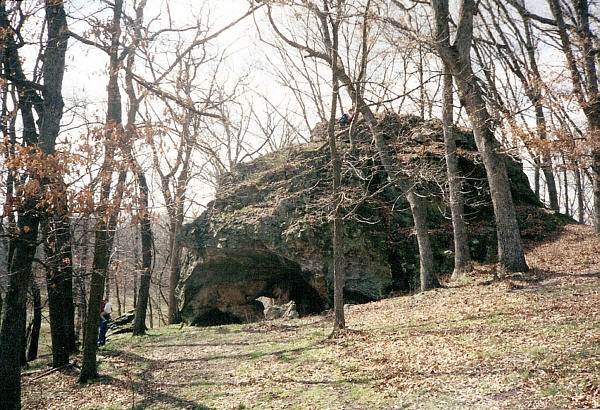
There are numerous caves in the county as well as mammoth springs. The largest cave perhaps is on the Big Tavern creek, in the bluff near its confluence with the Osage River.
Note: This cave now is known as Bat Cave (photo 17).

17 Bat Cave above J.R. Wells Steamboat
The entrance is about 25 feet square and 30 to 40 feet above the stream, in a solid limestone bluff, and is reached by means of a ladder, but as yet it has been only partially explored. It is said to have furnished a safe retreat on occasion during the Civil war for Captain Crabtree, the noted Confederate recruiting officer, who was killed in the county by state militia. The stalactite formations are of weird and awe inspiring appearance, some of them resembling colossal images of marble and the whole effect by torchlight is solemn if not awful, so strong is the resemblance of these natural formations to the work of the sculptor’s hand. Further up the creek are two other large caves; however, but little interest has thus far been taken in cave exploration. One of these latter, notwithstanding, was some years ago, prior to “local option,” utilized by a German as a brewery. Another noted cave, known as the Stark Cave, is located a few miles south of Aurora Springs and was, in the balmy days of the Springs as a health resort, quite an attraction. Its latest use, though, has been as a winter storage place by the farmers of the neighborhood for apples and other surplus products (photo 18).
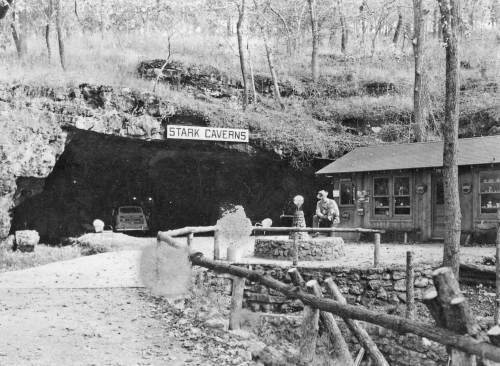
18 Stark Cave
PRODUCTS OF THE SOIL
The agricultural products are corn, wheat, rye, oats, kafircorn (tropical African variety of sorghum), sorghum, peas, beans, potatoes and a great variety of garden vegetables. Fine meadows abound and hay…timothy, redtop and clover…is a stable product. Millet is also grown and so far as tried farmers have made a success with alfalfa which, however, is in only an experimental stage as a crop.
The staples in fruit are apples, peaches, pears, cherries, plums, etc. Grapes and strawberries and all kinds of berries thrive to perfection. Vineyards are few in number but exceedingly productive. There is no better general fruit country anywhere.
PRINCIPAL STREAMS
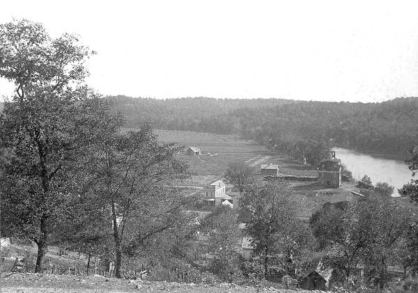
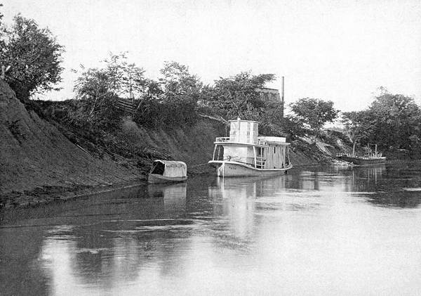
The Osage River, approximately 500 miles in length from source of main stream in Wabaunsee County, Kansas, to its confluence with the Missouri River nine miles below Jefferson City, which flows diagonally through the county in a northeasterly direction , is navigable for steamboats of medium tonnage for 200 miles or more (photo 19).

19 Osage River in Miller County
Click image for larger view
Its principal accessions within the county from the north are through Little Gravois and Saline Creeks with their numerous tributaries, Jim Henry and Cub Creeks, and Little Tavern of the north; from the south, Bear, Cat-tail, Coon, Dog, Humphrey’s, Lick, Panther and Tavern (or, perhaps, more properly, Cavern Creeks, the latter its largest tributary within the county. The last named creek flows in a devious course from the southeast corner of the county northwardly, debauching near the northeastern boundary and has numerous tributaries, Barren Fork, the largest, coming from the southwest, while from the southeast it is augmented by Brushy Fork, Sandstone, Bolin and Little Tavern Creeks, and other smaller branches from both east and west. The Grand Auglaize, a large tributary of the Osage, which empties its waters into the river in Camden County, has within its system of tributaries, a large territory of the southwestern portion of the county, while that part of the county of the north side of the county lying within the water shed of the Missouri River is drained by South Moreau, Blythes Fork, Brush Creek and other tributaries of the Moreau proper. Numerous springs abound, some of which have been utilized as motive power for mills, one on the waters of Little Saline Creek, near Tuscumbia, by means of an over shot water wheel, having at one time supplied power for a grist mill, sawmill and wool carding machine, while another on the waters of Tavern Creek, in the vicinity of Iberia, was similarly used (photo 20).
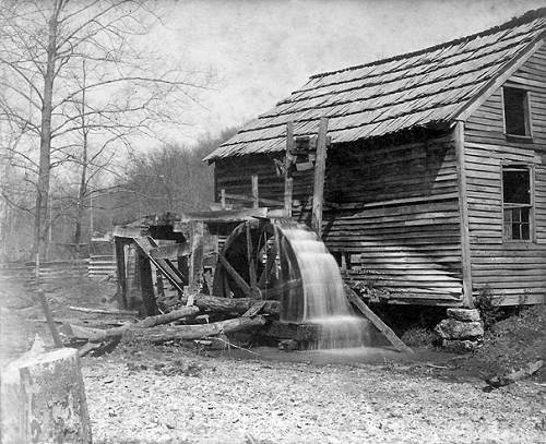
20 Wright Carding Mill on Little Saliine Creek
MINERAL RESOURCES
The mineral resources are varied and rich. Lead was discovered by the original frontiersmen who, in a crude way, smelted it for use in hunting. It exists in different localities of the county but has, so far, been commercially worked only on Saline Creek and its tributaries north of Tuscumbia. In 1869 and the early seventies it required two furnaces, running day and night, to smelt the ores that were being produced in that locality, but transportation at the time was both difficult and expensive and this fact, coupled with a material decline in the markets, caused continued development to be abandoned and the industry has not since been restored to its wonted interest. But some little mining of the ore, especially in the vicinity of Tuscumbia, on both sides of the river, has been continued and it is still occasionally mined. It is estimated that, first and last, a million dollars of value in lead ore has been mined in Miller County.
Large deposits of hematite (a black or blackish-red to brick-red mineral, essentially Fe2O3, the chief ore of iron) and specular iron (another name for hematite) have been known to exist in this county since 1836. In 1857 Charles Semple, an enterprising St. Louisan, selected iron lands near and south of Tuscumbia, but died before he could develop them; they had been developed sufficiently, however, to determine their immense richness. In 1872 iron was discovered near the southeast corner of the county, but was not worked and lies dormant to this day. Near this discovery, though, some very rich banks were developed in 1873 to a point of determining their value to some extent, one seam showing 18 feet in thickness. Coal has also been found and, to some little extent, mined in the county, north and south, but the great abundance of timber will probably prevent its development until the introduction of factories demand it for use therein.
Kaolin, which we commonly call chalk, has been found in different localities and is mined to profit. Only recently shipments were made by river from Tuscumbia by that old pioneer mine owner and developer, Captain W.A. Hackney, and this industry is worked more or less every year. Barium, or “tiff,” is also mined. A large deposit of this latter mineral on the waters of Little Gravois in the vicinity of Bagnell is being worked by a St. Louis company and regular shipments go to the metropolis for reduction and market. Professor H. L. Moles of Tuscumbia is in charge of the work (photo 21).
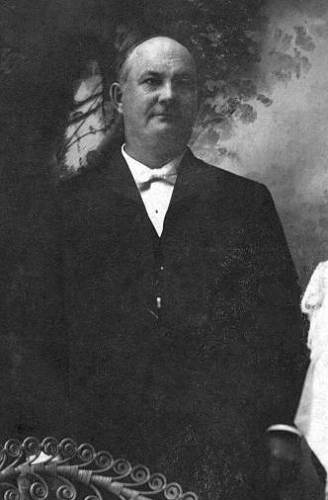
21 Herbert L. Moles
Miller County has lime “to burn” and the quality is everywhere unexcelled, but at only one point in the county has the lime industry become of commercial importance. But for more than half a century private kilns for private use have been burned in all parts of the county when lime was needed. On the C.R.I. and P. railroad (Chicago, Rock Island, and Pacific railroad) near Spring Garden, a little more than two years ago, the “Colorado Lime Company” was organized and equipped on a fairly extensive scale, but by reason of developments the company recently held a meeting at its offices in St. Louis and voted to change the name to the “Spring Garden Marble and White Lime Company,” and announced its intention to expend $100,000 for the development of machinery for the production of marble. The marble, which is declared to be a high graded gray marble, underlies the limestone. “Experts have reported that the marble deposit extends under nearly all of the property, which is 52 acres in extent, in strata from 4 to 8 feet thick, and borings showed the deposit to be 60 feet in thickness.” The lime kilns will be continued in operation.
Other valuable minerals abound, while building stone of most excellent quality is amply provided.
POPULATION
United States census returns give the population of the county by decades, as follows: 1840, 2,282; 1850, 3,834; 1860, 6,812; 1870, following the Civil War period, 6,616; 1880, 9,805; 1890, 14,162; 1900, 16717, the last number distributed among the several townships, as follows: Equality, including Tuscumbia, 1,530; Franklin, including Aurora Springs, Bagnell and Rocky Mount, 1,718; Glaze, including Brumley and Ulman, 2,490; Jim Henry, including Charlestown (St. Elizabeth), Mary’s Home and Hoecker, 1,398; Osage, including Capps, 1,259; Richwoods, including Iberia, 3,398; Saline, including Eldon, Etterville, Mount Pleasant, Olean and Spring Garden, 4,924, all white except a small settlement of negroes in the vicinity of Iberia and another near Olean, probably half a hundred in both neighborhoods.
The percentage of increase for the county, although comparatively small in the last decade, is nearly double that of the state of Missouri as a whole. Out of a total of 114 counties in the state, Miller takes rank with the 43 which showed an increased population by the census of 1910 as compared with the report of the bureau for 1900, and not only that, but with the “urban” counties checked off, she takes rank very near the top of the list of said 43 counties which would include only the rural counties. The Census Bureau has defined “urban population” as that residing in cities and other incorporated places of 2,500 or more, and “rural population” as that residing outside of such places.
Miller County has no city of 2,500 inhabitants and is therefore strictly and altogether a “rural” county. Of the rural counties (such counties as have no “urban” population) New Madrid, with its unprecedented increase of 72.7 per cent by reason of the reclamation of its swamp lands, takes first rank; Scott 70.8 per cent from the same cause, is 2nd; and then follow in order the other rural counties which show a gain of 10 per cent or more, as follows; (3) Reynolds 17.5, (4) Stone 16.8, (5) Stoddard 12.7, (6) Phelps ll.2, and then (7) Miller and (8) Pulaski with 10 per cent, all the other rural counties in the list of the 43 showing gains for the decade, being less than 10 per cent. 71 counties of the state show decreases for the period, ranging from three tenths of one per cent in McDonald County to 23 per cent in Buchannan, which contains the city of St. Joseph, the absolute decreases from 35 in the former to 28,818 in the latter. Of the 25 largest cities of the state only St. Joseph and Chillicothe lose, while Kansas City’s immense growth and the nearly 29 per cent advance in population for the city of St. Louis, Missouri’s two metropolitan cities, would indicate a drift toward the cities were it not for the splendid increase in the population of the counties of southeastern Missouri. But certain it is that Miller County does not suffer by comparison with the other strictly rural counties of the state except in the isolated instances referred to above, while she can boast of excelling all but a paltry half dozen.
RAILROADS
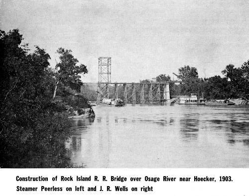
Miller County embraces within her borders trackage of two railroad systems, as follows: Jefferson City and Bagnell branch of the Missouri Pacific, which extends in a general southwest direction from Jefferson City on the Missouri River to Bagnell on the Osage River, a distance of 45 miles, its course through the county going north and south (photo 22); and the Chicago, Rock Island and Pacific’s St. Louis-Kansas City line which crosses the northern portion of the county east and west (photo 23).
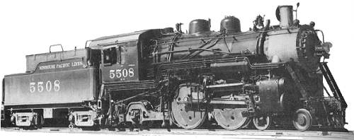
22 Missouri Paciic Engine
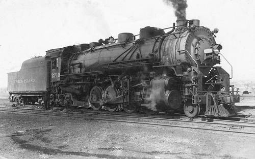
23 Rock Island Engine
The former has 19.18 miles of track and four depots in the county, the latter 21.49 miles of track and three depots (two in Cole County within approximately a stone’s throw of the Miller County line), the two roads aggregating a total of 40.67 miles of track within the county. The Missouri Pacific terminates at Bagnell, 10 miles above and the C.R.I. and P. crosses the river 18 miles below Tuscumbia.
The Missouri Pacific branch was originally chartered as the Jefferson City, Lebanon and Springfield railroad, and the C.R.I. and P.’s St. Louis-Kansas City line as the St. Louis and Colorado railroad. The “”Branch” will in the very near future be extended to Springfield to a connection with the Missouri Pacific’s Iron Mountain system and the Southwest and to the Southwest The C.R.I.P. will build a line southward through the county and on to a connection with its system at Little Rock, while the C. and A. branch with its south terminal at Jefferson City must sooner or later seek an outlet through this county. One of the best propositions on the river anywhere for a railroad bridge and crossing is in the vicinity of Tuscumbia and an excellent crossing is afforded directly at this point. With railroad facilities in connection with the river at Tuscumbia, the county seat, a town of no ill proportions would rapidly and substantially build, by reason of the varied mineral and other natural resources and advantages and the rich boom, agricultural and horticultural lands of the immediate vicinity. The St. Louis and San Francisco railroad passes along the southern border but has no trackage within the county. The county owes no railroad debt and never has.
Note: Of course, all the above predictions by Daniel Fraser Thompson of the expansion of the railroads throughout Miller County never occurred except for the Rock Island through Eldon to Kansas City and the Missouri Pacific to Bagnell.
SCHOOLS
There are 86 public schools in the county maintaining six to nine months school each year, except in a few isolated instances. Eldon boasts of one of the most excellent graded schools in the state, the services of a corps of 12 teachers being required in its conduct, while graded public schools of a high order, with a corps of teachers employed in each, are maintained both at Tuscumbia and Iberia.
Two academies of learning are also supported, one south, the other north of the river. The Iberia Academy has a modern school building for general educational work well equipped with library and laboratories and special departments in business, music and normal work; two “home buildings” for the accommodation of students from a distance and a campus of 20 acres (photo 24).
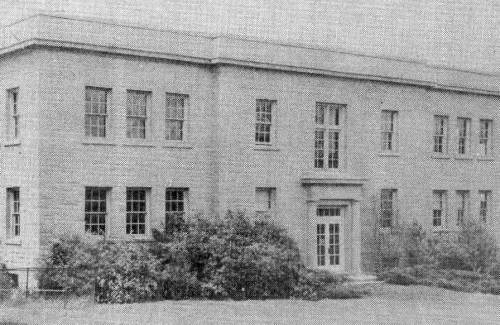
24 Iberia Academy
The Miller County Institute at Spring Garden was established in 1867 as the Spring Garden Seminary and is still conducted as an academy (photo 25).
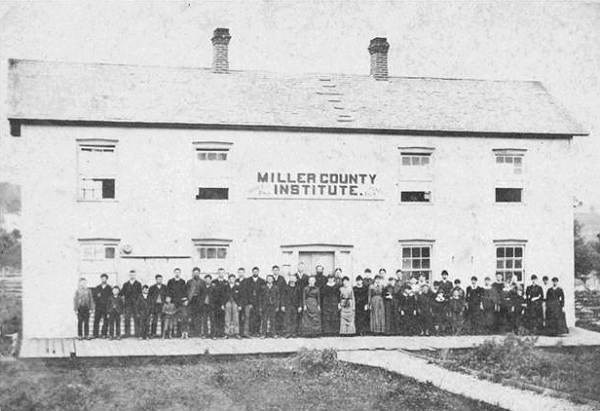
25 Miller County Institute
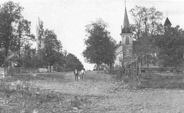
CHURCHES
About all the major Christian denominations are represented in the county and some have modern and valuable church buildings and property. The Christian and the Baptist churches are the strongest, in the order named, but the Methodists at an earlier date were numerous in all parts of the county. The Catholics are established at Charlestown (St. Elizabeth) (photo 26), Eldon and Mary’s Home (photo 27).
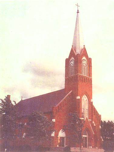
26 St. Lawrence Church
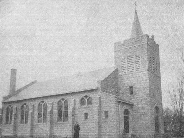
27 Mary's Home Church
Charlestown and Mary’s Home maintain parochial schools. In addition to these, the Congregationalists, New Lights and Presbyterians have both organization and property.
WEALTH
Valuation:
The assessed valuation of Miller County for the year 1910 was $4,105,327, as follows: real estate, $2,093,350; personal property, $1,368,365; railroad, telegraph, telephone and bridges, $461,152; merchants, $182,370. The present true value is doubtless in excess of $10,000,000.
COURT HOUSE
A new county court house is encompassing the old one at Tuscumbia which, when finished, will be a modern, magnificent and commodious building. It occupies one of the most romantic and commanding sites on the river. The walls are of native limestone, quarried nearby, with metallic roof surmounted by a dome. Convenient appointments for the accommodation of the court and the transaction of the public business, and a heating plant are contemplated by the plans. When completed, it will be the pride of every citizen of the county (photos 28 and 29).
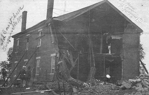
28 Second Courthouse being Remodeled - 1909
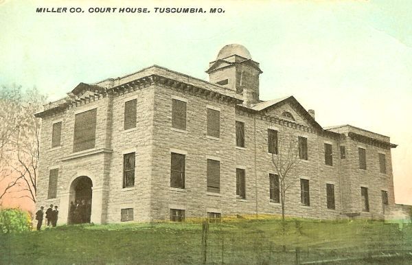
29 Miller County Courthouse - 1910
Note: The old courthouse, finished in 1858 was incorporated into the 1910 courthouse; in essence, the 1910 courthouse was built around and over the 1858 courthouse.
CITIES, TOWNS AND VILLAGES
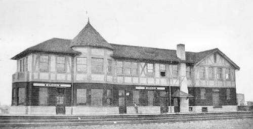
There are numerous towns and villages and one city of the fourth class within the county. The city of Eldon is a division point of the C.R.I. and P. railroad and a roundhouse and repair shops are located here. It is also a railroad crossing, has an ice plant, coal and wood yard, laundry, private waterworks, numerous hotels, two banks, livery barns, lumber yards, a variety of, and some elegant stores and buildings, a high school (one of the finest graded public schools in the state), a local newspaper, churches, halls and all the usual enterprises of a thrifty little city and railroad center. It has a beautiful location on the prairie in one of the richest agricultural districts of the county. The official census returns for 1910 show a population of 1,999, but the present population is doubtless far in excess of 2000.
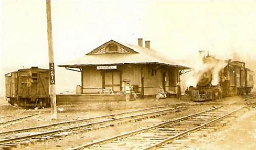
The other railroad towns are: on the Bagnell branch, Olean, Aurora Springs and Bagnell; on the C.R.I. and P.; Etterville and Hoecker, Mount Pleasant and Spring Garden being located, respectively, a short distance from the road, having no depots.
Note: Here are photos of the Miller County train depots (photos 30 - 35):
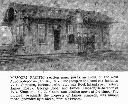
30 Missouri Pacific Train Station - Aurora Springs
31 Bagnell Station
32 Eldon Station
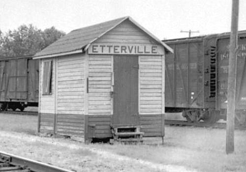
33 Etterville Station
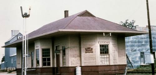
34 Eugene Station
35 Olean Station
Olean maintains a good public school, churches, lumber yard, hotel, livery barn and numerous stores and enterprises, has a local newspaper and near town there is a fine flouring mill. It is in a very rich farming section of the county and has a flourishing trade.
Aurora Springs is the station for the health resort of that name, something like a mile distant, which flourished some years ago, but which for lack of necessary improvement and requisite accommodations was allowed to decline. The water is recommended for various chronic ailments, and it has been used efficaciously in rheumatism, dyspepsia, kidney diseases, chronic and granulated sore eyes, scrofula, dropsy, erysipelas, paralysis, piles and milk leg. The station and the Springs each maintain a school and there is a store at each place. The station transacts considerable business in railroad ties (photo 36).
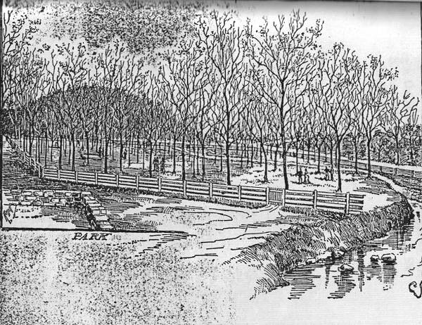
36 Aurora Springs Park
Bagnell, the terminus of the “branch” road, and on the Osage River, was at one time reputed the greatest railroad tie market in the world, excelling in its shipments to every other point on the globe. It still maintains the industry, but not its former reputation in shipments. It has stores, hotel, shop etc., and a ferry (photos 37 and 38).
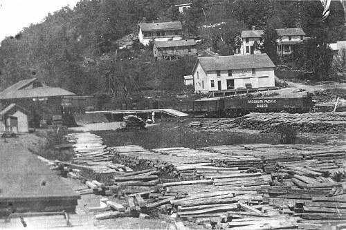
37 Bagnell Tie Yard
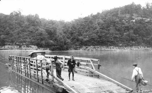
38 Bagnell Ferry - 1926
Hoecker is south of, and near, the Osage River, in a rich bend and soon as it is made easily accessible by good roads will doubtless flourish and become an important point (photo 39).
39 Hoecker Bridge
Etterville is another new town on the C.R.I. and P. railroad, has some right good stores and a healthy business air (photos 40 and 41).
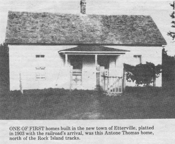
40 Antone Thomas House - First in Etterville
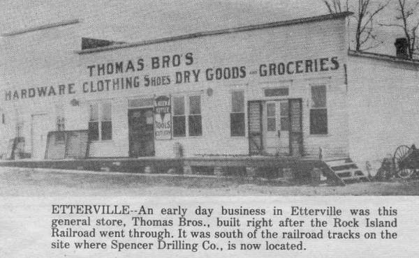
41 Thomas Brothers Hardware Store - Etterville
While old Mount Pleasant, at one time the metropolis of the county, shows signs of decay as a town, Spring Garden refuses to “give it up,” and the development of the white lime industry and discovery of marble on the railroad nearby created a demand for a “siding,” to be put in and it is not unlikely that a depot will be required within the next twelve months.
Mary’s Home has some good stores, a shop, hotel, Catholic Church and school and is a flourishing inland village (see photo 27 of church above). A distillery is located in the neighborhood and formerly produced an excellent article of whiskey. Local option, involving the county entire, rendered the industry unprofitable and the plant has closed down.
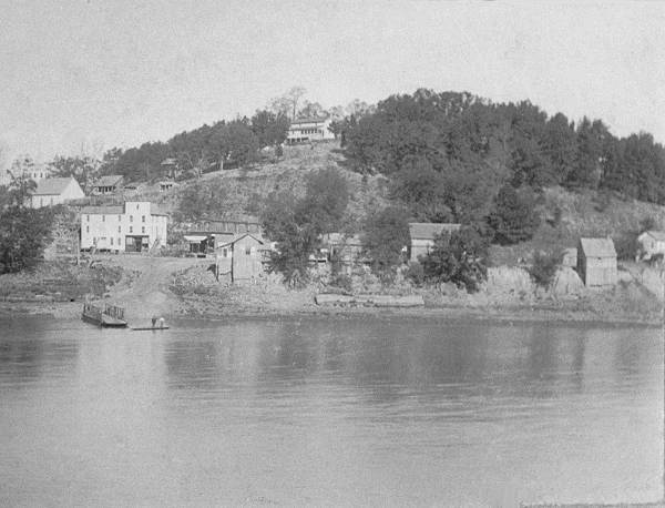
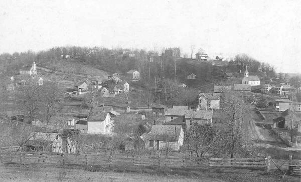
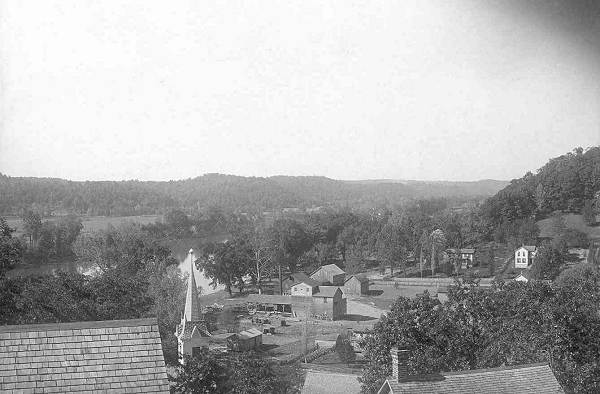
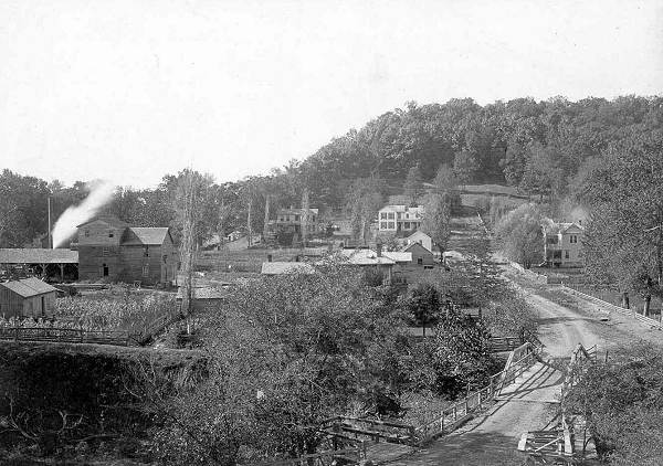
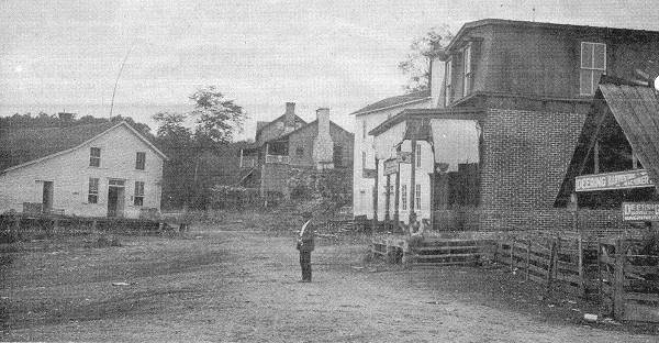
Tuscumbia, the county seat, is romantically located on the north bank of the beautiful Osage River 60 miles by water above its mouth, and 35 miles by the old stage road southwest of Jefferson City, in the center of the county.
The town was laid out in 1837 on land donated to the county by J.P. Harrison, was incorporated in 1856, and is the oldest town in the county. The business houses are located on the narrow bottom between the river and the court house hill, which rises nearly 200 feet and is adorned by the county grounds and buildings, the town’s fine graded public school, a church, a few offices and several residences. The bank, a substantial limestone building, and another church, the hotel and a store are located on the point of the first rise of the hill with the livery stable first below, while further around east of Shut In Branch is another church and several residences.
On the west side of the branch are some of the best residences in town, while the mill and lumber yard, blacksmith shop and wagon shops are in the lower end of the valley, which here widens out into extensive river bottom farms. Below the mill is the bridge approach, the structure being anchored on the opposite side into a solid stone bluff. There are several and a variety of stores: the Modern Woodmen have a splendid new hall building of concrete block work where all the lodges meet. The “Ruth,” a fine gasoline boat built by Mr. J.R. Wells at a cost of $2,000, makes regular trips on the river both ways. A lock and dam has recently been completed by the national government in the Osage at the first shoal above the mouth and the river is being dredged and side dammed.
Note: Here is a collage of photos of Tuscumbia (photos 42 - 51):
Hover your mouse pointer over the images below to view the captions and click on any of the photo thumbnails to view a larger image.
Note: Once you click on an image below, a new window will open. It would be best to maximize this new window by clicking on the middle box in the upper right-hand corner of the window. When you move your cursor over the image in this new window, it will change to a magnifying glass. Once this occurs, click on the image and it will show in a larger format for easier viewing.
The village of Rocky Mount stands in the northwestern portion on the high prairie, but near the breaks of Gravois Creek. It has a store and a church and is immediately surrounded by a thickly settled neighborhood of thrifty well to do farmers.
Charlestown (St. Elizabeth) is an enterprising German village, maintains an elegant and substantial Catholic Church and school, has a good hotel and stables, shops and numerous stores and offices. It is situated in the eastern portion of the south half of the county, about 10 miles from Hoecker station on the C.R.I. and P. railroad (see photo 26 above of St. Lawrence Church).
Capps is a small village on the Osage River on the opposite side and south of Mary’s Home. It contains a store and is an important shipping point for railroad ties (photo 53).
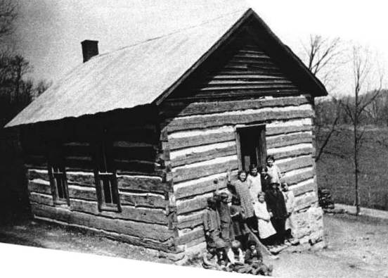
53 Original Log Capps School
Iberia is the biggest little town in the county, in fact, it is next in population to Eldon, and is located in one of the riches sections of South Miller. A township line runs through the town and census reports usually give but one side, that is about one half of the population. It has an actual population or about 800, numerous churches, halls, a graded public school, an academy, two banks, several shops and stores, local newspaper, flouring mill, and a fine opening for a hotel (photo 54).
54 Iberia Street Scene
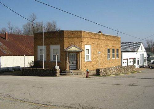
Brumley (at an early day known as Thompson’s Store) is a flourishing, busy village of the south side of the county, has a bank, a mill, shop, church, hall, and a number of stores (photo 55).
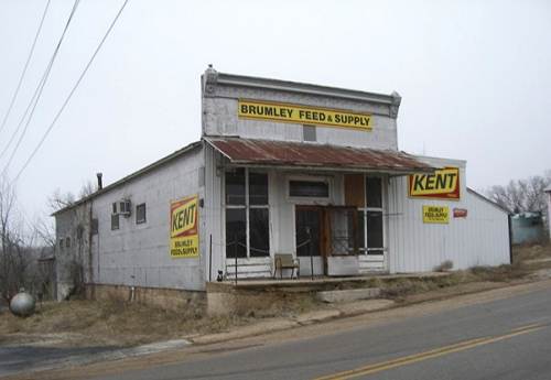
55 Hawkins - Thompson - Shelton Store in Brumley
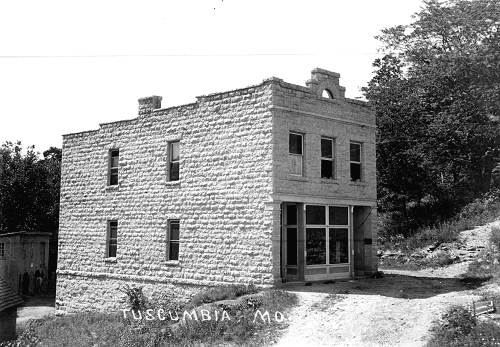
Ulman (located on Ulman’s Ridge) is in the same township and is also a thriving little business place; has a bank, mill, church, hall, stores and shop (photo 56).
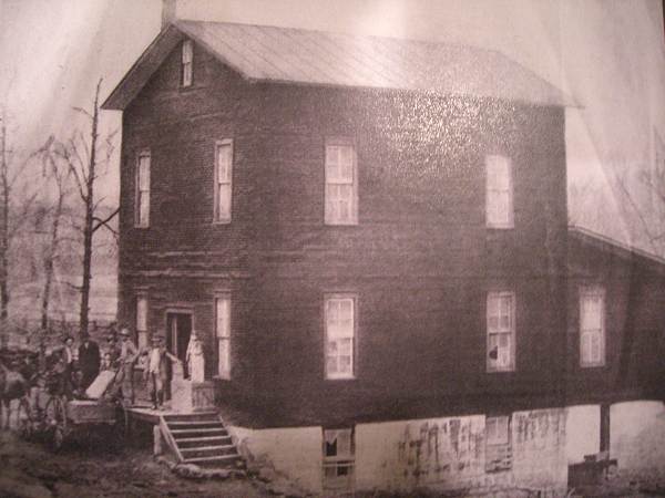
56 Old Ulman Mill
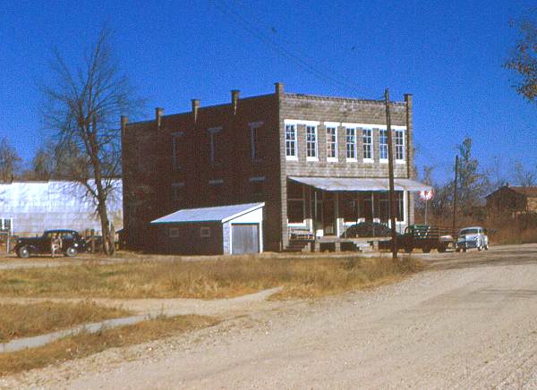
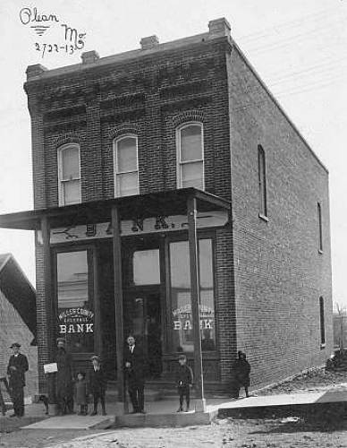
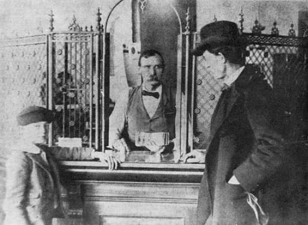
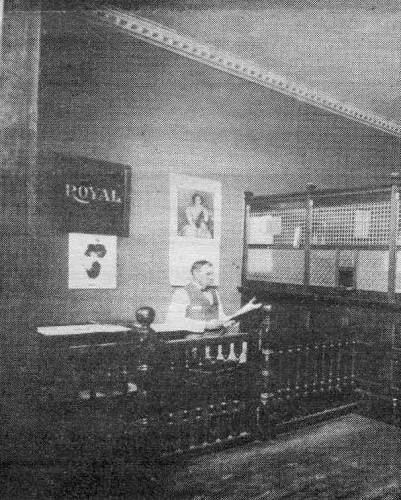
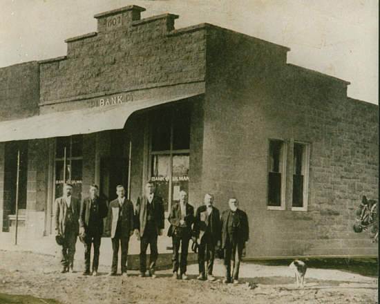
BANKS
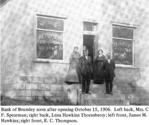
There are eight banks doing business in Miller County. The first to be established was the Miller County Exchange bank at Olean. It is capitalized at $15,000; surplus, $16,000; deposits, $140,000; Bank of Tuscumbia, capital, $15,000; surplus, $7500; deposits, $63,000; Bank of Eldon, capital, $40,000; surplus, $8,500; deposits $200,000; Citizens Bank of Eldon, capital, $12,000; surplus, $2,000; deposits, $52,000; Bank of Iberia, capital, $21,000; surplus, $21,000; deposits, $72,000; Farmers and Traders Bank of Iberia, capital, $25,000; surplus, 46,900; deposits, $96,127; Bank of Brumley, capital, $10,000; surplus, $5,000; deposits, $54,635; Bank of Ulman, capital, $10,000; surplus, $2,000; deposits, $15,500.
Note: Here is a collage of photos of Miller County Banks (photos 57 - 63):
Hover your mouse pointer over the images below to view the captions and click on any of the photo thumbnails to view a larger image.
BRIDGES
The Tuscumbia Bridge Company has a modern suspension bridge across the Osage River at Tuscumbia and is capitalized at $8,000 (photo 64).
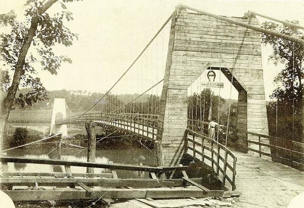
64 Suspension Bridge at Tuscumbia - 1905-1933
In addition to the Tuscumbia bridge, the county has constructed six steel bridges at various points in the county, as follows: Across Saline Creek near its confluence with the river; Gum Creek Bridge above Tuscumbia, and Shut in Branch bridge at Tuscumbia; Gardner’s Branch bridge near Iberia; Humphrey’s Creek bridge near Capps; and Tavern Creek bridge near the mouth of the Tavern.
I conclude this week’s Progress Notes with the obituary of Daniel Fraser Thompson from the Eldon Advertiser:
Eldon Advertiser
January 8, 1925
Major D.F. Thompson Died at Jefferson City
Was Formerly Editor of the Eldon Weekly Eagle
Took Great Interest in Miller County Politics and Always Voted at Tuscumbia
Major Dan Fraser Thompson, a prominent figure in Missouri Politics for the past half century and a leading resident of the Capital City for the last twenty five years, died at 1 o’clock Wednesday afternoon in this city at the home of his daughter, Mrs. J.M. Kallenbach, who lives on River Lane. Death resulted from heart trouble.
Major Thompson, who was 75 years old, had been in poor health for the past month but his condition did not become serious until last Sunday. Since that date he gradually grew worse and, little hope was held for his recovery. His son, Dr. T.F. Thompson, of Fulton, Kentucky, and his three daughters, Mrs. Kallenbach, of this city; Mrs. J. W. Adcock, of Eldon, and Mrs. George G. Sullivan, of St. Louis, were at this bedside when the end came.
Perhaps no man in Central Missouri enjoyed a larger number of friends than did Major Thompson. He was born in Tennessee and came to Missouri soon after the Civil War, in which he took part. For years he followed the newspaper trade and was the owner and publisher of papers at Waynesville, Versailles, Eldon, Iberia, Tuscumbia, and other places. Coming to Jefferson City he accepted a position in the adjutant general’s office, which position was held by him for 16 years and under four governors.
He was appointed to the official staff of Governor Folk and in that connection won for himself the title of major. During the past few years he has refrained from business worries and has spent the major portion of his time visiting his hundreds of acquaintances in various parts of the state.
Major Thompson always manifested an unusual interest in politics and was one of the leading Democrats of Missouri He was a strong Nelson supporter in the recent election and made a tour of several Central Missouri counties in behalf of the Democratic ticket. In his death the party has lost one of its “war horses”…a man who was ever found fighting in the front line.
As a private citizen Major Thompson was a loving father and a tender husband. He was a consistent member of the First Christian Church, a loyal citizen who could be depended upon to back every progressive movement and a friend that could be counted on in the hour of trial. His death will be deeply regretted all over Missouri, but especially will he be mourned in Cole and Miller counties where he was known and loved.
He is survived by one son, three daughters and many other relatives living in counties adjoining Cole.
Funeral services were held at 2 o’clock Friday afternoon at the First Christian Church. Reverend R.M. Talbert conducted the service and burial was made in the Riverview Cemetery.
That’s all for this week.
 Joe Pryor
Previous article links are in a dropdown menu at the top of all of the pages.
|