|
Monday, August 16, 2010
Progress Notes
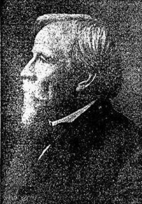
The primary emphasis of our website is to present the history of Miller County. We do this in quite a number of different ways, usually presenting articles or narratives which cover a specific subject rather than try to be too expansive. The longer book length Miller County histories such as Goodspeed’s, Schultz’s or Jenkins’ offer us a wealth of information but are too long to present here. Once in a while I come across a well written general history which is abbreviated enough for the Progress Notes page. One of these was written by Gerard Schultz (photo 01) in a series of articles for the Tuscumbia Autogram beginning on January 1, 1931:
01 Gerard Schultz Miller County Beginnings
Gerard Schultz
Miller County Autogram
January 1, 1931
Daring Frenchmen were the first white men to penetrate the Osage River region. As far as it is known, the first white man who traversed the territory now known as Miller County was Charles Claude Du Tisne, a French explorer.
Du Tisne in 1719 followed an overland trail of the Osage Indians, which led him to the headwaters of the Osage River (photo 03).
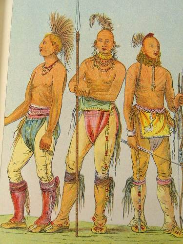
03 Osage Indian Warriors West of the present limits of Missouri, he took possession of the country in the name of the French king, Louis IV.
Louis Houck (photo 05), the most eminent historian of early Missouri, gives the following incident of DuTisne’s life as related by Bossu:
05 Louis Houck “On one occasion, being together with some Frenchmen, among unfriendly Indians, who were to barter goods, he found that the Indians meditated a hostile attack, and understanding fully their purpose, as he wore a wig, he took it from his head and threw it defiantly on the ground, saying from time to time, “You will have my scalp: take it up if you dare to do it!” the astonishment of the Indians was inexpressible, for Du Tisne had had his head shaved before this happened.
Afterwards, he told them it was very wrong of them to attempt to injure him, because he only came to make an alliance with them, but that, if they compelled him he would burn the waters in their lakes and rivers and thus hinder them from paddling their canoes, and also set fire to their forests. To demonstrate the truth of his power, he secured a little pot, put some brandy in it and set it on fire, and the Indians, not being then acquainted with brandy, were amazed. At the same time he took out of his pocket a convex glass and set fire to a rotten tree by means of the sun. The Indians, really believing that he had power to burn their lakes and rivers and forests, caressed and loaded him with presents and accompanied him as an escort, so that no one might do him any harm.”
At the time of the explorations of Du Tisne, modern Miller County was a part of the hunting grounds of the Osages. These Indians remained here until the coming of the white settlers.
Five years after the purchase of Louisiana Territory by the United States, the latter negotiated a treaty with the Great and Little Osages, providing for the cession of a large tract of land to the United States. Miller County was only a small part of this cession. The treaty was concluded at Fort Clark on November 10, 1808.
Note: This fort was later known as Fort Osage.
This fort was situated on the south bank of the Missouri river, about twenty miles east of Kansas City by land (photo 07).
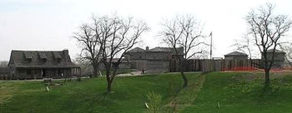
07 Fort Clark - Osage One of the negotiators was Jean Pierre Chouteau (photo 08).
08 Jean Pierre Chouteau By the treaty, the chiefs and warriors of the Great and Little Osages agreed upon a boundary line between them and the United States which began at Fort Clark and ran thence due south to the Arkansas river, and down the same to the Mississippi. The land east of this line was relinquished to the United States. In return for the cession, the Great Osages were given $800 in cash, and $1,000 in merchandise. The Little Osages received half that amount. These Indians were finally given a permanent reservation in what is now Oklahoma, where fate has been more generous. Today, the Osages are the richest people in the world, having an annual per capita income of $10,000 in 1930.
Note: I believe Gerard is referring to the oil income that was generated by the Oklahoma fields in the early 1900’s.
January 8, 1931
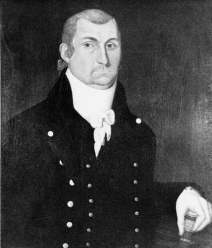
One of the most famous American explorers traversed what is now Miller County. In 1803 the United States purchased from France the region extending from the Mississippi river to the Rocky Mountains. As little was known of the geography of the newly acquired territory, several expeditions were sent out to explore it. One of the most notable of these was the southwestern expedition of Zebulon M. Pike (photo 10).
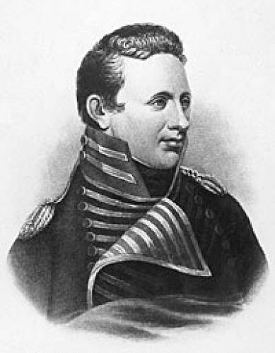
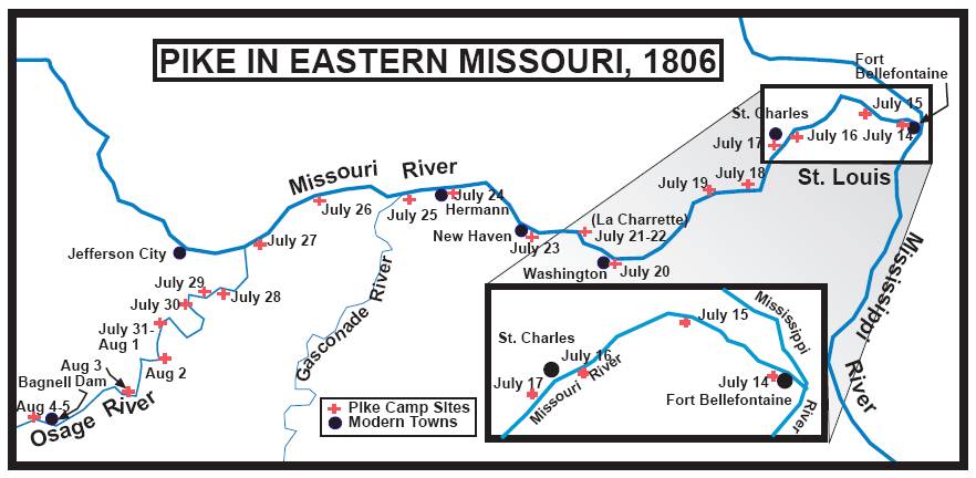
10 Zebulon Pike On July 10, 1806, expedition started up the Missouri river at Fort Belle Fountains, a United States military post located on the south bank of the river, four miles above its mouth. Pike was accompanied by one lieutenant, one surgeon, one sergeant, two corporals, sixteen privates and one interpreter. He also had under his charge fifty one Indians of the Osage and Pawnee tribes. The United States government had redeemed these Indians from captivity among the Potawatamies and they were to be returned to the villages of their tribes on the Osage River. On the morning of July 28, the mouth of the Osage River was reached (photo 11).
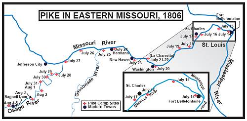
11 Pike's Map in Eastern Missouri - 1806
Click image for larger viewAfter three days journey up the Osage the party camped on the eastern bank of the river in the vicinity of the present day village of St. Thomas, situated in the southeastern corner of Cole County. The last day of July, Pike entered what is now Miller County. A study of Pike’s narrative and map seems to show that the party passed the present site of Tuscumbia on August 3.
The following record was made on that day:
“3d August, Sunday: Embarked early and wishing to save the fresh, (in other words, to take advantage of the high stage of water in the river) I pushed hard all day. Sparks was lost, and did not arrive until night. We encamped about twenty five paces from the river on a sandbar. Near day I heard the sentry observe that the boats had better be brought in, when I got up and found the water within a rod of our tent, and before we could get all our things out it had reached the tent. Killed nine deer, one wild cat, one goose, and one turkey. Distance eighteen miles.”
August 6, the expedition passed the mouth of Gravois creek in Morgan County, Pike writes,
“About three miles above this river (Gravois Creek) the Indians left us and informed me that by keeping a little to the south and west they would make in fifteen miles what would be at least thirty five miles for us.”
At the time the southwestern expedition of Zebulon M. Pike ascended the Osage in 1806, no settlements had been made along this river. Before the United State government sold land to private persons, it was surveyed into rectangular tracts, six miles square, called congressional townships. The north boundary of township thirty nine north of the base line range twelve west of the fifth principal meridian was the first government survey made in this county. This line was surveyed by Joseph C. Brown in 1816.
The first white man to make his home in Miller County according to the most reliable authorities, was Seneca R.Y. Day, who settled near the mouth of the Tavern creek in 1815. Four years later, A.J. Lindley located on the same creek. In 1822 John Wilson located on Tavern creek near the mouth of Barren Fork. These early settlers were “squatters,” who did not own the land on which they lived. In later days, John Wilson entered several tracts of land.
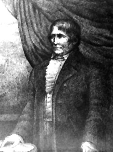
The first person to make an entry of land in the territory later organized as Miller County was William Miller, a native of Virginia (photo 13).
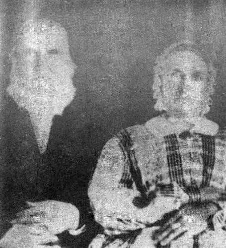
13 William and Sarah Miller His first entry is dated July 20, 1826. the land entered by him at this time was located near Spring Garden. In 1829 Stephen Bell, J.D. Bills, Benjamin L. Clark, John Greenup, David Johnson, James Mason, E. Vernon, Jeremiah Vernon and Edmund Wilkes filed on land. Several years later, Edmund Wilkes became Miller County’s first representative in the General Assembly.
January 15, 1931
The sixth of February is Miller County’s birthday. On February 6, 1837, Miller County was created by an act of the General Assembly of the state of Missouri. It was named in honor of John Miller, the fourth governor of Missouri.
Before the creation of this county, its territory formed parts of several older counties. Soon after Upper Louisiana was formally transferred by France to the United States in 1804, it was divided into five local districts. These were the districts of St. Louis, St. Charles, St. Genevieve, Cape Girardeau and New Madrid. These districts formed the foundation of county organization in Missouri. In 1812 they were reorganized into counties. Modern Miller County was first a part of St. Louis County. When Howard County was created in 1816, it included the part of Miller County situated north of the Osage River. Until 1818 the part which is south of the Osage remained within the limits of St. Louis County. In the latter year, it became a part of Franklin County and the area north of the river was included in Cooper County. Two years later the latter area became a part of Cole County. After the southern portion had belonged to Franklin County, it successively constituted a part of Gasconade, Crawford and Pulaski Counties.
Miller County residents may be interested in a brief sketch of the life of the man in whose honor the county was named. John Miller was born in Berkeley County, Virginia (now West Virginia). He served as Lieutenant Colonel in the War of 1812. After he had resigned his position in the United States Army, he was appointed registrar of land at Franklin, Howard County, Missouri. In 1825 he was elected governor of our state to fill the vacancy caused by the death of Governor Bates. His campaign for re election as governor was unique in that he had no opponents. From 1837 to 1843, he served Missouri in the United State House of Representatives. In his seventy fifth year he died at Florissant, Missouri (March 18, 1846).
Note: Local historians have always felt that the county father really was William Miller in whose home was organized the first county court as described below. However, to gain the governor’s permission for supporting the formation of the new county he was the one historians record as having the county’s namesake. Peggy Hake has written that she thinks William and John were distantly related.
By the act of February 6, 1837, the General Assembly of the site of Missouri appointed David Fullbright of Pulaski County, Zacheus German of Morgan County and John Hensley of Cole County, as commissioners, to locate the county seat. They selected the place where Tuscumbia now is. The land for the county seat was donated by James P. Harrison.
May 1, 1837, the county court held its first session in the log house of William Miller, located near the mouth of Saline Creek. The court appointed John Francis as presiding justice. The associate justices were Edmond Wilkes and Stephen A. Blevans. James P. Harrison was the first clerk of the court and William M. Harrison the first sheriff. On the second day of the first session, the court divided the county into four civil townships. These were Saline, Osage, Richwoods and Equality. The present day townships of Jim Henry and Glaze were at first parts of Osage and Equality townships, respectively. A part of modern Franklin Township then belonged to Morgan County. The remainder formed parts of Saline and Equality townships. The same day the court ordered an election of four justices of the peace and four constables to be held on July 1, 1837. It was the first election to be held in Miller County.
June 22, 1837, the first session of the circuit court in Miller County was also held at the log house of William Miller. The presiding judge was William Scott, an eminent jurist of his time. The members of the first grand jury were John L. Davis, foreman, Robert Shipley, William P. Dixon, Samuel Miller, Isaac Bass, Elisha Francis, Elihu Gregory, John G. Witten, James Brumley, Wiliam Blyze, John Stewart, John Hale, John Shelton, Pete Sullens, Leander Musick, Abraham Castleman and John Loveall. Finding no indictments, the grand jury was discharged. The members of the first trial jury were Gaddis E. Miller, Thomas H. Dawson, William Miller, Enoch McCarty, Johnathan Blevans, Stephen A. Blevans, Peter Bilyew, Samuel Gilleland, David Musick, John Degraffenreid, Tscharner Degraffenreid and Joel Musick. The first case was an appeal from a justice court. The court found the defendant guilty of trespass and awarded the plaintiff one cent damages.
January 22, 1931
It has been noted that the land for the county seat was donated by James P. Harrison. The boundaries of this tract of land were surveyed and marked out by Marquis Calmes (photo 15), the first county surveyor, in July, 1837.
15 Marquis Calmes Before the close of the year, the tract was laid out into lots by Alfred M. Houston. On February 8, 1838, the latter reported to the county court the sale of fifty one lots for $443.46. The money derived from the sale of lots was placed in a fund for the erection of county buildings. The county court ordered Houston to superintend the erection of a courthouse which was to be a one story log building. The lowest bid for the erection of this building was $375.40. This bid was made by J.L. Davis.
In 1857 the first courthouse was replaced by a two story brick building.
The first county court also appointed Harden M. Williams to superintend the erection of a jail for the county. The place provided for the dangerous criminals was known as the “The Dungeon,” which was partly below the level of the ground. “The dungeon” received its light through three grated windows each ten inches square. The entry to it was by means of trap doors. The second story of the jail above the level of the ground was the debters’room.
The first store in what is now Miller County was started at Spring Garden. In 1837 the first county court issued merchant licenses to William H. Pulliam, who had a store near the present day town of Iberia; James P. Harrison of Tuscumbia; William P. Dixon and Company of Spring Garden and Andrew Burris and Company of Pleasant Mount. The Licenses were issued for six months at the rate of ten dollars each.
The first United States census of Miller County was taken in 1840. The total population of the county at that time was 2284. Of this number 424 lived in Equality; 140 in Glaze, 370 in Richwoods, and 483 in Saline Township. Franklin Township was not organized until 1844, when part of Morgan County was added to Miller. Of the 2,284 persons enumerated in 1840, 2,171 were whites and 113 were slaves. More that one half of the slaves were found in Saline Township. By 1840 the population had increased to 4812 of which 114 were slaves. The census of 1840 gave the population of Tuscumbia as seventy seven.
The first mill in the county to be run by water power was built on Saline creek by William Brockman. In 1853 John Holmes built the first mill to be run by steam power near Pleasant Mount.
Before and for many years after the Civil War, Miller County was largely dependent in matters of commerce upon the Osage River. Steamboats began to ply on the Osage in the decade of the eighteen forties. Some of the first steamboats on the river were the “Leander,” “Wave,” “Warsaw,” “Crawford,” “Chippews,” “Laclede,” “Mary C,” and “Mansfield.” In the early eighties a boat was built for carrying the mail from Jefferson City to Tuscumbia. This boat was christened the “Tuscumbia.” It was ninety feet long and eighteen feet wide but had only one deck. The mail schedule called for the departure of the “Tuscumbia” at six o’clock in the evening. The mail service by steamer was discontinued when the branch of the Missouri Pacific was built to Bagnell.
In 1846 a company of Miller County volunteers was organized for the Mexican War. There were about eighty men in the company. On June 13 they paraded at Tuscumbia on horseback, each one having a rifle on his shoulder, a tomahawk and a bowie knife in his belt. John D. Davis was captain and Champ Smith and P. Belgen were Lieutenants of the company.
January 29
The Osage Valley Sentinel, the first newspaper in Miller County, was established at Tuscumbia in 1870. The first number of this newspaper appeared October 7, 1870. The owners and publishers were Lemen and Hitchcock. The following year J.G. Lemen, an attorney at law, became sole proprietor but Hitchcock remained as foreman of the office. In the campaign of 1872, the newspaper supported Horace Greeley, the presidential candidate of the Liberal Republican and Democratic parties. At this time, a rival paper, known as the Tuscumbia Republican, was started. The latter supported the candidate of the Republican party, Ulysses S. Grant.
The publication of the Miller County Autogram was begun at Aurora Springs in 1883 but two years later made Tuscumbia its home. The Eldon Advertiser was started by N.J. Shepherd and J. H. Hellfrich on June 11, 1894.
The Iberia Sentinel was established by George Martin, as editor and publisher, in March 1905.
Several other newspapers have been published at Tuscumbia. These were the Miller County Vidette, Gospel Proclamation, Vindicator, Helmet, Miller County Republican, Osage Valley Banner, Eye Opener, western Preacher, and Osage Valley Record. Still other papers which have appeared in Miller County are the Eldon News, Eldon Eagle, Iberia Advocate (the first newspaper at Iberia), Iberia Impetus, Iberia Intelligencer, Iberia Headflight, Aurora Crommet, Eldon Register, Aurora Springs Messenger and Aurora Springs Democrat.
Although no railroads were constructed in this county before 1880, there had been much agitation in favor of them. A few years after the Civil War, efforts were made to build a railroad between Jefferson City and Tuscumbia. This line was finally to be extended to Lebanon. The present branch of the Missouri Pacific to Bagnell was surveyed in the winter of 1892-1893.
The first railroad tax in Miller County was paid by this line, then known as the Jefferson City, Lebanon and Southwestern. This tax amounted to $572. 92. The total valuation of telegraph lines in the county in 1892 was $1653.75, the total tax being $18.01 which was paid by the Western Union.
The Rock Island was built through Eldon during the first years of this century.
A number of railroads were promised to southern Miller County, however, none was ever built. The first of these was a line which was to be built between St. Louis and Ft. Scott, Kansas. This line seems to have been surveyed in 1872. In the fall of 1879 a party of engineers and surveyors came to Iberia and made surveys for a railroad. The main object of the construction of this railroad was to convey iron ore to St. Louis.
Note: you can read more about the railroad history of Miller County at this previous Progress Notes.
Just at this time southern Miller County experienced a boom in iron ore mining. Some of the ore was carried by wagon to the railroad at Hancock and Eugene and some was hauled to Capps and shipped by boat down the Osage River.
The first telegraph line was completed to Eldon in July, 1903. The first telegram sent from Eldon read as follows: “To Mayor A. W. Cox of Jefferson City, Missouri. “Eldon sends greetings over the new line. J.W. Weeks” Mr. Weeks was at that time mayor and postmaster of Eldon.
The first telegram sent from Eldon read as follows: To Mayor H.W. Cox of Jefferson City, Mo. “Eldon sends greetings over the new line. J. W. Weeks.” Mr. Weeks was at that time mayor and postmaster of Eldon.
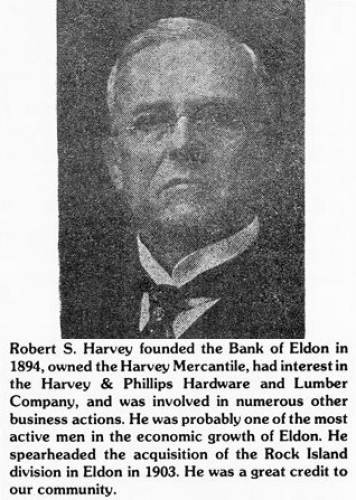
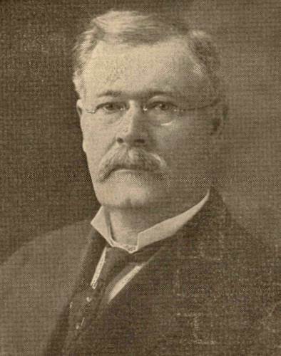
The Miller County Exchange Bank, the first banking institution in this county was established at Olean in 1889 (photo 24).
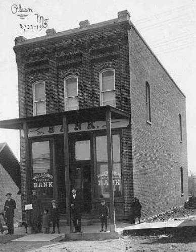
24 Miller County Exchange Bank in Olean The first officers of this bank were J.Goodman, president; R. S. Harvey, vice president (photo 25); A.A. English, cashier; H.E. Neville, assistant cashier.
25 Robert S. Harvey The first directors were J. Goodman, R.S. Harvey, F.R. Miller, W.T. Franklin, R.J. Miller, T. H. Taylor, H.A. Wieneke, W.S. Allee (photo 26) and I.W. Porter. The following year W.S. Allee was elected president and R.R. Inglish was re elected as cashier.
26 Dr. W. S. Allee At the end of the first year’s business, the bank had total resources of $61,057.05.
The condensed Miller County history by Gerard Schultz above was written before he published his complete book about Miller County in 1933. During the early thirties he published a number of Miller County articles in the Autogram such as this one which later were integrated into his book. However, I have noticed that not everything in the articles were included in the book. So I am happy to get on record on our website the occasional instances of his research found nowhere else but in these old articles from the Autogram.
As I write this week’s Progress Notes I am also very busy working with the bridge opening celebration committee. We are preparing for the celebratory events for Monday, August 16, the day the bridge is opened. I prepared a photo collage of bridges and local scenes of the distant past which will be displayed at the celebration in the Riverside Park (I realize that by the time most read this week’s Progress Notes the event will have already occurred).
One of the most popular bridge photos we have is the one taken from the bluff above the bridge the day the 1933 bridge was opened to the public (photo 27).
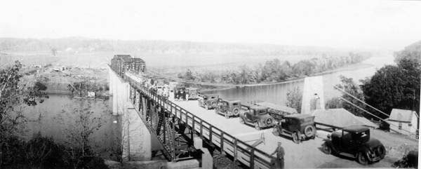
27 Tuscumbia Bridge - New 1933 - Old Suspension Bridge
Click image for larger viewSo this week I went over to the bluff, (which wasn’t easy because much of the terrain has been altered due to excavation) and took a photo of the just completed new bridge along side the 1933 bridge (photo 28).
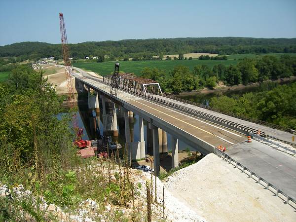
28 2010 and 1933 Bridges
Click image for larger viewThen I went over to the top of the big hill just north and west of the bridges where I took a regular photo (photo 29).
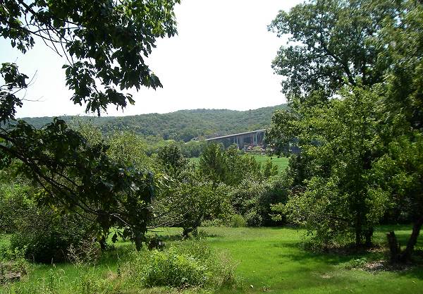
29 From top of the hill North of Bridge
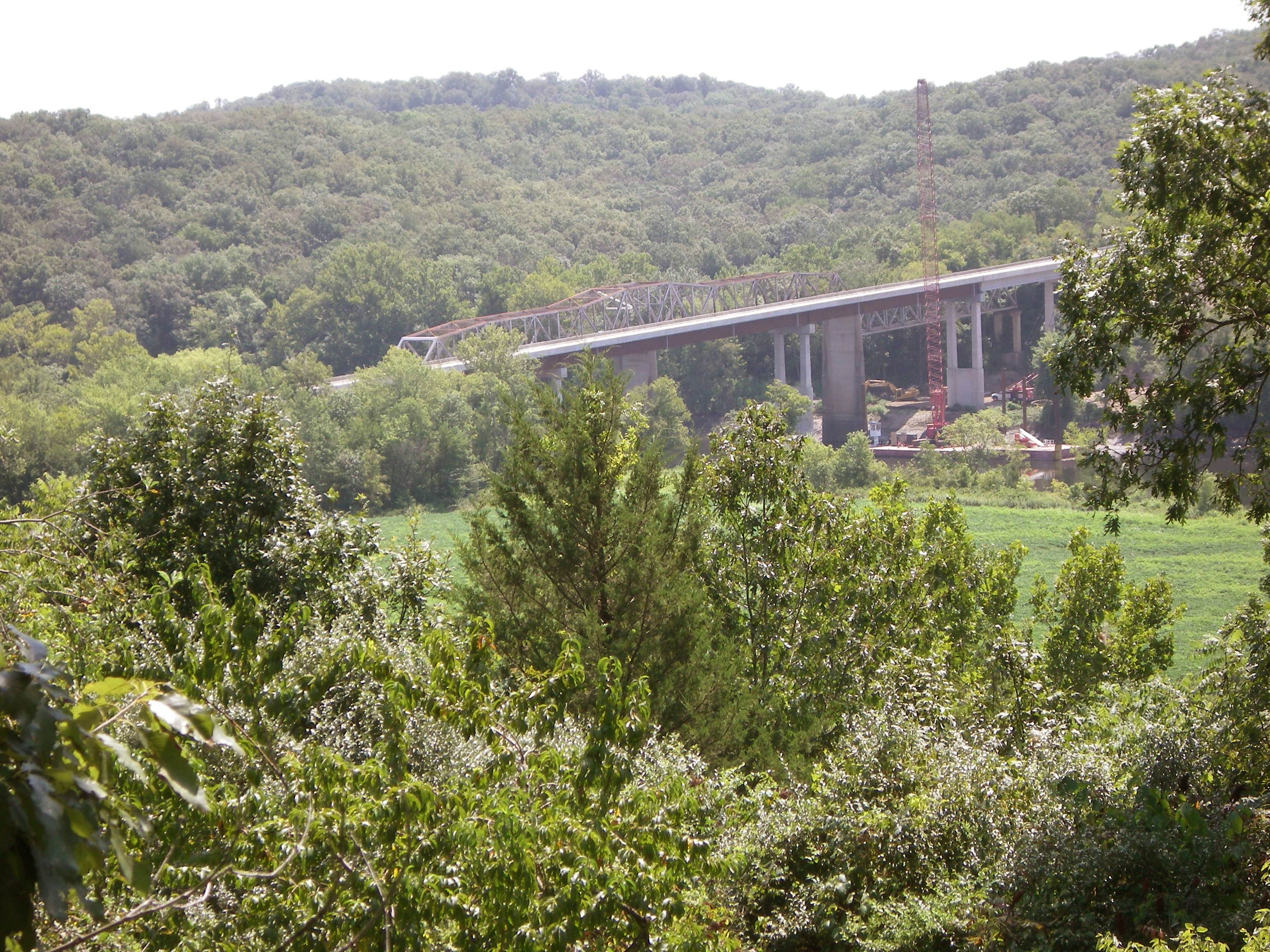
Click image for larger viewI spent the first four years of my life in a small little house on top of this hill but it burned down a couple of years ago. The next photo is from the same vantage point but telescoped (photo 30).
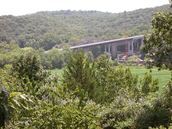
30 Telescopic close up View
Click image for larger viewHere is a photo of the 1933 bridge from the same vantage point taken soon after it was constructed (photo 31):
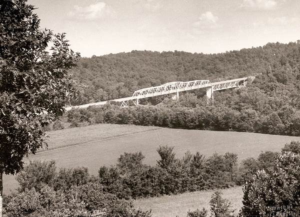
31 1933 Bridge taken soon after Construction
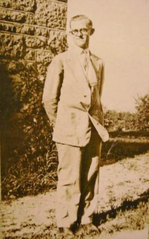
Bamber Wright (photo 32), native of Tuscumbia now living in Jefferson City, is one of our most valuable historians regarding Tuscumbia.
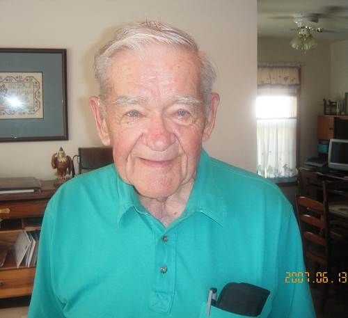
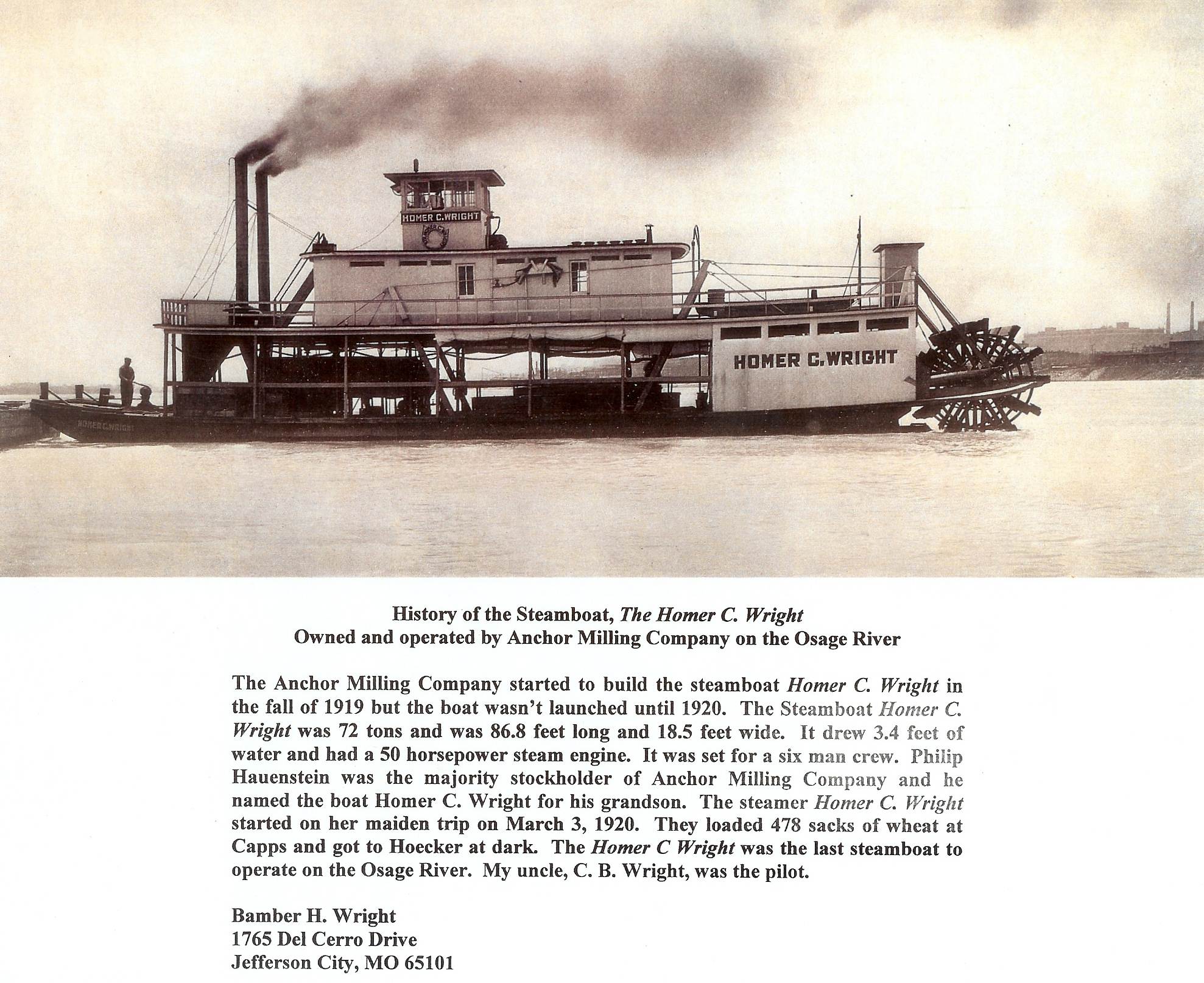
32 Bamber Wright He is a descendent both through his mother and father of those who started and operated the Anchor Mill Company of Tuscumbia, one of the town’s most successful business enterprises of the past. Bamber brought us this photo of the Homer C. Wright steamboat, which was built in honor of Bamber’s first cousin, Homer Clay Wright, the last president of the Anchor Mill (photo 33).

33 Homer C. Wright Steamboat History
Click image for larger viewThis is a photo I had not seen before so I am glad to add it to our files. Bamber remembers seeing this boat on the river when he was a child. However, it was sold early on when he was about four years of age. Bamber, at age 91, is one of the few still living who remember seeing the old steamboats operating on the Osage River at Tuscumbia.
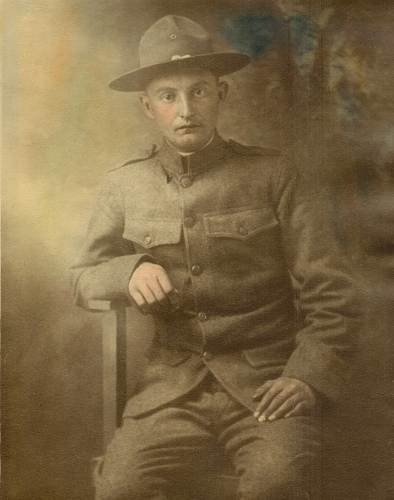
Not long ago I received a photo of Charles Williams, commonly known around Tuscumbia as “Catfish Williams.” He and his brother, Willard, commonly known as “Friday,” were fixtures always present around the old Hauenstein’s General store in Tuscumbia many years ago. Everyone knew them but strangely, few knew much about them regarding their family and from where they came. Recently, I was sent a photo of Charles by his granddaughter, Nina Strange, whom I met a couple of years ago at the museum when she visited with her aunt Ruby and Gary Tucker (photo 34).
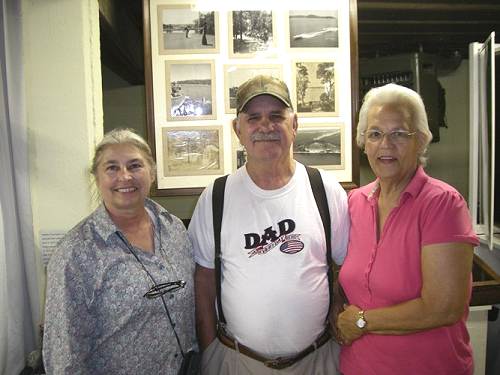
34 Nina Strange, Gary and Ruby Tucker The photo of Charles “Catfish” Williams was taken of him when he served in WWI (photo 35).
35 Charles "Catfish" Williams I do not have a photo of Willard “Friday” Williams, Charles’ brother. You can read the interesting story of Charles and Willard Williams at this previous Progress Notes.
The story of the brothers is near the end of the narrative for that week. However, you may enjoy reading the story of the Kallenbach family just above it which features Royal Kallenbach, who rode in last week’s Osage River Celebration parade.
That’s all for this week.
 Joe Pryor
Previous article links are in a dropdown menu at the top of all of the pages.
|